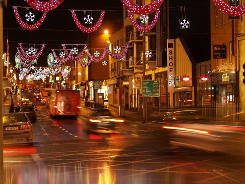
MUNDOTEKA 1- Europa

Colapsar
Este tema está cerrado
X
X
 
  • Tiempo
  • Mostrar
Limpiar Todo
nuevos mensajes
  • Nettus
    Usuario
    • 1 feb, 2008
    • 4715
    • Lundby

    Limerick

    )))))))))))))))))))))))))))))))))))))))))))))))))) )))))))))))))))))))))))))))))))))))))))))))))))))) )))))))))))))))))))))))))))))))))))))))))))))))))) )))))))))))))))))))))))))))))))))))))))))))))))))) ))))
    18. Condado: Limerick - Capital: Limerick
    Province: Munster - Area: 2,686 km2 - Population: ~ 190.000 - www.limerickcoco.ie

    www.rooneys.eu/map.aspx --- freepages.genealogy.rootsweb.ancestry.com/~mc...

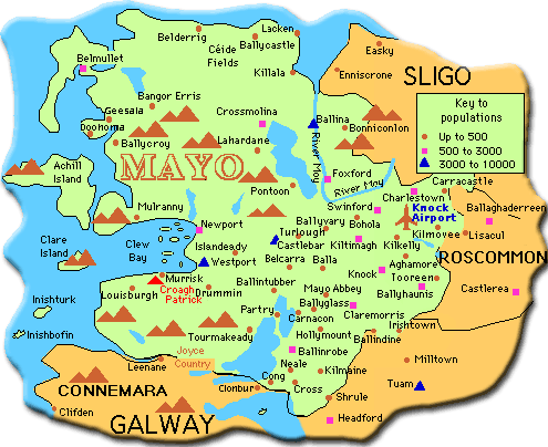
    Limerick (Luimneach en irlandés) es un condado en la provincia de Munster, al oeste de Irlanda. Limita con el Condado de Clare por el norte, con el Condado de Cork por el sur y con el Condado de Kerry por el oeste. El Río Shannon atraviesa la ciudad de Limerick y desemboca en el Océano Atlántico. Below the city, the waterway is known as the Shannon Estuary. Because the estuary is shallow, the county's most important port is several kilometres west of Limerick city, at Foynes.
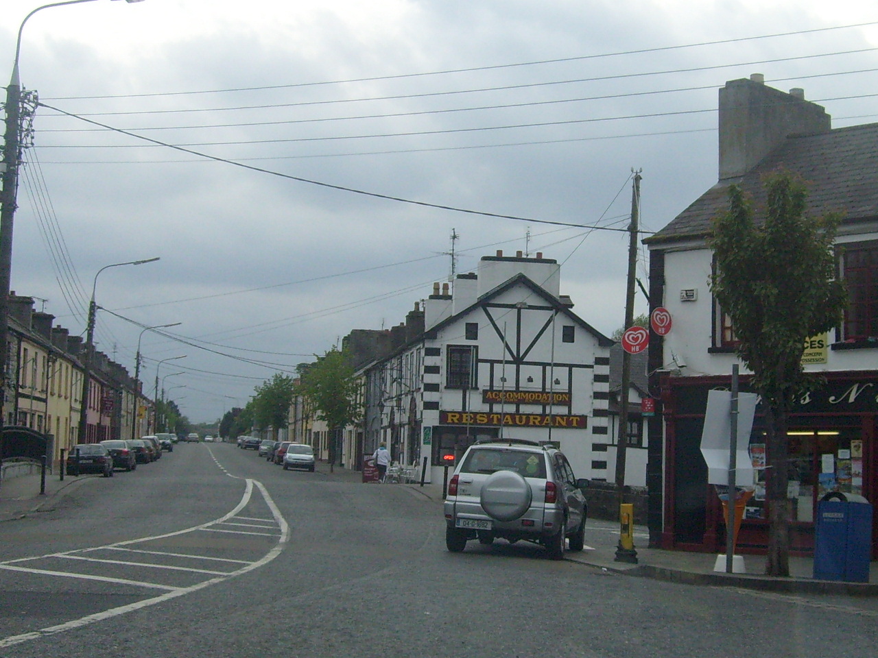
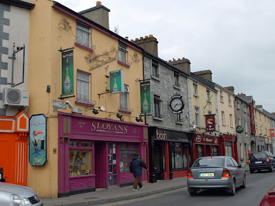
    Capital Limerick Otra ciudad importante del condado es Newcastle West que es la segunda luego de la capital.
    Other towns mainly lie along the Limerick – Tralee roads (N21) and Limerick – Cork road (N20).
    History-History of Limerick
    Geography
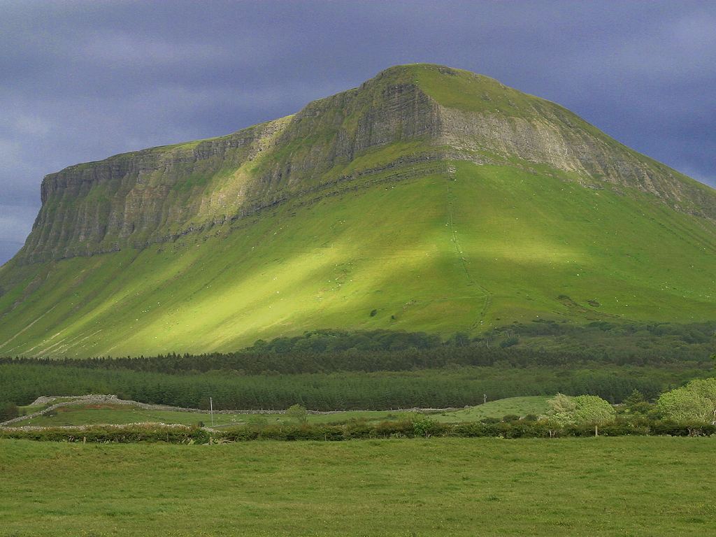
    County Limerick is the green heartland of Munster and one possible explanation of its Irish name Luimneach (the flat area) certainly makes sense when compared with the rest of the province. Especially in the east, the land consist mostly of a fertile limestone plain, which is ringed by mountains on its borders; The Slieve Felims, The Galtees (Na Gaibhlte) and the Ballyhoura Mountains. The highest point in County Limerick is Galtymore (919m), on the border with County Tipperary in the far south-east corner of the county. However it would be wrong to say that the county is a monotonous plain, for the county is dotted with hills and ridges. This eastern part of the county is the heartland of the Golden Vale, the rich, verdant fields famous for their dairy produce. Towards the west, the aptly named Mullaghareirk Mountains ("Mullach na Radhairc" in Irish, roughly meaning mountains of the view) push across the county offering dramatic views east over the county and west into County Kerry.
    Volcanic rock is to be found in numerous areas in the county, at Carrigogunnell, at Knockfierna, and principally at Pallasgreen/Kilteely in the east, which has been described as the most compact and for its size one of the most varied and complete carboniferous volcanic districts in either Britain and Ireland.
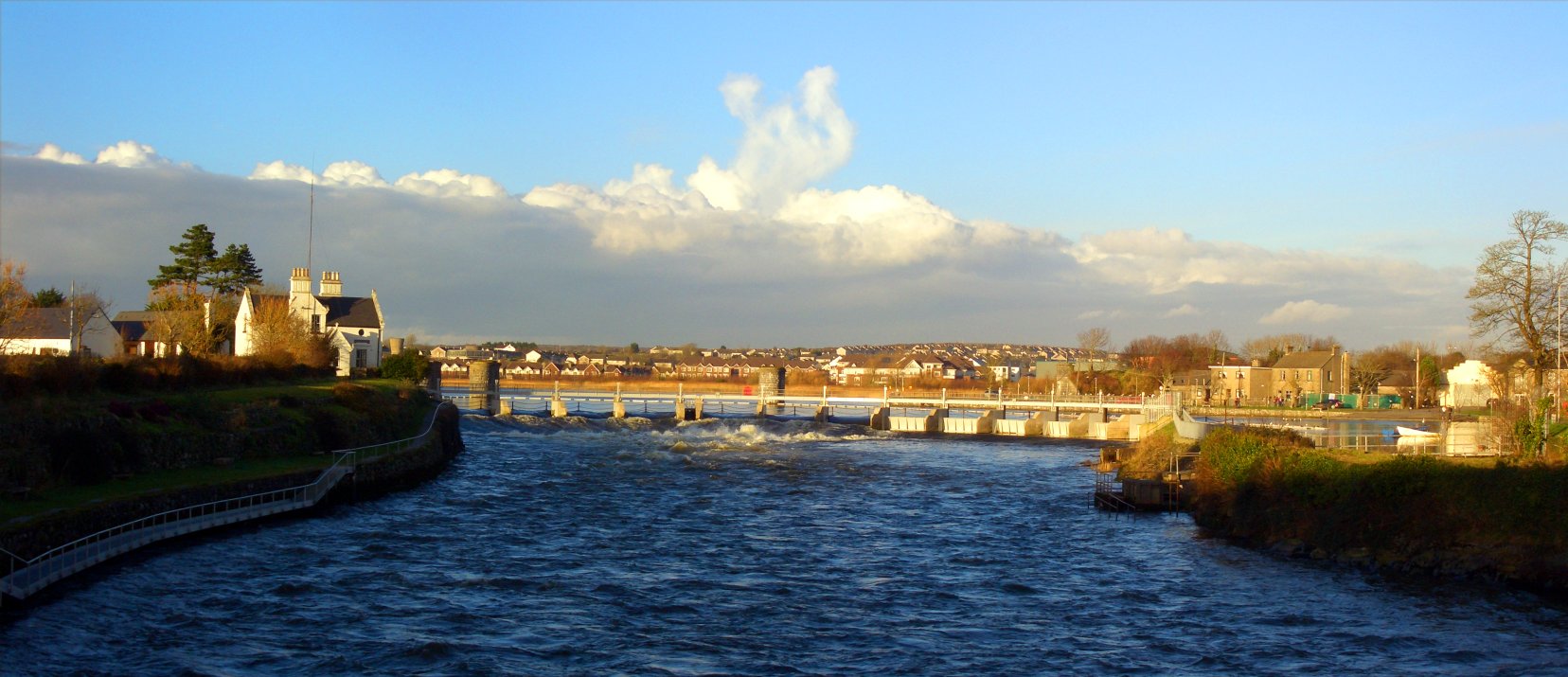
    County Limerick is drained principally by the Rivers Mulkear, Loobagh, Maigue, Deel and the Feale, which are all, ultimately, tributaries of the River Shannon. The Shannon Estuary forms the northern boundary of the county, giving Limerick a navigable outlet to the sea, the principal ports being Limerick and Foynes
    See also : Geography of Ireland

    Transportation--------------
    Rail
    Limerick has three operational railway lines passing through it,-the Ballybrophy line leading to North Tipperary through Nenagh and Roscrea
    -the Ennis line through County Clare (only that station is currently operation)
    -the Limerick Junction line which is the busiest line, connecting Limerick to the Cork-Dublin line.
    In addition, a line exists to Foynes but the last revenue service was in 2000.
    Bus
    The county's regional/national bus hub is located beside Limerick City train station.
    Air
    No commercial airports are situated in County Limerick and the region's needs are serviced from Shannon Airport in County Clare, although some in the south of the county may also use Kerry Airport and Cork Airport is also within 1 hour's drive.
    Tourist attractions in County Limerick
    Adare - Adare Manor - Castle Oliver - Clare Glens - Curraghchase Forest Park
    Foynes - Glin-Estuary Drive - Glenstal Abbey - King John's Castle - Lough Gur

    See Limerick for tourist attractions in Limerick city.
    Towns and villages
    Abbeyfeale - Adare - Annacotty - Ardpatrick - Askeaton - Athea - Athlacca - Ballingarry
    Ballylanders - Broadford -Bruff - Cappamore - Castleconnell - Castlemahon - Castletown - Clarina - Crecora - Croagh - Croom - Dromcolliher - Doon - Feenagh - Feohanagh - Foynes - Galbally - Garryspillane - Herbertstown - Hospital - Kilbehenny
    Kilfinane - Kilmallock - Kilteely-Dromkeen - Knockaderry - Limerick - Mountcollins -Murroe - Newcastle West - Oola - Pallasgreen - Pallaskenry - Patrickswell - Raheen
    Rathkeale - Shanagolden - Templeglantine - Tournafulla
    See also
    Teskey
    List of abbeys and priories in the Republic of Ireland (County Limerick)
    External links
    Limerick's Official Tourist Website
    Limerick County Council
    Map of Limerick
    Limerick GAA Website
    Worthies of Thomond by Robert Herbert- biographical profiles of notable Limerick & Clare people
    Ferrar's History of Limerick
    THE SÉAMUS Ó CEALLAIGH COLLECTION - Limerick sports history and Gaelic Games
    )))))))))))))))))))))))))))))))))))))))))))))))))) )))))))))))))))))))))))))))))))))))))))))))))))))) )))))))))))))))))))))))))))))))))))))))))))))))))) )))))))))))))))))))))))))))))))))))))))))))))))))) ))))
    Capital: Limerick
    Limerick.com Street Map of Limerick City
    Accommodation in Limerick-Map of Limerick-Accommodation Guide
    Limerick Map - Road detailed map of Limerick -
    WGS-84 (GPS) Coordenadas: 52.6652° N 8.6238° O
    www.foundmark.com/.../pages/Lk-stats.html
    Read more about Limerick:
    The City, Do & See, Cafés, Eating, Bars & Nightlife, Shopping, Sleeping, Essential Information
    Limerick (en idioma irlandés: Luimneach) es una ciudad capital del Condado de Limerick en la provincia de Munster, en el oeste de la República de Irlanda.
    Geografía
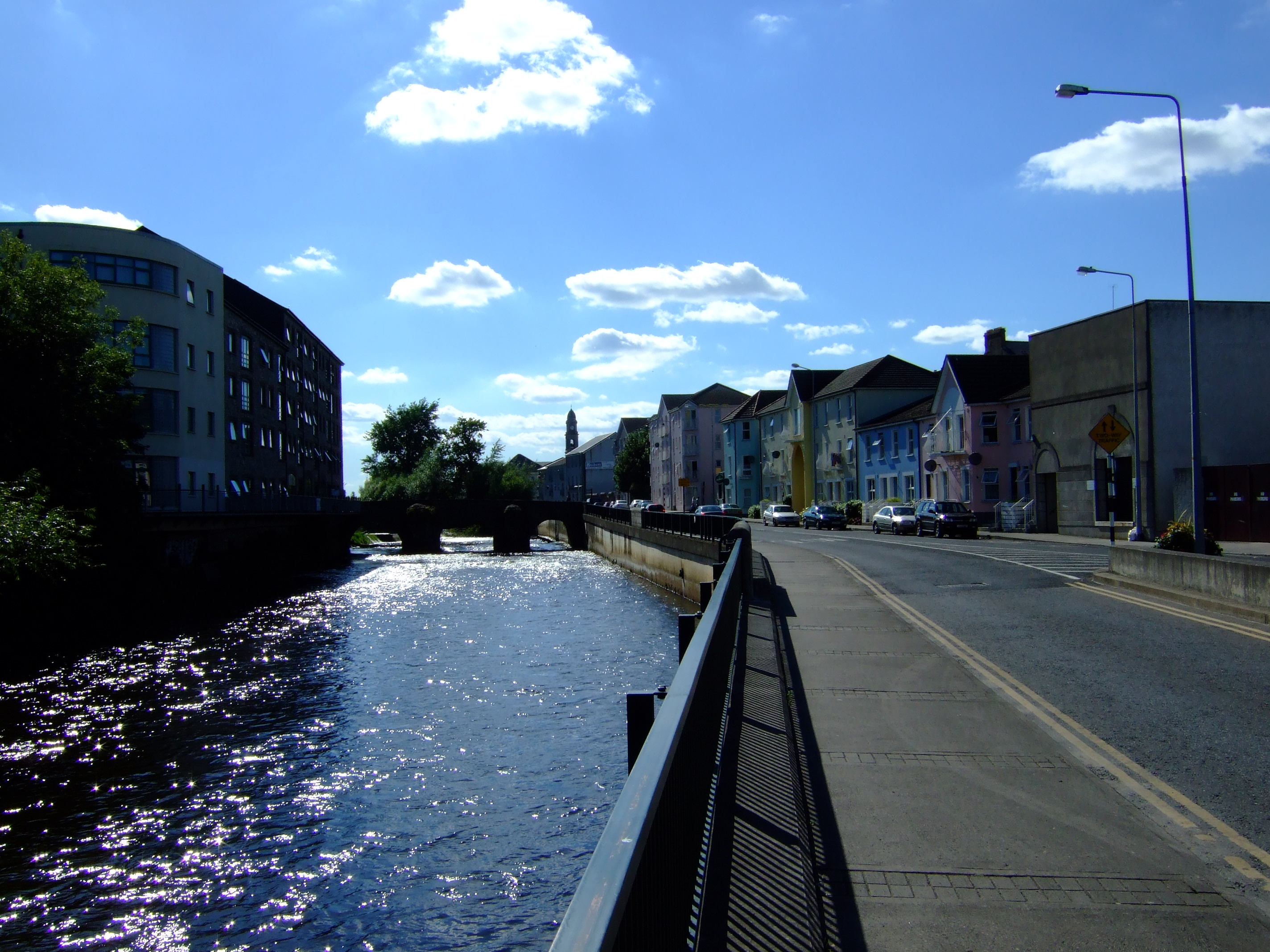
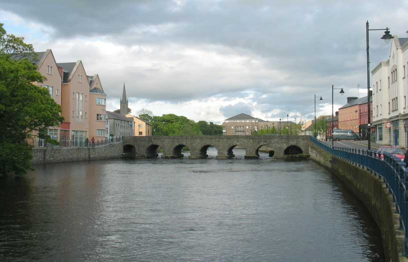
    La ciudad se encuentra a orillas del río Shannon, que se puede cruzar en tres puntos cercanos al centro de la ciudad. Aunque la población de la ciudad es de 54.023 habitantes (2002), contando su área metropolitana alcanzaría los 86.998 (2002). Su área es de 20,79 km²
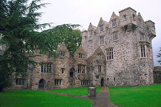
    Sus visitantes se mantienen siempre ocupados visitando King John´s Castle, St. Mary´s Cathedral, Hunt Museum, haciendo visitas a pié por la ciudad y paseos en barca a lo largo del Shannon.
    Economy - Transport - Architecture - Education -
    Historia de Limerick
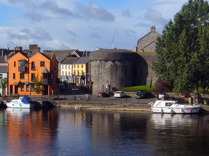
    La ciudad data desde al menos la colonización de los vikingos en el año 812; aunque algunos estudios sugieren la presencia de poblaciones anteriores en la zona. Los normandos rediseñaron la ciudad en el siglo XII y añadieron parte de los edificios más notables de la población, como por ejemplo, el Castillo del Rey Juan (St. John's Castle en inglés) o la Catedral de Santa María. Durante las guerras civiles del siglo XVII, la ciudad desempeñó un papel crucial, siendo sitiada por Oliver Cromwell en 1651 y dos veces por los Guillermistas en los años 1690. Al final del segundo de estos sitios se firmó el Tratado de Limerick (1691).
    Limerick se enriqueció del mercado a finales del siglo XVIII, pero el Acta de Unión en 1800 y la hambruna causó una depresión económica de la que el país solo logró superar en los tiempos del Tigre Celta en los años 1990. La línea ferroviaria a Waterford unió a la ciudad a la principal entre Cork y Dublín en 1848 y a Waterford en 1853. La apertura de cierto número de líneas secundarias, convirtió a la ciudad en un centro de comunicaciones a nivel regional.

    Vista del Río Shannon, con el barrio medieval al fondo
    Arte
    La ciudad ha servido como escenario al libro de Frank McCourt: Las cenizas de Ángela y para la película del mismo nombre.
    Turismo
    La ciudad de Limerick es una de los destinos turísticos favoritos dentro de la isla. La ciudad está a sólo 15 minutos en coche del Aeropuerto del Shannon. Actualmente el turismo se está incrementando a un ritmo espectacular tal que en 2006 se abrieron 5 nuevos hoteles proporcionando 1.000 camas más para los turistas.
    Las mayores atracciones turísticas de la ciudad incluyen el Castillo del Rey Juan (1212), La Catedral de St. Mary (1168), la Piedra del Tratado (Treaty Stone) o el Museo Hunt. Existen además distintos itinerarios turísticos por diversas partes de la ciudad, así como visitando los principales lugares citados en las obras de Frank McCourt. El pueblo de Adare se encuentra en los alrededores de la ciudad y es una atracción turística bastante popular por sus construcciones tradicionales.
    Crime
    Media articles often refer to Limerick as "Stab City", a term which originated in the press in the 1980s, but this is not supported by the facts or by official statistics. Specifically, in the last year Dublin has had 10 fatal stabbings (Limerick had 1, Cork had 2 in the same period). Knife crime is actually now perceived as a major problem throughout the entire country.
    A March 11th 2008 article in The Irish Times suggested that violent crime rates in Limerick are higher than elsewhere in the country.
    Recent years have seen serious crimes in Limerick being linked with feuds between criminal gangs within certain areas of the city, mainly Moyross, Southill and St. Mary's Park. Arguably, this rivalry was precipitated by the murder of alleged gang member Eddie Ryan in November 2000, in a public house in the Johnsgate area of the city.
    Despite a relative lull in gang violence between 2004 and the first half of 2006 in Limerick's housing estates, the problem seems to have escalated again in September 2006, with two children suffering extensive burns in the torching of their mother's car in early September, and a series of apparently retaliatory attacks including a drive-by shooting later that month.
    Recently the government appointed Mr. John Fitzgerald (retired Dublin City Manager) to carry out a speedy and comprehensive investigation of issues prevailing in Moyross and other parts of Limerick City and to make recommendations directly to the Government's Cabinet Committee on Social Inclusion. Mr. Fitzgerald reported back in early April 2007 and his recommendations were fully endorsed and approved by the Cabinet. A key element of the approved recommendations was the creation of two new special purpose Government Agencies for the Southside and Northside of Limerick City and these Agencies were established by Government Order dated 15th June 2007.
    Enlaces externos
    Wikimedia Commons / Limerick
    Limerick-City.com
    Limerick City Council
    Limerick.com
    Colegio Limerick
    www.limerickcoco.ie
    Cursos de inglés en Limerick, Escuelas de inglés en Limerick ...
    Castillo del Rey Juan (Limerick) - Wikipedia, la enciclopedia libre
    )))))))))))))))))))))))))))))))))))))))))))))))))) )))))))))))))))))))))))))))))))))))))))))))))))))) )))))))))))))))))))))))))))))))))))))))))))))))))) )))))))))))))))))))))))))))))))))))))))))))))))))) ))))
    Limerick
    Disfrute de un condado lleno de paisajes maravillosos y de sorpresas
    Descubra un condado espectacular, rico en herencia cultural y algunas de las localidades más bellas de Irlanda.
    Limerick es una verdadera joya, que se extiende a lo largo de la gloriosa región del Shannon. En cada esquina hay algo diferente, un pueblecito encantador, un castillo excéntrico, una maravilla arqueológica o una vista espectacular.
    La sobrecogedora belleza de las Montañas Ballyhoura preside sobre una campiña tranquila y salpicada de lugares históricos y monumentos evocadores.
    Los pueblecitos y ciudades de Limerick son famosos por su belleza, y hay lugares como Castleconnell, Killmallock y Adare llenos de una magia y romanticismo muy especiales. Quedará seducido al instante.

    County Limerick - Adare - Thatched Roof Cottage

    Tom Stade - Duke Special - Fitzgeralds Woodlands Hotel - Overnight Spa Escape - Shannon Region Tourist Authority - Adare Village - Visión general - Destacamos - Datos - Alojamiento - Mapa - Sobre Irlanda - Dónde Ir - Qué ver y qué hacer - Planficar visita - Alojamiento - Ofertas
    )))))))))))))))))))))))))))))))))))))))))))))))))) )))))))))))))))))))))))))))))))))))))))))))))))))) )))))))))))))))))))))))))))))))))))))))))))))))))) )))))))))))))))))))))))))))))))))))))))))))))))))) ))))
    ¿Lo sabía?
    El café irlandés se hizo por primera vez en Foynes, Condado de Limerick, centro de aviación en ese momento. El inventor, Joe Sheridan, ¡lo ideó para animar y calentar un poco a los congelados
    )))))))))))))))))))))))))))))))))))))))))))))))))) )))))))))))))))))))))))))))))))))))))))))))))))))) )))))))))))))))))))))))))))))))))))))))))))))))))) )))))))))))))))))))))))))))))))))))))))))))))))))) ))))
    Limerick is a medieval city, standing where the River Shannon becomes tidal.
    As an historic place it has many interesting features as well as being an important port and industrial centre.
    County Limerick is a place of quiet beauty and rural charm, offering good sport to the angler and golfer and some of the finest hunting country in Ireland.
    Much of County Limerick is low and undulating-particularly in the east, where it forms part of the rich plain known as the Golden Vale. There are, however, considerable elevations towards the west, south and north-east fringes of the county, and in the south-east the Galtee mountains reach into County Limerick from neighbouring County Tipperary.
    Many 12th century churches can be found throughout Limerick and The Hunt Museum houses a fine collection of Irish and European religious art. Recently moved, the Hunt Museum in the Old Customs House is one of the finest collections of antiquities in Europe. The Augustinian Friory has a true medieval feel, while the 13th-century Trinitarian Abbey is the only house of the order in Ireland. Both are still in use, the former by the Church of Ireland, the latter by the Catholic Church.
    Adare Village a few miles from Limerick City is billed as the prettiest village in Ireland. Restored in the 1820's by the Earl of Dunraven the long narrow Village Street is a picture of neat stonework and thatch roofs. The county spreads out around the mouth of the Shannon, Ireland's longest river, and its main focus Limerick City is built on the river, where it meets the Atlantic Ocean. Ireland's third largest city, Limerick, is home to a grid of gracious Georgian terraces and earlier medieval town plans.
    Co. Limerick has a whole range of visitor attractions that are well worth exploring. Attractions include the Adare Heritage Centre on Adare's pretty main street; Croom Mills Waterwheel and Heritage Centre, the Foynes Flying Boat Museum - once the centre of the aviation world where Irish coffee was invented; Celtic Park and Gardens; Curraghchase Forest Park and Lough Gur, habitat of Neolithic Man and one of Ireland's most important archaeological sites.
    Main Tourist Attractions
    · Croom Mills and Heritage Centre - Limerick
    This uniquely restored nineteenth century granary shows working conditions for millers and blacksmiths in dramatic settings. It is complimented by an audio-visual film on the history of grain milling locally. The mill race flows gently beneath the superb restaurant and craft shop
    · Curraghmore Forest Park - Kilcornan
    Located at Kilcornan, Curraghchase Forest Park is a six hundred acre plantation of exceptional beauty. It features walkways, a lake and garden, a nature trail and the ruins of the eighteenth century home of the poet Aubrey de Vere.
    · Foynes Museum - Limerick
    The Foynes museum recalls the era with a comprehensive range of exhibits and graphic illustrations. It also includes a 1940s style cinema, the original terminal building through which many VIPs passed, war years' radio and the weather room. Irish coffee was "invented" here in 1943. During the 1930s and early 1940s, the port of Foynes was the fulcrum point for air traffic between the United States and Europe. The famous flying boats were frequent visitors, carrying passengers who ranged from celebrities to refugees.
    · Lough Gur Stone Age Centre - Ballyneety
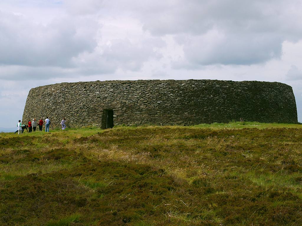
    Located at Ballyneety, the Lough Gur Centre is the most important Stone Age site in Ireland. The visitor centre, on its lakeside site, contains a display and audio-visual show presenting the site's history. The archaeology of the area provides evidence of the activities of the first farmers in the region, their dwellings, ritual and burial sites, as well as their tools and implements. The story stretches over 5,000 years and continues to the present day.
    · The Bishops Palace - Limerick
    The Bishops' Palace is located at Church Street, adjacent to King John's Castle and is the restored home of former Protestant Bishops of Limerick. The Palace has a classical facade and is related to the English Palladian style.
    · The Hunt Musem - Limerick
    Located at The Custom House, Rutland Street, Limerick City, the Hunt Museum is home to one of Ireland's greatest private collections of art and antiquities. Generously donated to the 'people of Ireland' by John and Gertrude Hunt who collected pieces from the four corners of the world. The Collection reflects our Celtic past as well as masterworks by Da Vinci, Yeats and Renoir.
    Heritage Sites
    · Banqueting Hall (Desmond Hall) - Newcastlewest
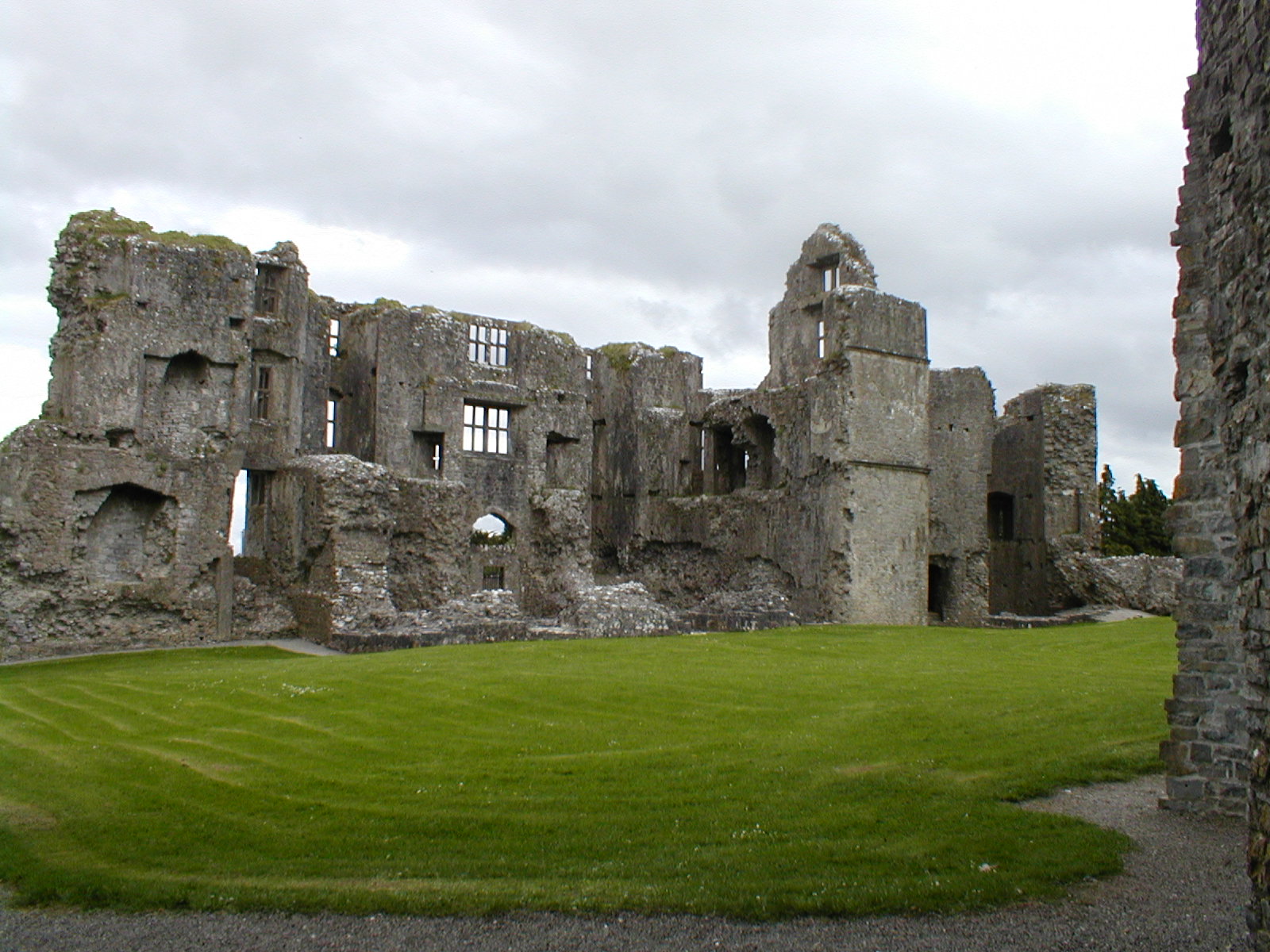
    West Limerick preserves many of Ireland's surviving spacious medieval halls. The desmond banqueting hall is an imposing two-storey structure and was used by the Earls of Desmond for banqueting and entertainment. The Hall, vaulted lower chamber and adjoining tower were all constructed during the 15th century (the hall and chamber were built on the remains of a 13th century structure of similar size).
    )))))))))))))))))))))))))))))))))))))))))))))))))) )))))))))))))))))))))))))))))))))))))))))))))))))) )))))))))))))))))))))))))))))))))))))))))))))))))) )))))))))))))))))))))))))))))))))))))))))))))))))) ))))
    En la ciudad más antigua de Irlanda podrás encontrar edificios medievales, exuberantes y verdes praderas, magníficos castillos y una extraordinaria vida nocturna.
    Limerick está situado en el río Shannon cerca de la pintoresca costa de Irlanda. Es la tercera ciudad más grande de Irlanda con 90.000 habitantes. Se caracteriza por poseer edificios históricos y un romántico castillo. Limerick es una ciudad de estudiantes con mucha vida y muy hospitalaria con varios pubs, bares y restaurantes. Hay varios museos y galerías de arte que muestran tanto arte irlandés como internacional. Limerick está situada en el corazón de la verde Irlanda y es ideal para hacer excursiones. Su capital, Dublín y Cork están a una distancia bastante cercana.
    Actividades de ocio y tiempo libre
    En la parte antigua de la ciudad de Limerick, conocida como la ciudad irlandesa, se encuentran la mayoría de los edificios antiguos de la ciudad. La mayoría de las casas fueron edificadas en el siglo XVIII.
    En el Hunt Museum, un viejo almacén del siglo XIX, han sido expuestas más de 2.000 obras de arte de conocidos artistas de los siglos XIX y XX. Por ejemplo, esculturas de Picaso o de Leonardo da Vinci. Hay más exposiciones contempóraneas, que se muestran en la galería de arte de Limerick.
    Limerick dispone de una animada escena musical. Muchas salas de conciertos y pequeños pubs ofrecen a numerosos grupos irlandeses la oportunidad de tocar en directo.
    El fin de semana se ofrece una excursión a la trepidante capital de la Isla, Dublín.También se llega rápido a Cork, la segunda ciudad más grande de Irlanda.
    Te recomendamos que reserves tu vuelo a Shannon o Dublín. Hay un servicio de autobuses desde el aeropuerto de Dublín hasta Limerick (precio aproximdo 20 €—45 € Duración: 5 horas). Para conseguir información adicional puedes visitar la web www.buseireann.ie. El primer autobús de Dublín a Limerick sale a las 7:30 de la mañana y el último a las 20:00. El primer autobús de Limerick a Dublín sale a las 7:30 (y llega al aeropuerto de Dublín a las 11:10), el último sale a las 19:30 (llega al aeropuerto de Dublín a las 23:10). El servicio de transfer desde el aeropuerto de Shannon (solo ida) o la estación de tren o autobuses de Limerick hasta el alojamiento está incluido en el precio del curso.
    1.Limerick - Inglés - Cursos de idiomas para adultos - Inglés - LISA ...
    )))))))))))))))))))))))))))))))))))))))))))))))))) )))))))))))))))))))))))))))))))))))))))))))))))))) )))))))))))))))))))))))))))))))))))))))))))))))))) )))))))))))))))))))))))))))))))))))))))))))))))))) ))))
    Limerick, el paseo más animado de Irlanda
    Limerick es conocida internacionalmente por ser el lugar donde pasó la infancia el escritor Frank McCourt, nacido en Nueva York y autor del best-seller Las cenizas de Ángela. Hoy en día se puede decir que, a pesar de que no le hace falta situaciones externas para atraer turistas, gracias a la novela han venido hasta aquí numerosísimas personas.
    La ciudad de Limerick tiene unos 91.000 habitantes y se encuentra en la zona más meridional del país. Vale la pena viajar hasta allí al menos un día, si no una estancia de un fin de semana. El centro de la ciudad se divide en tres secciones, conocidas como English Town, Irish Town y Newton Pery.
    - English Town es donde se concentra la mayoría de los lugares turísticos de la ciudad.
    - En Irish Town podemos encontrarnos con la gran belleza de sus calles.
    - Y en Newton Pery nos quedaremos con la arquitectura georgiana.
    Podemos comenzar nuestra visita en el Castillo del Rey Juan, una estructura fortificada del siglo X, justo cuando los vikingos comenzaron a llegar a la zona. De allí tenemos una fabulosa vista de la Catedral de Santa María, una catedral anglicana del siglo XII. Pero Limerick también tiene otra catedral, la de San Juan, catedral católica mucho más reciente. Construida en el siglo XIX, tiene la aguja más alta de Irlanda.
    La ciudad también cuenta con el Museo Hunt, donde se expone la colección de la familia Hunt. Algunas de las piezas que se exponen son de la Edad de Piedra e incluso otras pertenecen al antiguo Egipto.
    Otra de las grandes opciones que tenemos en Limerick es un paseo en barco, o bien un tour sobre los lugares más significativos del autor Frank McCourt. Nos acercamos ahora al Milk Market, construido a principios de 1800, un mercado interior que se puede visitar sobre todo los sábados. Durante el resto de la semana están abiertos los puestos que no venden productos de alimentación.
    El Newton Pery es la zona del centro, y es donde podemos contemplar la arquitectura típicamente georgiana, edificios construidos en el siglo XIX.
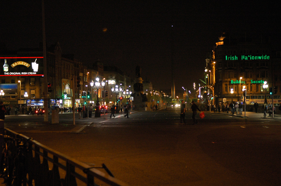
    Por otra parte, la vida nocturna aquí es muy activa, y ofrece un montón de lugares para pasar la noche. Desde los tradicionales pubs irlandeses a los bares más modernos. Además, teniendo en cuenta que Limerick es una ciudad universitaria, podéis estar seguro de que la noche y el ambiente suele estar muy animado.
    (Por: Jose Manuel Vargas) (sobreirlanda.com)
    )))))))))))))))))))))))))))))))))))))))))))))))))) )))))))))))))))))))))))))))))))))))))))))))))))))) )))))))))))))))))))))))))))))))))))))))))))))))))) )))))))))))))))))))))))))))))))))))))))))))))))))) ))))

    Comentario

    • Nettus
      Usuario
      • 1 feb, 2008
      • 4715
      • Lundby

      Tipperary

      )))))))))))))))))))))))))))))))))))))))))))))))))) )))))))))))))))))))))))))))))))))))))))))))))))))) )))))))))))))))))))))))))))))))))))))))))))))))))) )))))))))))))))))))))))))))))))))))))))))))))))))) ))))
      19. Condado: Tipperary
      Capital: norte: Nenagh - sur: Clonmel
      Province: Munster - Area: 4,303 km2 - Population: ~ 155.000
      County Tipperary (Irish: Contae Thiobraid Árann) is a county in Ireland situated in the province of Munster. Tipperary was one of the first Irish counties to be established in the 13th century. For all government administration purposes the county is divided into North Tipperary (county town: Nenagh) and South Tipperary (county town: Clonmel). This division dates back to the Local Government (Ireland) Act 1898, the county's two "ridings" having had separate assize courts for much longer. The use of riding for the divisions was a historical misnomer, since the word derives from the dividing of an area into three parts. Indeed the expression riding has been discontinued for official purposes since 2002 (Local Government Act, 2001 section 10 and schedule 5)
      Tipperary is sometimes referred to as the Premier County, a description attributed to Thomas Davis, Editor of The Nation newspaper in the 1840s as a tribute to the nationalistic feeling in Tipperary and said that "where Tipperary leads, Ireland follows". Tipperary is famous for its horse breeding industry and is the home of Coolmore Stud, which is the largest thoroughbred breeding operation in the world. The County forms a large part of the Golden Vale (or Vein) of Munster, boasting a rich and fertile agricultural landscape. The County particularly nurtures the ancient game of hurling and its teams have regularly been champions of Ireland since the 19th century.
      The town of Tipperary situated in the south west of the county was the subject of the famous World War IBritish army song It's a Long Way to Tipperary. As with several other counties in Ireland named for a town or village (examples include Leitrim and Mayo) Tipperary Town has never been the county town of County Tipperary. That honour belonged to Cashel for a while prior to the creation of the County Palatine and thereafter to Clonmel until the creation of separate assizes in 1838 when Clonmel has shared the honour with Nenagh
      Towns and villages
      Ballina - Bansha - Borrisokane - Borrisoleigh - Cahir - Carrick-on-Suir - Cashel -
      Castleiney - Clonmel - Cloughjordan - Dundrum - Emly - Fethard - Golden - Hollyford
      Holycross - Horse and Jockey - Killenaule - Kilmoyler - Knockgraffon - Lisronagh
      Littleton - Loughmore - Milestone - Nenagh - New Inn - Newport - Rearcross - Roscrea
      Rosegreen - Templemore - Thurles - Tipperary Town - Toomevara - Two-Mile Borris
      Upperchurch
      Townlands
      Boytonrath - Garranlea - Lagganstown
      Knockshegowna (Ballingarry) - Cnoc Shí Gubhna Baile an Gharraí
      Places of interest
      Athassel Priory - Cahir Castle - Dromineer
      Galtymore - the highest mountain in County Tipperary (919m).
      Glen of Aherlow - Holy Cross Abbey - Lough Derg - Ormonde Castle
      Redwood Castle (Castle Egan)
      Rock of Cashel
      Slievenamon - Sliabh na mBan - mountain associated with many Irish legends (721m).
      See also
      Irish Vehicle Registration Plates
      List of abbeys and priories in the Republic of Ireland (County Tipperary)
      North Tipperary
      South Tipperary
      Tipperary Hill, a neighbourhood in Syracuse, New York, United States, inhabited by many descendants of County Tipperary.
      External links
      Tipperary Institute
      County Tipperary Historical Society
      A website dedicated to the genealogical records of the county. It offers fragments of the 1766 census, the complete Down Survey, as well as a ream of other useful information
      )))))))))))))))))))))))))))))))))))))))))))))))))) )))))))))))))))))))))))))))))))))))))))))))))))))) )))))))))))))))))))))))))))))))))))))))))))))))))) )))))))))))))))))))))))))))))))))))))))))))))))))) ))))

      Nenagh (An tAonach in Irish) is the county town of North Tipperary, Ireland. It is the administrative capital of North Tipperary. It has a population in 2006 of 7,415.
      Nenagh was originally a market town, and its name in Irish, An tAonach means "The Fair", a reference to Aonach Urmhumhan, the Ormond (East Munster) Fair, of which it was the site. Nenagh is today a busy commercial town and is governed by Nenagh Town Council. The town's historic attractions include Nenagh Castle, the Heritage Centre, and the ruined Franciscanabbey.
      Geography
      Nenagh lies to the west of the Nenagh River, which empties into Lough Derg at Dromineer, 9 km to the north-west, a popular centre for sailing and other water sports. The Silvermines mountains lie to the south of the town, with the highest peak being Keeper Hill (Sliabh Ciamalta in Irish) at 694m. The Silvermines Mountains have witnessed mining for silver and base metals on and off over seven hundred years. Traces of 19th century mine workings remain.

      Road
      Nenagh is situated on the R445Regional Road, which links it to the N7National Primary Route (which bypasses the town to the south) between Limerick and Dublin, as well as the N52National Secondary Route to Birr (and through the Midlands to Dundalk).
      Rail
      Nenagh has a station on the railway line between Limerick and Ballybrophy. Passengers can connect at Ballybrophy to trains heading northeast to Dublin or southwest to Cork or Tralee. Nenagh railway station opened on 5 October 1863.
      The railway line is lightly used. Lack of upkeep means that the line is restricted to a maximum speed of 40 km/h and the existing trains are poorly timetabled for commuters. A committee (the Nenagh Rail Steering Committee) working in conjunction with Irish Railway News, had a meeting with the national railway company Iarnród Éireann (IÉ) on 1 September 2005 to present the results of a traffic study funded by Nenagh Town Council and North Tipperary County Council, and to seek a morning and evening service between Nenagh and Limerick which would increase commuter traffic. IÉ agreed to delay an afternoon service from the December 2005 timetable and to work towards an early service when equipment permitted from 2007.
      While the twice-a-day service on the Ballybrophy/Limerick line is poor, Nenagh is only 37 km from Thurles, which is on the main Dublin/Cork line, and which has around 18 trains daily in each direction, including non-stop services to and from Dublin.
      See also
      Nenagh Guardian
      Nenagh railway station
      Ardcrony
      List of towns and villages in Ireland
      Market Houses in Ireland
      External links
      Nenagh - The Friendly Town
      Nenagh Community Bulletin Board
      Nenagh Town Council
      )))))))))))))))))))))))))))))))))))))))))))))))))) )))))))))))))))))))))))))))))))))))))))))))))))))) )))))))))))))))))))))))))))))))))))))))))))))))))) )))))))))))))))))))))))))))))))))))))))))))))))))) ))))
      Capital: -sur: Clonmel
      Interactive Map of Clonmel, County Tipperary, Ireland
      WGS-84 (GPS) Coordinates: 52°21′14″N 7°42′42″W / 52.3539, -7.7116

      Clonmel (Cluain Meala en irlandés) es una localidad de la República de Irlanda situada en el Condado de Tipperary. Se encuentra en medio de un valle, rodeada de montañas y colinas. Tiene al sur las montañas de Comeragh y al este la población de Slievenamon. El río Suir atraviesa la localidad.
      Clonmel fue construida en la Edad Media y conserva muchos elementos que recuerdan su pasado, tales como parte de la muralla que la rodeaba. Oliver Cromwell sitió la ciudad en 1650.
      Clonmel ha sido siempre un centro importante de comercio. El río era navegable hasta Clomel hacia 1760 y la finalización de los trabajos en el Suir durante el siglo XIX permitió qué barcos de mayor tamaño alcanzaran los muelles de la localidad.

      Culture: Museums - Art galleries - TheatreMusic - Coursing - Events
      Transport
      The river had been made navigable to Clonmel from 1760 when completion of the River Suir Navigation in the 19th century allowed large vessels to reach the town's quays. Charles Bianconi, onetime mayor of Clonmel, ran his pioneering public transport system of horse-drawn carriages from Clonmel. Clonmel railway station opened 1 May1852. Today, there are four trains daily to Waterford and four to Limerick Junction which has main-line connections to Dublin.
      Clonmel is located on the N24, the national primary roadway that links the cities of Limerick and Waterford.
      Commerce
      In recent times Clonmel has become the home to many large multi-national companies, particularly in the medical area. The two biggest medical companies in the town are Abbott and Boston Scientific, both of which manufacture implantable devices. Bulmerscider, also known as Magners outside of Ireland, is brewed in a complex three kilometres east of the town, and the extensive orchards serving the brewery can be seen from the road when approaching Clonmel from that direction.
      See also
      List of towns in the Republic of Ireland
      Market Houses in the Republic of Ireland
      Siege of Clonmel
      External links
      Tipperary Institute
      Clonmel.ie, Clonmel town's official Website
      clonmel.ie, Página oficial de Clonmel
      visitclonmel.com: Clonmel Negocios, Turismo y Noticias
      )))))))))))))))))))))))))))))))))))))))))))))))))) )))))))))))))))))))))))))))))))))))))))))))))))))) )))))))))))))))))))))))))))))))))))))))))))))))))) )))))))))))))))))))))))))))))))))))))))))))))))))) ))))
      Tipperary, Ireland's largest inland county, has richly varied scenery in its hills and mountains, its plains and river valleys.
      In the south are the Galtee Mountains, the Knockmealdowns and the isolated height of Slievenamon.
      The middle of the county is a broad plain, through which the River Suir flows from north to south; and from this plain the rich land of the Golden Vale extends westwards into County Limerick.
      Apart from its scenery and Tipperary has excellent facilities for pastimes such as angling, golf, mountain climbing, caving and hunting.
      Tipperary is Ireland's best-recognized county, popularized in the World War One song 'Its a long long way to Tipperary'. Tipperary has a long and fabled history, and when traveling there, must-see's are the fabulous ruins at the Rock of Cashel, once a seat of the kings of Munster, is the most notable landmark. Approached from the north or west, The Rock of Cashel appears as a mirage of crenellations rising bolt upright from the vast encircling plain.
      The rock, less than a quarter of a mile wide, is arguably the most extraordinary architectural site in Ireland and is also the place where St Patrick is supposed to have picked a shamrock in order to explain the doctrine of the Trinity.
      Tipperary has beautiful lush mountain scenery and the most famous of these hills is known as the Devil's Bit, named for the bite taken out of it by the devil as he rode over Ireland, and the hunk he spat out is now the Rock of Cashel! The mighty River Shannon, Ireland's longest, flows through Tipperary, and Lough Derg, shown here is the biggest of its 3 lakes.
      Tipperary's countryside is rich in contrast. The Silvermines and Devil's Bit mountains provide spectacular drives and stimulating walks. The river Suir is noted for its brown trout and is accessible at many points.
      Tipperary attractions include Holy Cross Abbey - one of Europe's most significant early monastic sites; Nenagh and Roscrea heritage centres and "Lar na Pairce", Thurles, an interpretative centre that tells of the history of Gaelic Games. Activities include River Shannon cruising (including day cruises), sailing, angling, watersports, golf, horse riding and bird watching.
      Main Tourist Attractions
      · Carrick On Suir Heritage Centre - Carrick-On-Suir
      This former Protestant church, now restored as a heritage centre, was once part of the Pre-Reformation burial ground and church site of Carrick Mor. Its interesting gravestones include a memorial to Thomas Butler, an illegitimate son of Thomas, tenth Earl of Ormonde. Dorothea Herbert, daughter of the eighteenth century rector and author of 'Retrospections' is also buried here.

      · Cashel Folk Village - Cashel
      Located at Dominick Street, Cashel, it has a delightful series of informal reconstructions of various traditional thatched village shops, a forge and other business. It is housed within the town of Cashel, near by the famed Rock of Cashel.
      · Mitchelstown Cave - Cahir
      Located at Burncourt, Cahir, is considered one of the most spectacular caves in Europe. The caves have three massive caverns, in which the visitor is surrounded by indescribable drip stone formations, stalactites, stalagmites and huge calcite columns.
      · The Bru Boru Centre - Cashel
      Located beside the Rock of Cashel, it has a folk theatre, restaurant, craft and information centre and a genealogy suite. Traditional Irish music, song and dance are provided for visitors by the world famous resident Bru Boru group of Irish musicians and artists during the Summer season.
      · The Dundrum Plantarum - Dundrum
      It has eight acres of trees, shrubs and a two mile walk. There are sixty thousand plants and over two thousand varieties. A Celtic theme runs through the Plantarum with crannogs, dolmens and fairy forts all on view. There are also many interesting water features including lakes and waterfalls.
      Heritage Sites
      · Cahir Castle - Cahir
      Located at Castle Street, Cahir, is one of Ireland's largest and best preserved castles. It is situated on a rocky island in the river Suir. The Castle's attractions include an excellent audio-visual show called 'Partly Hidden and Partly Revealed' in English, French, German and Italian, informing visitors about all the main sites of the area.
      · Ormond Castle - Carrick -
      www.discoverireland.ie/Result/IndividualResul...
      Located at Castle Park, Carrick on Suir, is one of the finest examples of an Elizabethan manor house in Ireland. It was built by Thomas, the tenth Earl of Ormond in the 1560s. Closely integrated into the manor house are two fifteenth century towers. It is the country's only major unfortified dwelling from that turbulent period. The state rooms contain some of the finest decorative plasterwork in the country, including plasterwork portraits. Access to the castle is by guided tour only, with a maximum number of twenty people at one time.
      · Roscrea Heritage (Castle and Damer House) - Roscrea
      The stone castle consists of a gate tower, curtain walls and two corner towers dating from the 1280s. The castle rooms are furnished and some house exhibitions. Built in the early 18th century in the Queen Anne style, Damer House is an example of pre-Palladian architecture. Its rooms house temporary exhibitions.
      · Swiss Cottage - Cahir
      Located close to Cahir Town, the Swiss Cottage is a delightful 'cottage ornee' built in the early 1800s on the estate of the Earls of Glengall. It is situated on an elevated site with access by stone steps.
      · The Rock of Cashel - Cashel
      A spectacular group of medieval buildings on an outcrop of limestone. Set in the Golden Vale, the group includes a round tower, Romanesque chapel, cathedral and restored hall of the Vicars Choral. On site there's an audio visual show entitled, Strongholds of Faith.

      www.rayjeanne.com/IR2007Page.htm
      )))))))))))))))))))))))))))))))))))))))))))))))))) )))))))))))))))))))))))))))))))))))))))))))))))))) )))))))))))))))))))))))))))))))))))))))))))))))))) )))))))))))))))))))))))))))))))))))))))))))))))))) ))))
      ¿Lo sabía?
      Las Islas Blasket están en el mismo borde de Europa y estuvieron habitadas hasta 1953, cuando la persistente emigración de su población más joven las dejó con tan sólo 22
      )))))))))))))))))))))))))))))))))))))))))))))))))) )))))))))))))))))))))))))))))))))))))))))))))))))) )))))))))))))))))))))))))))))))))))))))))))))))))) )))))))))))))))))))))))))))))))))))))))))))))))))) ))))
      Sur
      La pintoresca costa irlandesa del sur se balancea a su propio ritmo. Tranquila, bonita y llena de atracciones naturales, este será tu principal destino si lo que quieres son paisajes impresionantes o probar algún producto recientemente elaborado en una granja local.
      La pintoresca costa irlandesa del sur se balancea a su propio ritmo. Tranquila, bonita y llena de atracciones naturales, este será tu principal destino si lo que quieres es probar algún producto recientemente elaborado en una granja local, en algún restaurante gourmet o en un Mercado de Productos Agrícolas, que puedes escoger entre los muchos que verás por los coloridos pueblos o ciudades.

      El sur está dividido entre los condados de Carlow, Cork, Kerry, Kilkenny, Tipperary, Waterford y Wexford y tiene gran encanto en todos los sentidos, ya sea en sus encalados pubs disfrutando de una buena sopa de marisco, practicar ala delta en su mágico entorno, o conocer los espectaculares anillos de Beara y de Kerry.
      Si lo que quieres es mimarte en un balneario de lujo, Kerry es el lugar ideal, Cork tiene una gran cantidad de restaurantes muy famosos y a lo largo del “Soleado Sureste”, los bonitos pueblos pesqueros de Wexford y Waterford son una encantadora oferta si lo que te apetece es desconectar, y dejar que se te pierda la vista en sus playas de arena interminables.
      Kilkenny, Carlow y Tipperary tienen también mucha historia que contar, restos arqueológicos, monumentos y antiguos rincones de arte pagano para que explores a tu aire. Y todo esto envuelto en la belleza y tranquilidad de estos condados de aguas brillantes y naturaleza virgen.
      Nunca ha sido tan fácil llegar al sur de Irlanda con vuelos directos desde muchas ciudades españoles y estarás encantado con la gran cantidad de cosas que ver y hacer ne esta zona.
      Rothe House Christmas Miscellany
      New Ross Nollaig Festival
      CLARION HOTEL - Weekend 2 nights B and B + 1 dinner
      Visión general - Destacamos - Datos - Alojamiento - Mapa
      )))))))))))))))))))))))))))))))))))))))))))))))))) )))))))))))))))))))))))))))))))))))))))))))))))))) )))))))))))))))))))))))))))))))))))))))))))))))))) )))))))))))))))))))))))))))))))))))))))))))))))))) ))))
      Did you know?
      Ronald Reagan is actually a pub as well as a US president. The bar in Ballyporeen celebrates the president’s visit to the town when he enjoyed a pint in the place, which was later named after him
      )))))))))))))))))))))))))))))))))))))))))))))))))) )))))))))))))))))))))))))))))))))))))))))))))))))) )))))))))))))))))))))))))))))))))))))))))))))))))) )))))))))))))))))))))))))))))))))))))))))))))))))) ))))
      Tipperary
      Grande, exuberante y variado. Disfrute de multitud de actividades en el condado más grande del interior de Irlanda
      Tipperary es el condado más grande del interior de Irlanda, y debido a su tamaño, normalmente se divide en Tipperary del sur, en la región del sureste, y Tipperary del norte, en la región del Shannon.
      Grande, rico y variado, el condado ofrece excelentes vistas y paisajes, ya que Tipperary del norte queda delimitado por el deslumbrante Lago Derg, y Tipperary del sur disfruta de exuberantes valles y paisajes realzados por las preciosas Montañas Galtee y el místico Slievenamon.
      Con un sinfín de atracciones históricas, que incluyen la Roca de Cashel, el Castillo de Roscrea, y la Abadía Holycross, además de montones de pequeños pueblos pintorescos y bonitas ciudades, como Dromineer, Garrykennedy, Cahir y Terryglass, Tipperary es un condado que le encantará descubrir.


      )))))))))))))))))))))))))))))))))))))))))))))))))) )))))))))))))))))))))))))))))))))))))))))))))))))) )))))))))))))))))))))))))))))))))))))))))))))))))) )))))))))))))))))))))))))))))))))))))))))))))))))) ))))


      )))))))))))))))))))))))))))))))))))))))))))))))))) )))))))))))))))))))))))))))))))))))))))))))))))))) )))))))))))))))))))))))))))))))))))))))))))))))))) )))))))))))))))))))))))))))))))))))))))))))))))))) ))))

      Comentario

      • Nettus
        Usuario
        • 1 feb, 2008
        • 4715
        • Lundby

        Clare

        )))))))))))))))))))))))))))))))))))))))))))))))))) )))))))))))))))))))))))))))))))))))))))))))))))))) )))))))))))))))))))))))))))))))))))))))))))))))))) ))))))))))))))))))))))))))))))))))))))))))))))))))
        20. Condado: Clare - Capital: Ennis
        Provincia: Munster - Superficie: 3.174 km² - Población: ~ 110.000 - www.clare.ie

        www.spirited-ireland.net/map/clare/
        1 - Killimer - Tarbert - 2 - Quilty - 3 - Spanish Point - 4 - Miltown Malbay -
        5 - Cliffs of Moher - 6 - Burren - 7 - Bealaclugga
        Special Edition County Clare

        El condado de Clare (An Clár en irlandés) se encuentra en la provincia de Munster, en la República de Irlanda. Está situado en la costa occidental de la isla, frente al Océano Atlántico, al noroeste del río Shannon.
        Sitios de Interés: Acantilados de Moher (Una hilera de acantilados de los más altos de Europa) The Burren. (Zona al oeste del condado que contiene restos paleolíticos)

        Cliffs of Moher Guided Tours

        Clare is one of the 26 counties within the Republic of Ireland and it provides a basis for local government, in the form of its own constituency within the Dáil Éireann. The county system has existed since the 16th century; as well as its governmental usage, the counties form a significant part of local identity and culture within the country. Located on the west coast of Ireland, Clare is northwest of the River Shannon.
        The most populated town and county seat is Ennis.
        County Clare succeeded the district of Thomond (which was part of Connacht), and when first created it was sometimes called County Thomond. Its nickname is the Banner County, which may refer to a former local tradition of carrying banners at political meetings and public occasions.
        Geography
        Physical and geological
        See also: Geology of Ireland Bodies of water define much of the physical boundaries of Clare. To the southeast is the River Shannon which is Ireland's longest river, the border to the northeast is defined by Lough Derg which is the third largest lake on Ireland and to the west is the Atlantic Ocean. The only county which is physically connected to Clare by land is County Galway to the north, however there are several across-water bridges which connects it to eastwards County Tipperary and southwards County Limerick. Along with County Cork, County Kerry, County Waterford, County Limerick and County Tipperary, County Clare is part of Munster which is one of the four traditional provinces of Ireland.
        County Clare contains The Burren, a unique karst region, which contains rare flowers and fauna. At the western edge of The Burren, facing the Atlantic Ocean, are the Cliffs of Moher.
        The highest point in County Clare is Moylussa, 532m, in the Slieve Bearnagh range in the east of the county.
        The county's Southern border is the River Shannon, the longest river in Ireland. Along this estuary is the town of Shannon and the location of Shannon International Airport. This airport was the first airport to have a duty-free zone.

        www.touristr.com/flag/search_results?search=k...
        Kilrush was once a major port. There's still a marina here, lots of pubs and you can take a boat to see the dolphins on the Shannon Estuary.
        Main towns
        Ennis - Shannon - Kilrush
        Other small towns and villages
        Ballynacally, Ballyvaughan - Carrigaholt - Carron - Clarecastle - Cooraclare - Corofin - Cratloe - Cree (Creegh) - Doolin - Doonbeg - Doora - Ennistymon - Feakle - Inagh - Inch - Kilbaha - Kilfenora - Kilkee - Killadysert - Killaloe - KilmihilKilnamona - Lahinch - Liscannor - Lisdoonvarna - Lissycasey - Meelick - Miltown Malbay - Mountshannon - Mullagh - Newmarket-on-Fergus - O'Briensbridge - Ogonnelloe - Quilty - Quin - Scariff - Sixmilebridge - Tuamgraney - Tubber - Tulla - Whitegate
        Bunratty - Burren - Doolin - Doonbeg - Ennis - Ennistymon - Kilrush - Lahinch
        Lisdoonvarna - Miltown Malbay - Scarriff - Shannon Airport - Spanish Point

        www.touristr.com/flag/search_results?search=k...
        Spanish Point's Description
        On the coast, 2.5km from Miltown Malbay, Spanish Point was named after the unfortunate Spanish who died here in 1588, when many ships of the Spanish Armada were wrecked during stormy weather. Those who escaped from their sinking ships and made it safely to land were executed by Sir Turlough O’Brien of Liscannor and Boethius Clancy, High Sheriff of County Clare.
        Spanish Point Accommodation-Cheap Spanish Point Accommodations ... -
        Lahiffs Caravan & Camping
        Lahiffs Caravan & Camping is a fully serviced site on the N67 Coast road. The site is within walking distance to restaurants, golf course and beaches. There is a children's play area, electricity points for caravans, washing machines, gas lamps for sale, showers and a food shop on site.
        Spanish Point, Co. Clare -Tel: 065- 7084006
        PLACES TO STAY | Camping | Clare.ie
        Islands
        Aughinish - Inishmore (or Deer) Island - Mutton Island - Scattery Island
        Transport
        Percy French, a 19th Century Balladist, wrote his most famous song Are Ye Right There Michael? lambasting the inefficient rail network in the country at that time – and particularly, the West Clare Railway. French recounts his journey by rail between the Clare towns of Ennis and Kilkee. Unfortunately, bad as the rail network was in French's day, most of the system was closed starting in the 1940s. It was dug up and dismantled by successive governments over several decades in the 1950s, 60s and 70s as it was deemed uneconomic.
        Places of interest
        County Clare is known for beautiful natural scenery.
        Cliffs of Moher
        Doolin
        Ballyea waterfall
        The Burren
        Spanish Point
        Scattery Island only 2km offshore from Kilrush town.
        See also
        Edmund Lenihan
        List of abbeys and priories in the Republic of Ireland, (County Clare)
        External links
        Clare County Council
        Clare County Library for the Archaeology, Folklore, Genealogy, History, Literature, Maps, People, Photos, Places and Placenames of Clare
        Map of Clare
        Meaning of Clare placenames (Co. Clare library)
        General Guide to County Clare
        County Clare photo gallery
        Worthies of Thomond by Robert Herbert- biographical profiles of notable Limerick & Clare people
        )))))))))))))))))))))))))))))))))))))))))))))))))) )))))))))))))))))))))))))))))))))))))))))))))))))) )))))))))))))))))))))))))))))))))))))))))))))))))) ))))))))))))))))))))))))))))))))))))))))))))))))))
        Capital: Ennis
        Interactive Map of Ennis, County Clare, Ireland -
        Ennis Map - Road detailed map of Ennis -
        WGS-84 (GPS) Coordinates: 52°50′47″N 8°58′51″W / 52.8463, -8.9807
        www.irelandtravelpictures.net/Ireland_Irish_t...

        Ennis es una ciudad del Condado de Clare en la costa oeste de Irlanda, a las orillas del río Fergus y a 241 km de Dublin y 67 km de Galway. Es una población de alrededor de 24.000 habitantes. En sus alrededores se encuentran áreas culturales como Galway Bunratty Castle y Killarney.
        Ennis (Irish: Inis, meaning Island) is the county town of Clare in Ireland. Situated on the River Fergus, it lies north of Limerick and south of Galway on the main N18 road connecting these two cities. Its name is a shortening of the original Inis Cluain Ramh Fhada ("Long Rowing Meadow Island"). The town is located only twelve miles from Shannon and Shannon Airport, which provides a large tourist business in the town.
        The 2006 census indicates that Ennis had a population of 24,253 making it the largest town in Munster and the sixth largest town in Ireland. It is the 11th largest urban centre in the country and bigger than the cities of Kilkenny and Armagh. Ennis has a large number of foreign national people living in the town with nationalities including Polish, Slovakian, Czech, Nigerian, and Latvian.
        Heritage and economy
        Ennis grew up around the Franciscan friary. The large building was an important seat of learning at its peak and was built by the O'Brien family in approximately 1242. It was a religious centre until the Dissolution of the Monasteries.
        Ennis is an historically important market town. The market square today is still home to market stalls on each Saturday through the year, although the practice has steadily decreased over the past few decades.
        The Town Centre consists of narrow streets and laneways dating back to medieval times, and many fine old buildings. Of the main thoroughfares, Parnell Street has been pedestrianised, while the others, O'Connell Street, Bindon Street and Abbey Street are one way. The Cathedral of Saint Peter and Saint Paul can also be found in the town.
        Ennis has several major shopping centres and the Town Centre itself (consisting primarily of O'Connell, Parnell and Abbey Streets and the Market area) contains numerous shops, restaurants and pubs.
        Ennis has become an important centre of Irish traditional music over the last fifteen years, and hosts the Fleadh Nua in late May each year, the second largest traditional music festival in Ireland.
        Transport (bus, rail & air services)
        Ennis is served by both bus and rail links to all major cities and towns in Ireland.
        Bus services are provided to Shannon Airport, Galway, Limerick, Cork, Dublin and all routes in between and run nearly every hour. Shannon Airport is 20 minutes from Ennis, providing daily flights to European and US destinations.
        In 1976 passenger trains were withdrawn on the railway line from Limerick to Claremorris via Ennis. County Clare thus became the only Irish county outside Ulster without a passenger train service. The closure of Ennis station proved to be only temporary; fourteen rail services per day are now provided to and from Limerick City, from where connecting rail services are available to both Dublin and Cork. The Western Railway Corridor north of Ennis (to Athenry and Galway) is expected to reopen in 2009.
        Ennis was formerly the starting point of the West Clare Railway, a narrow gauge railway which ran from Ennis to Ennistymon, Miltown Malbay and onwards to the towns and villages along the West Clare coastline. Trains ran from the same railway station as still used by mainline Irish railway services. The line was CIÉ's last narrow gauge railway and was finally closed in 1961, despite investment in new diesel trains in the early/mid 1950s.
        Culture
        Ennis is a stronghold of traditional music with many musicians in residence and regularly playing locally. The town is host each May to the annual Fleadh Nua, a traditional music festival. The Glór Irish Music Centre, hosts music concerts, comedy acts and plays. There is a thriving Rock music scene in Ennis with bands playing at Glor, and Pubs around the town (Brandons, May Kearneys, Charlie Stewarts, Baron McQs).
        People
        Boxer Muhammad Ali's great grandfather Abe Grady was from the Turnpike area of Ennis.
        See also
        List of abbeys and priories in Ireland (County Clare)
        List of towns and villages in Ireland.
        External links
        Wikimedia Commons / Ennis
        Official Ennis website
        Ennis Newspaper
        Fleadh Nua
        )))))))))))))))))))))))))))))))))))))))))))))))))) )))))))))))))))))))))))))))))))))))))))))))))))))) )))))))))))))))))))))))))))))))))))))))))))))))))) ))))))))))))))))))))))))))))))))))))))))))))))))))
        Did you know?
        Ten Irish people have won Nobel prizes: William Butler Yeats (Literature), George Bernard Shaw (Literature), Samuel Beckett (Literature), Seamus Heaney (Literature), Sean MacBride (Peace), Mairead Corrigan and Betty Williams (Peace), John Hume and David Trimble (Peace), and Ernest Thomas Sinton Walton (Physics).
        )))))))))))))))))))))))))))))))))))))))))))))))))) )))))))))))))))))))))))))))))))))))))))))))))))))) )))))))))))))))))))))))))))))))))))))))))))))))))) ))))))))))))))))))))))))))))))))))))))))))))))))))
        Clare, known as the 'Banner County' is also the County of seascapes and landscapes.
        Clare plays host to two of the Country's natural attractions.
        Firstly, the Cliffs of Moher and secondly, The Burren, whose geology, flora, caves, archaeology and history set it apart as a place of great mystery and beauty. The River Shannon and Lough Derg form the eastern boundary of County Clare.
        On the west is the wonderfully varied Atlantic coast, with mighty cliffs, caverns and sandy bays. To the north this rugged coast rises nearly 700 feet above the sea in the sheer Cliffs of Moher; here also is the amazing limestone district called the Burren, with its many caves, underground streams and rare flora. On the south is the broad Shannon estuary, where Ireland's greatest river meets the sea.
        Main Tourist Attractions
        · Ailwee Cave - Ballyvaughan
        Located near Ballyvaughan, with its stalactites and stalagmites, the Aillwee Cave beneath the Burren has become one of Irelands leading attractions. An essential part of a visit to the Burren, it affords the opportunity to travel through beautiful caverns, over bridged chasms and under weird formations.
        · Biddy Early Brewery - Inagh
        Located at Inagh, just 10 mile from Ennis on the Lahinch Road. Ireland's first pub-brewery is named after a Clare woman by the name of Biddy Early, who was renowned for her magical powers in the 1800s. Since it's opening in 1995 the brewery has continued to produce a unique selection of hand crafted beers in memory of the great woman. These include Black Biddy, Red Biddy, Blonde Biddy and Real Biddy.
        · Bunratty Castle and Folk Park - Bunratty
        One of Irelands top visitor attractions, Bunratty Castle is the most complete and authentic medieval castle in the country. Built in 1425, it was faithfully restored in 1954 and has furnishings and tapestries which capture the mood and style of the times. The Folk Park, set in 26 acres, recreates nineteenth century Ireland. The Park features include a recreated village street, eight farmhouses, a watermill, blacksmiths forge, Macs pub and restaurant and a display of nineteenth century agricultural machinery.
        · Cliffs of Moher - Lahinch
        Located just north of Lahinch on the coast of West Clare, are the Cliffs of Moher. Natural ramparts against the might of the Atlantic, they rise in places to over 215m and stretch for almost 8km.

        · Corofin Heritage Museum - Corofin
        This award winning Heritage Museum is housed in what was once Saint Catherine's Church, which was built in 1718 by a cousin of Queen Anne. Its main theme, 'Ireland West 1800 - 1860' portrays a traumatic period of Irish history under the headings of 'Lan d'Tenure', 'The Famine', 'Emigration', 'Education', 'Irish Language and Music' and others.
        · Craggaunowen - Quin
        Located at Quin, is Irelands original prize winning centre dedicated to interpreting Irelands prehistoric and early Christian eras. The exhibits around the grounds include a Ring Fort, a true reproduction of a farmers house dating from the 4th or 5th centuries, an Iron Age roadway and an outdoor cooking site. Also featured is the Brendan, the leather hulled boat which Tim Severin sailed from Ireland to North America, re-enacting the voyage of Saint Brendan, who is reputed to have discovered that continent before Columbus.
        · Killaloe Heritage Centre - Killaloe
        This centre elaborates on the theme of Celtic Ireland. Discover the history of the arrival of Christianity and the monastic tradition, as well as the development of the Shannon River as a transport system from early times.
        · Knappogue Castle - Quin
        Located near Quin was the pride of 42 castles built by the McNamara tribe who dominated the area for over 1,000 years. Built in 1467, it has over five troubled but colourful centuries of Irish history, given soccour to both friend and foe within its keep - including Cromwellian troops who occupied it in 1641
        · Lahinch Seaworld - Lahinch
        Located on the promenade in Lahinch is a dramatic new attraction where visitors can see and experience the underwater life of the Atlantic Coast. Sharks, rays and congor eels, starfish, lobsters and flatfish can all be viewed in a giant aquarium.
        · Newtown Castle - Newtown
        Located in the Burren, is a beautifully restored sixteenth Century round towerhouse. A tour of the castle's four floors reveals its unique architectural features and presents its social, cultural, political and historical context with rare exhibits including a limited edition facsimile copy of the Book of Kells. Adjacent to the castle is Newtown Nature Trail, a 1300m long guided walk. The trail covers an area of the Burren rich in natural and historical features.
        · The Burren Centre - Kilfenora
        Located in the ancient Cathedral town of Kilfenora, the centre introduces you to one of the most enigmatic areas in the world - the Burren District. Models, displays and audio-visuals reveal the mysteries and complexities of this unique area. The centre contains the greatest concentrations of high crosses in Ireland. Visitors can explore the geology and geography of the areas, including the rich diversity of Burren flora and fauna and the history of man in his landscape. For info on walks or guided tours of Burren
        · The Great Stalactite at Doolin Cave - Doolin
        Discovered in 1959, the Great Stalactite at Doolin Cave, Co. Clare, is set to become one of the most important eco-tourist attractions in Ireland. Measuring 6.54 metres (20 feet) in length, it is recognised as being the longest stalactite in the Northern hemisphere. Doolin Cave is located on the western edge of The Burren, an extensive karst area of North West Clare. The Burren is Ireland's most important cave area. This mystical, lunar-limestone region is punctuated by a large number of active stream caves, yet only one river runs overground through its terrain to reach the sea. Over 35 miles of cave passages have been surveyed in the region, with the Doolin Cave considered the most significant and fascinating of all.
        )))))))))))))))))))))))))))))))))))))))))))))))))) )))))))))))))))))))))))))))))))))))))))))))))))))) )))))))))))))))))))))))))))))))))))))))))))))))))) ))))))))))))))))))))))))))))))))))))))))))))))))))
        ¿Lo sabía?
        Los colores del Condado de Clare, azul y oro, son supuestamente los colores que portaba Brian Boru en la Batalla de Clontarf en 1014.
        )))))))))))))))))))))))))))))))))))))))))))))))))) )))))))))))))))))))))))))))))))))))))))))))))))))) )))))))))))))))))))))))))))))))))))))))))))))))))) ))))))))))))))))))))))))))))))))))))))))))))))))))
        Clare
        Haga un recorrido de Clare, y descubrirá espectaculares acantilados, paisajes evocadores y algunos de los pueblecitos más típicos de Irlanda
        Clare es un condado en el Oeste de Irlanda que no podrás olvidar una vez que lo hayas visitado. Desde los recortados acantilados de Moher a los paisajes lunares y místicos del Burren, las atracciones naturales de Clare despertarán tu admiración desde el primer momento.
        El condado está repleto de paisajes excepcionales, desde el agreste encanto de la costa Atlántica, azotada por las olas y el viento, al famoso Río Shannon y el Lago Derg.
        Los pueblos llenos de encanto te envolverán en una atmósfera típica, en sus pubs, con excelente música tradicional y gente de espíritu tranquilo, mientras que el condado bulle con el sinfín de actividades al aire libre que puede practicar: deportes acuáticos, surf, pesca, golf, hípica, senderismo y ciclismo. Visita Clare, y nunca te faltará algo que hacer.
        Traditional Irish Music Session
        TEMPLE GATE HOTEL - Weekend 2 nights B and B + 1 dinner
        Traditional Music
        )))))))))))))))))))))))))))))))))))))))))))))))))) )))))))))))))))))))))))))))))))))))))))))))))))))) )))))))))))))))))))))))))))))))))))))))))))))))))) ))))))))))))))))))))))))))))))))))))))))))))))))))
        Diríjase al Oeste para encontrar salvajes paisajes y una sublime línea costera barrida por el Atlántico
        Una visita al Oeste de Irlanda es la mejor forma de experimentar lo que Irlanda tiene que ofrecer en vacaciones. Ya sea maravillarse ante paisajes incomparables, o hacer un crucero por tranquilos canales, o disfrutar de festivales de arte internacionales. Ribeteada por la salvaje y dramática costa atlántica, se trata de una zona repleta de acantilados imponentes, playas doradas y tranquilas calas, todo en una de las costas más occidentales de Europa.
        Tiene paisaje dramático como las islas de Aran, el río Shannon, y los prados verdes y acantilados vertiginosos de Donegal. La zona del Oeste comprende los condados de Clare, Donegal, Galway, Leitrim, Limerick, Mayo, Roscommon, Sligo, Offaly y Tipperary y ofrece un mundo de oportunidades para pasar unas vacaciones inolvidables. Esta zona también ofrece la oportunidad para conocer a la Irlanda verdadera dentro del Gaeltacht, una zona donde todavía hablan entre ellos en gaélico.
        Aquí sabrás de verdad si tu vértigo supera los 214 metros de acantilado perpendicular enfrentándote a los Cliffs de Moher, en el condado de Clare, si no te han arrestado antes los sentidos la Slieve League de Donegal o la costa de Mayo con sus acantilados imposibles.

        Por encima de todo, esta área es una explosión de cultura, leyendas y patrimonio natural – desde Benbulben en el condado de Sligo, que tanto inspiró al poeta WB Yeats, el paisaje místico y lunar del parque nacional el Burren en el condado de Clare, hasta las historias de la Irlanda pre-celta que podrás escuchar en en el centro interpretativo de Lough Gur, condado de Limerick. Demasiado bueno para perdérselo.
        Hay 5 aeropuertos en esta zona - Shannon, Galway, Knock, Donegal y la Ciudad de Derry así que nunca ha sido tan fácil planear tus vacaciones al Oeste de Irlanda.
        )))))))))))))))))))))))))))))))))))))))))))))))))) )))))))))))))))))))))))))))))))))))))))))))))))))) )))))))))))))))))))))))))))))))))))))))))))))))))) ))))))))))))))))))))))))))))))))))))))))))))))))))

        Comentario

        • Nettus
          Usuario
          • 1 feb, 2008
          • 4715
          • Lundby

          Galway

          )))))))))))))))))))))))))))))))))))))))))))))))))) )))))))))))))))))))))))))))))))))))))))))))))))))) ))))))))))))))))))))))))))))))))))))))))))))))))))
          21. Condado: Galway - Capital: Galway
          Province: Connacht - Area: 6,148 km2 - Population: ~ 235.000 - www.galway.ie

          www.countygalway.com/galway_map.htm
          Select a Town - Click on the Map to select a town
          Annaghdown - Aran islands - Ardrahan - Athenry - Aughrim - Ballinasloe - Ballyconneely - Ballygar - Ballymoe - Ballynahonn - Barna - Bealadangan - Bushypark - Carna - Carnmore - Carraroe - Carrowkeel - Cashel - Cashel bay - Castlegar - Claregalway - Clarinbridge - Cleggan - Clifden - Clonbur - Connemara - Cornamona - Corrandulla - Costelloe - Craughwell - Deerpark - Dunmore - Eyrecourt - Foxhall - Furbo - Galway City - Glenamaddy - Glinsk - Gort - Gorumna island - Headford - Headford road - Inishbofin - Inishere - Inishmore - Inveran - Island of carna - Kilcolgan - Kilconnell - Kilkieran - Kilronan - Kinvara - Knockferry - Knocknacarra - Kylemore - Laurencetown - Leenane - Letterfrack - Lettermore - Loughrea - - Maam cross - Meelick - Monivea - Mountbellew - Moyard - Moycullen - Newcastle - Oranmore - Oughterard - Portumna - Rahoon - Recess - Renmore - Renvyle - Rosmuc - Rosmuck - Rossaveal - Rosscahill - Roundstone - Salthill - Shrule - Spiddal - St. macdara's island - Tuam - Williamstown - Woodford

          El Condado de Galway, en inglés County Galway (en irlandés: Contae na Gaillimhe) se encuentra en la costa oeste de Irlanda. Forma parte de la provincia de Connacht. Su capital es la ciudad de Galway. El condado contiene varias áreas, conocidas como Gaeltacht, en las que aún se habla el idioma irlandés.
          History
          The county comprises a number of distinct territories which predate the formation of the county by the English colonial administration in Ireland in the late 1500s. The major ones are Iar Connacht, or 'West Connacht', which covers the portion of the county (and also a small part of County Mayo) west of Loch Corrib and which contains Connemara in the far west and Joyce Country in the north-west. The territory of Aidhne lies in the south of the county and is coextensive with the diocese of Kilmacduagh.
          The territory of what was once known as Uí Maine or Tír Maine covers most of the east of the county but also covers south County Roscommon. Maigh Seola covers the portion of the county along the eastern side of Lough Corrib. A number of inhabited islands are administered by the county; they include Oileáin Árann (Aran Islands) and Inis Bó Fine (Inishbofin).
          The first inhabitants in the Galway area arrived over 7000 years ago. Shell middens tell us about the existence of people as early as 5000 BC.
          With the arrival of Christianity many monasteries were built.
          Geography
          County Galway is home to Lough Corrib (the largest lake in the Republic of Ireland) the Na Beanna Beola (Twelve Bens) mountain range, Na Sléibhte Mhám Toirc (the Maum Turk mountains), and the low mountains of Sliabh Echtghe (Slieve Aughty).
          The highest point in the county is one of the Twelve Bens, Benbaun, at 729m.

          Eyre Square, Galway
          Towns and villages
          Ahascragh, Ardrahan, Athenry, Aughrim, Ballinasloe, Ballinderreen, Ballyconneely, Ballygar, Ballymoe, Ballynahinch, Barna, Bealadangan, Bullaun, Camus, Carnmore, Carraroe, Casla, Castlegar, Claregalway, Clarinbridge, Cleggan, Clifden, Clonbur, Corofin, Corrandulla, Corr na Móna, Craughwell,Dunmore,Furbo, Glenamaddy, Gort, Headford, Hollygrove, Inverin, Kilcolgan, Kilconnell, Kilkerrin, Kilkieran, Killimor, Kilronan, Kiltullagh, Kinvara,Laurencetown, Lebane, Leenaun, Lettercallow, Letterfrack, Lettermore, Loughrea, Maam Cross, Maum, Monivea, Mountbellew, Moycullen, Muckanaghederdauhaulia, Newbridge, New Inn, Oranmore, Oughterard, Peterswell, Portumna, Recess, Rosmuck, Rossaveal, Roundstone, Spiddal, Tuam, Turloughmore, Williamstown, Woodford.
          See also
          Connacht Irish
          Galway East (Dáil Éireann constituency)
          Galway West (Dáil Éireann constituency)
          Galway GAA
          List of abbeys and priories in the Republic of Ireland (County Galway)
          External links
          Galway County Council
          Tourist information website
          Map of Galway
          *FLIRT FM* Galways Student Radio Station NUIG/GMIT
          Galway GAA
          Connemara National Park

          )))))))))))))))))))))))))))))))))))))))))))))))))) )))))))))))))))))))))))))))))))))))))))))))))))))) )))))))))))))))))))))))))))))))))))))))))))))))))) Galway (Gaillimh en irlandés) es la capital del condado de Galway, en Irlanda. La ciudad se encuentra en la costa oeste de la isla, en el rincón noroccidental de la bahía de Galway (53°17′N 9°04′E / 53.28, 9.06). El río Corrib atraviesa la ciudad. Juvenil y dinámica, es una de las ciudades con más crecimiento económico de la Unión Europea y resulta difícil precisar su número de habitantes (The population of Galway city and its environs is 72,729 (based on the 2006 census carried out by the CSO),
          pues aumenta constantemente con la llegada de estudiantes a cualquiera de sus dos universidades, la National University of Ireland, Galway y la MGIT, así como de trabajadores extranjeros, en gran parte españoles.
          The city takes its name from the Gaillimh river (River Corrib) that formed the western boundary of the earliest settlement, which was called Dún Bhun na Gaillimhe, or the fort at the bottom of the Gaillimh. The word Gaillimh means "stony" as in "stony river". (the mythical and alternative derivations are given in History of Galway.) The city also bears the nickname City of the Tribes / Cathair na dTreabh, because fourteen “Tribes” (merchant families) led the city in its Hiberno-Norman period. The term Tribes was originally a derogatory phrase from Cromwellian times. The merchants would have seen themselves as English nobility, and hence were loyal to the King. Their uncertain reaction to the siege of Galway by Cromwellian forces earned them this label, which they subsequently adopted in defiance. It is one of the constituent cities of the Cork-Limerick-Galway corridor with a population of 1 million people.
          Historia Antigua
          Con más de ocho siglos desde su fundación, Galway, en gaélico Gaillimh (de gall y am, "río rocoso"), debe su nombre al lecho de piedras del Corrib, el río que la atraviesa. Aunque, si hemos de creer en las leyendas, el origen del topónimo se hallaría en la mitología celta, según la cual Galvia, hija del rey Breasal, se ahogó cerca de una roca en el Corrib. Finalmente, una corriente minoritaria de historiadores defiende que el nombre es una derivación del término latino Gallaeci (Galicia), tierra con la que los ancestros de Galway habrían tenido fluidas relaciones desde tiempos muy remotos.

          Galway Harbour.
          Desde su fundación
          El nacimiento de la ciudad tuvo lugar en el siglo XIII cuando Richard de Burgo, uno de los invasores anglonormandos, llegó a estas latitudes e intentó tomar el castillo defendido por el clan local de los O'Flaherty. Tras dos años de asedios, consiguió su objetivo. Desde 1232, acosada por las tribus irlandesas, la villa de Galway creció amurallada y fiel al trono inglés. De la mano de los dirigentes normandos, unas cuantas familias monopolizaron los principales negocios. Esta fue la génesis de las llamadas catorce tribus de Galway, apelativo que los soldados de Oliver Cromwell dedicarían siglos después a los poderes fácticos de la ciudad. En los albores del siglo XIV, la villa ya comenzaba a perfilarse como un pujante puerto comercial en el que los vinos españoles eran muy apreciados. Quizá la más importante de esas familias fue la de los Lynch que construyeron la iglesia de Saint Nicholas, considerada como la segunda parroquia medieval más grande y mejor conservada de Irlanda.
          Relación con España
          La ciudad de Galway fue destino habitual de barcos españoles en los siglos XV y XVI, en el antiguo muelle aun se conservan arcos, justo delante del Spanish Parade. El comercio del vino,el cual era el centro de casi todas las transacciones comerciales en Galway; la pesca del salmón, disputada entre franceses, portugueses, ingleses y españoles, los cuales se salieron con la suya cuando Felipe II accedió a pagar 1.000 libras por el derecho español a pescar, la lucha contra el protestantismo y la común aversión a Inglaterra propiciaron una gran cooperación. "Todo en esta ciudad tiene un aire a España." Cuando el viajero escocés Robert Graham visitó Galway en 1836, escribió que la soberbia, que según él era típica de la península Ibérica, definía a sus habitantes, y que en los callejones se podía percibir el ambiente de duelo e indolencia propio de latitudes más meridionales. Aunque sus afirmaciones pueden considerarse hoy algo desfasadas, es imposible negar que Galway todavía conserva su vocación de puerto español y -robándole los versos a José Agustín Goytisolo- el deseo de ser capital de los mares, albergue de extranjeros y patria de los valientes.
          Sitios de interés
          Si Desea visitar Galway ,le recomendamos que coja el avion en Shannon , un pueblo situado a 16km al norte de Galway.
          En Irlanda podra encontrar los B&B que significa bed and breckfast (desayuno y cama) donde alquila una habitación , mas barata que los hoteles , y más practico ya que que los turistas desayunan y van de turismo ...
          ***La Catedral Católica de Nuestra señora de la Asunción y San Nicolás

          El arco español
          Parte de las paredes de la ciudad de la original y de un lugar preferido para relajar y para comtemplar el viejo comercio y las relaciones culturales con nuestros amigos españoles. ¡Columbus aterrizó aquí - pero fue descubierto antes eso!

          ***El museo de Galway y los Arcos españoles (City Museum and Spanish Archs)
          ***Nora Barnacle's museum pequeño museo (solamente abierto en verano) dedicado a James Joyce, uno de los más grandes escritores irlandeses. El museo está situado en la antigua casa de de Nora Barnacle, la esposa de James Joyce.
          ***El castillo de los Lynch antigua mansión de la familia Lynch, una de las 12 tribus de Galway, situada en la esquina de Shop Street con la Abbey Gate Street Upper. Es un buen ejemplo de conservación y adaptación de edificios antiguos a ciudades modernas: Actualmente se encuentran aquí una sucursal del AIB en Galway.
          ***El tribunal de Justicia y el antiguo Ayuntamiento (Court House & Town Hall). Ambos datan de 1818 pero han sufrido muchas rehabilitaiones. El ayuntamiento se trasladó en 1901. Actualmente sirve como teatro.

          ***St. Nicholas Church de la Iglesia de Irlanda, fundada en 1320, gracias a la célebre familia Lynch, en honor a Saint Nicolas de Myra, santo patrón de los marinos. Recibió la visita de Cristóbal Colón en 1477.
          ***El molino del puente (Bridge Mills) situado a uno de los lados del puente O'Brien, sobre el río Corrib.
          ***La calle de las compras (Shop Street) construida en el siglo XVIII.
          ***La presa y el puente de Salmón. El puente del salto del Salmon fue construido en 1818
          ***El festival de música medieval de Galway (Galway Early Music Festival)
          ***El festival de las ostras en Galway. (Galway Oyster Festival)
          ***Galway Races. Seguramente las más famosas carreras de caballos de Irlanda.
          Major squares in the city include Eyre Square, in the centre of the city; and Spanish Parade, next to the Spanish Arch.
          In 2007, Galway was named as one of the eight "sexiest cities" in the world.
          A 2008 poll ranked Galway as the 42nd best tourist destination in the world, or 14th in Europe and 2nd in Ireland (behind Dingle). It was ranked ahead of all European capitals except Edinburgh, and many traditional tourist destinations (such as Venice).

          The remains of Galway to Clifden Railway line bridge at Galway City over the River Corrib
          Culture
          Irish language and Culture - Architecture - Museum - Events - Theatre -Music
          Infrastructure -Airports -Buses -Waterways -Railway
          Road
          Three national primary roads serve the city: the N17 from the North (Tuam, Sligo, Donegal), the N6 from the East (Athlone, Dublin), and the N18 from the South (Shannon Town, Limerick and Cork). The M4 motorway connects Dublin to Kinnegad and the M6 motorway connects Kinnegad to Athlone; work on extending the M6 motorway to Galway is underway. By 2015, the Galway-Dublin (by 2010), Galway-Limerick and Galway-Tuam routes will be motorway or high-quality dual-carriageway standard.
          In addition, there are plans for a semi-ring road of the city, the Galway City Outer Bypass, which should also be complete by 2015. There is also an Inner City Ring (Cuar Inmheánach) route that encircles the city centre, most of which is pedestrianised.
          Galway is considered the gateway to Connemara and the Gaeltacht. The N59 along the western shore of Lough Corrib and the R337 along the northern shore of Galway Bay both lead to this wild and romantic region.
          Bus travel to the city from all major towns and airports is serviced by many private operators and the national bus company Bus Éireann.
          Galway Harbour
          Galway is the most central port on the West Coast of Ireland in the sheltered eastern corner of Galway Bay. The harbour can be used by vessels up to 10,000 metric tons of deadweight (DWT) and the inner dock can accommodate up to 9 vessels at any one time. Pending approval, Galway Harbour may see major changes, should the €1.5 billion development plan go ahead.
          With Rossaveal and Doolin, it is one of the gateways to the Oileáin Árann.
          Commuter ferry services have been proposed to the commuter town of Kinvara, on the opposite side of Galway Bay.
          Crime
          Galway is located in the Garda Western Region, which has the lowest crime rate in the country. It has been claimed that Galway is the safest city in Ireland. In 2005 the official figures for 'Galway West' show that the headline crime rate was 23.33 per 1,000 people, compared to Cork city's 27.81 crimes per 1,000 people and Dublin's 39.15 crimes per 1,000 people. In 2007 the crime rate had fallen further from the 2005 rate, despite some high-profile assault cases

          Explore Galway - Galway Guides
          Introduction - Entertainment - Where to Stay - Tours - History - Restaurants and Bars
          View Galway pictures - Read 16 reviews of Galway - Write a review of Galway
          Book a Galway Flight, Hotel or Holiday
          Where to eat & what to do
          Popular Restaurants in Galway
          Brannagan's - Druid Lane - Graal (Le) - Nimmo's - Biquets - Eddie Rocket's -
          An Tobhar Nua - Kirby's of Cross Street - Kirwan's Lane Restaurant -
          Maxwell McNamara's - List all Restaurants
          Popular Attractions in Galway
          Kirwan's Lane - Riverside Walk - Connemara Heritage and History Centre (The)
          Fountain (The) - Turoe Stone (The) - Caesars Palace Snooker Club - Claude's Casino
          Connemara Marble - Body and Sole Centre - St. Mary's Church of Ireland Cathedral
          List all Attractions
          Popular Hotels in Galway
          Radisson SAS Hotel Galway - Glenlo Abbey Hotel - Hotel Meyrick
          Quality Hotel & Leisure Centre - Westwood House Hotel -
          Clarinbridge Court Hotel Galway - The Hanley Oaks Hotel - Jurys Inn Galway
          Galway Bay Golf & Country Club Hotel - The House Hotel - List all Hotels
          Introduction - Not to miss - Roads in Ireland - Facts for the Traveller - Getting there & Getting around - Galway - Galway - tourist attractions - Getting around Galway
          History of Galway - Galway Races - Galway accommodation - Galway Cathedral
          Eyre Square - St. Nicholas' Collegiate Church - Nora Barnacle House - Lynch's Castle
          Spanish Arch
          Vill du se fler bilder från Galway tryck här! <<< (Fotos)
          )))))))))))))))))))))))))))))))))))))))))))))))))) )))))))))))))))))))))))))))))))))))))))))))))))))) ))))))))))))))))))))))))))))))))))))))))))))))))))
          Galway is a large county divided into two contrasting regions by the expanse of Lough Corrib.
          To the west, lying between the lake and the Atlantic, is Connemara - a region of superb scenic grandeur dominated by the rocky mountain range known as the Twelve Pins. A great many of the inhabitants are Irish speakers, and much of the ancient Gaelic culture is preserved. Galway East, or East of Lough Corrib, is a fertile limestone plain extends to Roscommon.
          Galway city, known as the 'city of the tribes' with its seaside suburb of Salthill, is an important tourist centre and a gateway to the scenic areas of the county.
          In the 1400's, there began in Galway the rule of the 'Tribes', as the leading fourteen families were called. Their names were Athy, Blake, Bodkin, Browne, Darcy, Deane, ffont, French, Joyce, Kirwan, Lynch, Martin, Morris, and Skerritt
          Members of these families served as Burgesses, and as Mayors of Galway up to the capture of Galway by a Cromwellian army in 1652.

          Calle de Quay - El punto focal para la reunión, el saludo, comer, beber, la música y la canción. El cuarto latino de Galway es el lugar para usted si es joven o los jóvenes en el corazón. No tenga prisa y no sea un extranjero.
          www.roadtoireland.eu/Ireland_Galway.html
          Main Tourist Attractions
          · Athenry - Mediaval Town with Arts and Heritage Centre - Athenry
          Amedieval town situated 23km from Galway City is steeped in history. Founded in the 13th century by Meiler de Birmingham, who surrounded the town with a curtain wall with towers and a moat. It is the only walled town in Ireland whose still-intact walls are clearly visible to the approaching visitor
          · Battle of Aughrim Interpretative Centre - Aughrim
          Relive the bloodiest battle in Irish history fought in a small Connaught village. Move back in time and place to that fateful day in 1691 through an audio-visual show based on the moving account of Captain Walter Dalton who fought at the Battle of Aughrim.
          · Clifden in West Galway - Clifden
          The location of the landing of the first Trans-Atlantic air crossing by Alcock and Brown. A very scenic part of Ireland.
          · Coole Park - Gort
          Located close to Gort, on the Galway Road, the former home of Lady Gregory, a founder of the Abbey Theatre and friend of William Butler Yeats. The house no longer stands, but the estate is now a national nature reserve. The garden of the house, with its yew walk and autograph tree is preserved. Carved on the autograph tree, among others are the signatures of John Masefield, George Bernard Shaw and Sean O'Casey. Attractions include nature trails, walks, a lake and turlough.
          · Dunguaire Castle - kinvara
          Dunguaire Castle was built by the O'Hynes in 1520. The clans association with the castle dates back as far as 662AD when their ancestor Guaire, King of Connnacht, ruled his kingdom from an earthwork rath close to the present castle site. Richhad Martyn, Mayor of Galway, acquired the castle in the seventeenth century and it was subsequently purchased by Oliver Saint John Gogarty. During his tenure the castle was the venue for meetings of the literary revivalists, led by W.B Yeats. The bardic tradition which Yeats believed in, is reflected in the Medieval Banquet held every night.
          · Eyre Square - Galway City - Galway City
          Eyre Square (renamed John F Kennedy Park) ; an open green park where on can relax or view the many attractions, including the Statue of Paraic O'Connaire ; erected in 1935 in memory of the writer who travelled the roads with his horse and cart. Best remembered for M'asal Beag Dubh. Died 1928
          · Galway Bay - Galway City
          Drive along the coast road from Galway to Spiddal and view the splendour of Galway Bay. Later in the day one can experience the famed in song 'Sun go down on Galway Bay' Continuing West takes one into the Twelve Pins of Connemara mountain range.
          · Kinvara - Galway Hooker Boats - Kinvara
          Kinvara hosts an annual festival to celebrate those unique sea boats each year. Always a selection of the old style Hooker boats on view. Those boats were used to transport turf in bygone days.
          · Kirwan's Lane - Galway City - Galway City
          Kirwan's Lane (off Quay Street) is one of Galway's last remaining late Mediaeval Lanes and has been recently redeveloped as a residential area. It was here that the Galway MP Richard Martin built a 100-seater theatre for his actress wife in 1783. Among those who acted there was the republican patriot, Wolfe Tone.
          · Mill Museum - Tuam - Tuam
          This is the last surviving corn mill in the Tuam area. It closed as a working mill in 1964 - its machinery is still in place, however, so visitors can view the old milling process. This mill played a vital part in the life of the local community and a voluntary committee opened it as a museum in 1974. It also serves as a seasonal tourist information office.
          · Portumna Castle - Portuma
          The great semi-fortifed house at Portumna was built before 1618 by Richard Burke or de Burgo, 4th Earl of Clanricarde. There are exhibitions in the castle and Gate House.
          · Quiet Man Film Locations - Cong
          County Galway has several locations which were used in the making of the file. The Quiet Man. Visit the main film locations in an organised tour or join the Quiet Man Fan Club.
          · St. Jarlaths Wheel - Tuam - Tuam
          Located beside the Catholic Cathedral in the North Galway town of Tuam. Tuam is also home to a 13th century parish church ruins and graveyard, located at Teampall Jarlath, High St. Tuam.
          · The Aran Islands - located in Galway Bay - Aran Islands
          Situated at the mouth of Galway bay. Day trips available from Galway and Clare coasts. Organised tours available on the Islands. Visit the cottage where J.M. Synge, the well-known Anglo-Irish author and playwright stayed and took the theme of The Playboy of the Western World.
          · Thoor Ballylee - Gort
          Once the former summer home of W.B. Yeats this restored Norman tower house was purchased by Yeats in 1916. In 1965 the tower was opened to the public. An audio visual presentation and push button audio narratives in the rooms are available in the tower, which is open to the public from Easter to October.
          · Tropical Butterfly Centre - Casla
          2 miles from Rossaveal Harbour on R343. Located in the heart of Connemara, Seawinds Nurseries and Tropical Butterfly Centre offers a unique experience in family entertainment, regardless of weather. Set amid the lush splendour of a tropical enclosure, you can see hundreds of free flying exotic Butterflies in their natural environment.
          · Turoe Pet Farm - Loughrea
          In a beautiful rural setting, Turoe Pet Farm provides great attractions for young and old, native and tourist! Excellent facilities are provided catering for individual, family and group needs
          Heritage Sites
          · Athenry Castle - Athenry
          Athenry is one of the most notable medieval walled towns surviving in Ireland, owing its foundation to Meiler de Bermingham who built his Castle there c.1250. The great three-storey tower, surrounded by defensive walls, is entered at first-floor level through an unusual decorated doorway. Recently re-roofed, the interior contains an audio visual room and exhibition.
          · Aughnanure Castle Galway - Oughterard
          Built by the O'Flahertys c. 1500, Aughnanure Castle lies in picturesque surroundings close to the shores of Lough Corrib. Standing on what is virtually a rocky island, the Castle is a particularly well-preserved example of an Irish tower house. In addition, visitors will find the remains of a banqueting hall, a watch tower, an unusual double bawn and bastions and a dry harbour.
          · Dun Aonghasa - Aran Islands
          Inishmore. Perched spectacularly on a cliff overlooking the Atlantic ocean, this is the largest of the prehistoric stone forts of the Aran Islands. It is enclosed by three massive dry-stone walls and a "chevaux-de-frise" consisting of tall blocks of limestone set vertically into the ground to deter attackers. The fort is about 900m from the Visitor Centre and is approached over rising ground.
          · Teach an Phiarsaigh - Rosmuc
          (Patrick Pearse's Cottage) Rosmuc, A small restored cottage used by Patrick Pearse (1879 - 1916) leader of the 1916 Rising, as a summer residence. The interior, although burned during the War of Independence, has been reconstructed and contains an exhibition and a number of momentoes of Pearse.
          ¿Que ver y que hacer en el condado de Galway?
          ¿ Que ver y que hacer en la ciudad de Galway?
          Historia - ¿Comó llegar a Galway? - Galería de Fotos
          - La cocina irlandesa - La cultura irlandesa - Información útil
          el condado de Galway y del Connemara - County Galway - Oueste ... -
          Guia de Viajes de Condado de Galway - Turismo en Condado de Galway ... -
          Irlanda, los veinte lugares más románticos
          )))))))))))))))))))))))))))))))))))))))))))))))))) )))))))))))))))))))))))))))))))))))))))))))))))))) ))))))))))))))))))))))))))))))))))))))))))))))))))
          Lo sabía?
          La historia de los ponys de Connemara se remonta a hace 2.500 años, y es considerada la única raza nativa de Irlanda
          )))))))))))))))))))))))))))))))))))))))))))))))))) )))))))))))))))))))))))))))))))))))))))))))))))))) ))))))))))))))))))))))))))))))))))))))))))))))))))
          Galway
          Haga un viaje al maravilloso y agreste condado de Galway para vivir una experiencia única
          Un condado sorprendente, impregnado de un ambiente único, Galway, en el Oeste de Irlanda se convertirá en algo suyo, como ninguna otra parte del mundo puede hacerlo.
          Sorprendente, misterioso, y salvaje, el paisaje agreste a veces parece implacable, a veces está lleno de color y salpicado de unos lagos perfectos y tranquilos.
          La zona Gaeltacht del Condado de Galway ofrece una visión auténtica de la vida a través de la lengua irlandesa, y las islas Aran nos muestran una belleza sobrecogedora y un ambiente realmente especial.
          Además de todo esto, Galway tiene estupendas playas, elevadas montañas, preciosos pueblos, fabulosos pubs, y algunas de las gentes más amables del país. Venga a verlo todo de cerca y a descubrir más...
          Your Gateway to Galway
          Safety Direct Galway International Rally 2009
          Merriman Winter School - Scoil Gheimhridh Merriman
          )))))))))))))))))))))))))))))))))))))))))))))))))) )))))))))))))))))))))))))))))))))))))))))))))))))) ))))))))))))))))))))))))))))))))))))))))))))))))))
          Galway, la Bahia verde
          La ciudad de Galway representa uno de los más bellos condados del litoral irlandés. Los visitantes acuden una y otra vez a esta región, animados por el popurrí de contrastes que ofrece. Las remotas zonas rurales se confunden con las más vibrantes y populares ciudades.
          La ciudad de Galway se halla en la desembocadura de la Bahía de Galway. Es una pintoresca y animada ciudad, con fascinantes tiendas especializadas en la artesanía local. Precisamente la artesanía local es una de las principales características de la región, incluyendo tejidos, cerámica, vidrio, joyería y madera.
          La ciudad tiene muchas reliquias de su pasado medieval y vale la pena tomarse el tiempo para explorarla. Realmente ha cambiado considerablemente con el paso de los años y es de destacar el contraste entre la vieja y la moderna arquitectura de sus calles. Un paseo por el centro de Galway es de lo más recomendado que os podemos ofrecer.
          Galway tiene una gran variedad de actividades que ofrecernos. Maravillosos campos de golf, paseos a caballo, senderismo en torno a la ciudad y sus zonas rurales. Son preciosas en especial las rutas por Connemara, donde el paisaje es inmejorable. Además, la costa es un buen lugar para la práctica de deportes náuticos. La pesca es otra de las opciones que nos ofrece Galway.

          La playa de la bandera azul de Galway (una concesión para las instalaciones y la limpieza) está a 3 millas al oeste de la ciudad, así que usted necesitará un coche para esto, pero está bien digno de una visita.
          www.crookhaven.net / www.crookhaven.net/attractions.php
          Dentro de la ciudad de Galway podemos admirar la Torre Ballylee, torre que compró el poeta ingles W.B. Yeats en 1916, así como sus casas adyacentes. Él consideró este lugar como lugar de su retiro e inspiración. Su colección de poemas La Torre contiene varios poemas escritos en la torre Ballylee. Hoy en día es un lugar que se puede visitar para conocer la vida que el poeta inglés tuvo allí en la década de los 20.
          Se puede recorrer la torre a través de una presentación audiovisual. Además, hay hermosos jardines y una zona de pic-nic, una tienda de artesanía y una oficina de información turística. Otro castillo asociado con Yeats es el Castillo Dunguaire.
          Otro de los emblemas de la ciudad es el famoso salmón de Galway. Hay incluso una ruta que realiza el recorrido de este pez, desde el río Corrib a la Bahía de Galway. Allí llegaréis al Acuario Nacional, que presenta una visión completa del mundo del agua, recreando hábitats naturales de los fondos marinos locales. Allí podéis sumergiros en un submarino, para vivir la sensación de estar bajo el agua.
          Cómo llegar
          La mejor forma de llegar a Galway es a través de su aeropuerto, que tiene conexiones directas con Dublín, Manchester y Edimburgo. Desde el aeropuerto, un autobús os acercará a la ciudad, donde podréis alojaros y organizar los distintos viajes que os llevarán a conocer toda la zona. También podéis coger un taxi, y el precio desde el aeropuerto hasta Galway es de 15 euros.
          (Por Jose Manuel Vargas)(sobreirlanda.com)
          )))))))))))))))))))))))))))))))))))))))))))))))))) )))))))))))))))))))))))))))))))))))))))))))))))))) ))))))))))))))))))))))))))))))))))))))))))))))))))

          Comentario

          • Nettus
            Usuario
            • 1 feb, 2008
            • 4715
            • Lundby

            Dublín, Wicklow, Wexford- Atracciones turísticas

            Dublín, Wicklow, Wexford- Atracciones turísticas
            ))))))))))))))))))))))))))))))))))))))))))))))))))
            Dublín
            Tiendas modernas, pubs con mucha marcha y un montón de historia hacen de Dublín un destino único
            Con su mezcla de estilo urbano, exuberantes zonas verdes, fantástica costa y boutiques de las mejores marcas, Dublín, Condado de Dublín, late con energía a la vez que conserva un ambiente acogedor y relajado.
            Una de las capitales europeas más emocionantes, Dublín esta ubicada en la Costa Este y ofrece al visitante todo lo que se puede esperar de un destino en el que pasar unos días: historia, cultura y más pubs de los que pueda imaginar.
            Afortunadamente ver todo lo que Dublín ofrece no le va a costar tanto como cree, puesto que puede ahorrar dinero en más de 30 atracciones por toda la ciudad al comprar su Dublin Pass antes de ir.
            ¿Lo sabía?
            Dublín se llamó originariamente Dubh Linn, que significa Estanque Negro. El estanque original es el más antiguo conocido en Europa del Norte y se encuentra en el centro del recinto de los pingüinos en el Zoo de Dublín.
            Main Tourist Attractions
            · A trip along the Liffey - Dublin City
            As Eddie Rabbit said in the Commitments there are two Dublin's, North & South. The Liffey is the border. The river rises in the Wicklow mountains near Poulaphuca , south of Dublin. it enters the Irish Sea at Dublin Bay. It is over 120Kms long. It is spanned by many bridges in the city. The first one is Sean Heuston bridge, located near the entrance to the Phoenix Park, the last bridge is the East link bridge, not far east of the Customs House. The sights along the Liffey include the National Museum, Customs House and Guinness Brewery.
            · Bull Island - Dublin City
            Bull Island is 5km long and 800m wide, and the area above high tide is approximately 300 hectares. It contains a wide range of natural habitats which include inter tidal mudflats, salt marsh, freshwater marsh, dunes, and beach area. The mudflats support a large population of birds, at any time up to 27,000 birds are present, which gives the area the highest bird density in Ireland. The Island also provides the only Irish example of an undisturbed sequence of plant communities, from salt marsh to dune vegetation.
            · Customs House - Dublin City
            Located on the north side of the river Liffey at Customs House Quay. It is a fine example of Georgian building. It was destroyed during the war of Independence in 1921. It was designed by James Gandon. It is said that the 14 keystones of the building were to represent the Liffey "Anna Livia" the Atlantic Ocean and the other twelve to represent the main rivers of Ireland
            · Grafton Street - Dublin City
            Grafton street is heaven with coffee at 11 and a stroll round Stephens Green" or so the song goes. Surrounding Grafton street are many pubs and hotels made famous by Dublin's literary greats. McDaid's in Harry St, boasted Brendan Behan, Patrick Kavanagh and Flann O'Brien as regulars. Davy Byrne's Lounge, visited in James Joyce's "Ulysses" Duke St, Peter's Pub Johnson place, frequented by Brendan Behan's family. The Bailey, many literary associations with this pub. At the bottom of Grafton St, the Trinity end, you will find a monument to one of Dublin's best known characters "Molly Malone"
            · Moore Street Market - Dublin City
            An wonderful open market selling fruit, vegetables and meat. The Moore Street traders have fought vigorously to maintain their market. A great opportunity to meet some really remarkable Dublin characters.
            · O'Connell Street - Dublin City
            The sights along O'Connell Street include the General Post Office (GPO). Scene of intense fighting during the 1916 Rising. The building was reconstructed after the Rising. A statue of Cuchulainn is on display in the main area. Also along the street is Anna Livia, a monument in celebration of Dublin's life blood, The Liffey. Dubliners are well known for their subtle sense of humour have named it "The Floozy in the Jacuzzi" At the top of O'Connell St in Parnell St and just beyond the Rotunda Hospital you will find the Garden of Remembrance. A tribute to those who died in the War for Independence.
            · Stephens Green - Dublin City
            A favourite meeting place for the people of Dublin. It is a meeting place for students from nearby Trinity College, workers from the offices and shops that surround the park, tourists and shoppers from nearby Grafton St. It was originally a walled area with walks surrounding it. The area was levelled and walled in 1678 and a ditch dug round it. The four sides, each a quarter of a mile in length, were known as Leeson's Walk (S), French Walk (W), Beaux' Walk (N) and Monks's Walk (E).
            · Temple Bar - Dublin City
            Temple Bar is Dublin's Cultural quarter. First developed in the 19th Century, with narrow cobbled streets running close to the banks of the river Liffey, the area is full of character and charm. The streets are pedestrianised and to really appreciate all that Temple Bar has to offer, take time to stroll around. Ideally situated in the heart of the city centre, the area is a hive of activity where artists, designers and young entrepreneurs with creative ideas have set up small art galleries, cafes, theatres and colourful shops.
            · Trinity College - Dublin City
            Trinity College is the oldest university in Ireland. Founded in 1592 by Queen Elizabeth I, the College is in an enviable position in the very heart of Ireland's capital and in 1992 celebrated 400 years. The campus contains a unique collection of buildings dating from the 17th to the 20th century. The College is famed for the great treasures it has the honour to be guardian off. These include the BOOK OF KELLS, a 9th century illuminated manuscript, the books of Durrow and Armagh and an early Irish harp. These are displayed in The Colonnades exhibition Gallery and the Long Room which is the most impressive library in the College housing over 200,000 of Trinity's oldest books
            Heritage Sites
            · Casino Marino - Dublin City
            Casino is located at Marino, just off the Malahide Road and only 3 miles north of the centre of Dublin. It was designed by Sir William Chambers as a pleasure house for James Caulfeild, 1st Earl of Charlemont. It is one of the finest 18th century neo-classical buildings in Europe. The Casino, meaning "small house", surprisingly contains a total of 16 finely decorated rooms.
            · Kilmainham Gaol - Dublin City
            One of the largest unoccupied gaols in Europe, covering some of the most heroic and tragic events in Ireland's emergence as a modern nation from 1780s to the 1920s. Attractions include a major exhibition detailing the political and penal history of the prison and its restoration. The tour of the prison includes an audio-visual show.
            · Lusk Heritage Centre - Dublin City
            Lusk Heritage Centre comprises of a round tower, a medieval belfry and a 19th century church. They form a unit, although they were built over a period of almost a thousand years. The belfry now houses an exhibition on medieval churches of North County Dublin and also the magnificent 16th century effigy tomb of Sir Christopher Barnewall and his wife Marion Sharl.
            · Pearse Museum - Rathfarnam
            Located at Grange Road, Rathfarnam, the former school run by Patrick Pearse, now a museum in beautiful grounds. Attractions include exhibitions, a nature study room with attractive displays on Irish flora and fauna and an audio-visual show titled "This Man Kept a School".
            · Phoenix Park Visitor Centre - Dublin City
            A lively and entertaining exhibition on the history and the wildlife of the Phoenix Park is on display in the Visitor Centre. Here the visitor can enjoy a historical interpretation of the park from 3500 B.C. to the present day and can also view an audio-visual presentation on the Phoenix Park through the ages. Adjoining the Visitor Centre is the fully restored Ashtown Castle, a medieval tower house that probably dates from the 17th century.
            · Rathfarnham Castle - Rathfarnam
            The date of the foundation of the Castle is uncertain, but recent research would suggest 1583 as the most likely date. It was built by Adam Loftus, a Yorkshireman. The Castle has a colourful and interesting history with 18th century interiors by Sir William Chambers and James 'Athenian' Stuart and was declared a National Monument in the mid-1980s. The Castle is presented to visitors as a castle undergoing active conservation.
            · St. Mary's Abbey - Dublin City
            Located at Meetinghouse Lane, off Chapel Street, the Abbey was founded in 1139 as a daughter house of the Benedictine Order of Savigny but became Cistercian in 1147. It was, until its suppression in the 16th century, one of the largest and most important monasteries in Ireland. The Heritage Service along with the Dublin Archaeological Society and the History of Art Department of Trinity College, Dublin, have put together an interesting exhibition.
            · Waterways Visitor Centre - Dublin City
            A modern building constructed in the Grand Canal Basin, beside Pearse St. Bridge and the I.D.A. Enterprise Tower. The Centre houses an exhibition designed to introduce the visitor to the story of Ireland's Inland Waterways and the range and diversity of activities and experiences they offer. Attractions include an audio-visual show and working models, showing various engineering features, as well as an interactive multimedia presentation. Access for people with disabilities to ground floor.

            ))))))))))))))))))))))))))))))))))))))))))))))))))
            Wicklow
            Entre al glorioso jardín de Irlanda
            Acurrucados entre las exuberantes colinas de Wicklow se encuentran bonitas cañadas, hermosas cascadas y lagos transparentes.
            Es con razón que a este condado lo llaman el “jardín de Irlanda”. Wicklow reluce con infinitos matices de verde y su espectacular paisaje proporciona un fondo perfecto para un montón de actividades al aire libre, incluyendo equitación, golf y senderismo.
            Además de su espectacular paisaje, recoletos pueblos y tramos de playas prístinas, Wicklow es un lugar histórico maravilloso con elegantes mansiones y jardines y un lugar monástico del siglo VI.
            ¿Lo sabía?
            Wicklow es una lugar de filmación de primera clase, y hay tres rutas cinematográficas que puede realizar en el condado, son la ruta Excalibur, la ruta Braveheart, y la ruta Michael Collins, que le llevarán por los lugares de filmación de estos tres records de taquilla.
            Main Tourist Attractions
            · Avoca Hand Weavers - Avoca
            Located in Avoca Village, Avoca Hand Weavers is the oldest working mill in Ireland today and dates from 1723. Visitors are welcome to watch the whole weaving process and to examine the yarns. The adjacent mill shop houses the complete Avoca range of clothing and a wide variety of the fine Irish crafts.
            · Avondale House and Forest Park - Avondale
            Built in 1779 by Samuel Hayes, based on a design by James Wyatt, Avondale House is set in the spectacular surroundings of Avondale Forest Park at Rathdrum. Now a museum to the memory of one of the greatest political leaders of modern Irish history, Charles Stewart Parnell, who was born in Avondale on 27th June, 1846. Parnell spent much of his time at Avondale until his death on 6 October 1891. The House has been refurbished to the decor of 1850 and a specially commissioned video has been produced to introduce visitors to Parnell and Avondale.
            · Glenroe Farm - Kilcoole
            Located at Kilcoole, as both a real and fictional rural community Glenroe Open Farm appeals to young and old alike. In addition to being one of the principal filming locations of popular TV series 'Glenroe', the Farm offers close and easy access to a terrific selection of farm animals and pets.
            · Mount Usher Gardens - Ashford
            Located at Ashford, Mount Usher Gardens are amongst the loveliest in the country. They combine a long time famous collection of plants, gathered from all corners of the world, with a romantic garden planted in the tradition of William Robinson. Informal paths wander along the river Vartry, across grassy expanses patterned with bulbs, and on through light woodland and groves of eucalyptus and magnolias. There are 20 acres of flowers, trees, shrubs and lawns laid out along the river Vartry, comprising of over 5000 different types of shrubs and plants.
            · National Sea Life Centre - Bray
            Located in Bray, the National Sea Life Centre hosts over twenty fascinating displays, housing more than one hundred different marine species. Exciting close encounters with marvels of marine life, from shrimps and sharks to octopus and eels are guaranteed.
            · Powerscourt Gardens - Enniskerry
            Located at Enniskerry, one of the worlds great gardens, Powerscourt Estate is situated twelve miles south of Dublin in the foothills of the Wicklow Mountains. The garden was begun in the 1740s and stretches out over 45 acres. It is a sublime blend of formal gardens, sweeping terraces, statuary and ornamental lakes together with secret hollows, rambling walks, walled gardens and over 200 variations of trees and shrubs.
            · Russborough House - Russborough
            Located at Blessington, Russborough House was built for Joseph Leeson, later Earl of Milltown, between 1740 and 1750. The architect was the German Richard Castle. Sir Alfred Beit bought Russborough in 1952 as a home for the Beit Collection of paintings. The collection is dominated by Dutch, Flemish and Spanish masterpieces, and includes English, Scottish, Italian and French paintings. The house, which is beautifully maintained, also contains fine furnitures, tapestries, carpets, porcelain, sliver and bronzes. The Maize is open every Sunday in July and August.
            · Wicklow's Historic Goal - Kilmantin Hill
            Located at Kilmantin Hill, Wicklow, this is a major new visitor attraction located in Wicklow town. There has been a Gaol on this site since 1702 and it remained active until 1924. During this time thousands of prisoners, young and old, men, women and children, guilty and innocent passed through its doors. The story of Wicklows Historic Gaol is their story. The exhibition covers such episodes as the 1798 rebellion, the famine, life in the gaol during the eighteenth and nineteenth centuries and transportation to the penal colonies of Australia.
            Heritage Sites
            · Dwyer McAllister Cottage - Derrynamuck
            The cottage nestles in the shade of Kaedeen mountain at the top of a grassy lane off the Donard to Rathdangan road in Co. Wicklow. It is a fine example of a traditional thatched cottage built with local stone and whitewashed inside and out. It was from this cottage, in the Winter of 1799, that the famed rebel, Michael Dwyer, fought the encircling British groups and finally made good his escape over the snow covered mountains. The cottage was later destroyed by fire and lay in ruins for almost 150 years. It was restored to its original form as a monument in the late 1940's and again extensively repaired and re-roofed in 1992.
            · Glendalough Visitor Centre - Bray
            Glendalough Visitor Centre, close to Bray, stands at the entrance to Glendalough Valley, just beside the main part of the monastic settlement. The monastery was founded in the sixth century by Saint Kevin and survived up until the sixteenth century. The buildings which survive date from between the eighth and the twelfth centuries and include a well preserved round tower, a number of fine stone churches and various crosses.
            ))))))))))))))))))))))))))))))))))))))))))))))))))
            Wexford
            Pronto se rendirá ante la calidez y la belleza del soleado condado de Wexford
            Desde playas bañadas por el sol y preciosos pueblos costeros, como Courtown, Curracloe y Duncannon hasta la tranquila belleza del Arboreto John F Kennedy, Wexford transmite una sensación de calma a cada paso.
            Nada va demasiado rápido, no existen las prisas en este tranquilo rincón del soleado sureste de Irlanda. En vez de eso, el condado nos ofrece montones de pueblecitos pintorescos, una gran variedad de aves silvestres, fascinantes castillos y casas de campo, y por supuesto, el faro más antiguo del mundo, todavía en funcionamiento, en Hook Head.
            ¿Lo sabía?
            El Faro de Hook en el Condado de Wexford es el faro en funcionamiento más antiguo del mundo. La leyenda narra que Dubhan, un monje galés del siglo VI estableció el primer faro en Hook Head después de haberse desmayado tras la consternación de ver los cuerpos de los marineros muertos tras naufragar en las rocas.
            Main Tourist Attractions
            · Ballyhack Castle - Ballyhack
            Ballyhack Castle is situated on a steep slope overlooking Waterford estuary. The Castle, a large tower house, is thought to have been built in 1450 by the Knights Hospitallers of Saint John. The Knights were one of the two great military orders founded at the beginning of the twelfth century at the time of the crusades.
            · Berkeley Forest House Museum - New Ross
            Located at New Ross, Berkeley Forest Museum houses 18th and 19th Century toys, costumes, toy carriages, embroidered textiles and rare dolls - many of them from Irish families. The property is that of the family of George Berkeley, in whose honour the University of California is named. The fine collection is housed in the main rooms. A small pretty garden is included in the visit.
            · Duncannon Fort - Duncannon
            Duncannon Fort is star shaped and built at a strategically important promontory in Waterford Harbour. It was erected in 1588 in the expectation of an attack by the Spanish Armada. There had previously been a Celtic fort and a Norman castle on the site. The fort is noted for its dry moat, exterior walls and the legend of the croppy boy.
            · Hook Lighthouse - Churchtown
            Located opposite Churchtown, Hook Lighthouse was built in the thirteenth century as a navigation aid by William Marshal - Earl of Pembroke, as part of the development of his Lordship of Leinster. The massive structure has three stone vaulted chambers with a spiral stairway ascending through the thickness of the wall. According to tradition, a warning beacon was established at Hook Head in the sixth century by a Welsh monk named Dubhan, whose church still exists at nearby Churchtown. His successors were appointed custodians of Marshal's Tower and continued to keep the light for several centuries. Visitors to the oldest operational lighthouse in both Ireland and Great Britain will experience a journey through time from the story of the sixth century beacon up to present day light keeping.

            · John F. Kennedy Arboretum - New Ross
            Located at New Ross, the John F Kennedy Arboretum displays extensive collection of trees and shrubs from temperate regions of the world, dedicated to the memory of John Fitzgerald Kennedy. Arranged in botanical sequence, it covers 252 hectares of the Southern slopes and summit of Slieve Coillte. It includes 200 forest plots, rhododendrons, dwarf conifers, hedges, lake and viewing point.
            · Johnstown Castle - Johnstown
            Once owned by the Grogan family who were the biggest untitled landowners in Ireland. It was donated to the state after the death of the last resident Lady M Fitzgerald in 1942 on condition that it be used for agricultural education and research. The castle itself a gothic revival style masion is not open to the public but the wonderful 50 acre gardens are.
            · Maritime Museum - Kilmore Quay
            Located at Kilmore Quay, The Maritime Museum is housed on board the lightship Guillemot. There are two museums in one, since the lightship is the last Irish Lights vessel, complete with all its cabins (containing the original furniture, generations and fittings). It also houses many original and unusual artifacts. From the bridge desk both the book and the barrels lights can be seen, there are also excellent views of the Saltee Islands. Below deck there are model ships, a very extensive collection of pictures, and many sea antiques.
            · National Heritage Park - Ferrycarrig
            Located at Ferrycarrig, the National Heritage Park traces the habitation of man in Ireland, from the first settlers to the arrival of the Normans in the twelfth century. It demonstrates this through life size reconstruction of homesteads, burial modes and places of ritual. Your senses are sure to come alive with sites and sounds stretching back almost nine thousand years. Celtic Banquets are held on selected evenings where a lordly Celtic Chief fills vats with liquor, and prepares great quantities of food. Traditional Bards are also provided to entertain.
            · The Irish Agricultural Museum - Johnstown
            This Museum is located in the old farmyard buildings of Johnstown Castle, which were built about 1810. These have been restored and converted to provide facilities for Ireland's largest Agricultural Museum. There is also a new display of lawn and garden equipment. The exhibitions cover farm and rural transport, rural crafts, all the major farming activities as well as the activities on the farmyard and farm dwelling. A large permanent exhibition on the story of the potato and of the Great Famine of 1845-47 has recently opened.
            · Yola Farmsted Folk Park - Rosslare
            Located at Rosslare Harbour, Yola Folk Park rediscovers the delights of eighteenth century village life in Ireland, taking in a restored farmhouse and dining in the old world surroundings of Granny's Kitchen with its authentic open fire. Watch and listen as the wind drives the sails on one of the country's few working windmills. Call into the schoolhouse, the Kennedy House with its adjoining aviary and visit the lofted Kilmore Cottage.
            Heritage Sites
            · Ballyhack Castle - Ballyhack
            Ballyhack Castle is located on a steep slope in a commanding position overlooking Waterford estuary. The castle, a large tower house, is thought to have been built c. 1450 by the Knights Hospitallers of St. John, one of the two great military orders founded at the beginning of the 12th century at the time of the Crusades
            · Tintern Abbey - Saltmills
            Located at Saltmills, close to New Ross, Tintern is a Cistercian abbey, founded circa 1200 by William Earl of Marshal, and named after Tintern in Wales. The remains of the Abbey consist of the nave, chancel, tower, chapel and cloister. It was partly converted into living quarters after 1541, and further adapted over the centuries. Guided tours are available on request.

            ))))))))))))))))))))))))))))))))))))))))))))))))))

            Comentario

            • Nettus
              Usuario
              • 1 feb, 2008
              • 4715
              • Lundby

              Mayo

              )))))))))))))))))))))))))))))))))))))))))))))))))) )))))))))))))))))))))))))))))))))))))))))))))))))) )))))))))))))))))))))))))))))))))))))))))))))))))) ))))))))))))))))))))))))))))))))))))))))))))))))))
              22. Condado: Mayo - Capital: Castlebar
              Province:Connacht - Area:5,397 km2 - Population: ~ 125.000 - www.mayococo.ie
              El Condado de Mayo (en irlandés: Maigh Eo) es un condado en la costa oeste de Irlanda. Se encuentra en la provincia de Connacht. La capital de Mayo es Castlebar.
              Mayo is bordered to the south by Galway, to the east by Roscommon, and to the north-east by Sligo. Castlebar and Ballina are by far the two most populous towns in the county, with 10,729 and 10,146 residents respectively according to the 2006 census; with Ballina being much larger by land area. These are followed by Westport, a popular tourist town, which has 5,140 residents. The fourth largest town is Claremorris with a population of 3,170. Other towns include Ballinrobe, Ballyhaunis, Belmullet and Swinford.
              Geography
              The highest point in Mayo and Connacht is Mweelrea (814 m/2,670 ft). The river Moy in the northeast of the county is renowned for its salmonfishing. Ireland's largest island, Achill, lies off Mayo's west coast.

              Charlestown
              Towns and villages
              Achill Island, Balla, Ballina, Ballinrobe, Ballintober, Ballycastle, Ballyhaunis, Ballyvary, Belmullet, Bohola, Boytown, Castlebar, Charlestown, Claremorris, Cong, Crossmolina, Derrew, Foxford, Geesala, Islandeady, Keel, Kilkelly, Killala, Kiltimagh, Knock, Louisburgh, Mayo, Mulrany, Newport, Shrule, Swinford, Tourmakeady, Westport
              Ballycastle - Ballycroy ¨- Ballyglass - Ballyhaunis - Ballyheane / Errew - Ballyvary - Bangor - Belcarra
              Belderrig ¨- Belmullet - Bohola - Bonniconlon - Carnacon - Carracastle - Castlebar - Charlestown - Claremorris - Clare Island - Clogher - Clonbur (Galway) - Cong - Cross - Crossmolina - Doohoma - Drummin / Brackloon - Easky (Sligo) - Enniscrone (Sligo) - Foxford - Geesala - Hollymount - Irishtown - Islandeady - Kilkelly - Killala - Killawalla - Kilmaine - Kilmovee - Kiltimagh - Knock - Lacken - Lahardane - Leenane (Galway) - Louisburgh - Manulla - Mayo Abbey - Moygownagh - Mulranny - Murrisk - Newport - Partry / Kilkieran - Pontoon - Shrule - Straide - Swinford - The Neale - Tooreen - TuarMhic Eadaigh¨-
              Turlough - Westport

              Slievemore mountain dominates the centre of the island
              Places of interest
              The Knock Shrine is in Mayo, close to the border with County Roscommon. Mayo is also home to Croagh Patrick, a mountain where St Patrick is said to have fasted for forty days and nights, although worship connected with the mountain is believed to have preceded the arrival of Christianity.
              Ashford Castle, Achill Island, Ballintubber Abbey, Ceide Fields, Clare Island, Clew Bay, Croagh Patrick, Ireland West Airport Knock, Lough Mask, Mullet Peninsula, Nephin Beg Mountains, Partry Mountains, Rockfleet Castle
              See also
              Mayo County Council - Castlebar transmitter - Connacht Irish
              List of abbeys and priories in the Republic of Ireland (County Mayo)
              Earl of Mayo - Mayo College
              External links
              Mayo County Council's website - Connaught Telegraph - Tourism in West Ireland
              Mayo Web Directory - Club Mayo - Map of Mayo - Western People
              County Mayo Genealogical records
              Mayo Echo - Mayo's Free Weekly Newspaper (Published online) - Photos of Mayo
              Castlebar Restaurants
              Cox's Restaurant and Bars - Bar One -Tulsi Restaurant - Raynards Restaurant
              More Restaurants in Castlebar...
              Castlebar Pubs & Nightlife
              QT Nightclub - Shotts - Mulroy's
              Castlebar Accommodation
              Hotels in Castlebar - Bed and Breakfast (B&B) accommodation in Castlebar
              Self-Catering Accommodation in Castlebar - Campsites and Caravan Parks in Castlebar
              B&B - Hostels - Hotels - Rental
              Art & Crafts -Health -History -Jobs -Language Schools -Leisure -Museums -Music -News -Newsletters -Photography -Property -Restaurants -Summer Schools & Workshops -Tourism -Towns -Transport -Weddings
              Camping - Caravans
              )))))))))))))))))))))))))))))))))))))))))))))))))) )))))))))))))))))))))))))))))))))))))))))))))))))) )))))))))))))))))))))))))))))))))))))))))))))))))) ))))))))))))))))))))))))))))))))))))))))))))))))))
              Capital: Castlebar
              Castlebar, Co Mayo
              Castlebar Map | Ireland Google Satellite Maps
              WGS-84 (GPS) Coordinates: 53°51′39″ N 9°17′56″ W
              www.castlebar.ie
              Castlebar (Irish: Caisleán an Bharraigh, meaning Barry's Castle ) is the county town of, and at the centre of, County Mayo, Ireland. A campus of Galway-Mayo Institute of Technology and the Country Life section of the National Museum of Ireland are two important local amenities. The town is connected by railway to Dublin and the neighbouring Mayo towns of Westport and Ballina. The town has several small satellite villages around it, such as Breaffy. The main route by road is the N5. Its economy is primarily service based. The population at the 2006 census was 11,891 (including environs).
              History
              The modern town grew up as a settlement around the de Barry castle in the 12th century and was later the site of an English garrison. A military barracks operates in the town to this day. Armed conflict has been the centrepiece of the town's historical heritage. French forces under the command of General Humbert aided in a rout of the English garrison in the town during the failed Irish Rebellion of 1798. This was so comprehensive that it would be known as "The Races of Castlebar". A shortlived provisional Republic of Connaught was declared following the victory and John Moore, head of the Mayo United Irishmen and the brother of a local landowner, was declared its president. His remains are today interred in a corner of the town green, known as the Mall, previously the cricket grounds of Lord Lucan, whose family, the Binghams, have owned and own large tracts of the town and county. The town received its charter from King James I in 1613 and is today governed by an urban district council, a subdivision of Mayo County Council. The Lake in Castlebar is also known as Lough Lannagh.
              The Irish National Land League was founded by Michael Davitt, of Straide in Co. Mayo, at the Imperial Hotel in Castlebar on 21 October 1879.
              Culture
              Castlebar is the location for important festivals and traditions, among which is the International Four Days Walk. A well-established blues music festival in venues across the town takes place on the weekend before the first Monday in June each year.
              Castlebar is home to The Linenhall Arts Centre which exhibits visual art throughout the year, as well as hosting live drama and music performances. The Linenhall also organises a children's arts festival (Roola Boola) annually. The Royal Theatre & Event Centre, with a capacity of two thousand two hundred fully seated, four thousand standing[1], hosts larger-scale productions and popular music concerts.
              There are Roman Catholic, Church of Ireland (Anglican), Elim Pentecostal and Spiritualist churches in the town. There is a recently established Mayo male voice choir, and Mayo Orchestra. Throughout the 1980s and 1990s, Castlebar experienced significant immigration, growth and investment.
              Retail
              Castlebar is traditionally a market town, and it is still a major destination for shoppers from all over the west of Ireland. It boasts an increasing number of national and international chain stores, and several new shopping areas have been developed in the past 10-12 years on what were considered the outskirts of the town. The modern shopping precinct along Hopkins Road is now the commercial heart of the town, surpassing Main Street.
              Castlebar is the second biggest retail centre in Connacht, after Galway city. A survey by consultants Experian showed that €284 million is spent in by shoppers in Castlebar every year. The Irish Retail Centre Rankings (http://press.experian.com/documents/showdoc.cfm?doc=3152) show Castlebar is the 12th biggest retail centre in the Republic of Ireland in terms of retail spend, and 20th on the island of Ireland overall.
              However, the survey counts many major shopping centres separately from the cities they are situated in. If the spend for several major shopping centres in the Dublin area are included with the Dublin figures, Castlebar moves up to the seventh-biggest retail centre in the Republic. It is surpassed only by the Republic's five main cities, and the town of Tralee.
              Social Life
              Castlebar has a selection of places to eat and drink. There is a broad range of types of food available, Italian (El Moretto, Portifino), Indian, Chinese, Irish (An Carraig,), Fastfood (Cafollas, Danollas, Blue thunder, Top Nosh, Supermacs, McDonalds, Apache Pizza. Cafe's (Cafe Rua, Moka, McCarthys)
              See also
              List of towns in the Republic of Ireland
              Museum of Country Life
              External links
              Official Castlebar website* Castlebar Railway Station
              Connaught Telegraph
              Castlebar info at Mayo on the Move
              Castlebar International 4 Day's Walks
              Mayo Echo
              )))))))))))))))))))))))))))))))))))))))))))))))))) )))))))))))))))))))))))))))))))))))))))))))))))))) )))))))))))))))))))))))))))))))))))))))))))))))))) ))))))))))))))))))))))))))))))))))))))))))))))))))
              Mayo's attractions include delightful uncongested holiday resorts, excellent angling or fishing waters, exciting walking and mountain climbing trails, a good choice of golf courses, opportunities for many other types of activity-holidays, as well as some of the most interesting archaeological and historical sites in Ireland.
              Some of the main attractions include Croagh Patrick and the Marian Shrine of Knock.
              County Mayo got its name from the diocese of that name which evolved from a 7th century monastery established by Saint Colmán and some English monks on 'the plain of yews', about 3km. south of Balla. Mayo became a diocese in the 12th century, but it was amalgamated with Tuam about 500 years later
              When the county was established around 1570, it was called 'Mayo'after the famous monastery and diocese. The Irish name for Mayo is Maigh Eo , which means 'plain of yew-trees'.
              Main Tourist Attractions
              · Ballintubber Abbey - Claremorris
              This 13th century abbey is unique, not only is it the only church in Ireland still in use which was founded by an Irish King, but it is also the one Irish church where for over 781 years Mass has been offered without a break. Its story is graphically told in a video documentary on show at the abbey. Founded in 1216 by the last King of Connaught, Cathal Crovdearg O'Connor, for the Canons Regular of St. Augustine order, the Abbey had large tracts of land in the district until the dissolution of the Monasteries by King Henry VII. Retreats, pilgrimages and tours are available today. The Celtic Furrow Visitors Centre provides guided tours of the region, tracing 5,000 years of Irish culture.
              · Croagh Patrick - Westport - Westport
              The Pilgrimage mountain of Croagh Patrick is located close to Wesport town. In 441 AD St. Patrick reached the summit of Croagh Patrick and fasted for 40 day. St. Patrick is also noted for banishing the snakes from Ireland. A wonderful experience and challenge on a fine day. Spectacular view of County Mayo. For info on Guided Tours of Croagh Partick
              · Doon - Archaeological Nature Peninsula - Cong
              A designated Area of Scienific Interest, Accredited a National Heritage Area. Doon Promontory Fort, on Lough Carra, with sites from Late Bronze Age, enclosed in a spectacular landscape of mountain, lake and woodland, is one of the largest identified site of its type in Ireland. A self-guided Tour along a woodland trail from our earliest ancestors, through Bronze Age (2,000 B.C.), Iron Age (300 B.C.), Early Christian and Norman Times. A town noted for the filming of the Quiet Man, with John Wayne and Maureen O'Hara. Many connections with the Quiet Man are on show. Also the location of Ashford Castle, a high quality hotel with private golf course.
              · Kiltimagh Museum - Kiltimagh
              In the 1980s the Historical Society acquired the old Goods Store of Kiltimagh Railway Station and turned it into a Museum. Two old Railway Carriages were acquired to commemorate the thousands of our people who had had to emigrate, and these were incorporated into the Museum. Now the Museum houses many artifacts from our past, such as the Land League Banner, buried for safety in a bog for forty years, the instruments of the 19th century town band, items from Kiltimagh Lace School, Railway artifacts and many other items reflecting different aspects of our past.
              · Michael Davitt Museum - Foxford
              The Michael Davitt Museum and the adjoining community centre were opened at Straide on 23 April 1984 to honour its native son, 'the father of the Land League' and one of Ireland's greatest patriots. Michael Davitt (1846-1906) was the founder, chief organiser and inspiring genius of the Land League, the biggest mass movement in modern Irish history, which transformed tenant-farmers into owner-occupiers by constitutional means.
              · Museum of Country Life - Castlebar
              Turlough Park, Almost 200,000 visitors in first year of business. Complete with restaurant. Here you can immerse yourself in the lives of our rural ancestors from the mid - 19th to the mid - 20th centuries. Lifestyles which were established for several hundred years came to an end well into living memory, and here amidst furniture and fittings, the tools they used to work the land and the clothes and textiles they wore, you can reach out and touch those vanished lives.Turlough Park is the site of the first de Burgo castle and the impressive High Victorian Gothic style house was built in 1865 by the Fitzgeralds, who farmed the surrounding land. Today the museum offers guided tours, an audio - visual exhibition, lectures, workshops, special events, family days, a museum shop & cafe.

              Cottage in Cong

              · Quiet Man Film Locations - Cong
              County Galway has several locations which were used in the making of the file. The Quiet Man. Visit the main film locations in an organised tour or join the Quiet Man Fan Club.
              · The Marian Shrine - Knock
              Our Lady's Shrine Knock, is one of the great Marian shrines of the world, attracting over 1,500,000 visitors annually. It is an oasis of peace, tranquility and deep spirituality where many who come to see, remain to pray and find reconciliation. Knock is the scene of the apparition of the Blessed Virgin Mary, St. Joseph and St. John on 21 August 1879, witnessed by fifteen local people.
              · The Tóchar Valley - Westport
              A beautiful area of rural communities stretching from Balla to Murrisk, at the foot of Croagh Patrick, "Ireland's Holy Mountain". Steeped in antiquity, the unspoiled countryside is liberally sprinkled with churches, Celtic artifacts and historical sites. The Tóchar Phádraig pilgrim route, which links these townlands and villages for a distance of 55km., is the ancient pilgrim pathway to Croagh Patrick.
              · Westport Zoo - Westport
              Westport, a tourist town with wildlife park and zoological gardens.
              Heritage Sites
              · Céide Fields - Ballina
              Ballycastle - 8 miles from Ballins. Beneath the wild boglands of North Mayo lies Ceide Fields, the most extensive stone age monument in the world; field systems, dwelling areas and megalithic tombs of 5,000 years ago. In addition, the wild flora of the bog is of international importance and is bounded by some of the most spectacular rock formations and cliffs in Ireland. The Visitor Centre houses displays and exhibitions in English and Irish.
              )))))))))))))))))))))))))))))))))))))))))))))))))) )))))))))))))))))))))))))))))))))))))))))))))))))) )))))))))))))))))))))))))))))))))))))))))))))))))) ))))))))))))))))))))))))))))))))))))))))))))))))))
              ¿Lo sabía?
              Ceide Fields al Norte de Mayo es el monumento de la Edad de Piedra más grande del mundo
              )))))))))))))))))))))))))))))))))))))))))))))))))) )))))))))))))))))))))))))))))))))))))))))))))))))) )))))))))))))))))))))))))))))))))))))))))))))))))) ))))))))))))))))))))))))))))))))))))))))))))))))))
              Mayo
              Prepárese para evocadores paisajes y un sinfín de atracciones históricas
              Mayo sobresale como uno de los condados más pintorescos de Irlanda. Pero mientras que la agreste costa le deja boquiabierto al ser golpeada por las poderosas aguas del Atlántico, no se olvide de que hay mucho más que hacer en Mayo, el oeste de Irlanda.

              Ceide Fields es el Monumento de la Edad de Piedra más antiguo del mundo. Croagh Patrick es donde el santo patrón de Irlanda ayunó durante 40 días en el año 441dC, y la Isla de Achill es un precioso lugar al borde de Europa occidental, repleto de historia y paisajes espectaculares.
              Y por si todo eso no fuera suficiente, hay un montón de pueblecitos encantadores que visitar, como Westport, en un emplazamiento privilegiado, a Cong, hermosa y tranquila localidad.
              Castlebar International Four Days' Walking Festival
              Féile na Tuaithe - Turlough Park - A Celebration of Country Life Today
              OLD DEANERY HOLIDAY COTTAGES - General Offer
              )))))))))))))))))))))))))))))))))))))))))))))))))) )))))))))))))))))))))))))))))))))))))))))))))))))) )))))))))))))))))))))))))))))))))))))))))))))))))) ))))))))))))))))))))))))))))))))))))))))))))))))))
              Sitios y atracciones turísticas
              Achill Island
              Achill Island es la isla más grande de Irlanda con paisajes encantadores: montañas, hermosas playas, acantilados,... Hay 3000 habitantes que les acogerán calurosamente. Descubrirán también sus modos de vida.


              Overlooking the west coast of Achill Island


              Ceide Fields
              Es un sitio arqueológico que comprende un museo y un campo datando de la Edad de piedra (hace 5000 años). Muestra la vida diaria de los habitantes durante esta época. Está situado en la costa Norte de Mayo, entre Belderrig y Ballycastle.
              Clare Island
              Clare Island es una isla encantadora y romántica donde hay varias especies de parejas. Podrán hacer excursiones en un espléndido paisaje.
              Hay solamente 150 habitantes.
              Podrán llegar a Clare Island por barco desde Louisburgh o Westport.
              Westport y Clew Bay
              Westport fue diseñada en el siglo XVIII por James Wyatt, con planos muy precisos. Está situada cerca de la montaña Croagh Patrick y dominada por la bahía (Clew Bay.) Westport está clasificada como ciudad de patrimonio por la guía turística irlandesa Bord Failte. Hoy, es un importante centro turístico, famoso gracias a su arquitectura. El paseo "The Mall", bordeado de árboles es la viva imagen de este patrimonio.
              Clew Bay, la bahía con 365 islas, es un encantador lugar para navegar o relajarse.
              Knock Shrine
              Es un lugar de peregrinaje ineludible. Los irlandeses van a Knock Shrine al menos una vez en sus vida. Cada año, el "Lourdes irlandés" acoge un millón de peregrinos de todas nacionalidades.
              Foxford Woollen Mills
              Foxford Woollen Mills es una fábrica de textil tradicional que produce lana irlandesa. Hoy en día ha vuelto una famosa atracción a Irlanda que consiste en la explicación de las técnicas de fabricación del Tweed y la historia de la ciudad de Foxford.
              Croagh Patrick
              Croagh Patrick (765m) es la montaña sagrada de Irlanda. Cada año, millones pelegrinos suben a su cima. Desde la cumbre, las vistas son espléndidas: podrán admirar las islas Inishturk e Inishbofin al suroeste, Clare Island al noroeste y la bahía Clew Bay al norte con Achill Island en segundo plano.
              El condado de Mayo tiene otros numerosos tesoros. Para obtener más información, pueden visitar nuestra página web que muestra las ciudades o contactar con las oficinas de turismo locales.
              Información del condado de Mayo, Irlanda

              | Alojamiento | Generalidades | ¿Que ver y que hacer en el condado de Mayo? | Historia | (ireland.es)
              )))))))))))))))))))))))))))))))))))))))))))))))))) )))))))))))))))))))))))))))))))))))))))))))))))))) )))))))))))))))))))))))))))))))))))))))))))))))))) ))))))))))))))))))))))))))))))))))))))))))))))))))

              Este post del condado de Mayo lo tenía ayer acabado a las 6 de la tarde y justo segundos antes de que lo subiera hubo un apagón de luz en el edificio y lo perdí todo, o sea que he tenido que rehacerlo todo, o sea que a ver si lo leéis con mimo...

              Comentario

              • Nettus
                Usuario
                • 1 feb, 2008
                • 4715
                • Lundby

                Roscommon
                )))))))))))))))))))))))))))))))))))))))))))))))))) )))))))))))))))))))))))))))))))))))))))))))))))))) )))))))))))))))))))))))))))))))))))))))))))))))))) ))))))))))))))))))))))))))))))))))))))))))))))))))
                El Condado de Roscommon (Ros Comáin en irlandés) es un condado situado en el centro de Irlanda.
                County Roscommon (Irish: Contae Ros Comáin) is a county located in central Ireland. Area: 2,547 square kilometres (983 sq mi). Roscommon is in the province of Connacht. It is the only county in Connacht that does not have a sea shore.
                Roscommon is also the name of the county town. Athlone, on the River Shannon, which lies partly in Roscommon and partly in County Westmeath (in the neighbouring province of Leinster), is considered to be Ireland's most central town. Tulsk is the nearest village to the mythological site of Rath Cruachán, home of QueenMedb (Maebh, Maeve) and the Morrigan, which was the starting point for an epic tale in Irish Literature of the Táin Bó Cúailgne, or Cattle Raid of Cooley, famously translated by Thomas Kinsella. In 2008 it was revealed that statistically, Roscommon has the longest life expectancy of any county on the island of Ireland.
                Lough Key in north Roscommon is noted for having thirty-two islands. This is, coincidentally, the number of counties on the island of Ireland.
                Towns and Villages
                Arigna, Athleague, Athlone, Ballaghaderreen, Ballintober, Ballinlough, Bellanagare, Bellanamullia, Boyle, Ballyfarnan, Ballyforan, Cloonfad, Castlerea, Castleplunket, Drum, Elphin, Frenchpark, Keadue, Knockvicar, Knockcroghery, Lecarrow, Rahara, Roscommon, Roosky, Strokestown, Tarmonbarry, Tulsk

                Athlone
                History
                Roscommon comes from the Irish 'Ros' meaning a wooded, gentle height and 'Coman', the name of the county's famous saint and the first bishop of the see. Rathcroghan was home to the Kings of Connacht and then to the High Kings of Ireland. Dr Douglas Hyde (first Irish president) was born in County Roscommon and the GAA park in County Roscommon is named after him - Hyde Park. Strokestown Park House and Famine Museum is an award-winning museum for its portrayal of the great Irish Famine.
                See also
                List of abbeys and priories in Ireland (County Roscommon)
                External links
                Official site - County Council
                Tourism Information
                Tulsk Visitor Centre
                Map of Roscommon
                Información útil sobre Irlanda - Lugares con encanto - Sitios que no te puedes perder
                )))))))))))))))))))))))))))))))))))))))))))))))))) )))))))))))))))))))))))))))))))))))))))))))))))))) )))))))))))))))))))))))))))))))))))))))))))))))))) ))))))))))))))))))))))))))))))))))))))))))))))))))
                Capital: Roscommon
                Accommodation in Roscommon Ireland-Map of Roscommon-Accommodation ... -
                WGS-84 (GPS) Coordinates: 53°38′00″N 8°11′00″W / 53.6333, -8.1833

                Roscommon (Irish: Ros Comáin) is the county seat of County Roscommon in Ireland.
                HistoryThe name Roscommon is derived from Saint Coman, who built a monastery there in the fifth century. The woods near the monastery became known as Saint Coman's Wood, or Ros Comáin in Irish. This was later anglicised to Roscommon.
                This attractive and busy market town once had a hangwoman called Lady Betty, as well as a DominicanFriary, founded in 1253 by Felim O'Connor, King of Connacht (see abbeys and priories in Ireland). Roscommon Castle, built in 1269, is an Anglo-Norman fortress. Roscommon is situated 145 km (90 mi) west of Dublin and 75 km (47 mi) east of Galway and 32 km (20 mi) west of Athlone.
                Amenities
                Roscommon Golf Club was founded in 1904, the course, set in parklands filled with mature sycamore, beech, whitethorn trees and ash trees, was extended to eighteen holes in 1996 and now measures 6,390 metres (6,900 yards). Dr Douglas Hyde park Roscommon with a capacity of 30,000 is an important GAA venue in Ireland and is home to the county footballers and Roscommon Gaels club. A horse racing course is situated approximately 1.6 km (1 mi) from the town centre, the track itself is an oblong right-handed track 2 km (1.25 mi) in length, the course has stabling for up to 95 horses. Roscommon has a leisure centre which opened early 2002 and has a 25m deck level pool with a learner swimming pool and spectator gallery and fully equipped gymnasium, situated next to the swimming pool is St Comans handball club established in 1930 which has produced many All-Ireland winning handballers. Moate park approximately 1.6 km (1 mi) from the town centre is a woodland area covering several miles and is popular with walkers.
                Transport
                Roscommon railway station opened on 13 February1860. Roscommon is situated near the major road networks in Ireland. Bus Eireann runs regular bus services to other major towns which can be taken from Roscommon square.
                See also
                List of towns in Ireland
                Market Houses in Ireland
                Lord Roscommon
                External links
                Roscommon - Catholic Encyclopedia article
                Roscommon Bands

                www.irishbeds.com/roscommon_cmp.html
                Gailey Bay Caravan and Camping Park - Knockroghery, Roscommon
                Tel: 090 6661058 - Fax: 090 6661058 - Email: gaileybay@hotmail.com
                Friendly and family-run. Local attractions: historical monuments and Lough Funshinage, the Disappearing Lake! On site: boats for hire, pitch and putt, TV lounge, Camper’s Kitchen, children’s play area & games room. 3 mobile homes for hire.
                Directions: From Athlone : N61 to Roscommon, turn right then immediately left before railway crossing (Knockroghery). Continue 1.5Km, at crossroads turn right.
                From Roscommon: N61 towards Athlone. Turn left then immediately left after railway crossing (Knockroghery). Continue 1.5Km, at crossroads turn right.
                )))))))))))))))))))))))))))))))))))))))))))))))))) )))))))))))))))))))))))))))))))))))))))))))))))))) )))))))))))))))))))))))))))))))))))))))))))))))))) ))))))))))))))))))))))))))))))))))))))))))))))))))
                Roscommon is an inland county situated between the Shannon River, to the east, and its chief tributary, the Suck River, to the west.
                The counties main attraction is the beauty of island-dotted lakes. Much of the county is level plain, bogland and river meadow - broken with low hills and many lakes.
                Roscommon was little affected by the Norman invasion and was one of the counties left to the native proprietors by Cromwell in the seventeenth century.
                One result was that many of the old ways survived here longer than elsewhere.
                The land is undulating, with natural grazing areas interspersed with rocky outcrops, lakes, and peat bogs.
                When the county was created in 1565, its name was taken from the major town, Roscommon. Little is known about Coman, the fifth-century saint from whom the name comes. The ruined abbey which dominates the town was founded by the Dominicans in the thirteenth century.

                Roscommon Castle
                Main Tourist Attractions
                · Clonalis House - Castlerea
                Clonalis is the ancestral home of the O'Connors, Kings of Connaught and the family from which the last High Kings of Ireland came. The O'Conor inauguration stone, similar to the Stone of Scone which lies in Westminster, belonged to the O'Connor clan for 1,500 years. A fascinating historic archive of over 100,000 documents is maintained at Clonalis, including a copy of the last Brehon Law judgement, handed down about 1580. A harp owned by Turlough O'Connor, the blind Irish bard, is on display in the house.
                · Elphin Windmill - Elphin
                A fully restored, working 18th century windmill, the oldest type in the country. It was perfectly located to harness the winds sweeping over the plains of Elphin. It has a thatched revolving roof and four sails that are turned into the wind by using a tail pole attached to a cartwheel on a circular track.
                · King House - Boyle
                The house was built in the 1720s by Sir Henry King, King House is one of the most important provincial townhouses in Ireland and Britain. It was home to the Earls of Kingston until 1788 when it became a military barracks for the Connaught Rangers Regiment of the British Army, and later for the Irish Army. Now beautifully restored, King House has a series of exciting interactive exhibitions focusing on Gaelic Ireland, the King Family and their time as landlords, the construction of the house and its military history.

                · Roscommon County Museum - Roscommon
                The museum has a unique collection of artefacts relating to the history of the county, the town and its people. Formerly a Presbyterian Church, it was built in the 1860s. A collection of horse drawn farm machinery is also displayed in a yard behind the museum.Items on display include a ninth century inscribed slab from St. Comans foundation, Church street Roscommon, a replica of the Cross of Cong with the inscription "made in Roscommon", and a superb example of a "Sheel na Gig" figure from Rahara.
                · Roscommon Heritage and Genealogical Centre - Strokestown
                Offers a family research service to people with County Roscommon roots. There is a permanent display dealing with Roscommon surnames, around which a series of historical and heritage exhibitions are held each season.The Church of Ireland Church, in which the centre is housed, contains an octagonal nave, a unique architectural feature of its period in Ireland. The centre is open to deal with genealogy all year round.
                · The Old Schoolhouse Museum - Ballintubber
                The schoolhouse, which dates from 1929, captures the atmosphere of an Irish classroom of the time and reflects a period in Irish education which straddles two centuries. The craft shop and art gallery has a large selection of quality paintings, giftware and knitware, most of which were produced in the county. Home baked produce and an open turf fire will further stimulate the nostalgia and the taste buds in the lovely tea rooms.
                Heritage Sites
                · Boyle Abbey - Boyle
                An impressive and well preserved Cistercian Monastery which was founded in the 12th century under the patronage of the local ruling family, the MacDermotts. Though mutilated during the 17th and 18th centuries when it was used to accommodate a military garrison, Boyle Abbey nevertheless retains its ability to impress the visitor as one of the most formidable of the early Cistercian foundations in Ireland. A restored gatehouse of 16th/17th century houses an exhibition.
                )))))))))))))))))))))))))))))))))))))))))))))))))) )))))))))))))))))))))))))))))))))))))))))))))))))) )))))))))))))))))))))))))))))))))))))))))))))))))) ))))))))))))))))))))))))))))))))))))))))))))))))))
                El Oeste
                Diríjase al Oeste para encontrar salvajes paisajes y una sublime línea costera barrida por el Atlántico
                Una visita al Oeste de Irlanda es la mejor forma de experimentar lo que Irlanda tiene que ofrecer en vacaciones. Ya sea maravillarse ante paisajes incomparables, o hacer un crucero por tranquilos canales, o disfrutar de festivales de arte internacionales. Ribeteada por la salvaje y dramática costa atlántica, se trata de una zona repleta de acantilados imponentes, playas doradas y tranquilas calas, todo en una de las costas más occidentales de Europa.
                Tiene paisaje dramático como las islas de Aran, el río Shannon, y los prados verdes y acantilados vertiginosos de Donegal. La zona del Oeste comprende los condados de Clare, Donegal, Galway, Leitrim, Limerick, Mayo, Roscommon, Sligo, Offaly y Tipperary y ofrece un mundo de oportunidades para pasar unas vacaciones inolvidables. Esta zona también ofrece la oportunidad para conocer a la Irlanda verdadera dentro del Gaeltacht, una zona donde todavía hablan entre ellos en gaélico.
                Aquí sabrás de verdad si tu vértigo supera los 214 metros de acantilado perpendicular enfrentándote a los Cliffs de Moher, en el condado de Clare, si no te han arrestado antes los sentidos la Slieve League de Donegal o la costa de Mayo con sus acantilados imposibles.
                Por encima de todo, esta área es una explosión de cultura, leyendas y patrimonio natural – desde Benbulben en el condado de Sligo, que tanto inspiró al poeta WB Yeats, el paisaje místico y lunar del parque nacional el Burren en el condado de Clare, hasta las historias de la Irlanda pre-celta que podrás escuchar en en el centro interpretativo de Lough Gur, condado de Limerick. Demasiado bueno para perdérselo.
                Hay 5 aeropuertos en esta zona - Shannon, Galway, Knock, Donegal y la Ciudad de Derry así que nunca ha sido tan fácil planear tus vacaciones al Oeste de Irlanda.
                Winter Music Weekend - Safety Direct Galway International Rally 2009
                LOUGH LANNAGH COTTAGES - 7 Days Self-Catering
                Hotel Meyrick - Gourmet Spring Special
                (discoverireland.com)

                Lekarrow
                )))))))))))))))))))))))))))))))))))))))))))))))))) )))))))))))))))))))))))))))))))))))))))))))))))))) )))))))))))))))))))))))))))))))))))))))))))))))))) ))))))))))))))))))))))))))))))))))))))))))))))))))
                ¿Lo sabía?
                La capitana y reina de los piratas Grace O’Malley patrulló las aguas de la Costa Oeste de Irlanda en el siglo XVI, y pirateó y comerció con sus botines durante más de 50 años. Incluso dio a luz a su hijo menor a bordo del barco mientras que estaba siendo atacado por piratas del norte de África.
                )))))))))))))))))))))))))))))))))))))))))))))))))) )))))))))))))))))))))))))))))))))))))))))))))))))) )))))))))))))))))))))))))))))))))))))))))))))))))) ))))))))))))))))))))))))))))))))))))))))))))))))))
                Roscommon / Ros Comáin
                El condado de los mil lagos
                Este condado tomó su nombre del celta antiguo. Es un condado con numerosos lagos, el Lough Rea, Lough Ree, Lough Key, Lough Gara y Lough Boderg, junto al río Shannon y el río Suck.
                Veras zonas muy grandes de turba, esta es utilizada para dar calor en la chimenea y también como abono en los jardines una vez tratada.
                Increibles paisajes y ciudades te haran descubrir poco a poco este condado.
                Strokestow Park House- Un recuerdo de la hambruna
                Boyle Abbey / Mainister an Bhuill - Los restos de lo que fue una gran abadía

                Athlone
                )))))))))))))))))))))))))))))))))))))))))))))))))) )))))))))))))))))))))))))))))))))))))))))))))))))) )))))))))))))))))))))))))))))))))))))))))))))))))) ))))))))))))))))))))))))))))))))))))))))))))))))))
                Turismo de Irlanda | Recorrido a Irlanda | Termine la información ...
                De mochila na Irlanda: Condados
                )))))))))))))))))))))))))))))))))))))))))))))))))) )))))))))))))))))))))))))))))))))))))))))))))))))) )))))))))))))))))))))))))))))))))))))))))))))))))) ))))))))))))))))))))))))))))))))))))))))))))))))))
                El condado de Roscommon

                El condado de Roscommon tiene numerosos lugares para descubrir como el impresionante castillo de la ciudad de Roscommon datando del siglo XIII, la antigua abadía o el museo.

                El parque de Strokestown

                Al norte de Roscommon, podrán visitar el parque de Strokestown. La restauración de la casa noble y de los jardines (del siglo XVIII) permitió recrear la vida de los irlandeses durante el siglo XIX. Es un lugar único; ha conservado su autenticidad desde que la familia Mahon vivió en esta casa.


                Podrán también visitar el museo donde se explica la época de la Gran Hambruna en Irlanda. Se organizan visitas acompañadas a la casa noble donde podrán ver muebles de época.

                El museo Folklore

                El museo Folkore es un lugar ideal para los apasionados de la historia, donde descubrirán las costumbres de Irlanda.

                La destilería de Locke

                Este museo recuerda la historia de la fabricación del whisky. Es seguramente la destilería más antigua del mundo que data de 1757 (fue cerrada en 1954).

                El bosque del lago Key

                El parque está situado en las riberas del maravilloso lago Key, a 5 minutos del centro de la ciudad de Boyle, a algunos kilómetros al norte de Roscommon. Antaño, formaba parte del campo de Rockingham y pertenecía a la familia del rey Harman.


                Hay numerosas actividades acuáticas como windsurf, esquí náutico o paseo en barco. Podrán también pasearse por senderos silvestres y apreciar el espléndido panorama del parque y el lago. Es un lugar ideal para los campistas, los pescadores y los senderistas.

                La abadía de Boyle

                La abadía fue creada en 1161 por Maurice O'Duffy, bajo las órdenes de la familia local MacDermotts. Es un hermoso edificio cisterciense donde podrán admirar las esculturas de animales y las extrañas figuras que fueron descubiertas en las columnas de piedra.

                King House

                King House es muy famosa en Irlanda. Fue restaurada con gusto. Conocerán la historia de la casa, la vida del rey y las tradiciones gaélicas.

                El museo del condado de Roscommon

                El museo tiene una colección única de objetos de la historia del condado, de la ciudad y de los habitantes.

                The Old Schoolhouse Museum - museo

                La escuela data de 1929. Refleja el espíritu de la educación irlandesa que perdura desde 200 años.

                Clonalis House

                La casa Clonalis fue la vivienda de los antepasados de la familia O'conors, los reyes de la región de Connaught en el centro-oeste. Los últimos reyes son los descendentes de esta familia.

                www.keywestloughkey.com/photos.htm


                El molino de viento Elphin

                El molino data del siglo XVIII y fue restaurado en su totalidad. Es el molino más antiguo de este tipo.

                La casa Frybrook

                Frybrook House es un ejemplo excepcional de la arquitectura del siglo XVIII. La casa urbana y su jardín tienen una decoración en escayola de estilo georgiano.

                Información del condado de Roscommon, Irlanda
                | Alojamiento | Generalidades | ¿Que ver y que hacer en el condado de Roscommon?
                | Historia | Galería de Fotos


                )))))))))))))))))))))))))))))))))))))))))))))))))) )))))))))))))))))))))))))))))))))))))))))))))))))) )))))))))))))))))))))))))))))))))))))))))))))))))) ))))))))))))))))))))))))))))))))))))))))))))))))))

                Comentario

                • Nettus
                  Usuario
                  • 1 feb, 2008
                  • 4715
                  • Lundby

                  x Post anterior corregido
                  (El post anterior ha salido un poco "dislocado" y difícil de leer debido al formato demasiado ancho que ha cogido por una raya de estas como la de abajo ))))))))) que ha cogido demasiado ancho y resulta inleíble. Aquí ahora el mismo post, corregido, más estrecho y leíble)
                  )))))))))))))))))))))))))))))))))))))))))))))))))) )))))))))))))))))))))))))))))))))))))))))))))))))) )))))))))))))))))))))))))))))))))))))))))))))))))) ))))))))))))))))))))))))))))))))))))))))))))))))))
                  El Condado de Roscommon (Ros Comáin en irlandés) es un condado situado en el centro de Irlanda.
                  County Roscommon (Irish: Contae Ros Comáin) is a county located in central Ireland. Area: 2,547 square kilometres (983 sq mi). Roscommon is in the province of Connacht. It is the only county in Connacht that does not have a sea shore.
                  Roscommon is also the name of the county town. Athlone, on the River Shannon, which lies partly in Roscommon and partly in County Westmeath (in the neighbouring province of Leinster), is considered to be Ireland's most central town. Tulsk is the nearest village to the mythological site of Rath Cruachán, home of QueenMedb (Maebh, Maeve) and the Morrigan, which was the starting point for an epic tale in Irish Literature of the Táin Bó Cúailgne, or Cattle Raid of Cooley, famously translated by Thomas Kinsella. In 2008 it was revealed that statistically, Roscommon has the longest life expectancy of any county on the island of Ireland.
                  Lough Key in north Roscommon is noted for having thirty-two islands. This is, coincidentally, the number of counties on the island of Ireland.
                  Towns and Villages
                  Arigna, Athleague, Athlone, Ballaghaderreen, Ballintober, Ballinlough, Bellanagare, Bellanamullia, Boyle, Ballyfarnan, Ballyforan, Cloonfad, Castlerea, Castleplunket, Drum, Elphin, Frenchpark, Keadue, Knockvicar, Knockcroghery, Lecarrow, Rahara, Roscommon, Roosky, Strokestown, Tarmonbarry, Tulsk

                  Athlone
                  History
                  Roscommon comes from the Irish 'Ros' meaning a wooded, gentle height and 'Coman', the name of the county's famous saint and the first bishop of the see. Rathcroghan was home to the Kings of Connacht and then to the High Kings of Ireland. Dr Douglas Hyde (first Irish president) was born in County Roscommon and the GAA park in County Roscommon is named after him - Hyde Park. Strokestown Park House and Famine Museum is an award-winning museum for its portrayal of the great Irish Famine.
                  See also
                  List of abbeys and priories in Ireland (County Roscommon)
                  External links
                  Official site - County Council
                  Tourism Information
                  Tulsk Visitor Centre
                  Map of Roscommon
                  Información útil sobre Irlanda - Lugares con encanto - Sitios que no te puedes perder
                  )))))))))))))))))))))))))))))))))))))))))))))))))) )))))))))))))))))))))))))))))))))))))))))))))))))) )))))))))))))))))))))))))))))))))))))))))))))))))) ))))))))))))))))))))))))))))))))))))))))))))))))))
                  Capital: Roscommon
                  Accommodation in Roscommon Ireland-Map of Roscommon-Accommodation ... -
                  WGS-84 (GPS) Coordinates: 53°38′00″N 8°11′00″W / 53.6333, -8.1833

                  Roscommon (Irish: Ros Comáin) is the county seat of County Roscommon in Ireland.
                  HistoryThe name Roscommon is derived from Saint Coman, who built a monastery there in the fifth century. The woods near the monastery became known as Saint Coman's Wood, or Ros Comáin in Irish. This was later anglicised to Roscommon.
                  This attractive and busy market town once had a hangwoman called Lady Betty, as well as a DominicanFriary, founded in 1253 by Felim O'Connor, King of Connacht (see abbeys and priories in Ireland). Roscommon Castle, built in 1269, is an Anglo-Norman fortress. Roscommon is situated 145 km (90 mi) west of Dublin and 75 km (47 mi) east of Galway and 32 km (20 mi) west of Athlone.
                  Amenities
                  Roscommon Golf Club was founded in 1904, the course, set in parklands filled with mature sycamore, beech, whitethorn trees and ash trees, was extended to eighteen holes in 1996 and now measures 6,390 metres (6,900 yards). Dr Douglas Hyde park Roscommon with a capacity of 30,000 is an important GAA venue in Ireland and is home to the county footballers and Roscommon Gaels club. A horse racing course is situated approximately 1.6 km (1 mi) from the town centre, the track itself is an oblong right-handed track 2 km (1.25 mi) in length, the course has stabling for up to 95 horses. Roscommon has a leisure centre which opened early 2002 and has a 25m deck level pool with a learner swimming pool and spectator gallery and fully equipped gymnasium, situated next to the swimming pool is St Comans handball club established in 1930 which has produced many All-Ireland winning handballers. Moate park approximately 1.6 km (1 mi) from the town centre is a woodland area covering several miles and is popular with walkers.
                  Transport
                  Roscommon railway station opened on 13 February1860. Roscommon is situated near the major road networks in Ireland. Bus Eireann runs regular bus services to other major towns which can be taken from Roscommon square.
                  See also
                  List of towns in Ireland
                  Market Houses in Ireland
                  Lord Roscommon
                  External links
                  Roscommon - Catholic Encyclopedia article
                  Roscommon Bands

                  www.irishbeds.com/roscommon_cmp.html
                  Gailey Bay Caravan and Camping Park - Knockroghery, Roscommon
                  Tel: 090 6661058 - Fax: 090 6661058 - Email: gaileybay@hotmail.com
                  Friendly and family-run. Local attractions: historical monuments and Lough Funshinage, the Disappearing Lake! On site: boats for hire, pitch and putt, TV lounge, Camper’s Kitchen, children’s play area & games room. 3 mobile homes for hire.
                  Directions: From Athlone : N61 to Roscommon, turn right then immediately left before railway crossing (Knockroghery). Continue 1.5Km, at crossroads turn right.
                  From Roscommon: N61 towards Athlone. Turn left then immediately left after railway crossing (Knockroghery). Continue 1.5Km, at crossroads turn right.
                  )))))))))))))))))))))))))))))))))))))))))))))))))) )))))))))))))))))))))))))))))))))))))))))))))))))) )))))))))))))))))))))))))))))))))))))))))))))))))) ))))))))))))))))))))))))))))))))))))))))))))))))))
                  Roscommon is an inland county situated between the Shannon River, to the east, and its chief tributary, the Suck River, to the west.
                  The counties main attraction is the beauty of island-dotted lakes. Much of the county is level plain, bogland and river meadow - broken with low hills and many lakes.
                  Roscommon was little affected by the Norman invasion and was one of the counties left to the native proprietors by Cromwell in the seventeenth century.
                  One result was that many of the old ways survived here longer than elsewhere.
                  The land is undulating, with natural grazing areas interspersed with rocky outcrops, lakes, and peat bogs.
                  When the county was created in 1565, its name was taken from the major town, Roscommon. Little is known about Coman, the fifth-century saint from whom the name comes. The ruined abbey which dominates the town was founded by the Dominicans in the thirteenth century.

                  Roscommon Castle
                  Main Tourist Attractions
                  · Clonalis House - Castlerea
                  Clonalis is the ancestral home of the O'Connors, Kings of Connaught and the family from which the last High Kings of Ireland came. The O'Conor inauguration stone, similar to the Stone of Scone which lies in Westminster, belonged to the O'Connor clan for 1,500 years. A fascinating historic archive of over 100,000 documents is maintained at Clonalis, including a copy of the last Brehon Law judgement, handed down about 1580. A harp owned by Turlough O'Connor, the blind Irish bard, is on display in the house.
                  · Elphin Windmill - Elphin
                  A fully restored, working 18th century windmill, the oldest type in the country. It was perfectly located to harness the winds sweeping over the plains of Elphin. It has a thatched revolving roof and four sails that are turned into the wind by using a tail pole attached to a cartwheel on a circular track.
                  · King House - Boyle
                  The house was built in the 1720s by Sir Henry King, King House is one of the most important provincial townhouses in Ireland and Britain. It was home to the Earls of Kingston until 1788 when it became a military barracks for the Connaught Rangers Regiment of the British Army, and later for the Irish Army. Now beautifully restored, King House has a series of exciting interactive exhibitions focusing on Gaelic Ireland, the King Family and their time as landlords, the construction of the house and its military history.

                  · Roscommon County Museum - Roscommon
                  The museum has a unique collection of artefacts relating to the history of the county, the town and its people. Formerly a Presbyterian Church, it was built in the 1860s. A collection of horse drawn farm machinery is also displayed in a yard behind the museum.Items on display include a ninth century inscribed slab from St. Comans foundation, Church street Roscommon, a replica of the Cross of Cong with the inscription "made in Roscommon", and a superb example of a "Sheel na Gig" figure from Rahara.
                  · Roscommon Heritage and Genealogical Centre - Strokestown
                  Offers a family research service to people with County Roscommon roots. There is a permanent display dealing with Roscommon surnames, around which a series of historical and heritage exhibitions are held each season.The Church of Ireland Church, in which the centre is housed, contains an octagonal nave, a unique architectural feature of its period in Ireland. The centre is open to deal with genealogy all year round.
                  · The Old Schoolhouse Museum - Ballintubber
                  The schoolhouse, which dates from 1929, captures the atmosphere of an Irish classroom of the time and reflects a period in Irish education which straddles two centuries. The craft shop and art gallery has a large selection of quality paintings, giftware and knitware, most of which were produced in the county. Home baked produce and an open turf fire will further stimulate the nostalgia and the taste buds in the lovely tea rooms.
                  Heritage Sites
                  · Boyle Abbey - Boyle
                  An impressive and well preserved Cistercian Monastery which was founded in the 12th century under the patronage of the local ruling family, the MacDermotts. Though mutilated during the 17th and 18th centuries when it was used to accommodate a military garrison, Boyle Abbey nevertheless retains its ability to impress the visitor as one of the most formidable of the early Cistercian foundations in Ireland. A restored gatehouse of 16th/17th century houses an exhibition.
                  )))))))))))))))))))))))))))))))))))))))))))))))))) )))))))))))))))))))))))))))))))))))))))))))))))))) )))))))))))))))))))))))))))))))))))))))))))))))))) ))))))))))))))))))))))))))))))))))))))))))))))))))
                  El Oeste
                  Diríjase al Oeste para encontrar salvajes paisajes y una sublime línea costera barrida por el Atlántico
                  Una visita al Oeste de Irlanda es la mejor forma de experimentar lo que Irlanda tiene que ofrecer en vacaciones. Ya sea maravillarse ante paisajes incomparables, o hacer un crucero por tranquilos canales, o disfrutar de festivales de arte internacionales. Ribeteada por la salvaje y dramática costa atlántica, se trata de una zona repleta de acantilados imponentes, playas doradas y tranquilas calas, todo en una de las costas más occidentales de Europa.
                  Tiene paisaje dramático como las islas de Aran, el río Shannon, y los prados verdes y acantilados vertiginosos de Donegal. La zona del Oeste comprende los condados de Clare, Donegal, Galway, Leitrim, Limerick, Mayo, Roscommon, Sligo, Offaly y Tipperary y ofrece un mundo de oportunidades para pasar unas vacaciones inolvidables. Esta zona también ofrece la oportunidad para conocer a la Irlanda verdadera dentro del Gaeltacht, una zona donde todavía hablan entre ellos en gaélico.
                  Aquí sabrás de verdad si tu vértigo supera los 214 metros de acantilado perpendicular enfrentándote a los Cliffs de Moher, en el condado de Clare, si no te han arrestado antes los sentidos la Slieve League de Donegal o la costa de Mayo con sus acantilados imposibles.
                  Por encima de todo, esta área es una explosión de cultura, leyendas y patrimonio natural – desde Benbulben en el condado de Sligo, que tanto inspiró al poeta WB Yeats, el paisaje místico y lunar del parque nacional el Burren en el condado de Clare, hasta las historias de la Irlanda pre-celta que podrás escuchar en en el centro interpretativo de Lough Gur, condado de Limerick. Demasiado bueno para perdérselo.
                  Hay 5 aeropuertos en esta zona - Shannon, Galway, Knock, Donegal y la Ciudad de Derry así que nunca ha sido tan fácil planear tus vacaciones al Oeste de Irlanda.
                  Winter Music Weekend - Safety Direct Galway International Rally 2009
                  LOUGH LANNAGH COTTAGES - 7 Days Self-Catering
                  Hotel Meyrick - Gourmet Spring Special
                  (discoverireland.com)

                  Lekarrow
                  )))))))))))))))))))))))))))))))))))))))))))))))))) )))))))))))))))))))))))))))))))))))))))))))))))))) )))))))))))))))))))))))))))))))))))))))))))))))))) ))))))))))))))))))))))))))))))))))))))))))))))))))
                  ¿Lo sabía?
                  La capitana y reina de los piratas Grace O’Malley patrulló las aguas de la Costa Oeste de Irlanda en el siglo XVI, y pirateó y comerció con sus botines durante más de 50 años. Incluso dio a luz a su hijo menor a bordo del barco mientras que estaba siendo atacada por piratas del norte de África.
                  )))))))))))))))))))))))))))))))))))))))))))))))))) )))))))))))))))))))))))))))))))))))))))))))))))))) ))))))))))))))))))))))))))))))))))))))))))))))))))
                  Roscommon / Ros Comáin
                  El condado de los mil lagos
                  Este condado tomó su nombre del celta antiguo. Es un condado con numerosos lagos, el Lough Rea, Lough Ree, Lough Key, Lough Gara y Lough Boderg, junto al río Shannon y el río Suck.
                  Veras zonas muy grandes de turba, esta es utilizada para dar calor en la chimenea y también como abono en los jardines una vez tratada.
                  Increibles paisajes y ciudades te haran descubrir poco a poco este condado.
                  Strokestow Park House- Un recuerdo de la hambruna
                  Boyle Abbey / Mainister an Bhuill - Los restos de lo que fue una gran abadía

                  Athlone
                  )))))))))))))))))))))))))))))))))))))))))))))))))) )))))))))))))))))))))))))))))))))))))))))))))))))) )))))))))))))))))))))))))))))))))))))))))))))))))) ))))))))))))))))))))))))))))))))))))))))))))))))))
                  Turismo de Irlanda | Recorrido a Irlanda | Termine la información ...
                  De mochila na Irlanda: Condados
                  )))))))))))))))))))))))))))))))))))))))))))))))))) )))))))))))))))))))))))))))))))))))))))))))))))))) )))))))))))))))))))))))))))))))))))))))))))))))))) ))))))))))))))))))))))))))))))))))))))))))))))))))
                  El condado de Roscommon
                  El condado de Roscommon tiene numerosos lugares para descubrir como el impresionante castillo de la ciudad de Roscommon datando del siglo XIII, la antigua abadía o el museo.
                  El parque de Strokestown
                  Al norte de Roscommon, podrán visitar el parque de Strokestown. La restauración de la casa noble y de los jardines (del siglo XVIII) permitió recrear la vida de los irlandeses durante el siglo XIX. Es un lugar único; ha conservado su autenticidad desde que la familia Mahon vivió en esta casa.
                  Podrán también visitar el museo donde se explica la época de la Gran Hambruna en Irlanda. Se organizan visitas acompañadas a la casa noble donde podrán ver muebles de época.
                  El museo Folklore
                  El museo Folkore es un lugar ideal para los apasionados de la historia, donde descubrirán las costumbres de Irlanda.
                  La destilería de Locke
                  Este museo recuerda la historia de la fabricación del whisky. Es seguramente la destilería más antigua del mundo que data de 1757 (fue cerrada en 1954).
                  El bosque del lago Key
                  El parque está situado en las riberas del maravilloso lago Key, a 5 minutos del centro de la ciudad de Boyle, a algunos kilómetros al norte de Roscommon. Antaño, formaba parte del campo de Rockingham y pertenecía a la familia del rey Harman.
                  Hay numerosas actividades acuáticas como windsurf, esquí náutico o paseo en barco. Podrán también pasearse por senderos silvestres y apreciar el espléndido panorama del parque y el lago. Es un lugar ideal para los campistas, los pescadores y los senderistas.
                  La abadía de Boyle
                  La abadía fue creada en 1161 por Maurice O'Duffy, bajo las órdenes de la familia local MacDermotts. Es un hermoso edificio cisterciense donde podrán admirar las esculturas de animales y las extrañas figuras que fueron descubiertas en las columnas de piedra.
                  King House
                  King House es muy famosa en Irlanda. Fue restaurada con gusto. Conocerán la historia de la casa, la vida del rey y las tradiciones gaélicas.
                  El museo del condado de Roscommon
                  El museo tiene una colección única de objetos de la historia del condado, de la ciudad y de los habitantes.
                  The Old Schoolhouse Museum - museo
                  La escuela data de 1929. Refleja el espíritu de la educación irlandesa que perdura desde 200 años.
                  Clonalis House
                  La casa Clonalis fue la vivienda de los antepasados de la familia O'conors, los reyes de la región de Connaught en el centro-oeste. Los últimos reyes son los descendentes de esta familia.

                  www.keywestloughkey.com/photos.htm
                  El molino de viento Elphin
                  El molino data del siglo XVIII y fue restaurado en su totalidad. Es el molino más antiguo de este tipo.
                  La casa Frybrook
                  Frybrook House es un ejemplo excepcional de la arquitectura del siglo XVIII. La casa urbana y su jardín tienen una decoración en escayola de estilo georgiano.
                  Información del condado de Roscommon, Irlanda
                  | Alojamiento | Generalidades | ¿Que ver y que hacer en el condado de Roscommon?
                  | Historia | Galería de Fotos
                  )))))))))))))))))))))))))))))))))))))))))))))))))) )))))))))))))))))))))))))))))))))))))))))))))))))) )))))))))))))))))))))))))))))))))))))))))))))))))) ))))))))))))))))))))))))))))))))))))))))))))))))))

                  Comentario

                  • Nettus
                    Usuario
                    • 1 feb, 2008
                    • 4715
                    • Lundby

                    Sligo

                    )))))))))))))))))))))))))))))))))))))))))))))))))) )))))))))))))))))))))))))))))))))))))))))))))))))) ))))))))))))))))))))))))))))))))))))))))))))))))))
                    24. Condado: Sligo- Capital: Sligo
                    Province:Connacht - Area: 1,837 km2 - Population: ~ 65.000 - www.sligococo.ie

                    Select a Town - Click on the Map to select a town
                    Achonry - Aclare - Ballinafad - Ballinfad - Ballisodare - Ballymote - Ballysadare
                    Beltra - Bunduff - Carney - Carrowmore - Castlebaldwin - Cliffoney - Cloonacool
                    Collooney - Coolaney - Dromore west - Drumcliffe - Easkey - Grange - Gurteen
                    Inishcrone - Kilglass - Knocknahur - Lissadell - Monasteraden - Mullaghmore
                    Riverstown - Rosses point - Skreen - Sligo - Strandhill - Toorlestraun -Tubbercurry

                    Sligo (Sligeach en irlandés) es un condado de la provincia de Connacht, en el oeste de Irlanda. El nombre Sligeach significa "área en la que abundan las conchas".
                    Área: 1.836 km². Población (2002): 58.200. Capital: Sligo
                    Generalidades
                    Zona de gran belleza paisajística, como el Lago (Lough) Gill con el bosque de Hazelwood, el Lago Arrow, el cerro Benbulben, el cerro Knocknarea donde se encuentra la tumba megalítica de la famosa Reina Maeve (Maedhbh, en Gaélico) y playas frecuentadas por surfistas de toda la isla.
                    El poeta y Premio Nobel W. B. Yeats (1865-1939) pasó la mayor parte de su infancia en el norte del condado, siendo posteriormente enterrado en los jardines de la iglesia anglicana de Drumcliffe. Sus paisajes, en especial la Isla de Inisfree en el Lago Gill, fueron motivo de inspiración para gran parte de su obra.
                    La ciudad de Sligo fue uno de los puertos más desarrollados en la Irlanda del siglo XIX y por esa razón y debido a la pobreza reinante en la región, sería uno de los más usados por la gran cantidad de emigrantes que salieron del oeste de la Isla (se estima que salían cerca de 10.000 personas por año), escapando de la Gran Hambruna de mediados de ese siglo, hacia América, Australia, Nueva Zelanda y Sudáfrica. Existe en el condado un museo destinado a conservar la memoria de este hecho.
                    De la ciudad de Sligo, capital del condado homónimo, es originaria la banda Westlife, uno de los grupos de pop actuales más famosos de Irlanda.
                    Debido a ventajas impositivas habilitadas por el estado irlandés a partir del comienzo del próspero período del Tigre Celta con el fin de equilibrar el desarrollo de las regiones más empobrecidas del noroeste con el del resto del país, desde 2003 en adelante, el condado de Sligo ha sufrido uno de los desarrollos más rápidos de su historia. El gobierno irlandés le ha otorgado el estatus de "Gateway City" o "ciudad-pórtico" a la ciudad de Sligo, para toda zona del norte del Connaught y ello se ha transparentado en grandes proyectos inmobiliarios y viales puestos en marcha en la Ciudad, cambiando el rostro de un condado más conocido a nivel nacional por la dureza de sus condiciones climáticas y su aire campesino, que por su impresionante belleza natural.

                    Vida Cultural en el Condado
                    Sligo también es conocido por su activa vida cultural, la que ha veces parece desproporcionada para su tamaño. existen varias galerías de arte, como la Modern Art & Niland Gallery y otras más pequeñas, que mantienen constantes exposiciones de pintura y arte en general, amén de festivales de música tradicional y clásica realizados anualmente en varios lugares del condado.
                    El condado de Sligo es también poseedor de una de las mayores reservas de vestigios y tumbas relativamente bien conservadas de europa del período megalítico. Digno de mención es el museo a cielo abierto de Carrowmore, el cual posee el segundo grupo más grande de tumbas y monumentos de ese período en Europa.
                    Sligo en la Mitología Celta
                    Sligo fue centro de muchas leyendas célticas en la antigüedad, algunas de éstas son:
                    --La reina Maeve de Connaught, enterrada según la leyenda en Knocknarea o Cnóc na Rí, la colina del Rey (o la Reina) en gaélico.
                    --Gráinne, Diarmait Ó Duidhne and Fionn MacCumhail y el jabalí encantado del cerro Benbulben.
                    --Knocknashee, Cnóc na Sé o la colina de las Hadas, cerca de Tubbercurry.
                    --La caverna de Cormac MacAirt, uno del Reyes más famosos de la antigua Irlanda, en la colina Keshcorran, cerca de Keash, al sur-este del Condado.
                    El Condado de Sligo y la Armada Española [editar]
                    En 1588 y luego del malogrado intento de invadir Inglaterra por parte de la Grande y Felicísima Armada Española, los galeones "Santa María de la Visión", "Julianía" y "La Lavia", encallaron en la playa de Streedagh, cerca de Grange, al norte de Sligo. Francisco de Cuéllar, uno de sus capitanes, logró sobrevivir y junto con otros sobrevivientes, llegaron caminando a Derry, donde consiguió embarcarse de vuelta a España después de un azaroso viaje. El recorrido hecho por De Cuéllar ha sido re-trazado y hoy es una de las atracciones turísticas de la zona. En un buen día después de algún temporal en invierno, es aún posible ver los restos de los barcos naufragados en las arenas de la playa.

                    Ben Bulben, Co. Sligo
                    Otras particularidades
                    El condado de Sligo también posee el peculiar record de tener la catedral más pequeña del país, "Achonry Cathedral", ubicada al sur del condado, cerca de Tubbercurry, de casi unos 80m². En la actualidad, esta pequeña construcción, propiedad de la Iglesia de Irlanda se encuentra en desuso desde 1997, pero aún se llevan a cabo ceremonias ecuménicas esporádicamente.
                    En 2005, firma el primer convenio de hermanamiento con una ciudad latinoamericana: la ciudad de Illapel, IV región de Chile. Oportunidad que permitirá a ambas ciudades trabajar por el intercambio cultural, educativo y tecnólogico, basado en el legado de Ambrosio O'Higgins. Todo esto gracias a las gestiones realizadas por la Agrupación de Amigos de Irlanda y al apoyo del municipio local Chileno.
                    Representantes de ambas ciudades inauguraron el Parque Ambrosio O'Higgins en Illapel.
                    Geography
                    Sligo is bordered to the west by Mayo, to the south by Roscommon, and the east by Leitrim.

                    Pueblos, Villorrios y Lugares en el Condado de Sligo
                    Sligo, Sligo. Achonry, Aclare, Ballaghnatrillick, Ballinafad, Ballymote, Beltra, Carney, Castlebaldwin, Cliffony, Cloonacool, Collooney, Coolaney, Dromore West, Drumcliffe, Easky, Enniscrone, Enniscrone, Geevagh, Grange, Gurteen/Gorteen, Kilglass, Monasteraden, Mullaghmore, Riverstown, Rosses Point, Rosses Point. Skreen, Strandhill, Tourlestrane, Tubbercurry.
                    Music tradition
                    County Sligo has a long history of traditional music. The south of the county is particularly noted with such musical luminaries as James Morrison, Michael Coleman, Paddy Killoran, Fred Finn , Peter Horan , Oisín Mac Diarmada (of Téada), tin-whistle player Carmel Gunning and the band Dervish. The county has many traditional music festivals and one of the most well known is the Queen Maeve International Summer School, a traditional Irish Music summer school of music and dance which is held annually in August in Sligo Town. On the more contemporary music scene there are Westlife, Tabby Callaghan and The Conway Sisters who are from Sligo. Strandhill, about 9km west of Sligo, hosts the Strandhill Guitar Festival each year, featuring a wide variety of guitar music and musicians.
                    Cultural riches/Literary inspiration
                    The megalithic cemetery of Carrowmore is located in County Sligo. It forms part of a huge complex of Stone Age remains connecting Carrowkeel in South Sligo to the Ox Mountains, to the Cuil Irra Peninsula, where Queen Maeve's tomb dominates the skyline from the crest of Knocknarea Mountain. The poet and Nobel laureateWilliam Butler Yeats (1865-1939) spent much of his childhood in northern Sligo and the county's landscapes (particularly the Isle of Innisfree, in Lough Gill) were the inspiration for much of his poetry. Yeats said, "the place that has really influenced my life most is Sligo." He is buried in North County Sligo, "Under Ben Bulben", in Drumcliffe.
                    See also
                    List of abbeys and priories in the Republic of Ireland (County Sligo)
                    List of Sligo people
                    Sligo Rovers F.C.
                    External links
                    Collection of Sligo Landscape Photographs
                    Sligo County Council
                    Sligo Borough Council
                    Map of Sligo
                    Sligoheritage.com
                    Sligo Rovers F.C.
                    County Sligo travel guide from Wikitravel
                    History of Sligo, County and Town By William Gregory Wood-Martin
                    Wikimedia Commons / County Sligo
                    )))))))))))))))))))))))))))))))))))))))))))))))))) )))))))))))))))))))))))))))))))))))))))))))))))))) ))))))))))))))))))))))))))))))))))))))))))))))))))
                    Capital: Sligo
                    Interactive Map of Sligo, County Sligo, Ireland -
                    Sligo is at coordinates 54°16′00″ N 8°29′00″ W
                    
                    Sligo (Irish: Sligeach, meaning Shelly place) is the county town of County Sligo in Ireland. The town is a borough and has a charter and a town mayor. It is the second largest urban area in Connacht (after Galway). It is home to the Sligo Institute of Technology.
                    History
                    Transport
                    The primary arteries of Sligo's road network are: the N4 road to Dublin (which is motorway on some stretches, dual-carriageway in others); the N15 (known as the Bundoran Road) to LiffordCounty Donegal; and the N16 (the Enniskillen road) which runs through Manorhamilton, County Leitrim to the border at Blacklion, County Cavan/Belcoo, County Fermanagh, Northern Ireland.

                    Sligo garavogue river in the evening
                    The section of the N4 road between Sligo and Collooney, extending about 15 kilometers outside Sligo, is made up of dual carriageway. The first phase of this road was completed in January1998, bypassing the towns of Collooney and Ballysadare. An extension to this road was completed in September2005, known as The Sligo Inner Relief Road. This road consists of motorway style dual carriageway from Carraroe, south of Sligo town to Summerhill roundabout, where it becomes an avenue style, 5 lane road to Hughes Bridge, a four lane crossing of the river at its narrowest bridging point. This bridge was opened on 9 December1988, minorly bypassing the core streets of Sligo town, via the existing outer orbital streets through which the N4 ran until the completion of the IRR in 2005.
                    The Sligo County Council ‘Traffic & Transportation Plan’ identified the pedestrianisation of Sligo’s core streets as a priority following the opening of the Sligo Inner Relief Road. O'Connell Street - the main street in the town - was pedestrianised on 15 August2006. Plans of the proposed redevelopment and paving of this street were publicly unveiled on 23 July2008 in that day's edition of The Sligo Champion. This work is hoped to bebin in early 2009
                    Sligo acquired rail links to Dublin in 1862, with the opening of the Sligo railway station on 3 December of that year. Connections to Enniskillen and the north followed in 1881 and Limerick and the south in 1895. The line to Enniskillen closed in 1957 and passenger services to Galway-Ennis-Limerick closed in 1963. For many years CIE kept the latter line open for freight traffic, and although it is now disused, it forms part of the Western Rail Corridor redevelopment project. In 1966 Sligo railway station was renamed Mac Diarmada Station after Irish rebel Seán Mac Diarmada from County Leitrim. Iarnród Éireann, Ireland's national railway operator, runs inter-city rail services between Sligo and Dublin Connolly.

                    Sligo
                    Sligo Town and County Sligo are served by Sligo Airport, 8 kilometres (5 miles) from Sligo town and close to Strandhill village, served by Aer Arann, which operates flights to Dublin and to Manchester in the United Kingdom.
                    Sligo port handles relatively small ships up to 2,000 metric tons of deadweight (DWT).
                    There is also a bus service provided by Bus Éireann (known as the Sligo City Service) that operates two different routes in the town, the Sligo Central City Service and the Sligo Western City Service. There are two other routes operating in the town, which operate between the town and Strandhill and Rosses Point respectively.
                    See also
                    List of Sligo people
                    List of towns and villages in Ireland
                    Sligo Jail
                    Institute of Technology, Sligo
                    External links
                    Official site - Sligo Borough Council
                    Sligo Heritage
                    Sligo travel guide from Wikitravel
                    )))))))))))))))))))))))))))))))))))))))))))))))))) )))))))))))))))))))))))))))))))))))))))))))))))))) ))))))))))))))))))))))))))))))))))))))))))))))))))
                    Sligo's name - 'the Place of Shells' comes from the fact that there was an abundance of shellfish found at the river and estuary - the river was also called the Sligeach (now called the Garavogue River).
                    Located on the banks of the Garavogue River with Sligo Bay, the Coolera peninsula and Knocknarea to the west, Lough Gill to the East, the Ox Mountains to the south and the Dartry Mountains with the striking outline of Benbulben to the north.
                    Sligo City is the largest city in the North West and is one of the most beautifully situated towns of Ireland.
                    Sligo has all the amenities and services needed by the visitor; art galleries, theatres, a museum, excellent shops, restaurants and pubs, great traditional music and many links with the poet W.B. Yeats and his brother, Jack B. Yeats.
                    The Ordnance survey letters of 1836 state that 'cart loads of shells were found underground in many places within the town where houses now stand.' At that time shells were constantly being dug up during the construction of foundations for buildings.
                    This whole area, from the river estuary of the 'Shelly River', around the coast to the river at Ballysadare Bay was rich in marine resources and was a prime reason for large settlement of the region during the prehistoric period.

                    Benbulben
                    Main Tourist Attractions
                    · Culkin's Emigration Museum - Dromore West
                    Cannaghanally, Dromore West, relives a poignant era when emigration was the only hope for a better life and when families were scattered all over the world. The museum brings back to life this landmark, in a purpose built modern museum, with a host of fascinating artifacts and features, such as the original shop it self, now restored and housed within the building.
                    · Drumcliffe Village - Drumcliffe
                    Drumcliffe is the final resting place of W. B. Yeats, one of Ireland's greatest writers. When visiting Drumcliffe, take the opportunity to view the film animation 'Saint Columba and Drumcliffe' and discover Drumcliffe as an important sixth century Christian site.
                    · Lisadell House - Drumcliffe
                    The Gore Booths have lived near Drumcliffe since the time of Elizabeth I and the present house, built by Sir Robert Gore Booth in 1830s is still their home. Lisadell holds the legacy of generations of colourful Gore Boths including pictures and artifacts collected by Sir Robert on the Grand Tour. Lisadell is a fine but austere example of Greek Revival architecture and as a lot of the house was last refurbished 100 years ago visitors can expect an atmosphere of faded grandeur.
                    · Sligo Art Gallery - Sligo
                    Located in the Yeats Memorial Building at Hyde Bridge, this Gallery was founded in 1977 under the auspices of the Yeats Society. Its aim was to provide exhibition facilities for all art forms.
                    · The Sligo County Museum and Library - Sligo
                    Located in the Heritage Centre at Stephen Street, houses the Sligo Branch Library, Museum and Niland Gallery. The library contains books, newspapers, periodicals, audio tapes and information service. The Niland Gallery, contains the largest collection of Jack B Yeats, work outside of Dublin. It also houses an important selection of twentieth century Irish art including work by Paul Henry, Estella Solomons, Sean Keating and Patrick Collins amongst others.
                    · Woodville Farm - Woodville
                    Located in the townland of woodville, offers a guided tour through mature woodland, green fields and historic farm buildings. A variety of farm animals, including some rare breeds live in their natural surroundings here. Collect free range eggs from our hens, feed pet lambs and donkeys, hold chicks and ducklings and see our pigs enjoying the outdoor life. The farm museum is located in renovated horse stalls.
                    Heritage Sites
                    · Carrowmore Megalithic Cemetery - Sligo
                    4Km from Sligo. This is the largest cemetery of megalithic tombs in Ireland and is also among the country's oldest. Over 60 tombs have been located by archaeologists - the oldest pre-date Newgrange by some 700 years. A restored cottage houses a small exhibition relating to the site.
                    · Sligo Abbey - Abbey Street, Sligo Town - Sligo
                    Known locally as the Abbey, this Dominican Friary was founded in the mid-13th century by Maurice FitzGerald. The site contains a great wealth of carvings including Gothic and Renaissance tomb sculpture, well preserved cloisters and the only sculptured 15th century high altar to survive in any Irish monastic church. This enigmatic Friary will inspire and enlighten its visitors.

                    )))))))))))))))))))))))))))))))))))))))))))))))))) )))))))))))))))))))))))))))))))))))))))))))))))))) ))))))))))))))))))))))))))))))))))))))))))))))))))
                    El condado de Sligo
                    ¿Que ver y que hacer en el condado de Sligo?-
                    Los vestigios megalíticos
                    A 5 kilómetros del aeropuerto regional, hay los más grandes vestigios megalíticos de Europea. Es un lugar muy interesante para los apasionados de arqueología y para los curiosos visitantes: podrán descubrir la vida de los hombres prehistóricos.
                    El pueblo de Drumcliff
                    En la ciudad de Drumcliff hay numerosas cruces altas y vestigios de una torre círcula. Aquí, el famoso poeta W.B Yeats fue enterrado. A proximidad, en la casa de Lisadell, datando del siglo XIX, podrán ver sus obras. Es un majestuoso castillo, abierto al público, ¡ lo que es raro en Irlanda !
                    Los baños de alga marina de Kilcullen
                    Abierta en 1962, esta casa tiene una espléndida decoración de la época de Edwardian. Cuando llegarán, serán sumergidos en un imenso baño de aceites esenciales, ideal para relajarse.
                    El museo de la emigración - The Museum of Emigration de Culkin
                    El museo trata de la época en que la emigración era la única esperanza para una mejor vida. Numerosas familias fueron dispersadas a través el mundo. Antaño el museo fue el organismo de la emigración, un paso ineludible para llegar al Nuevo mundo.
                    La granja de Woodville
                    La granja les propone una visita acompañada en los campos verdes y arbolados y en los edificios tradicionales donde podrán ver los animales de la granja.
                    El cementerio de tumbas megalíticas
                    Este cementerio está situado en el pueblo de Carrowmore. Es uno de los más grandes y más antiguos cementerios del país. Hay dolmenes, circulos monolitos y 60 tumbas datando de 4000 antes de Cristo.
                    Información del condado de Sligo, Irlanda
                    Alojamiento - Generalidades - Historia - ¿Comó llegar a Sligo? - Galería de Fotos
                    (ireland.es)

                    Enniscrone
                    ¿ Que ver y que hacer en la ciudad de Sligo?
                    El museo de Sligo
                    Un lugar ideal para los apasionados de arqueología y de historia. Se exponen numerosos objetos del poeta W.B Yeats.
                    La Abadía de Sligo
                    La Abadía de Sligo es un monasterio dominicano, contruido en el siglo XIII. Hay numerosas esculturas, una tumba gótica, una tumba Renacentista y un altar escultado durante el siglo XV (el único altar conservado).
                    Es abierta de junio a septiembre y se organizan visitas acompañadas por encargo.
                    Excursiones
                    Es una ciudad muy encantadora. Podrán pasearse a lo largo del río Garavone y observar la fauna. El ideal punto de partida es Hyde Bridge.
                    La galería de arte de Sligo
                    La galería está situada en el edificio conmemorativo del poeta Yeats en Hyde Bridge y fue fundada en 1977. Su vocación es exponer los diferentes estilos de arte. Cada año hay 15 a 20 principales exposiciones.

                    http://www.sligotourism.ie/index.php?pagid=don1k00028&useid=htg7899530
                    Read more... - Sligo Touriam
                    Special Offers - Festival and Events - Get Active - Things to See - An Ancient Place
                    Attractions - Beaches - Cultural Sligo - Entertainment - Family Fun
                    Health and Wellness - Shopping in Sligo - Getting Here - Rally Ireland - Contact
                    )))))))))))))))))))))))))))))))))))))))))))))))))) )))))))))))))))))))))))))))))))))))))))))))))))))) ))))))))))))))))))))))))))))))))))))))))))))))))))
                    Inglés en Irlanda, Sligo - Idiomas Viajando.com
                    DESCRIPCIÓN:
                    Sligo es el centro comercial del noroeste de Irlanda. Tiene una población de 25.000 habitantes y está situada en la costa oeste, a 145 km al norte de Galway. Sligo es una ciudad rica en tradición musical y literaria, donde se mezcla de forma agradable el encanto del pasado con un próspero presente.
                    Este curso está especialmente diseñado para aquellos alumnos de 14 a 16 años que prefieran convivir con jóvenes de otros países, alojándose en residencia. Los alumnos comparten el programa con alumnos de otras nacionalidades (italianos, franceses, etc.)
                    Instalaciones: El programa se desarrolla en el campus del Instituto de Tecnología, que está dotado de modernas instalaciones: espaciosas aulas, biblioteca, gimnasio, polideportivo, restaurante y una sala de ordenadores con conexión a Internet de alta velocidad.
                    CURSO/ACTIVIDADES:
                    Curso: Los participantes asisten a 15 clases a la semana, impartidas por profesores titulados en la enseñanza del inglés como segundo idioma.
                    Actividades: Cuatro tardes a la semana se organiza un variado programa de actividades. Algunas de ellas son deportivas como: buceo, rutas a caballo, natación, surf, campeonatos de fútbol, baloncesto o bádminton. Otras son creativas, como: taller de cerámica, pintura sobre cristal, taller de manualidades o cetrería. Otras, culturales y de ocio como: bailes irlandeses, búsqueda del tesoro, películas, etc. En todas las actividades de equipo el uso del inglés juega un papel muy importante.
                    Este programa se completa con cuatro actividades nocturnas por semana, entre las que se incluyen discoteca, cine, etc.
                    Excursiones: El programa incluye una excursión de día completo a la semana a lugares como:
                    • La ciudad de Galway.
                    • Los pueblos costeros de Westport y Achill.
                    • La ciudad de Donegal y acantilados de Slieve Liag.
                    • La ciudad de Dublín.
                    Se incluye, además, una excursión de medio día durante la estancia como por ejemplo a la montaña de Benbulben o Woodlands Park.
                    ALOJAMIENTO:
                    Los estudiantes se alojan en pequeños chalets adosados con una capacidad de 4 a 7 personas, localizados en una zona cerrada y vigilada. Cada chalet cuenta con habitaciones dobles e individuales con cuarto de baño y dispone, además, de salón, lavadora, etc.
                    OBSERVACIONES:
                    Un monitor español por cada 20 alumnos. Supervisión 24 horas por parte de la Dirección.
                    )))))))))))))))))))))))))))))))))))))))))))))))))) )))))))))))))))))))))))))))))))))))))))))))))))))) ))))))))))))))))))))))))))))))))))))))))))))))))))

                    Comentario

                    • Nettus
                      Usuario
                      • 1 feb, 2008
                      • 4715
                      • Lundby

                      Carlow - más info

                      Más info que no encontré cuando empecé con Irlanda. Ya subí sobre Dublín, Wicklow y Wexford. Y seguiré poco a poco hasta Offaly (12). El resto de condados ya la tiene.
                      )))))))))))))))))))))))))))))))))))))))))))))))))) )))))))))))))))))))))))))))))))))))))))))))))))))) ))))))))))))))))))))))))))))))))))))))))))))))))))

                      www.carlowaccommodation.com/location.htm
                      Sur
                      La pintoresca costa irlandesa del sur se balancea a su propio ritmo. Tranquila, bonita y llena de atracciones naturales, este será tu principal destino si lo que quieres son paisajes impresionantes o probar algún producto recientemente elaborado en una granja local.
                      La pintoresca costa irlandesa del sur se balancea a su propio ritmo. Tranquila, bonita y llena de atracciones naturales, este será tu principal destino si lo que quieres es probar algún producto recientemente elaborado en una granja local, en algún restaurante gourmet o en un Mercado de Productos Agrícolas, que puedes escoger entre los muchos que verás por los coloridos pueblos o ciudades.
                      El sur está dividido entre los condados de Carlow, Cork, Kerry, Kilkenny, Tipperary, Waterford y Wexford y tiene gran encanto en todos los sentidos, ya sea en sus encalados pubs disfrutando de una buena sopa de marisco, practicar ala delta en su mágico entorno, o conocer los espectaculares anillos de Beara y de Kerry.
                      Si lo que quieres es mimarte en un balneario de lujo, Kerry es el lugar ideal, Cork tiene una gran cantidad de restaurantes muy famosos y a lo largo del “Soleado Sureste”, los bonitos pueblos pesqueros de Wexford y Waterford son una encantadora oferta si lo que te apetece es desconectar, y dejar que se te pierda la vista en sus playas de arena interminables.
                      Kilkenny, Carlow y Tipperary tienen también mucha historia que contar, restos arqueológicos, monumentos y antiguos rincones de arte pagano para que explores a tu aire. Y todo esto envuelto en la belleza y tranquilidad de estos condados de aguas brillantes y naturaleza virgen.
                      Nunca ha sido tan fácil llegar al sur de Irlanda con vuelos directos desde muchas ciudades españoles y estarás encantado con la gran cantidad de cosas que ver y hacer ne esta zona.
                      New Ross Nollaig Festival
                      Rothe House Christmas Miscellany
                      AGHADOE HEIGHTS HOTEL & SPA - Weekend 2 nights B and B + 1 dinner
                      )))))))))))))))))))))))))))))))))))))))))))))))))) )))))))))))))))))))))))))))))))))))))))))))))))))) ))))))))))))))))))))))))))))))))))))))))))))))))))
                      4 . Condado: Carlow

                      www.lookaroundireland.com/mapofcarlow.htm
                      )))))))))))))))))))))))))))))))))))))))))))))))))) )))))))))))))))))))))))))))))))))))))))))))))))))) ))))))))))))))))))))))))))))))))))))))))))))))))))
                      ¿Lo sabía?
                      Las Islas Blasket están en el mismo borde de Europa y estuvieron habitadas hasta 1953, cuando la persistente emigración de su población más joven las dejó con tan sólo 22 habitantes.
                      )))))))))))))))))))))))))))))))))))))))))))))))))) )))))))))))))))))))))))))))))))))))))))))))))))))) ))))))))))))))))))))))))))))))))))))))))))))))))))
                      Uno de los más pequeños condados de Irlanda, el encanto de Carlow reside en sus pintorescos pueblos que han cambiado muy poco en los últimos 100 años, y en un campo ondulado dominado por los Blackstairs.
                      CARLOW
                      Queda muy poco del pasado medieval de Carlow, pero esta ciudad de estudiantes está siendo renovada.
                      La Carlow Brewing Company (llamar al 913 4356 para más informaciones o por internet al www.carlowbrewing.com) propone una visita guiáda interesante, con una copa de “sustancia negra” en recompensa.
                      Alojamiento_Carlow

                      www.megalithicireland.com/Brownes%20Hill%20Do...

                      ALREDEDORES DE CARLOW
                      Browne’s Hill Dolmen es una célebre mesa irlandesa de granito . Se
                      trata del más grande dolmen de Europa , datando de aproximadamente 5000 años.
                      Killeshin Chuch son los restos de un importante monasterio que
                      fué destruido en el siglo XVIII. El pueblo de Borris posee mucho
                      carácter y parece intacto.
                      Podrá disfrutar de agradables paseos alrededor del pueblo. Una
                      excursión sobre el Mt Leinster se impone, sobre todo a causa de las
                      magníficas vistas sobre Carlow y los condados de Wexford y de Wicklow.
                      La South Leinster Way comienza en Kildavin.
                      )))))))))))))))))))))))))))))))))))))))))))))))))) )))))))))))))))))))))))))))))))))))))))))))))))))) ))))))))))))))))))))))))))))))))))))))))))))))))))
                      Main Tourist Attractions
                      · Altamont Gardens - Tullow
                      Located close to Tullow, Altamont are large, beautiful old world gardens. Robinsonian in style, the garden has a strong emphasis on the informal tradition of combining a good plant collection within the natural landscape of its environment. Lawns and clipped yews slope down to a lake surrounded by rare trees and shrubs and a profusion of roses and herbaceous plants scent the air.
                      · Brown's Hill Dolmen - Carlow
                      Located at Rathvilly Road, Carlow, a field monument of huge proportions, the capstone is believed to be the largest in Europe. The location, setting, and purpose of this megalithic structure have been the subject of conjecture for centuries. Most likely, it marks the burial place of a local king from long ago but has been invested with a rich overlay of myth and legend. Access is direct via the carpark and enclosed pedestrian pathway.
                      · Carlow Mini Brewery - Carlow
                      Located at Station Road, Carlow, and opened in August 1998, this Mini Brewery currently provides just two varieties of beer brewed on site and served in a 'themed' transport bar. Located in a former railway store, the brewery retains a lot of the feel and flavour of this fine stone building. The aim of Carlow Brewing Company is to produce high quality beers for the local Carlow area reminiscent of those once brewed in this region as far back as the Celtic times.

                      · Carlow Museum - Carlow
                      Located in Carlow Town Hall, the Carlow Museum is operated by the Old Carlow Society. It displays, in a series of shop layouts, aspects of early nineteenth and twentieth century domestic and commercial life in the Carlow area. It also houses a fine display of Celtic artifacts found locally.
                      · Killeshin Romanesque Doorway - Killeshin
                      Killeshin derives its name from one of the abbots of its famous monastery - Uisin, Gleann Uisin meaning the Glen of Uisin. Killeshin is a small rural community of approximately 1300 people. It is situated 5km west of Carlow town and overlooks the picturesque Barrow Valley. The Church at the foot of the Killeshin Hills is the site of an early Christian monastery. The Church, a preserved ruin, is on the site of an old monastery founded by Saint Comghan towards the end of the fifth century. The present church features a very fine romanesque doorway which is now a national monument. The well preserved doorway features stone carvings of heads with intertwining hair, foliage and animal motifs. A very rare example of Irish Romanesque architecture.
                      · Myshall Memorial Church - Myshall
                      A small village at the base of the northwestern slopes of the Blackstairs Mountains, there is a lovely drive from Myshall up to Mount Leinster and the nine stones lookout point. There's also a magnificent church in the village - the Adelaide Memorial Church. Built as a miniature of Salisbury Cathedral, this architectural gem was completed in 1913 by London businessman John Duguid as a memorial of love to his daughter following her death on the hunting field. Rathnageeragh Castle, near Myshall consists of a square gatehouse with two storeys.

                      Ruins of Carlow Castle as you’ve probably never seen them. You’d need a crane or a plane to get this shot.
                      Microsoft’s Virtual Earth (http://maps.live.com) has bird’s eye views of Carlow.
                      )))))))))))))))))))))))))))))))))))))))))))))))))) )))))))))))))))))))))))))))))))))))))))))))))))))) ))))))))))))))))))))))))))))))))))))))))))))))))))

                      Comentario

                      • Nettus
                        Usuario
                        • 1 feb, 2008
                        • 4715
                        • Lundby

                        Irlanda -fotos y enlaces


                        www.jobsoxo.com/zTour_Sligo_Benbulben.php
                        Online Sources Of Reference for Benbulben
                        Yeats Country - Frank L Ludwig
                        The Little White Dots on Benbulben are sheep
                        The Slopes Of Benbulben (Trad. Reel)
                        The Benbulben Challenge
                        Tour Guide > >
                        Benbulben Mountain, Sligo, Ireland
                        The loaf-shaped Benbulben Mountain with its long outward protrusion, is one of the great landmarks of CountySligo. Looking west from the mountain you can see the Drumcliffe Round Tower and Drumcliffe Graveyard where world renouned poet Willian Butler Yeats (Brother of Jack Yeats the famous Artist)is buried. Beyond that lie the shores of Lisadell where Countess Markievicz the famed Irish Freedom Fighter and long-standing friend of Willian Butler Yeats, grew up at Lisadell House</B>. Benbulben Mountain itself is the lead in to a glacial valley and was formed by the erosion of Dartry Limestone and shale during the Ice Age and testimony to this is the litter of scree at its feet Moving inward along the Mountain Range there are a number of Waterfalls the most beautiful being Glencar Waterfall which is sequestered and overhung by the forest above.
                        Much lore surround Benbulben. To its North is the mythical Glendiff Horseshoe Valley, mountain locked it countains the cave where Grainne and Diarmuid hid to avoid detection. It is also rumoured that the erractic boulders at its base were hurled off there by Fergus, Finn Mc Cumhaills blood-brother.
                        It is certainly worth a visit and a great area for hill-walking

                        www.brilliantireland.com/.../14
                        Benbulben - a magical place
                        One of Ireland's most distinctive mountains, this imposing 526m peak overlooks Yeats' grave at Drumcliff and inspired his work. It is steeped in history and legend, and affords tremendous views of the surrounding countryside and Atlantic Ocean.

                        www.random-good-stuff.com/.../

                        www.gsi.ie/Programmes/Heritage/Exhibitions/Mi...
                        www.trekearth.com/gallery/photo935327.htm

                        cianmcliam.smugmug.com
                        Browne's Hill Dolmen

                        www.geocities.com/hunebedden/Ireland33.html

                        The Brownes Hill Dolmen, in Carlow, Ireland, dates to 3300 - 2900 B.C.
                        www.stormfront.org/forum/showthread.php?p=6096377
                        .................................................. .................................................. ........
                        Adventure Tours -Airports In Ireland - All Ireland Tour - Beer - Climate - Culture
                        dublin city - Educational - Escorted Tours - Fauna and Flora - Festivals
                        Flag of Ireland - Guesthouse - Holiday Accommodations in Ireland - Holiday Homes
                        Hop On Hop Off Tours - Hotels - Interactive - Ireland Drive - Ireland's finest Beers
                        Irish Culture - Irish Music - Irish Restaurants - Irish Whiskey - Nightlife
                        Popular Attractions - Pub Tours - Romantic Places - Shopping - Surf Spots
                        Symbols for Ireland - Tours - Uncategorized - What's New - Bed Breakfast -GroupsCastle - Holiday Homes - Sitemap - Popular Attractions - Holiday Homes
                        Holiday Accommodations in Ireland - Guesthouse - Symbols for Ireland
                        Irish Culture - Airports In Ireland
                        www.travelinireland.com/hotels/top-ten-budget...
                        www.goireland.com/sligo/drumcliffe.htm
                        .................................................. .................................................. .........

                        Comentario

                        • Nettus
                          Usuario
                          • 1 feb, 2008
                          • 4715
                          • Lundby

                          Leitrim

                          )))))))))))))))))))))))))))))))))))))))))))))))))) )))))))))))))))))))))))))))))))))))))))))))))))))) ))))))))))))))))))))))))))))))))))))))))))))))))))
                          25. Condado: Leitrim - Capital: Carrick -on-Shannon
                          Province: Connacht - Area: 1,588 km2 - Population: ~ 30,000 - www.leitrim.ie
                          Leitrim (en irlandés: Liatroim) es uno de los condados del oeste de Irlanda que forman parte de la provincia de Connacht. Su nombre se deriva del gaélico Liath Druim. Antiguamente, Leitrim era la mitad occidental del reino de Breifne. esta región fue dominada por la familia O'Rourke de Dromahair, cuyo león herálico ocupa el estandarte oficial del condado hasta nuestros días. (Wikipedia)
                          Leitrim que significa "canto gris", se encuentra en el oeste de Irlanda y apenas tiene 2 millas de costa por lo que lo hace ser un condado principalmente de interior y es dividido prácticamente en dos por el Lough Allen y el río Shannon.
                          El río Shannon pasa por este condado donde tiene su desembocadura y el Erne que se unen en el canal Shannon/ Erne, siendo el canal navegable interior más largo de Europa.
                          En el condado de Leitrim tiene numerosos sitios para visitar como:
                          La capilla De Costello: Esta bonita capilla, es la más pequeña de Irlanda y la segunda más pequeña del mundo, es una muestra de amor de Edward Costello en memoria de su esposa Maria Josephine después de que esta muriera a la edad de 47 años, su cuerpo al igual que los de su marido fallecido bastantes años después descansan en esta capilla.
                          Glencar Lough Waterfall: Es una preciosa y romántica cascada aún más si tienes suerte de verla después de llover.
                          Tienes numerosas ciudades y aldeas para visitar: Manorhamilton (Béal un na Móir de Átha), Rossky (Rúscaigh), Ballinamore (Béal un na Móir de Átha), Carrigallen ( Carrig Alían), Dromod (Dromad), Carrick-en-Shannon (Cora Droma Rúisc). Los nombres entre paréntesis son la traducción en gaélico del nombre de cada ciudad.
                          (vacaciones-en-irlanda.com)

                          Ballinamore
                          History
                          In ancient times Leitrim formed the western half of the Kingdom of Breifne. This region was long influenced by the O'Rourke family of Dromahair, whose heraldic lion occupies the official county crest to this day. Close ties initially existed with East Breifne, now County Cavan, and the O'Reilly clan seated there. The Normans invaded in the 13th century and occupied the south of Breifne. Much of the county was confiscated from its owners in 1620 and given to Villiers and Hamilton. Their initial objective was to plant the county with English settlers. However, this proved unsuccessful. British Deputy Sir John Perrot had ordered the legal establishment of "Leitrim County" a half-century prior, in 1565. Perrott also demarked the current county borders around 1583. The County takes its name from Leitrim Village which is situated on the banks of the Shannon within Co. Leitrim. Five forests are traditionally said to have stood in Leitrim up till the 17th century. Vast marshes likely formed soon after the county's trees were felled. Dampness quickly permeated the area's reputation: a local saying tells how farmland "wasn't sold by the acre—it was sold by the gallon!". With soil suitable principally for cows and potatoes, Leitrim's 155,000 residents (as of the 1841 census) were ravaged by the Potato Famine and the population dropped to 112,000 by 1851. The population subsequently continued to decrease due to emigration. After many years, the wounds of such rapid population decline have finally started to heal. Agriculture improved over the last century. Leitrim now has the fastest growing population in Connacht.
                          Working of the county's rich deposits of iron ore began in the 15th century and continued until the mid 18th century. Coal mining became prominent in the 19th century to the east of Lough Allen in Sliabh an Iariann and to the west in Arigna, Roscommon. The last coal mine closed in July 1990 and there is now a visitor centre. Sandstone was also quarried in the Glenfarne region. William Butler Yeats spent the turn of the twentieth century fascinated with Lough Allen and much of Leitrim. In the northwest, 11 km from Manorhamilton can be found Glencar Waterfall, which was an inspiration to Yeats and is mentioned in his poem The Stolen Child.
                          Geography
                          Leitrim has a dramatic hilly and mountainous landscape in its northwest and is relatively flat in the southeast, each separated from the other by Lough Allen in the middle of the county. It is an unspoiled, peaceful land of great natural beauty, consisting of lofty mountains, deep valleys, pastures, lakes, rolling hills and rivers. Leitrim is not a landlocked county as it has a short length of Atlantic coastline (5km) between Sligo and Donegal in the northwest. Neighbouring Leitrim are the Ulster counties of Donegal to the north, Fermanagh to the northeast, and Cavan to the east, the Leinster county of Longford to the south and, to the west, the Connacht counties of Roscommon and Sligo. Fermanagh is in Northern Ireland while all the other neighbouring counties are within the Republic. Leitrim offers scenic panoramic vistas of Lough Allen and the River Shannon. The Shannon is linked to the Erne via the Shannon-Erne Waterway.

                          Jamestown
                          Lakes in Leitrim
                          -Lough Melvin is internationally renowned for its unique range of plants and animals.
                          -Lough Allen offers amazing views, especially from the road between Leitrim Village and Drumkeeran
                          -Lough Gill is to the northwest of Dromahair; Parke's Castle is located on the lake shore.
                          -Other particularly beautiful lakes include Lough Garadice, Lough Glenade, Lough Rynn and Lough MacNean.
                          Transport
                          -Supplementing the local and regional road networks are the N15 (Sligo-Leitrim-Donegal), N16 (Sligo-Leitrim-Enniskillen) and N4 (Sligo-Leitrim-Dublin) national roads.
                          -Railway stations in Leitrim on the Dublin to Sligo line include Dromod and Carrick-on-Shannon
                          -The Cavan and Leitrim Railway opened on 17 October 1887. It consisted of two branches, meeting at Ballinamore which connected Dromod and Arigna with Belturbet. Services carried goods, passengers and coal from around Lough Allen. Although protested, the line finally closed on 31 March 1959.
                          -Railway stations in Leitrim on the former Sligo-Enniskillen Railway included Dromahair, Manorhamilton and Glenfarne.
                          -The Shannon and Shannon-Erne Waterway give access to much of Leitrim by boat.
                          Towns
                          Ballinamore, Carrick on Shannon, Drumshanbo, Manorhamilton, Mohill
                          Villages
                          Buckode, Carrigallen, Cloone, Drumcong, Dromahair, Drumkeeran, Drumsna, Dromod, Fenagh, Gorvagh, Glenfarne, Jamestown, Keshcarrigan, Kinlough,
                          Kiltyclogher, Killara, Largydonnell, Leitrim village, Newtown, Rossinver, Tullaghan
                          Tully
                          )))))))))))))))))))))))))))))))))))))))))))))))))) )))))))))))))))))))))))))))))))))))))))))))))))))) ))))))))))))))))))))))))))))))))))))))))))))))))))
                          Capital: Carrick -on-Shannon
                          Carrick-on-Shannon, Co Leitrim (mapa)
                          WGS-84 (GPS) Coordinates: 53°56′49″N 8°05′24″W / 53.9469, -8.09
                          www.carrickonshannon.ie

                          Carrick-on-Shannon (Irish: Cora Droma Rúisc) is situated in County Leitrim in Ireland on the County Roscommon border. The population of the town was 3,163 in 2006. It is the largest town in County Leitrim.
                          History
                          Ancient stronghold of the O'Rourke's of Breffni and their oft-times rivals, the O'Raghnaills (Reynolds) of North Roscommon, Carrick was granted a Royal Charter and named a borough with its own seal in 1607. The remains of Carrick Castle can still be seen on the N4 By-Pass near the Carrick Bridge. Carrick is steeped in history and signposted walking tours of the town allow us to discover its interesting historical buildings, in particular the Workhouse and Famine Graveyard, Hatley Manor (a restored Georgian period home of the St. George Family, now under the benevolent care of MBNA), St George's Church of Ireland (currently undergoing renovation to include an interactive Visitor Centre), and the Costello Chapel which is believed to be the smallest chapel in Europe. The Carrick-on-Shannon & District Historical Society is very active and holds monthly lectures for members and the general public as well as running trips to various places.
                          Carrick-on-Shannon nestles on the most scenic stretch of the Shannon and is also surrounded by some of the most beautiful and unspoilt scenery in Ireland. It is the gateway to the Shannon-Erne Waterway, Lough Key, Acres Lake and Lough Allen via the picturesque villages of Cootehall, Knockvicar, Leitrim Village, Drumshanbo and Keshcarrigan and is only a short distance away as are the spectacular Glens of North Leitrim.
                          Carrick Bridge and Quay
                          Our trail begins outside the Tourist Information Office on the Quay... Until the early 19th Century, the head of the Shannon Navigation was Drumsna, where the famous English novelist, Trollope, was Postmaster. In the 1840's the improvement of the navigation entailed extensive dredging of the river, the cutting of Jamestown Canal, the construction of locks at Drumsna and Knockvicar, and the building of a new bridge and Quays at Carrick-on-Shannon. The new bridge, built in 1846, took the place of a nine arch stone bridge, which in turn replaced a wooden structure. For over a century, until the closing of the Grand Canal Company in 1960, Carrick was a major depot for river trade; timber, cemnt, hardware, and especially Guinness stout (see the Old Barrell Store, right) were all transported here from Dublin, Athlone and Limerick. Nearby is the clubhouse of Carrick-on-Shannon Rowing Club, which has been one of the foremost in the country since its establishment in 1827. Its traditions are very much alive and visitors may observe club members in practice on the river.
                          The annual regatta at the August Holiday was a famed highlight of the festive season in the whole North West. M.J. McManus recalls that he watched...
                          "In August sunshine, the eights and the fours and the pleasure boats and the turf-cots competing on Carrick's day of days."
                          St.Mary's and St.George's Church
                          We now retrace our steps to the Town Clock and Main Street. St. Mary's Catholic Church is on our left. This fine edifice which is in the Gothic style was designed by W.H. Hague, a distinguished Dublin architect and was dedicated on 19th October, 1879. The church is enhanced by its position on elevated ground and the flights of stone steps leading to it. Fr. Thomas Fitzgerald, the priest responsible for its construction is buried within the chancel in front of the Blessed Sacrament Altar.
                          St. George's Church, which stands uphill to the left of Main St. at the top of St. Mary's Close, is the Church of Ireland parish Church. Prior to 1698 the parish church was situated at Kiltoghert. In that year it was transferred to its present site in Carrick. It was re-built in 1829 and the interior reconstructed in the years 1910-1914. Rev. W.A. Percy who was Rector from 1869 to 1886 was grandfather of the famous song writer Percy French. We now come back down St. Mary's Close and further on up Main St. "The Priest's Lane" was the old name for the road at the Swan Bar leading to St. Patrick's Park. This was where the Catholic clergy first lived after the relaxation of the Penal Laws. It is also reputed to have been the home of Turlough O'Carolan, the harpist and composer when he came to Carrick as a boy with his family from Nobler, Co. Meath in 1684.

                          Fishing
                          Carrick-on-Shannon is acknowledged nationally and internatioally as an Anglers Paradise, and has hosted National and International Fishing Competitions. Within a 10km radius of the town are no fewer than 41 lakes, all of which are free unrestricted and easily accessible. Catchwise expect excellent Roach, Bream, Rudd, Tench, Pike, Perch, Eel or Trout. Boats, live bait, specialised fishing maps and a vast fund of lacal fishing knowledge and expertise are readily available throughout the town.
                          Carrick Water Music Festival
                          Since its inception in 2005, the Festival has brought a range of musical talent to Carrick-on-Shannon, the intention, to reinforce the image of the Northwest as a desirable place to live, work and visit. In 2008 the Festival has grown from a five day event to a week long festival with an even greater breadth of performances from a variety of musical genres. This year we are delighted to see the return of The Veronica Dunne Singers who will be performing at our key note event and back by popular demand are the hugely entertaining Black Magic Big Band. Festival goers will also enjoy many new acts including Lunfardia & Havana Son, The Slovak Festival Orchestra, Caroline Moreau and Redmond O'Toole & Cora Venus Lunny.
                          Once again we will have a full programme of Fringe Events planned adding to the very special atmosphere of the Festival.
                          We hope you and your friends and families will join us in August for what promises to be a memorable occasion and valuable addition to the Carrick-on-Shannon calendar of events.
                          Geography
                          As its name implies the town is located on the river Shannon which is linked to the Erne via the Shannon-Erne Waterway.
                          The Dock Arts Centre
                          The Dock is a multi purpose arts centre in Carrick on Shannon, Co. Leitrim with an extensive performing and visual arts programme and a vibrant community workshop programme.
                          Housed in a beautifully renovated 19th Century courthouse building overlooking the river Shannon, The Dock houses an intimate theatre space with regular performances of music, theatre, comedy and more; three art galleries with monthly exhibitions showcasing the best of local, national and international work; artists' studios, workshop spaces, a coffee shop and theatre bar and The Leitrim Design House, a unique retail gallery with work from a wide array of local artists and designers.
                          The building was completely refurbished and re-opened as an arts centre, The Dock, in August 2005.

                          Carrrick-on-Shannon - Photo by Keith Nolan - http://www.iwai.ie/gallery/index2005.html
                          (Hacer CLIC en el enlace arriba si desaparece la foto)

                          Transport
                          Carrick on Shannon railway station opened on 3 December1862.The N4 is the main road artery that links Dublin with the North West of Ireland. Offering an excellent road link between East and West the N4 enjoys motorway status for considerable amount of its length.
                          N4 West - Sligo (30 Minutes) - Donegal (1 Hour) - North Roscommon (10 Minutes)
                          N4 East - Dublin (2 Hours) - Longford (25 Minutes) - West Meath (1 Hour) - Kildare (1.5 Hours)
                          R280 - Cavan (30 Minutes) - Northern Ireland (45 Minutes) - Belfast (2 Hours)
                          See also
                          List of towns in the Republic of Ireland
                          Market Houses in the Republic of Ireland
                          External links
                          Tour of Old Carrick-on-Shannon
                          Carrick on Shannon Chamber of Commerce
                          Carrick on Shannon Education Centre
                          Carrick on Shannon Cineplex
                          The Dock Arts CentreWater Music Festival
                          )))))))))))))))))))))))))))))))))))))))))))))))))) )))))))))))))))))))))))))))))))))))))))))))))))))) ))))))))))))))))))))))))))))))))))))))))))))))))))
                          With just two miles of coastline, Leitrim is a mainly inland county of rolling hills, lakes, rivers, pastures and boglands. Leitrim remains unspoilt, a haven from the stresses and strains of modern urban living.
                          A holiday in the midst of Leitrim's charming rustic scenery is a recipe for relaxation and renewal. River cruising is amongst the many popular activities in the area.
                          The main town is Carrick-on-Shannon. This is one of the best developed locations on the River Shannon for hiring cruising boats. In addition, the Shannon-Erne Waterway weaves through the streams, rivers and lakes which are widely scattered between Leitrim village and the River Erne.
                          Main Tourist Attractions
                          · Glencar Waterfall - Glencar Lough
                          Particularly impressive after rain. There are many more waterfalls visible from the road, although none quite as romantic as this one.
                          · Glens Centre - Manorhamilton
                          New Line, Manorhamilton, the Glens Centre is a lively arts centre hosting a large number of classes and activities, concerts, drama, recitals and readings. It is the home of North Leitrim Glens Tourism Coop which organises fishing, hill walking etc.
                          · Lough Rynn House - Mohill
                          Formerly the home of the Earls of Leitrim, the Lough Rynn estate is an intricate mingling of land and water. The notable mid-nineteenth century walled garden, with its terraces designed to catch the sun, no longer provides fruit and vegetables for an Earl's table.Its architectural features include a turreted summer house with splendid views over Lough Rynn. Lough Rynn House and Gardens has ornamental gardens, nature trails and a terraced walled garden which dates from 1859.
                          · Sliabh an Iarainn Visitor Centre - Drumshanbo
                          Provides audio-visual displays reflecting life, transport and industry between Arigna and the Sliabh an Iarainn mountains. Special emphasis is placed on the railway, canal, lakes, iron and coal mining. Sliabh an Iarainn, the beautiful rugged mountain of legend and song, lies behind Drumshanbo.


                          Costello Memorial Chapel, Carrick-on-Shannon


                          The Costello Memorial Chapel is the smallest chapel in Europe and the 2nd smallest chapel in the world.
                          It was built in 1877 by Edward Costello, a rich merchant, as a memorial and burial vault for his wife, Josephine who died two years previously.
                          It is sixteen feet long, 12 feet wide and 30 feet high. Each side of the aisle holds a coffin lined with lead and covered with slabs of thick reinforced glass. The remains of Josephine and Edward, who died in 1891, lie in them in the beautiful memorial.
                          It is no longer open to the public, probably on account of vandalism, or the fear thereof.


                          ..........................................
                          · The Costello Memorial Chapel - Carrick-On-Shannon
                          This is the second smallest chapel in the world. It was built in the nineteenth century by Costello in memory of his wife. Husband and wife now rest side by side in the beautiful memorial.
                          Heritage Sites
                          · Parkes Castle - Five Mile Burren
                          This impressive manor house sits on the shores of one of Ireland's most beautiful lakes, Lough Gill. The splendour of Parkes Castle is immediately evident as you drive around the lake. Once an important stronghold of the local O'Rourke family, rulers of Breffni, Parkes Castle has been recently restored to its true 17th century style.
                          More info in Leitrim
                          Accommodation - Restaurants - Local Attractions - Heritage Sites - Property For Sale
                          )))))))))))))))))))))))))))))))))))))))))))))))))) )))))))))))))))))))))))))))))))))))))))))))))))))) ))))))))))))))))))))))))))))))))))))))))))))))))))


                          How to get here
                          Leitrim
                          The county boasts Ireland’s earliest salmon river – the Drowes at Tullaghan. There are lively riverside towns and cruise bases, with friendly pubs and impromptu music sessions. Visit Costello chapel , the smallest in Europe, the Glencar waterfall, or Parkes Castle.
                          Leitrim is bound by water, which defines its character and supplies its recreation. The Shannon Erne Waterway, Europe’s longest inland navigable waterway, stretches through the county.
                          )))))))))))))))))))))))))))))))))))))))))))))))))) )))))))))))))))))))))))))))))))))))))))))))))))))) ))))))))))))))))))))))))))))))))))))))))))))))))))
                          ¿Lo sabía?
                          San Patricio nació alrededor del año 387, en Escocia, en Bennhaven Taberniae (pueblecito que hoy no se encuentra en los mapas). Murió en Irlanda alrededor del 461. Utilizaba un lenguaje sencillo al evangelizar. Por ejemplo, para explicarles acerca de la Trinidad, les presentaba la hoja del trébol, diciéndoles que así como esas tres hojitas forman una sola verdadera hoja, así las tres personas divinas, Padre, Hijo y Espíritu Santo, forman un sólo Dios verdadero. Por eso uno de sus simbolos era el trébol.

                          ¿Lo sabía?
                          La Línea de Ferrocarril Cavan yLeitrim fue una de las más famosas líneas de vapor de vía estrecha.
                          )))))))))))))))))))))))))))))))))))))))))))))))))) )))))))))))))))))))))))))))))))))))))))))))))))))) ))))))))))))))))))))))))))))))))))))))))))))))))))
                          ·El condado de Leitrim
                          · La Capilla Costello
                          · Fue construida en 1877 por Costello, para rendir homenaje a su esposa. Es considerada como la más pequeña capilla en el mundo. Hay sus tumbas en este monumento funerario.
                          · El castillo de Parke
                          · Este castillo fue construido al siglo XVII en las riberas del lago Gill y perteneció a la rica familia O'Rourke. Fue recentemiente restorado.
                          · La particularidad de este castillo es la forma de la chimenea. En el patio, podrán ver las ruinas de una torre datando del siglo XVI. Se organizan visitas acompañadas por encargo con una presentación audiovisual, llamada "Pierre by stone".
                          · La cascada de Glencar
                          · Esta cascada hizo famosa por el poeta W.B Yeats, mide 150 metros de altura. Es aún más impresionante después la lluvia. Se vierte en el lago Glencar.
                          · Lough Rynn House
                          · Esta casa perteneció al Conde de Leitrim. Fue una de las más grandes casas del país, con una superficie de una hectárea. Al principio, el jardín era un huerto y después fue transformado en un hermoso jardín de estilo victoriano.
                          · Información del condado de Leitrim, Irlanda
                          | Alojamiento | Generalidades | ¿Que ver y que hacer en el condado de Leitrim?| Historia | Galería de Fotos |
                          (ireland.es)
                          )))))))))))))))))))))))))))))))))))))))))))))))))) )))))))))))))))))))))))))))))))))))))))))))))))))) ))))))))))))))))))))))))))))))))))))))))))))))))))
                          Leitrim
                          Disfrute del agua en el precioso condado de Leitrim en el noroeste de Irlanda
                          Su espíritu se verá reconfortado en los tranquilos pueblos a orillas del río y con un ritmo de vida tan relajado que convierten a Leitrim en uno de los condados más amables de Irlanda.
                          Con animadas ciudades al borde del agua, como Carrick-on-Shannon, la capital de los cruceros en barco de Irlanda, el precioso pueblo pesquero de Dromod sobre los lagos Bofin y Boderg, este bonito condado en el noroeste de Irlanda está repleto de cosas que hacer. Elija entre relajarse en un pub a orillas del río, explorar lugares históricos o probar su suerte con la caña de pescar.
                          Leitrim tiene un ambiente muy especial, que sin duda se origina en las Vías fluviales del Shannon-Erne, pues se entretejen por todo el condado para aportarle un atractivo único.
                          Flook - Slide - RAMADA HOTEL AND SUITES AT LOUGH ALLEN - 2 nights B and B
                          Leitrim
                          (discoverireland.com)


                          The river Drowes or its full title is the Bundrowes is one of Irelands most famous and prolific salmon rivers, it is situated in the village of Tullaghan just a mile or so from Bundoran .
                          Thousands of irish visitors come to the river to watch the anglers from the bridge as at any time of the year Salmon can be seen jumping in the pools below the bridge it is a most wonderfull experience !!
                          Tullaghan (Irish: An Tulachán) is a village in County Leitrim, Ireland. Due to unrestrained property development, fuelled by tax breaks, it has now mushroomed in size and is effectively a suburb of Bundoran - a holiday resort in the neighbouring County Donegal.
                          It is the northmost village in Leitrim. It's situated on the 3 km coastline of County Leitrim, on the N15 between Sligo, County Sligo (35 km) and Bundoran, County Donegal (3 km). The river Drowes denotes the border between County Leitrim and County Donegal and the River Duff denotes the border between County Leitrim and County Sligo.
                          )))))))))))))))))))))))))))))))))))))))))))))))))) )))))))))))))))))))))))))))))))))))))))))))))))))) ))))))))))))))))))))))))))))))))))))))))))))))))))
                          Camping & Caravan Parks
                          Leitrim Vilage > Battlebridge -- Mohill >> Lough Rynn
                          Battlebridge Caravan & Camping Park, Carrick-on-Shannon, Leitrim ...
                          LOUGH RYNN CARAVAN AND CAMPING PARK
                          Carrick-on-Shannon Restaurants >>> The Barge Steakhouse - The Oarsman Bar & Cafe
                          The Bush Hotel - The Courtyard Restaurant - Ferrari's Restaurant
                          Carrick-on-Shannon Pubs & Nightlife >>> Cartys
                          )))))))))))))))))))))))))))))))))))))))))))))))))) )))))))))))))))))))))))))))))))))))))))))))))))))) ))))))))))))))))))))))))))))))))))))))))))))))))))

                          Comentario

                          • Nettus
                            Usuario
                            • 1 feb, 2008
                            • 4715
                            • Lundby

                            Ballinamore


                            Ballinamore (foto desaparecida del post anterior)

                            www.kevinkochfamily.com/200105-ireland.html

                            www.ballinamore.ie/

                            Comentario

                            • Nettus
                              Usuario
                              • 1 feb, 2008
                              • 4715
                              • Lundby

                              Donegal


                              Donegal (Irlandés: Dún na nGall) es un condado en el NO de Irlanda. Es uno de los tres condados del Ulster que no son parte de Irlanda del Norte. Cuando fue creado, era conocido como Condado de Tyrconnel (en gaélico Tír Chonaill).
                              La capital del condado es la ciudad de Lifford, pero su mayor ciudad es Letterkenny. El condado tiene una superficie de 4.830 km² y 129.994 habitantes.
                              Geografía
                              El condado de Donegal se caracteriza por su relieve de colinas poco elevadas y un litoral muy recortado. Los acantilados de Slieve League son los segundos más altos de Europa. Malin Head es el punto más septentrional de Irlanda. El clima es templado y está dominado por la influencia de la Corriente del Golfo, que provoca veranos frescos e inviernos fríos y húmedos. En alta mar, dos islas están habitadas de modo permanente: Arranmore y Tory.
                              La región es una de las zonas donde más se habla gaélico. El gaélico que allí se habla es un gaélico algo distinto del resto de Irlanda, que se parece al gaélico escocés. Donegal es también una región donde la música tradicional irlandesa está muy presente.

                              Grianan of Aileach
                              Historia -History
                              Donegal ha estado poblado desde hace más de 9.000 años y es conocido por sus restos arqueológicos de renombre; los campesinos precristianos dejaron numerosas tumbas que pueblan el condado, además de vestigios de procedencia vikinga.
                              Al sur, Lough Derg es un famoso lugar de peregrinaje mientras que la ciudad de Donegal tiene un monasterio franciscano que data del siglo XVII.
                              Economía
                              La existencia de amplias praderas de hierba verde han permitido al condado ser una de las principales áreas de cría de ovejas de Irlanda. El centro de la economía pesquera irlandesa se encuentra en Killybegs.
                              Ciudades principales
                              Buncrana - Donegal - Gaoth Dobhair - Letterkenny
                              Annagry, Ardara
                              Ballintra, Ballybofey, Ballyliffin, Ballyshannon, Buncrana, Bundoran, Burtonport
                              Carndonagh, Carrigart, Castlefin, Churchill, Clonmany, Convoy, Creeslough,
                              Donegal, Downings, Dunfanaghy, Dungloe
                              Glencolmcille, Glenties, Gortahork, Greencastle, Gweedore
                              Falcarragh
                              Laghey , Letterkenny, Lifford
                              Kerrykeel, Kilcar, Killybegs, Kilmacrennan
                              Magheroarty, Malin, Manorcunningham, Milford, Moville, Muff
                              Narin, Newtowncunningham
                              Pettigo
                              Ramelton, Ranafast, Raphoe, Rathmullan, Rossnowlagh
                              Stranorlar, St. Johnston
                              Termon
                              Monumentos
                              Glenveagh National Park - Donegal Bay y St. John's Point - Halbinsel Inishowen
                              Malin Head - el punto más septentrional de Irlanda.
                              Culture and heritage
                              The variant of the Irish language spoken in Donegal is distinctive, and shares traits with Scottish Gaelic. The Irish spoken in the Donegal Gaeltacht (Irish speaking area) is of the West Ulster dialect, while Inishowen, which became English-speaking only in the early 20th century, used the East Ulster dialect. Ulster Scots is still widely spoken in the Laggan Valley and Finn Valley of East Donegal. Donegal Irish has a strong influence on learnt Irish across Ulster.
                              Like other areas on the western seaboard of Ireland, Donegal has a distinctive fiddle tradition which is of world renown. Donegal is also well known for its songs which have, like the instrumental music, a distinctive sound. Donegal musical artists such as the bands Clannad and Altan and solo artist Enya, all from Gaoth Dobhair, have had international success with traditional or traditional flavoured music. Donegal music has also influenced people not originally from the county including folk and pop singer Paul Brady. Popular music is also common, the county's most famous rock artist being the Ballyshannon born Rory Gallagher, Kilcar based indie band The Revs also had some good success in the Irish charts. A well known fiddler from Donegal is P.V. O'Donnell, though he currently lives in Manchester, Connecticut in the United States.
                              Donegal has a long literary tradition in both Irish and English. The famous Irish Navvy-turned novelist Patrick MacGill, author of many books about the experiences of Irish migrant itinerant labourers in Britain at around the turn of the 20th century, such as The Rat Pit and the autobiographical Children of the Dead End, is from the Glenties area. There is a literary summer school in Glenties named in his honour. The novelist Peadar O'Donnell hails from The Rosses in west Donegal.
                              Modern exponents include the Inishowen playwright and poet Frank McGuinness and the playwright Brian Friel. Many of Friel's plays are set in the fictional Donegal town of Ballybeg.
                              Authors in Donegal have been creating works, like the Annals of the Four Masters, in Gaelic and Latin since the Early Middle Ages. In modern Irish Donegal has produced famous, and sometimes controversial, authors such as the brothers Séamus Ó Grianna and Seosamh Mac Grianna from The Rosses and the contemporary (and controversial) Irish-language poet Cathal Ó Searcaigh from Gortahork in Cloghaneely, and where he is known to locals as Gúrú na gCnoc ("the Guru of the Hills").
                              Although the vast majority of its population is Roman Catholic, County Donegal also has a large Protestant minority. The county's Protestant community was founded during the Plantation of Ulster in the early seventeenth-century. A large percentage of the county's Protestants are Presbyterians. Many County Donegal Protestants are members of the Orange Order, a religious and social society. The vast majority of the county's Protestants live in the Laggan Valley and Finn Valley of East Donegal. There is also a large Protestant population in Donegal Town in the south of the county.
                              Donegal has also contributed to culture elsewhere. One Donegal native, Francis Alison, was one of the founders of the College of Philadelphia, which would later become the University of Pennsylvania.Rev Francis Makemie from Rathmullan founded the Presbyterian Church in America.
                              Tourism
                              With its sandy beaches, unspoilt boglands and friendly communities, Co.Donegal is a favoured destination for many travellers, Irish (especially Northern Irish) and foreign alike. One of the county treasures is Glenveagh National Park (formerly part of the Glenveagh Estate), as yet (February 2008) the only official national park anywhere in the Province of Ulster. The park is a 140 km² nature reserve with spectacular scenery of mountains, raised boglands, lakes and woodlands. At its heart is Glenveagh Castle, a beautiful late Victorian 'folly' that was originally built as a summer residence.
                              The Donegal Gaeltacht (Irish-speaking district) also attracts young people to County Donegal each year during the school summer holidays. The three week long summer Gaeltacht courses give young Irish people from other parts of the country a chance to learn the Irish language and traditional Irish cultural traditions that are still prevalent in parts of Donegal. The Donegal Gaeltacht has traditionally been a very popular destination each summer for young people from Northern Ireland.
                              Scuba Diving is also very popular with a club being located in Donegal Town.
                              Véase también
                              Condados de Irlanda
                              La Girona
                              Enlaces externos
                              Wikimedia Commons/ Condado de Donegal
                              Official County Donegal Portal
                              Donegal County Council
                              Donegal County.com & Dún-na-nGall.com Bi-lingual County Site
                              A site of information
                              On an Irish Jaunting Car through Donegal and Connemara (1902)
                              )))))))))))))))))))))))))))))))))))))))))))))))))) )))))))))))))))))))))))))))))))))))))))))))))))))) ))))))))))))))))))))))))))))))))))))))))))))))))))

                              Lifford (Leifear in Irish) is the County Town of Donegal, Ireland. It is the administrative capital of the County and the seat of Donegal County Council, Letterkenny is often mistaken for fulfilling this role. The town is located in the Finn Valley of East Donegal. The town grew up around a castle established there by Manghus Ó Domhnaill, ruler of Tír Chonaill (modern County Donegal), in the 16th century, and later became a British army garrison until most of Ireland won independence in 1922. It is situated across the River Foyle from Strabane, County Tyrone, Northern Ireland, and is connected to that town by Lifford Bridge. Lifford has achieved national recognition in the 2008 Tidy Towns Awards as the best newcomer to the competition in Category 'C'.
                              History
                              Lifford came into the possession of Sir Richard Hansard during the Plantation of Ulster in 1607. One of the conditions of his grant was that a ferry crossing be provided over the River Finn. This service continued until 1730 when the first bridge linking Lifford and Strabane was built.
                              In the 19th century a curious custom existed when if, by the end of the Assizes in Lifford or Omagh courthouses, a jury could not reach a unanimous verdict in a case, they were sent to the "verge" of the county to be dismissed. In the case of counties Donegal and Tyrone, this was the middle of Lifford Bridge.
                              The present bridge was constructed by engineering company McAlpines in 1964, jointly funded by Donegal County Council and the old Tyrone County Council (the present Strabane District Council was only formed in the early 1970s). During The Troubles in 1968, an attempt was made to blow the bridge up. However, it was only closed for a short time and today remains an important road link.
                              Places of Interest
                              Lifford has several noted buildings. One is the Old Courthouse & Museum, located across from the HQ of Donegal County Council in the Diamond area of the town. The museum houses a permanent display of O'Donnell clan documentsand artefacts, as well as minute books from various institutes in Donegal. Also noteworthy is Cavanacor House on the outskirts of the town - which is the ancestral home of the 11th President of the United States of America, James Knox Polk. His great, great, great grandmother (Magdelene Tasker) was born here in 1634, she later married Capt. Robert Bruce Pollock and emigrated to the USA. King James I dined at Cavanacor House on his way to the siege of Derry in 1689.
                              Another building of note is the Prior Endowed School. It was built in 1880 to cater for local Protestant children with monies bequeathed by Miss Eleanor Prior from Ballindrait. The Prior school closed in 1972, being amalgamated with the Royal School in Raphoe to create the "Royal & Prior Comprehensive School". The school and grounds were first taken over by the then Irish Department of Posts & Telegraphs, and later (from 1974) by the Irish Defence Forces for use as a military barracks. It is currently occupied by ‘A’ Company, 28 Infantry Battalion of the Irish Army.
                              Transport
                              Roads
                              Lifford is known as the ‘Gateway to Donegal’, this is because it is the first town you enter in Donegal when travelling from Dublin on the N2 (A5/A38 through Northern Ireland). Two national primary routes, the N15 to Sligo via Stranorlar, Donegal Town and Ballyshannon and also the N14 to Letterkenny take travellers to all parts in the County. There is also the R265/R236 national secondary route to Derry City. Lifford has several daily bus services operated by Bus Éireann to Dublin Airport / Dublin City Centre (Busáras). They also serve Letterkenny and Ballybofey, where connections can be had for travelling onwards to Sligo with its train and bus station.
                              Canal
                              In 1792 the 6 km (4 mi) Strabane Canal was constructed from the tidal waters of Lough Foyle at Leck, to Strabane. The canal fell into disuse in 1962. In June 2006 the Strabane Lifford Development Commission awarded a £1.3m cross-border waterways restoration contract. The project was launched by President of Ireland, Mary McAleese, in Lifford and involves the restoration of 2.4 km (1.5 mi) of canal and two locks to working order. Work is due to start on the Lough Foyle side of the canal in the summer of 2006.
                              Rail
                              Lifford Halt railway station opened on 1 January1909 and finally closed on 1 January1960. Lifford was a stop on the Strabane to Letterkenny narrow gauge rail line. It was run by the CDR, as it was known at the time or County Donegal Railways Joint Committee. This line also stopped at Ballindrait, Raphoe and Convoy, County Donegal on route to Letterkenny.
                              External links
                              Lifford Bridge
                              )))))))))))))))))))))))))))))))))))))))))))))))))) )))))))))))))))))))))))))))))))))))))))))))))))))) ))))))))))))))))))))))))))))))))))))))))))))))))))
                              The name Donegal comes from the Irish 'Dun na nGall' meaning fort of the foreigner.
                              Ireland's most northerly county has little in common with its neighbours in the Republic, either geographically or historically. Donegal's supreme appeal lies in the natural beauty of its coast, with windswept peninsulas, precipitous cliffs and a host of golden beaches that rival any in Europe.
                              Blanket bogs, now rare in the world, cover much of the county. Donegal has been occupied by humans for over 9,000 years and is renowned for its history and archaeology.
                              Pre-Christian farmers left tomb monuments which still dot the county, while evidence of Viking settlements can also be seen.
                              Christianity had a profound influence in Donegal and many early Christian monuments are still evident today
                              These include churches and religious sites commemorating St. Colmcille, the Donegal man who converted Scotland to Christianity. To the south, Lough Derg is a famous pilgrimage site while.
                              Surrounded by mountains and sea, Donegal has preserved its Gaelic culture and language longer than most places. Today, that language and culture remain strong in its extensive Gaeltacht area stretching from Fanad Head to Slieve League. Fishing and tweed production are Donegal's major industries, with exports world-wide. The county's friendly people, lively pubs and fine restaurants all add to the charm of Donegal.
                              The Iron Age fortress Grianan an Aileach situated in County Donegal.
                              Main Tourist Attractions
                              · Bundoran Waterworld - Bundoran
                              With an indoor swimming and spectator area. There is also an outdoor adventure playground and award winning leisure facilities. Great famility facility.
                              · Colmcille Heritage Centre - Gartan
                              Located at Gartan, Churchill, Letterkenny, this centre houses a unique interpretative exhibition featuring the life and times of Saint Colmcille (Columba) - Patriarch of the Irish monastic system and founder of the Scottish Church. The exhibition is housed in a beautiful stone building on the shores of Lough Gartan, within the Derryveagh mountain range.
                              · Colmcille Monastry on Tory Island - Tory Island
                              For a thousand years the monastery founded by Colmcille flourished until sacked by the Elizabethans. The ruins are mostly in the west of Tory. Of the five churches recorded in the middle ages only the ruins of one remain. Cursing stones were used to keep out tax collectors. Access to the island by ferry from Magheraroarty, Bunbeg and Portnablagh.
                              · Donegal County Museum - Letterkenny
                              Located at High Street, Letterkenny, houses a fascinating range of artefacts covering all aspects of life in Donegal. The museum charts the history of the county over the last three centuries, from the Penal Laws to the emergency. Donegal County Museum is based in a fine old stone building, once part of the Letterkenny Workhouse, built in 1846.
                              · Glencolmcille Folk Village and Museum - Glencolmcille
                              This exhibition features Donegal's cottage dwellings. It spans more than 300 years and has family homes equipped with furniture, artefacts and utensils of the period. The schoolhouse is also featured. Replicas of local historical items, such as standing stones and a round tower make for an interesting outdoor trail.
                              · Slieve League Cliffs - Slieve
                              Slieve League Cliffs, south of Glencolumbkille. and west of Teelin in Co. Donegal are very spectacular. You can take a hair rising 8 km drive, beyond Teelin, along roads with hairpin bends and sheer drops to the sea to arrive at this view at Bunglass Point. They are the highest cliff face in Europe. The cliffs drop 765ft to the sea, and Slieve League rises to 1972ft at its highest.
                              Heritage Sites
                              · Ardara Heritage Centre - Ardara
                              Located at Ardara, it tells the story of Donegal tweed from the shearing of sheep to the manufacture of the woven cloth. Weavers at work show how a loom operates and the different stitches which make up Aran knitwear can be examined.
                              · Donegal Castle - Donegal
                              Built by the O'Donnell chieftain in the 15th century, beside the River Eske, the Castle has extensive 17th century additions by Sir Basil Brooke. The Castle is furnished throughout and includes Persian rugs and French tapestries. Information panels chronicle the history of the Castle owners from the O'Donnell chieftains to the Brooke family.
                              · Glenveagh National Park - Churchill
                              Located at Churchill, Letterkenny. Here within a late 19th century setting in a rugged and remote mountain valley, Henry Mc Ilhenny from Philadelphia created one of the most celebrated gardens in Ireland. Woodland gardens and pleasure grounds, an Italian terrace with antique sculpture and terracotta pots, are all skilfully interwoven against the wild and beautiful Donegal landscape.
                              · Newmills Corn and Flax Mills - Letterkenny
                              The oldest surviving building here is said to be 400 years old. Indeed, the whole complex is an interesting reminder of a stage in the industrial development of this country which has now given way to a more sophisticated, but usually far less fascinating technology. The visitor to Newmills can experience the pleasure of seeing one of the largest waterwheels in Ireland in action as it drives the machinery of the corn mill.
                              · The Glebe House and Gallery - Churchill
                              Located at Churchill, Letterkenny, the Glebe House is a Regency house set in woodland gardens beside Lake Gartan. The Glebe is decorated with William Morris wallpapers and textiles and has Islamic and Japanese art. The Derek Hill permanent collection includes 300 works by leading 20th century artists, including Picasso and Kokosha, as well as Irish and Italian artists.
                              )))))))))))))))))))))))))))))))))))))))))))))))))) )))))))))))))))))))))))))))))))))))))))))))))))))) ))))))))))))))))))))))))))))))))))))))))))))))))))
                              El condado de Donegal
                              El parque nacional de Glenveagh
                              Es el más grande y el más variado parque de Irlanda: hay montañas, pantanos, lagos y selvas. Es un lugar ideal para pescar, pasear, observar la riqueza de la fauna y la flora. ¡ No necesita aventurar fuera de los senderos trillados !
                              Bundoran
                              Niños y adultos estarán encontados por esta ciudad al borde del mar muy dinámica. Es un paraíso para los surfistas y podrán tomar lecciones. Podrán también pasearse, practicar el golf, el body boarding, montar a caballo, correr y pescar.

                              Donegal Castle, seat of the O'Donnells

                              El castillo "O'Donnell Castle"
                              Este castillo fue construido al borde del río Eske, por Hugh O' Donnell. Fue el lugar de vida del clan O'Donnell que reinó en Tirconaill del siglo XV al siglo XVII.
                              La "Old Abbey"
                              La abadía está situada cerca del malecón. Tiene lazos históricos con el castillo. Fue construida por los monjes franciscanos que escribieron "Annals of the Four Masters". Dominando la ciudad, apreciarán los vestigios de numerosos fuertes de arenisca. Un documentario trata de la antigua fortaleza danesa que fue seguramente destruida por Murtagh Mac Lochlainn, Gran Rey de Irlanda en 1159.
                              La iglesa Santo Patrick
                              Es una de las más hermosas iglesias de Donegal. Fue construida en 1935 con materiales de construcción locales (granito extraído de la cantera de Barnesmore y arena de Mountcharles).
                              Podrán también visitar "The Church of Ireland" (iglesia), de estilo gótico, construida en 1828. El campanario tiene una maravillosa reloj. Está situada cerca del castillo.
                              El "Waterbus"
                              El "Waterbus" les propone un circuito turístico en Donegal. Admirarán la naturaleza, los paisajes y visitarán sitios como la tumba de Red Hugh O'Donnell o "The old Abbey" (abadía). Podrán también pasearse por la bahía de Donegal. El circuito dura 90 minutos y los horarios de salida dependen de las mareas.

                              Mount Errigal sits over Gweedore and Cloughaneely.

                              Las montañas "Blue Stack Mountains"
                              Hace millones años las montañas se formaron por el movimiento de los glaciares. Es un lugar ideal para los senderistas; podrán subir la montaña en una tarde. Desde el cumbre, las vistas son espectaculares.
                              El pueblo y el museo folclóricos Glencolumbkille
                              El museo es una especie de "ecomuseo". Cuenta 300 años de historia a través de casas con muebles de época, de una escuela, de una tienda y de un salón de té ("teahouse") donde podrán degustar scones (galletas tradicionales), sopas y pan moreno.
                              La isla de Tory
                              Durante la Media Edad, un monasterio fue construido en la isla de Tory por Colmcille. Hoy, quedan ruinas al este de la isla.
                              El castillo nacional y el parque de Glenveagh
                              Al fin del siglo XIX, Henry Mc Ilhenny de Filadelfia creó un espléndido jardín en el condado salvaje de Donegal. Es un lugar muy famoso en Irlanda. Es un parque arbolado con una terraza italiana decorada de una escultura antigua y vasijas de terracota.
                              Ardara Heritage Centre
                              Este centro recuerda la historia del tweed de donegal, del esquileo de las ovejas al tejido. Los tejedores presentan sus métodos de trabajo. Podrán descubrir cada etapa de la fabricación de los jerseys de Aran.
                              Sleave League y los acantilados de Bunglass
                              En la región de Carrick, el camino Sleave League llega a los acantilados de Bunglass (las más altas de Europea). Las vistas son espléndidas y espectaculares. ¡ Cuidado, el camino es muy abrupto y peligroso, sobretodo cuando hay viento !
                              St John's Point
                              En medio de la bahía de Donegal, una estrecha carretera llegará a St John's Point. Podrán admirar la bahía con un espléndido panorama. Es un lugar ideal para los aficionados al submarinismo y a la pesca.
                              Información del condado de Donegal, Irlanda
                              Alojamiento | Generalidades | ¿Que ver y que hacer en el condado de Donegal? | Historia | Galería de Fotos
                              )))))))))))))))))))))))))))))))))))))))))))))))))) )))))))))))))))))))))))))))))))))))))))))))))))))) ))))))))))))))))))))))))))))))))))))))))))))))))))
                              Did you know?
                              County Donegal is famous for its inspirational music. So it’s not surprising that it’s the birthplace of Enya, Clannad, Rory Gallagher and Daniel O'Donnell, with millions of record sales between them!
                              )))))))))))))))))))))))))))))))))))))))))))))))))) )))))))))))))))))))))))))))))))))))))))))))))))))) ))))))))))))))))))))))))))))))))))))))))))))))))))
                              Donegal
                              Piérdase en algunos de los mejores paisajes que Irlanda ofrece
                              Si desea escapar de todo, Donegal es el lugar perfecto. Con acantilados que caen súbitos sobre el océano, desiertas playas de arena, paisajes que le dejarán perplejo, excelente marisco y acogedores y tranquilos pubs, Donegal le obliga a relajarse, a tomárselo con calma, y admirar las vistas.
                              Pero si lo que quiere es ir a dar largos paseos sobre el terreno agreste, o descansar en una pintoresca playa, o bien explorar lugares históricos, este espectacular rincón en el Noroeste de Irlanda es difícil de superar.
                              North West and Lakelands - Donegal Tourism
                              CASTLE GROVE COUNTRY HOUSE - Weekend 2 nights B and B + 1 dinner
                              Donegal Direct - North West and Lakelands - Concerto Malaga - Concerto Malaga
                              )))))))))))))))))))))))))))))))))))))))))))))))))) )))))))))))))))))))))))))))))))))))))))))))))))))) ))))))))))))))))))))))))))))))))))))))))))))))))))

                              Kilclooney dolmen near Ardara

                              Donegal
                              Escondido en el extremo norte de Irlanda, el condado de Donegal guarda celosamente las tradiciones más ancestrales y auténticas de una cultura celta enfrentada al Atlántico. El poeta y dramaturgo William Butler Yeats se estremeció ante esta tierra, a la que calificó como de una belleza terrible. El paisaje, dominado por un viento ensordecedor y laberínticas escolleras, alcanza unas dimensiones ciclópeas que nunca dejan indiferente al viajero, que cae rendido ante el poder de una naturaleza tan fascinadora

                              El guardián de las tradiciones
                              En Ardara hay un importante mercado regional cada semana donde se venden los famosos jerséis. La localidad de Gweedore tiene una enorme tradición musical. En Rathmullan están los mejores hoteles de esta parte de Irlanda

                              Durante toda su historia ha sido un territorio marginado, de difícil acceso y cuyas escasas riquezas naturales nunca atrajeron el interés de las fuerzas invasoras. Una situación que con el tiempo permitió conservar e incluso desarrollar, como en ninguna otra parte de la isla, unas raíces culturales perfectamente definidas dentro del mundo gaélico, muy distintas a las anglosajonas que imperaban en Dublín y en toda la costa este.
                              En la actualidad, esta región sigue geográficamente aislada al estar rodeada, en casi la totalidad de su superficie terrestre, por el Ulster, el territorio que aún controla el Reino Unido. Antes de entrar propiamente en este condado hay que acercarse a Drumcliff, un lugar de resonancias mágicas que dicen fue fundado por San Columba.
                              A pocos metros de la frontera, surge un monumento singular con más de 5.000 años a sus espaldas. Se trata del Creevykeel Court Cairn, un túmulo megalítico con una amplia cámara central repleto de extrañas vibraciones que preparan al viajero para entrar en el Donegal. No tarda en llegarse a la capital del condado homónimo, una pequeña población dominada por una torre fortificada desde que gobernaron los O'Donnell de Tyrconnell.
                              Desde el Donegal se puede bordear la costa haciendo continuos zigzagues que nos van descubriendo minúsculas poblaciones pesqueras como Kilcar o Carrick, situadas en lugares imposibles, en el vértice de ensenadas rocosas. En Ardara se realiza un importante mercado regional cada semana, donde se venden los famosos jerséis y tweed del Donegal.
                              Un pueblo cuidado.
                              Más adelante llama la atención el pueblo de Glenties, situado en un entorno de gran belleza. Sus gentes están orgullosas de haber conseguido varias veces el premio al pueblo mejor cuidado de Irlanda. Por la R-252 se inicia un recorrido de unos 50 kilómetros por el interior que conduce al Parque Nacional de Glenveagh: 10.000 hectáreas de bosques y brezales celosamente protegidos. La zona, deshabitada desde hace miles de años, conserva interesantes especies de flora y fauna de entre las que destaca un ciervo autóctono de grandes dimensiones.
                              El centro del parque está atravesado por una garganta por la que discurre con fulgor el río Glenveagh, que desemboca en la ría del mismo nombre. Bordeando los agrestes montes de Derryveagh se vuelve a la costa, cerca de Dunglow, un pintoresco puerto pesquero que sirve de puerta de entrada a la península conocida como The Rosses.
                              Lo primero que llama la atención del viajero es el extraño perfil de la Isla de Aran, que no hay que confundir con el famoso archipiélago del mismo nombre que se encuentra mucho más al sur.
                              Desde Burtonport salen embarcaciones regularmente que tardan unos 20 minutos en alcanzarla. Siguiendo esa misma costa se divisa otra isla legendaria, Tory Island, donde se dice que vivían piratas gigantes que atemorizaban a los navegantes. En el extremo meridional costero se encuentra Gweedore, el centro cultural gaélico más importante de esta parte de Irlanda.
                              Con enorme tradición musical, no resulta extraño descubrir que es la tierra de la cantante Enia, cuya familia tiene un pub, Leo's, donde todavía se puede oír música tradicional cada noche.
                              Lugares mágicos.
                              Siguiendo siempre por la serpenteante costa del Donegal vuelven a surgir parajes de gran espectacularidad, rodeados invariablemente por un mar permanentemente embravecido, aunque vigilados celosamente por majestuosas colinas como la sombría Muckish .
                              Hay lugares mágicos. Al Sheep Heaven (Cielo de las ovejas), por ejemplo, se llega pasando por un misterioso istmo que pasa por Horn Head (Cabeza con cuernos). En la zona no hay grandes mansiones, pero todavía quedan restos de algunas fortalezas como Doe Castle, donde vivía la familia de origen escocés MacSweeney.
                              Una península sucede a otra entre escolleras, playas de arena blanca, lagos y torrentes. Así se pasa de la de Rosguill a la de Fanad, salpicadas las dos por pequeñas localidades que aún conservan los molinos que se utilizaban para trabajar el lino. Antes de llegar a Letterkenny, la mayor población del condado, se bordea la ría del Lough Swilly pasando por Rathmullan, un lugar de gran atractivo aprovechado por dos de los mejores hoteles de esta parte de Irlanda.
                              Letterkenny no tiene demasiado interés para el viajero, pero es un buen sitio para repostar y coger fuerzas antes de dirigirse hacia la zona más salvaje del Donegal, la Península de Inishowen. Antes de adentrarse en esas tierras hay que acercarse, sin embargo, a un lugar sagrado, muy especial, llamado Grianan of Aileach.
                              Norte solitario.
                              Encaramada en un cerro que domina un amplísimo paisaje, se ubica una extraña fortificación de planta circular que ya era conocida por Claudio Tolomeo en el siglo II de nuestra era y que, años más tarde, fue utilizada como sede real por uno de los monarcas autóctonos de la isla. Inishowen es la tierra tradicional de los O'Neil, cuyo perímetro completo, que se puede recorrer, tiene 100 millas (160 kilómetros).
                              Aquí todas esas características del Donegal se superan, alcanzando su punto culminante en lugares como Mamore Gap o Malin Head, el extremo septentrional de Irlanda, de lo más espectacular que se pueda imaginar. Más adelante hay bahías solitarias como la de Kinnagoe, donde en 1971 se recuperaron restos de un galeón de la Armada Invencible. En el camino surgen también varios castillos, entre los que destaca el del pueblo pesquero de Greencastle, o Culdaff House, que nunca tuvo necesidades defensivas a pesar de sus aires guerreros.
                              La vuelta a Sligo se puede realizar de forma rápida, por el interior, aunque el paisaje es mucho menos interesante y carece de la espectacularidad de la costa.
                              .................................................. ....................................

                              Slieve League cliffs, the second tallest in Ireland.
                              COMER.
                              Como en Gran Bretaña, la cocina irlandesa ha experimentado una notable mejoría en los últimos años, haciendo un mejor uso de productos locales, especialmente del pescado y el marisco. En el Donegal, al ser una zona muy tradicional, se sigue comiendo también mucho cordero: los toques gastronómicos franceses, tan llamativos en Dublín y otros centros importantes del Eire, son menos acusados en estos lugares tan remotos. Es importante reservar con antelación telefónicamente.
                              BALLYBOFEY: Kee's Hotel (07-353-74-310 18). El restaurante de este hotel rural ha conseguido varios premios gastronómicos gracias al buen hacer de su chef Frederic Souty. Forma parte de una antigua posada de carretera con vistas a las Bluestack Mountains. Precio: entre 7.000 y 8.000 pesetas.
                              INISHOWEN: St. John's Restaurant (07-353-77-602 89). En un lugar de gran belleza, Reg Ryan ha convertido una casa del siglo XVIII en un buen restaurante especializado en carnes de cordero. Ofrece también alojamiento. Precio: Entre 5.000 y 7.000 pesetas.
                              ROSSNOWLAGH: Smugglers Creek Inn. (07-353-72-523 66). Pub de lujo con restaurante, situado en el campo y especializado en pescados y mariscos. Ha sido elegido mejor pub del año muchas veces. Precio: 6.000 pesetas.
                              EN COCHE.
                              Iberia tiene vuelo directo diario desde Barcelona a Dublín, aunque desde otros puntos de España resulta más cómodo viajar vía Londres. British Airways tiene numerosas conexiones diarias con Irlanda. Desde Dublín se puede alquilar un coche para llegar al condado de Donegal. En Irlanda se conduce por la izquierda, algo a recordar en los cruces, donde tienen preferencia los que vienen por la izquierda, y en los adelantamientos. Los límites de velocidad son de 112 kilómetros por hora en los tramos de autopista y de 97 en las carreteras generales. Las indicaciones sobre velocidad y las distancias están indicadas en millas. Las carreteras recomendadas en esta ruta están en buenas condiciones, aunque algunas son muy estrechas y tortuosas. En líneas generales, a la ida se utiliza la N-56 que bordea gran parte de la costa, y al volver las N-13 y N-15, que representan la vía rápida por el interior del condado. Aunque el total de kilómetros no supera los 400, es recomendable utilizar tres o cuatro días para re
                              correr esta región. Si se desea atravesar la frontera con Irlanda del Norte, el punto más cómodo es el que comunica con la ciudad de Derry. No se necesita ningún documento, pero se debe llevar el DNI a causa de los controles de seguridad.
                              DORMIR.
                              Aunque el Donegal es una de las zonas más despobladas de Irlanda, su oferta hotelera es grande, existiendo una gran variedad de establecimientos de todas las categorías.
                              DONEGAL: St.Ernans House Hotel (07-353-73-210 65). En la N-15, tres kilómetros al sur de la población. Precio: 25.000 pesetas. Construida en 1823 por John Hamilton, sobrino del duque de Wellington, esta mansión situada en una minúscula península de la ría cuenta con 12 habitaciones decoradas con elegancia y sobriedad. Tiene un buen restaurante que utiliza productos del mar pescados localmente.
                              ROSSNOWLAGH: Sand House Hotel (07-353-72-517 77). Situado frente al océano, este lujoso hotel ocupa un antiguo palacete del siglo XIX. Cuenta con tres campos de golf en sus alrededores. Precio: 30.000 pesetas.
                              LETTERKENNY: Rathmullan House (07-353-74-581 88). Precio: 30.000 pesetas. Mansión del siglo XIX situada en un lugar idílico entre bosques y jardines y cerca de una playa desierta. Tiene piscina interior de agua caliente y otros servicios de lujo. Los salones están decorados con antigüedades. Es uno de los dos mejores hoteles del condado.
                              ARDEEN: Ramelton (07-353-74-512 43). Anne Campbell tiene cinco habitaciones disponibles en su casa señorial al borde de Lough Swilly. Sólo abre desde Semana Santa hasta finales de octubre. Precio: 25.000 pesetas.
                              BRUCKLESS: Bruckless House (07-353-73-370 71). Clive & Joan Evans aceptan huéspedes en su casa de campo construida en el siglo XVIII. Tienen cuatro habitaciones disponibles. Precio: 25.000 pesetas.

                              Como opción económica siempre se puede acudir a la amplia oferta de B&B.
                              (usuarios.lycos-es)
                              )))))))))))))))))))))))))))))))))))))))))))))))))) )))))))))))))))))))))))))))))))))))))))))))))))))) ))))))))))))))))))))))))))))))))))))))))))))))))))

                              Comentario

                              • Nettus
                                Usuario
                                • 1 feb, 2008
                                • 4715
                                • Lundby

                                5. Kildare -más info

                                Kildare
                                Desde las más veloces carreras de caballos a un buen partido de golf
                                Internacionalmente famoso por ser el condado hípico de Irlanda, Kildare es mucho más que simplemente un centro equino.
                                En este condado se encuentran los Establos Nacionales, el hipódromo de Punchestown y el Curragh, pero este precioso lugar de encanto rural ofrece además excelente pesca e instalaciones de golf, así como una extraordinaria selección de alojamiento rural de alto nivel.
                                Predominantemente rural, Kildare es un condado precioso, tranquilo, y a veces insuficientemente valorado, pero sus grandes extensiones verdes, sus ricos prados de turba, bosques neblinosos y bonitos canales fluviales, merecen la pena ser visitados. Además, salpicando este idílico paisaje rural, encontramos lugares tan sorprendentes como el precioso Jardín Japonés, en los Establos Nacionales, los Jardines Arcadios de Larchill y la majestuosa Mansión Russborough.
                                Todo esto a tan sólo 40 kilómetros del centro de la ciudad de Dublín!
                                Página web del condado de Kildare


                                )))))))))))))))))))))))))))))))))))))))))))))))))) )))))))))))))))))))))))))))))))))))))))))))))))))) ))))))))))))))))))))))))))))))))))))))))))))))))))
                                ¿Lo sabía?
                                El Curragh en Kildare ha sido utilizado como fondo para muchas producciones cinematográficas, la más famosa de las cuales es Braveheart, de Mel Gibson.
                                )))))))))))))))))))))))))))))))))))))))))))))))))) )))))))))))))))))))))))))))))))))))))))))))))))))) ))))))))))))))))))))))))))))))))))))))))))))))))))
                                Tierra de leyendas
                                Para llegar a Irlanda todo son facilidades, vuelos de bajo coste y ferrys desde Santander y Bilbao a precios muy asequibles. La capital irlandesa, Dublín, es un buen punto de partida. Conviene alquilar un coche, el gasoil es un poco más barato que en España y aunque Irlanda no cuenta todavía con grandes autovías, recorrer sus paisajes pudiendo decidir sobre la marcha, es una buena opción. Un consejo, acostúmbrense cuanto antes: conducen por la izquierda y el volante está en el asiento de la derecha.
                                Para alojarse nada más apropiado que alquilar una casa rural. No suelen sobrepasar los 450 euros semanales (las más grandes) y existe una amplia oferta: granjas, edificios antiguos rehabilitados, o casas de campo en pleno bosque o en pequeños pueblos donde es un placer comprar en las típicas tiendas de comestibles y comprobar la amabilidad de sus gentes y la calidad de sus productos, entre los que destacan el beef and cabbage, carne de vaca y repollo cocido, el soda bread (pan horneado) o un barm brack (pastel de frutas), que se toman en cualquier coffee shop.
                                Viajar al sur de la isla desde Dublín significa pasar por los Condados de Kildare y de Cork.
                                Hay mucho que ver: extensos campos de cultivo de cebada, granjas, rebaños de ovejas, verdes colinas que descienden hasta el mar y muchos, muchos pueblos con encanto y muy cuidados. Las puertas de las casas pintadas de colores intensos y todas diferentes y los macizos de flores que aparecen en cualquier lugar son dos buenos recuerdos.
                                La tercera ciudad de Irlanda, Cork, aparece escondida entre la bruma y cuenta con uno de los puertos marítimos más importantes. Pasear por sus canales y sus estrechas calles es un deleite. El río Lee separa las dos catedrales: en la margen izquierda, la catedral gótica de San Finne Barre y en el lado opuesto, la neogótica de Santa María y Santa Ana, la Universidad y la Crawford Art Gallery. El Lee recorre la ciudad, es una serpiente gigante que huye al mar, derrotada por San Finn Barre, su fundador. Tras visitar Cork de nuevo en marcha.
                                A tan sólo ocho kilómetros se encuentra el Castillo de Blarney, una fortaleza del siglo XVI que tiene en lo alto de su torre una gran loseta colgada casi en el vacío y que si se besa, el afortunado consigue el don de la elocuencia. Mitos y leyendas no faltan en la Isla Esmeralda.
                                Lagos y montañas en Kerry:
                                El paisaje invita a no parar y querer llegar cuanto más lejos, mejor. El Condado de Kerry es toda una sorpresa; el Ring of Kerry (el anillo de Kerry) es la joya de la Corona, una zona de lagos y montañas dentro del Parque Nacional de Killarney con lugares tan espectaculares como el Mirador de las Damas (Lady's Wiew), desde donde se ven tres lagos; el Leane, el Upper y el Guitane situados a diferentes niveles y poblados de islas. En una de ellas, en Innisfallen, está la Abadía de Muckross una de las mejores conservadas de Irlanda y el Castillo de Ross.
                                Dormir en los Bed &Breakfast es una experiencia también muy agradable. Son alojamientos familiares en los que el precio ronda los 30 euros por noche en una habitación doble con baño. Permiten descansar, reponer fuerzas y desayunar como mandan sus cánones: bacon, huevos y café o te para proseguir el camino.
                                Merece la pena visitar Limerick la ciudad que el escritor Frank Mc Court en su libro las "Cenizas de Ángela", ha hecho famosa y más al norte Galway, situada en la bahía del mismo nombre donde la música, las carreras de caballos, las tabernas y los teatros se combinan para crear una atmósfera medieval. Más al norte los acantilados de Moher en el Condado del Burren, con más de 214 metros de altura sobre el mar. Aquí el concepto de perspectiva se confunde y hay que buscar referencias naturales como gaviotas o personas, para poder asimilar el abismal corte en la tierra y de repente, el mar. Visita obligada y recomendada.
                                De vuelta a Dublín, palabra que en gaélico significa pantano negro, se puede aprovechar para recorrer la zona de Temple Bar entre Dame Street y el río Liffey, un laberinto de calles que forman el epicentro de la vida nocturna y cultural de Dublín. En la margen izquierda del Liffey hay dos monumentos importantes: la Catedral católica de San Patricio y a 400 metros la Catedral anglicana, también del siglo XII, la Christ-church. Los edificios georgianos dan un aire distinguido al corazón histórico de la capital irlandesa, igual que el Trinity Collage, la Universidad más antigua de la Isla que conserva en su Biblioteca el tesoro literario irlandés por excelencia: el Libro de Kells, un manuscrito ilustrado celta del siglo IX y el arpa celta. Si nos queda una tarde libre hay que pasear por el Phoenix Park, el parque público más grande de Europa. Y por supuesto, hay que tomar una pinta de Guiness o una Murphy's en cualquier pub escuchando música de Van Morrison.
                                Opinión de X-WOMAN sobre Irlanda (Eire) del 16 de Septiembre de 2007 (ciao.es)
                                )))))))))))))))))))))))))))))))))))))))))))))))))) )))))))))))))))))))))))))))))))))))))))))))))))))) ))))))))))))))))))))))))))))))))))))))))))))))))))
                                Donadea Forest Park - Kilkea Castle - Moore Abbey - Top of Page -
                                Kildare Hotel and Tourism Guide - Places to Visit and Attractions in Ireland
                                Places to Visit in Co Kildare
                                Farms
                                Fun Places
                                Historic Buildings
                                Museums and Galleries
                                Parks and Gardens
                                Tourist Offices and Centres
                                Near Dublin
                                North Kildare County
                                South Kildare County
                                Top Attractions in Kildare
                                Irish National Stud, Japanese Gardens and St Fiachras Garden

                                Castletown House
                                Leixlip Castle
                                Straffan Butterfly Farm
                                )))))))))))))))))))))))))))))))))))))))))))))))))) )))))))))))))))))))))))))))))))))))))))))))))))))) ))))))))))))))))))))))))))))))))))))))))))))))))))
                                1. Gardens
                                Go to ALL Gardens in Kildare
                                Irish National Stud & Japanese Gardens
                                Tully, Co. Kildare
                                Show me all the details for Irish National Stud & Japanese Gardens
                                2. Bogs
                                Go to ALL Bogs in Kildare
                                Show me all the details for Peatland World
                                3. Tourist Attractions
                                Go to ALL Tourist Attractions in Kildare
                                Show me all the details for Celbridge Abbey Grounds
                                4. Sightseeing Tours
                                Go to ALL Sightseeing Tours in Kildare
                                Mary Gibbon's Tours - The Boyne Valley Tour
                                Mary Gibbons , Co. Kildare
                                Show me all the details for Mary Gibbon's Tours - The Boyne Valley Tour
                                5. Canals
                                Go to ALL Canals in Kildare
                                St Mullins, Co. Kildare
                                Show me all the details for Along The Barrow Navigation
                                6. Rivers
                                Go to ALL Rivers in Kildare
                                St Mullins, Co. Kildare
                                There are 17.7 kilometres (11 miles) of canals with 22 locks on the navigation.
                                Show me all the details for Along The Barrow Navigation
                                7. Walks
                                Go to ALL Walks in Kildare
                                Irish National Stud & Japanese Gardens
                                Tully, Co. Kildare

                                Show me all the details for Irish National Stud & Japanese Gardens
                                8. Visitors Centre
                                Go to ALL Visitors Centre in Kildare
                                Tully, Co. Kildare
                                )))))))))))))))))))))))))))))))))))))))))))))))))) )))))))))))))))))))))))))))))))))))))))))))))))))) ))))))))))))))))))))))))))))))))))))))))))))))))))

                                Comentario

                                Trabajando...