Arad

)))))))))))))))))))))))))))))))))))))))))))))))))) )))))))))))))))))))))))))))))))))))))))))))))))))) ))))))))))))))
- DistritoArad es un distrito (Judeţ) occidental de Rumania en la región de Transilvania. Su superficie es de 7.754 km˛ y su población es de 478.108 habitantes (2002) (densidad: 62 habitantes/km˛). La mayoría son de etnia rumana, y hay una importante minoría húngara (10%).
La capital del distrito es Arad (185.272 habitantes). Otras ciudades importantes son Lipova (11.246 hab.), Ineu (10.200 hab.) y Curtici (9.726 hab.).
El distrito de Arad limita con Hungría por el oeste, y con los distritos de Bihor por el norte, Hunedoara y Alba por el este, y Timiş por el sur.
Geografía
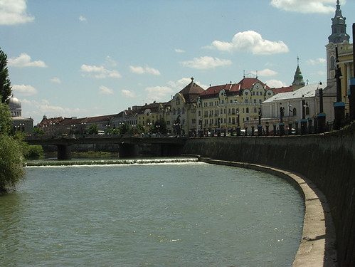
El territorio está atrevesado por el Mureş, por el sur, y por el río Crişul Alb en el norte.
En la zona oriental del distrito se encuentran los montes Zarand, uan de las estribaciones de los muntes Apuseni.
Economía
Junto con el distrito de Timiş se trata de uno de los distritos más desarrollados y dinámicos de Rumania. Por su proximidad a la frontera húngara atrae un gran número de inversiones extranjeras.
Los principales sectores industriales de la zona son:-Motores y componentes del automóvil.
-Industria alimentaria.
-Industria textil.

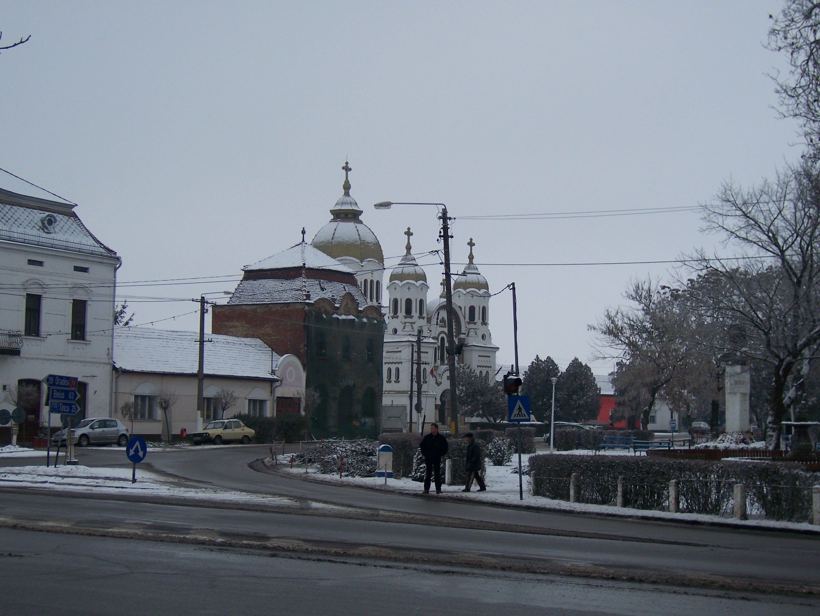
Mures RiverAtracciones turísticas
Las principales atracciones turísticas son:La ciudad de Arad.
Los centros turísticos de Lipova y Moneasa.
Enlaces externos
www.arad.ro (Enlace roto. Disponible en Internet Archive el historial y la última versión.)
www.primariaarad.ro
www.virtualarad.net
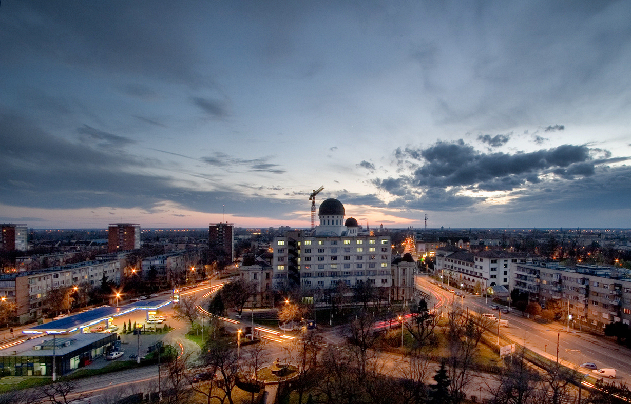
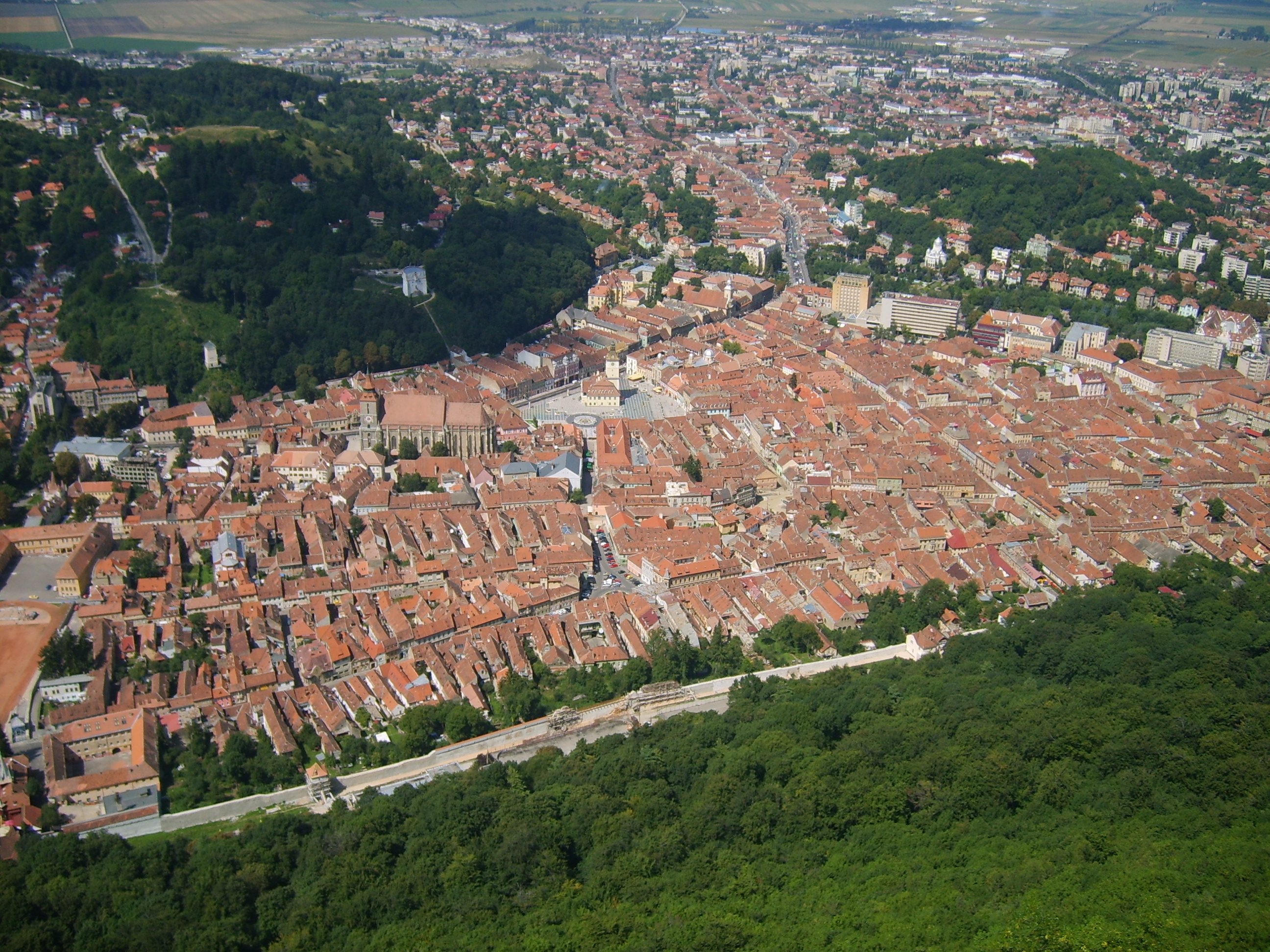
Arad es la capital del distrito de Arad, en la parte más occidental de Rumanía, en la región de Transilvania. Se encuentra a unos 563 km por ferrocarril de la capital nacional, Bucarest; 265 km de la capital húngara, Budapest; y 506 km de la capital austriaca, Viena. Situada en la orilla derecha del Mureş, la ciudad consiste en un centro urbano interior y cinco suburbios. Con su aire moderno, la ciudad cuenta con numerosas edificaciones privadas y públicas de notable belleza arquitectural, incluyendo una catedral. Es la sede de un obispado ortodoxo, y posee un seminario teológico ortodoxo, así como dos escuelas preparatorias para profesores - una húngara, la otra rumana - y un conservatorio de música.
 Población
La municipalidad de Arad cuenta con una población de ~ 180.000 habitantes, que se dividen étnicamente de la siguiente manera:
Rumanos: ~ 82,72%
Húngaros: ~ 13,02%
Gitanos: ~ 1,73%
Alemanes: ~ 1,30%
así como ~ 2,100 pertenecientes a otras nacionalidades.
Historia
Arad aparece mencionada por primera vez en documentos históricos del siglo XI. Como resultado de la invasión mongola a mediados del siglo XIII, que encontró a la ciudad totalmente desprotegida, se construyeron las fortalezas de Soimos, Siria y Dezna para defender la ciudad. En 1551 la región de Arad fue conquistada por el Imperio Otomano, que mantuvo su dominio sobre la misma hasta la firma de la Paz de Karlowitz con los austriacos en 1699.
La nueva fortaleza, construida entre 1763 y 1783, aunque pequeńa, resultó formidable y desempeńó un papel fundamental durante la lucha por la independencia húngara en 1849. Tras ser capturada por los rebeldes húngaros, se convirtió en cuartel general de los insurrectos. Fue aquí donde Lajos Kossuth lanzó su famosa proclamación del 11 de agosto de 1849, y donde éste último le traspasó el mando supremo a Artúr Görgey. Tras la rendición de Görgey ante las tropas rusas, aliadas de los austriacos, en Világos (Şiria), la fortaleza paso nuevamente a manos de los últimos que, por órdenes del general Haynau, el 6 de octubre de 1849, ejecutaron en su interior a trece generales rebeldes. A estos hombres se les conoce hoy como los 13 mártires de Arad, y en una de las principales plazas públicas de la ciudad se levanta hoy un monumento en su memoria, que consiste en una representación colosal de la figura de Hungría, con cuatro grupos alegóricos y los medallones de los generales ejecutados.
En 1834, el emperador austriaco Francisco I le reconoció a la ciudad el título de "ciudad real libre". Arad disfrutaba por entonces de un gran desarrollo económico.

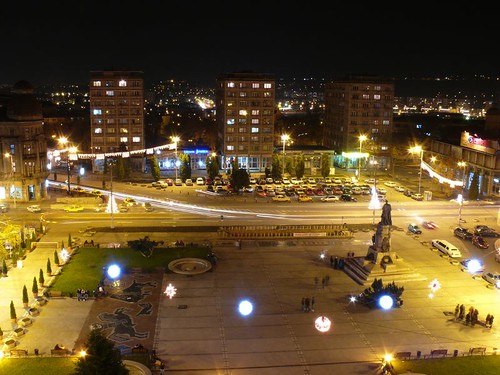
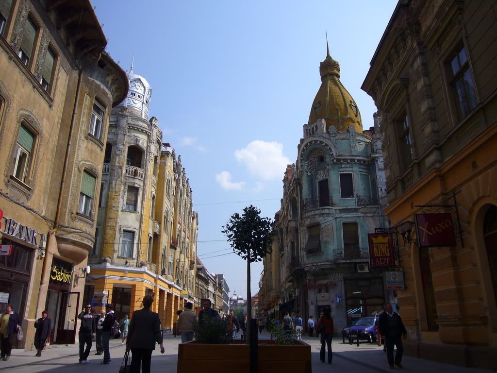
Arad cultural centerLa ciudad de Aradu Nou ("Nueva Arad"), situada en la orilla opuesta del Río Mureş, constituye en la práctica un suburbio de Arad, con la que está unida por un puente. Aradu Nou fue fundado por los turcos durante las guerras del siglo XVII. Las edificaciones levantadas por los turcos en su preparación para la toma de la fortaleza de Arad formaron el núcleo de la nueva ciudad.
Lugares de interés
Entre los lugares de interés de la ciudad destacan:
-La Catedral Ortodoxa Romana de San Juan el Bautista, construida entre 1862 y 1865 en estilo barroco. Los frescos de estilo bizantino que se pueden ver en el interior se pintaron en 1966.
-La Catedral Católica, construida en 1902-1904 en estilo renacentista, según planos del arquitecto Emil Tabacovics. Es una construcción impresionante por su bóveda y sus monumentales columnas.
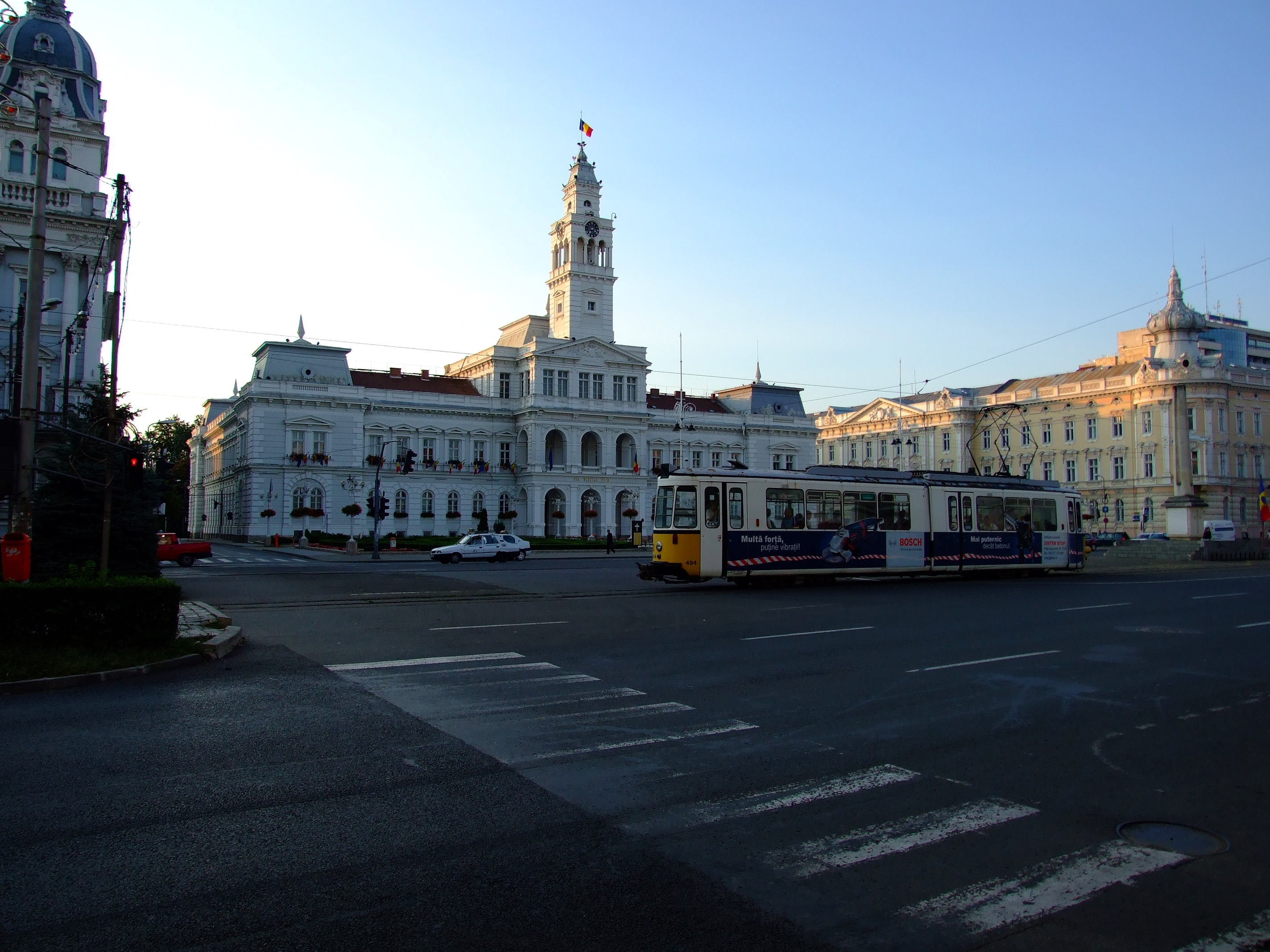
-El Ayuntamiento, construido en 1872-1874 en estilo neorenacentista flamenco. Destaca la torre de 54 m de altura.
-El Palacio de Cultura (Palatul Cultural), construido entre 1911-1913 por el arquitecto húngaro Ludovic Szantay en estilo ecléctico, con influencias Art Nouveau. El edificio acoge actualmente un museo y es sede también de la Filarmónica Estatal.
-La Iglesia Evangélica Luterana, construida en 1906 en estilo neogótico, también conocida como la biserica roşie (iglesia roja), por el color rojizo de sus muros.
-La ciudadela (Cetatea Aradului), construida entre 1762 y 1783 por el arquitecto austriaco Filip Ferdinand Harsch. La puerta principal y los edificios interiores son de estilo barroco.
 Enlaces externos
Monumento a los trece mártires de Arad (en inglés, rumano y húngaro)
www.arad.info.ro (en rumano)
Mapa satélite (Google maps)
Architectural monuments
-The Fortified Town of Arad is one of the Transylvanian fotresses built in the Vauban star-shaped style, in the second half of the 18th century. It was used as a prison for the rebels led by Horia, Cloşca, and Crişan
-Administrative Palace, built in 1872-74, renaissance architecture
-Ioan Slavici Classical Theatre, built in 1874, neoclassical architecture, architect Anton Czigler
-Neuman Palace, built in 1891, eclecticism
-Judiciary Palace, built in 1892, eclecticism
-Cenad Palace, built in 1894, eclecticism and neoclassical architecture
-National Bank Palace, built in 1906, neoclassical architecture
-Bohuş Palace built in 1910, Vienna Secession. (For the first time in Arad, reinforced concrete was used)
-Szantay Palace, built in 1911, Vienna Secession
-Cultural Palace, built in 1913, neoclassical, gothic, renaissance architecture, and Corinthian capitals
-Cloşca Street, Vienna Secession
Historic buildings
-The House with Cannon Balls, built in 1800. Its name derives from the fights between 1848 and 1849. Seventeen cannon balls are incorporated in its walls.
-The High Teacher Training School (Clădirea Preparandiei), the first school for Romanian-language teachers from Transylvania, 1812
-The House with the Padlock, built in 1815
-The Old Theatre (Hirschl), built by Jacob Hirschl in 1817, the oldest stone theatre in Romania
-Water Tower, built in 1896, medieval dungeon architectural style
-The Old Custom House, built in 1907, used as a customs point for goods entering the Arad markets
 Monuments
-The Statue of St. John of Nepomuk, raised in 1729, baroque sculpture
-The monument of the Holy Trinity, raised in 1746 to commemorate the plague that swept the town in 1738-1740
-Reconciliation Park
´-The Statue of Liberty, raised in 1890 by György Zala in the memory of the heroes of the Hungarian revolutionary army
-The Arch of Triumph, raised in 2004 by Ioan Bolborea in memory of the heroes of the 1848 - 1849 Romanian Revolution (fighting against the Hungarians)
-Martyrs' Cross, raised in 1936, in memory of the priests martyred between November 1918 and spring 1919
-The Bust of Vasile Goldiş (1862 – 1934) * The Bust of Moise Nicoară (1784 – 1861) Religious tourism
-The "St. Peter and Paul" Serbian Church, raised in 1698-1702, early Baroque architecture
-"St. Simon" Monastery , raised in 1762, Baroque architecture
-"St. Anthony of Padua" Cathedral (Roman Catholic). The Order of Minorite Monks raised this cathedral in 1904, in a renaissance architecture style
-The "Birth of Saint John the Baptist" Cathedral (Romanian Orthodox), raised in 1862-1865, Baroque architecture, architect Antoniu Czigler. The mural painter, Anastase Damian, started his work in 1957 and finished it one year later
-The Red Church (Evangelical-Lutheran), built in 1906, Neo-gothic architecture
-The Neolog Synagogue, built in 1834, Greek, Tuscan architectural style
 Recreational tourism
-Neptun Swimming Place, known in Romanian as "Strandul Neptune", one of the most beautiful places of amusement of this kind in Romania
-The Mureş Embankment
-The Grove
-The Ceala Forest with Măltăreţ Lake and Mureş Isle
-The Vladimirescu Forest
-Ghioroc Lake
-Miniş - Măderat Vineyard, situated about 30 km east of Arad
Cultural life-Arad State Theater, hosting an annual Classical Theater Festival
-Philharmonic orchestra
-Puppet theater
Museums and exhibitions
-Arad Museum Complex
-History Department
-Natural Sciences Department
-Art Department
-Vasile Goldiş Memorial Museum
-Doina and Baruţu Arghezi Art Collection
-Delta Gallery, with three major events of Arad artistic life: The International Biennial Drawing Saloon, The Biennial Small Sculpture Saloon, The Annual Art Saloon.
-Alfa Gallery
-Clio Gallery
-Water Tower Gallery
-Takács Gallery
-Carola's Gallery
Expo Arad, The Exhibition Centre of the Chamber of Commerce, Industry and Agriculture of the County of Arad.
(Wikipedia)
La historia de la ciudad es bastante compleja y tiene estatus de ciudad (municipio) por vez primera mencionada alrededor del ańo 1,189.La ciudad es un símbolo de la convivencía de los húngaros, rumanos y serbios que viven el la ciudad, con peculiaridades lingüisticas en la ciudad de Vinga donde se habla búlgaro, y la ciudad de Nădlac donde se habla eslovaco. Cualquier originario de Arad, es capaz de relacionarse en los idiomas oficiales de la ciudad, rumano, húngaro,y serbocroato, además de hablarse el inglés, francés e italiano.
Llegar
Pueden llegar por carretera, ferrocarril o avión.Aeropuerto de Arad (abrev. ARW) situado a unos kilómetros de la ciudad y bastante pequeńo destinado a vuelos europeos, sobre todo de bajo coste (low-cost), donde operan las compańías Blue Air desde Barcelona, Valencia,Verona,y más recientemente Stuttgard en Alemania y RyanAir con vuelos desde Milán.
La entrada de los nacionalea UE-27 no requieren la necesidad de un visado o permiso de trabajo, así como los ciudadanos de EE.UU, Australia, Japón, Nueva Zelanda y Canadá, estos últimos si desean trabajar en el país necesitarán un permiso de trabajo y residencia previamente solicitado en el país de origen.
La ciuadad está situada a tan sólo 60km por carretera de su vecina Hungría, y por ferrocarril a tan sólo 35 km, y las formalidades de entrada están simplificadas para los nacionales UE-27, es decir DNI, o pasaporte.Es un buen comienzo en el sentido de emprender el viaje hacia el norte de Transilvania, los Cárpatos Orientales o Meridianos,además los billetes del ferrocarril suelen ser mucho más baratos si los compran en la Estación del ferrocarril de Arad, también en el centro de la ciudad hay una agencia de la Compańía Nacional del Ferrocarril, que despacha billetes de tren, o comprar los suplementos adecuados si tienes un interrail,eurail o railplus y además podrás solicitar información más detallada. RENFE tiene información sobre como conseguir estos pases, y precios actualizados, suelen ser más asequibles que el avión además te ofrece la posibilidad de ver en detalle las zonas que deseas recorrer.

Arad town hall squareCircule
Se circula por la derecha al igual que la mayoría de los países europeos. Arad tiene una buena red de carreteras que conecta con el resto del país, la velocidad en los poblados es de 50km/h, 80km/h fuera de los poblados, el cinturón de seguridad abrochado es obligatorio, las luces de cruces encendidas y la tasa de tolerancia del alcohol en la sangre es 0. No respetar las leyes en carretera conllava con perdida de puntos e inclusive la retirada del carné, y a todo esto hay que ańadir las multas que son bastante elevadas Policia Rumana, tiene información sobre el tráfico en tiempo real, la pena es que es sólo en rumano, aunque también hay información en inglés.
Vea
Virtual Arad, página con información y noticias diarias actualzadas y bastante detallada sobre la ciudad, alojamiento, restaurantes, museos, universidades, TV locales en directo y fotos del área. Válida en rumano, inglés e alemán.
Ayuntamiento de Arad, página con información sobre la ciudad, noticias actulizadas. Válida en rumano, inglés e hungaro.
Compańía de ferrocarriles de Rumania información actualizada sobre el horario de los trenes.
Compre
Intente evitar las compras en el centro de la ciudad, resultan bastante caro, por ejempo un café con leche suele salir por unos 1,50€ o 1,75€ en las cafeterias del centro , pero si no están en la zona centro las compras resultarán mucho más baratas,la ciudad tiene 2 áreas de mercado donde puedes comprar fruta y alimentos de primera necesitad, además algunos días de la semana hay también mercadillos más asequibles que en el centro de la ciudad, donde los precios son similares a cualquier país europeo, en otras palabras caro, visinten uno de los tres mercados de la ciudad que tiene y las compras suelen salir muy baratas y es donde los demás rumanos compran, están muy bien surtidos.Arad tiene varios centros comerciales a las afueras de la ciudad, hay un MAKRO que en Rumania se llama METRO, BILLA,aunque la ciudad está bien surtida, por la cercania muchos rumanos van a la vecina Hungría hacer las compras donde resultan aun más baratas, en los pueblos pasando la frontera.
Coma
Arad dispone de muchas posibilidades para descubrir la gastronomía local e internacional, eso si acompańando con uno de los mejores vinos de la región que no tiene nada que desperdiciar
(Wikitravel)
)))))))))))))))))))))))))))))))))))))))))))))))))) )))))))))))))))))))))))))))))))))))))))))))))))))) ))))))))))))))
Arad
Arad Map | Romania Google Satellite Maps
Arad Region Map: Aciuta — Zimbru | Romania Google Satellite Maps
Arad City Map - Romania Maps and views
)))))))))))))))))))))))))))))))))))))))))))))))))) )))))))))))))))))))))))))))))))))))))))))))))))))) ))))))))))))))
Región: Transilvania - Capital: Arad
Indicativo: AR - Población: ~ 490.000 hab - Densidad: ~ 62 hab/km˛
Superficie: 7.754 km˛ - Web: Consejo del distrito
Prefijo telefónico: (+40) x57
)))))))))))))))))))))))))))))))))))))))))))))))))) )))))))))))))))))))))))))))))))))))))))))))))))))) ))))))))))))))
)))))))))))))))))))))))))))))))))))))))))))))))))) )))))))))))))))))))))))))))))))))))))))))))))))))) ))))))))))))))
- Distrito
La capital del distrito es Arad (185.272 habitantes). Otras ciudades importantes son Lipova (11.246 hab.), Ineu (10.200 hab.) y Curtici (9.726 hab.).
El distrito de Arad limita con Hungría por el oeste, y con los distritos de Bihor por el norte, Hunedoara y Alba por el este, y Timiş por el sur.
Geografía
El territorio está atrevesado por el Mureş, por el sur, y por el río Crişul Alb en el norte.
En la zona oriental del distrito se encuentran los montes Zarand, uan de las estribaciones de los muntes Apuseni.
Economía
Junto con el distrito de Timiş se trata de uno de los distritos más desarrollados y dinámicos de Rumania. Por su proximidad a la frontera húngara atrae un gran número de inversiones extranjeras.
Los principales sectores industriales de la zona son:-Motores y componentes del automóvil.
-Industria alimentaria.
-Industria textil.
Mures River
Las principales atracciones turísticas son:La ciudad de Arad.
Los centros turísticos de Lipova y Moneasa.
Enlaces externos
www.arad.ro (Enlace roto. Disponible en Internet Archive el historial y la última versión.)
www.primariaarad.ro
www.virtualarad.net
)))))))))))))))))))))))))))))))))))))))))))))))))) )))))))))))))))))))))))))))))))))))))))))))))))))) ))))))))))))))
Arad, Capital
Comarca: Arad - Estatus: Capital de distrito
Coordinadas: 46°10′56″ N 21°19′18″ E / 46.182326, 21.321716
Superficie: 46,18 km˛ - Población: ~ 180.000 hab. - Densidad: ~ 3.742 hab./km˛
Sitio web: http://www.primariaarad.ro
)))))))))))))))))))))))))))))))))))))))))))))))))) )))))))))))))))))))))))))))))))))))))))))))))))))) ))))))))))))))
Arad es la capital del distrito de Arad, en la parte más occidental de Rumanía, en la región de Transilvania. Se encuentra a unos 563 km por ferrocarril de la capital nacional, Bucarest; 265 km de la capital húngara, Budapest; y 506 km de la capital austriaca, Viena. Situada en la orilla derecha del Mureş, la ciudad consiste en un centro urbano interior y cinco suburbios. Con su aire moderno, la ciudad cuenta con numerosas edificaciones privadas y públicas de notable belleza arquitectural, incluyendo una catedral. Es la sede de un obispado ortodoxo, y posee un seminario teológico ortodoxo, así como dos escuelas preparatorias para profesores - una húngara, la otra rumana - y un conservatorio de música.

La municipalidad de Arad cuenta con una población de ~ 180.000 habitantes, que se dividen étnicamente de la siguiente manera:
Rumanos: ~ 82,72%
Húngaros: ~ 13,02%
Gitanos: ~ 1,73%
Alemanes: ~ 1,30%
así como ~ 2,100 pertenecientes a otras nacionalidades.
Historia
Arad aparece mencionada por primera vez en documentos históricos del siglo XI. Como resultado de la invasión mongola a mediados del siglo XIII, que encontró a la ciudad totalmente desprotegida, se construyeron las fortalezas de Soimos, Siria y Dezna para defender la ciudad. En 1551 la región de Arad fue conquistada por el Imperio Otomano, que mantuvo su dominio sobre la misma hasta la firma de la Paz de Karlowitz con los austriacos en 1699.
La nueva fortaleza, construida entre 1763 y 1783, aunque pequeńa, resultó formidable y desempeńó un papel fundamental durante la lucha por la independencia húngara en 1849. Tras ser capturada por los rebeldes húngaros, se convirtió en cuartel general de los insurrectos. Fue aquí donde Lajos Kossuth lanzó su famosa proclamación del 11 de agosto de 1849, y donde éste último le traspasó el mando supremo a Artúr Görgey. Tras la rendición de Görgey ante las tropas rusas, aliadas de los austriacos, en Világos (Şiria), la fortaleza paso nuevamente a manos de los últimos que, por órdenes del general Haynau, el 6 de octubre de 1849, ejecutaron en su interior a trece generales rebeldes. A estos hombres se les conoce hoy como los 13 mártires de Arad, y en una de las principales plazas públicas de la ciudad se levanta hoy un monumento en su memoria, que consiste en una representación colosal de la figura de Hungría, con cuatro grupos alegóricos y los medallones de los generales ejecutados.
En 1834, el emperador austriaco Francisco I le reconoció a la ciudad el título de "ciudad real libre". Arad disfrutaba por entonces de un gran desarrollo económico.

Arad cultural center
Lugares de interés
Entre los lugares de interés de la ciudad destacan:
-La Catedral Ortodoxa Romana de San Juan el Bautista, construida entre 1862 y 1865 en estilo barroco. Los frescos de estilo bizantino que se pueden ver en el interior se pintaron en 1966.
-La Catedral Católica, construida en 1902-1904 en estilo renacentista, según planos del arquitecto Emil Tabacovics. Es una construcción impresionante por su bóveda y sus monumentales columnas.
-El Ayuntamiento, construido en 1872-1874 en estilo neorenacentista flamenco. Destaca la torre de 54 m de altura.
-El Palacio de Cultura (Palatul Cultural), construido entre 1911-1913 por el arquitecto húngaro Ludovic Szantay en estilo ecléctico, con influencias Art Nouveau. El edificio acoge actualmente un museo y es sede también de la Filarmónica Estatal.
-La Iglesia Evangélica Luterana, construida en 1906 en estilo neogótico, también conocida como la biserica roşie (iglesia roja), por el color rojizo de sus muros.
-La ciudadela (Cetatea Aradului), construida entre 1762 y 1783 por el arquitecto austriaco Filip Ferdinand Harsch. La puerta principal y los edificios interiores son de estilo barroco.

Monumento a los trece mártires de Arad (en inglés, rumano y húngaro)
www.arad.info.ro (en rumano)
Mapa satélite (Google maps)
)))))))))))))))))))))))))))))))))))))))))))))))))) )))))))))))))))))))))))))))))))))))))))))))))))))) ))))))))))))))
Some tourist attractionsArchitectural monuments
-The Fortified Town of Arad is one of the Transylvanian fotresses built in the Vauban star-shaped style, in the second half of the 18th century. It was used as a prison for the rebels led by Horia, Cloşca, and Crişan
-Administrative Palace, built in 1872-74, renaissance architecture
-Ioan Slavici Classical Theatre, built in 1874, neoclassical architecture, architect Anton Czigler
-Neuman Palace, built in 1891, eclecticism
-Judiciary Palace, built in 1892, eclecticism
-Cenad Palace, built in 1894, eclecticism and neoclassical architecture
-National Bank Palace, built in 1906, neoclassical architecture
-Bohuş Palace built in 1910, Vienna Secession. (For the first time in Arad, reinforced concrete was used)
-Szantay Palace, built in 1911, Vienna Secession
-Cultural Palace, built in 1913, neoclassical, gothic, renaissance architecture, and Corinthian capitals
-Cloşca Street, Vienna Secession
Historic buildings
-The House with Cannon Balls, built in 1800. Its name derives from the fights between 1848 and 1849. Seventeen cannon balls are incorporated in its walls.
-The High Teacher Training School (Clădirea Preparandiei), the first school for Romanian-language teachers from Transylvania, 1812
-The House with the Padlock, built in 1815
-The Old Theatre (Hirschl), built by Jacob Hirschl in 1817, the oldest stone theatre in Romania
-Water Tower, built in 1896, medieval dungeon architectural style
-The Old Custom House, built in 1907, used as a customs point for goods entering the Arad markets
-The Statue of St. John of Nepomuk, raised in 1729, baroque sculpture
-The monument of the Holy Trinity, raised in 1746 to commemorate the plague that swept the town in 1738-1740
-Reconciliation Park
´-The Statue of Liberty, raised in 1890 by György Zala in the memory of the heroes of the Hungarian revolutionary army
-The Arch of Triumph, raised in 2004 by Ioan Bolborea in memory of the heroes of the 1848 - 1849 Romanian Revolution (fighting against the Hungarians)
-Martyrs' Cross, raised in 1936, in memory of the priests martyred between November 1918 and spring 1919
-The Bust of Vasile Goldiş (1862 – 1934) * The Bust of Moise Nicoară (1784 – 1861) Religious tourism
-The "St. Peter and Paul" Serbian Church, raised in 1698-1702, early Baroque architecture
-"St. Simon" Monastery , raised in 1762, Baroque architecture
-"St. Anthony of Padua" Cathedral (Roman Catholic). The Order of Minorite Monks raised this cathedral in 1904, in a renaissance architecture style
-The "Birth of Saint John the Baptist" Cathedral (Romanian Orthodox), raised in 1862-1865, Baroque architecture, architect Antoniu Czigler. The mural painter, Anastase Damian, started his work in 1957 and finished it one year later
-The Red Church (Evangelical-Lutheran), built in 1906, Neo-gothic architecture
-The Neolog Synagogue, built in 1834, Greek, Tuscan architectural style
-Neptun Swimming Place, known in Romanian as "Strandul Neptune", one of the most beautiful places of amusement of this kind in Romania
-The Mureş Embankment
-The Grove
-The Ceala Forest with Măltăreţ Lake and Mureş Isle
-The Vladimirescu Forest
-Ghioroc Lake
-Miniş - Măderat Vineyard, situated about 30 km east of Arad
Cultural life-Arad State Theater, hosting an annual Classical Theater Festival
-Philharmonic orchestra
-Puppet theater
Museums and exhibitions
-Arad Museum Complex
-History Department
-Natural Sciences Department
-Art Department
-Vasile Goldiş Memorial Museum
-Doina and Baruţu Arghezi Art Collection
-Delta Gallery, with three major events of Arad artistic life: The International Biennial Drawing Saloon, The Biennial Small Sculpture Saloon, The Annual Art Saloon.
-Alfa Gallery
-Clio Gallery
-Water Tower Gallery
-Takács Gallery
-Carola's Gallery
Expo Arad, The Exhibition Centre of the Chamber of Commerce, Industry and Agriculture of the County of Arad.
(Wikipedia)
)))))))))))))))))))))))))))))))))))))))))))))))))) )))))))))))))))))))))))))))))))))))))))))))))))))) ))))))))))))))
ComprendaLa historia de la ciudad es bastante compleja y tiene estatus de ciudad (municipio) por vez primera mencionada alrededor del ańo 1,189.La ciudad es un símbolo de la convivencía de los húngaros, rumanos y serbios que viven el la ciudad, con peculiaridades lingüisticas en la ciudad de Vinga donde se habla búlgaro, y la ciudad de Nădlac donde se habla eslovaco. Cualquier originario de Arad, es capaz de relacionarse en los idiomas oficiales de la ciudad, rumano, húngaro,y serbocroato, además de hablarse el inglés, francés e italiano.
Llegar
Pueden llegar por carretera, ferrocarril o avión.Aeropuerto de Arad (abrev. ARW) situado a unos kilómetros de la ciudad y bastante pequeńo destinado a vuelos europeos, sobre todo de bajo coste (low-cost), donde operan las compańías Blue Air desde Barcelona, Valencia,Verona,y más recientemente Stuttgard en Alemania y RyanAir con vuelos desde Milán.
La entrada de los nacionalea UE-27 no requieren la necesidad de un visado o permiso de trabajo, así como los ciudadanos de EE.UU, Australia, Japón, Nueva Zelanda y Canadá, estos últimos si desean trabajar en el país necesitarán un permiso de trabajo y residencia previamente solicitado en el país de origen.
La ciuadad está situada a tan sólo 60km por carretera de su vecina Hungría, y por ferrocarril a tan sólo 35 km, y las formalidades de entrada están simplificadas para los nacionales UE-27, es decir DNI, o pasaporte.Es un buen comienzo en el sentido de emprender el viaje hacia el norte de Transilvania, los Cárpatos Orientales o Meridianos,además los billetes del ferrocarril suelen ser mucho más baratos si los compran en la Estación del ferrocarril de Arad, también en el centro de la ciudad hay una agencia de la Compańía Nacional del Ferrocarril, que despacha billetes de tren, o comprar los suplementos adecuados si tienes un interrail,eurail o railplus y además podrás solicitar información más detallada. RENFE tiene información sobre como conseguir estos pases, y precios actualizados, suelen ser más asequibles que el avión además te ofrece la posibilidad de ver en detalle las zonas que deseas recorrer.

Arad town hall square
Se circula por la derecha al igual que la mayoría de los países europeos. Arad tiene una buena red de carreteras que conecta con el resto del país, la velocidad en los poblados es de 50km/h, 80km/h fuera de los poblados, el cinturón de seguridad abrochado es obligatorio, las luces de cruces encendidas y la tasa de tolerancia del alcohol en la sangre es 0. No respetar las leyes en carretera conllava con perdida de puntos e inclusive la retirada del carné, y a todo esto hay que ańadir las multas que son bastante elevadas Policia Rumana, tiene información sobre el tráfico en tiempo real, la pena es que es sólo en rumano, aunque también hay información en inglés.
Vea
Virtual Arad, página con información y noticias diarias actualzadas y bastante detallada sobre la ciudad, alojamiento, restaurantes, museos, universidades, TV locales en directo y fotos del área. Válida en rumano, inglés e alemán.
Ayuntamiento de Arad, página con información sobre la ciudad, noticias actulizadas. Válida en rumano, inglés e hungaro.
Compańía de ferrocarriles de Rumania información actualizada sobre el horario de los trenes.
Compre
Intente evitar las compras en el centro de la ciudad, resultan bastante caro, por ejempo un café con leche suele salir por unos 1,50€ o 1,75€ en las cafeterias del centro , pero si no están en la zona centro las compras resultarán mucho más baratas,la ciudad tiene 2 áreas de mercado donde puedes comprar fruta y alimentos de primera necesitad, además algunos días de la semana hay también mercadillos más asequibles que en el centro de la ciudad, donde los precios son similares a cualquier país europeo, en otras palabras caro, visinten uno de los tres mercados de la ciudad que tiene y las compras suelen salir muy baratas y es donde los demás rumanos compran, están muy bien surtidos.Arad tiene varios centros comerciales a las afueras de la ciudad, hay un MAKRO que en Rumania se llama METRO, BILLA,aunque la ciudad está bien surtida, por la cercania muchos rumanos van a la vecina Hungría hacer las compras donde resultan aun más baratas, en los pueblos pasando la frontera.
Coma
Arad dispone de muchas posibilidades para descubrir la gastronomía local e internacional, eso si acompańando con uno de los mejores vinos de la región que no tiene nada que desperdiciar
(Wikitravel)
)))))))))))))))))))))))))))))))))))))))))))))))))) )))))))))))))))))))))))))))))))))))))))))))))))))) ))))))))))))))


Comentario