40. East Sussex
Sussex del Este (East Sussex en inglés) es un condado en el sureste de Inglaterra, en el Reino Unido. Limita con los condados de Kent, Surrey y Sussex del Oeste y al sur con el canal de la Mancha.
El antiguo reino de Sussex se dividió en las regiones administrativas este y oeste, con consejos del condado independientes en 1888.
La capital del condado se estableció en Lewes.
En el nuevo condado de Sussex del Este existen tres distritos administrativamente independientes: Brighton, Eastbourne y Hastings
 Historia
Historia del antiguo condado de Sussex, lo que incluye a los actuales Sussex del Estey Sussex del Oeste
Dejando aparte los restos prehistóricos, la historia de Sussex se inicia en el ańo 477 cuando los sajones llegaron al oeste del condado y fundaron el "reino de los sajones del sur".
Nota: El descubrimiento de restos romanos en Fishbourne en 1960 dieron luz a la historia de la ocupación romana del condado y su implicación en toda Britania durante el periodo pre-sajón.
Los sajones tomaron la ciudad romana de Regnum, que se convertiría en Chichester, así como la fortaleza de Anderida y el castillo de Pevensey. El rey Aelle se convirtió en el más influyente de los jefes sajones. Tras su reinado, el reino de Sussex inició su declive, cayendo por completo bajo el dominio de Wesex en el ańo 823.
A partir del ańo 895, Sussex sufrió continuos ataques por parte de los Danés (vikingos), hasta la ascensión del rey Canuto. La influencia normanda fue también fuerte en Sussex antes de la conquista normanda. Los puertos de Hastings, Rye, Winchelsea y Steyning estuvieron bajo el poder de la abadía normanda de Fecamp.
Por su situación, Sussex fue un escenario constante para la preparación de invasiones y estuvo a menudo afectada por rebeliones. Durante la guerra de los barones, el condado se convirtió en el centro para las fuerzas reales. Las fuerzas del rey y las de Simon de Montfort se enfrentaron en la batalla de Lewes en 1264.
 History
East Sussex is part of the ancient kingdom of the South Saxons, who established themselves there in the 5th century AD, after the departure of the Romans, although the area had been populated for many thousands of years before then. Archaeological remains are plentiful, especially in the upland areas. The area's position on the coast has also meant that there were many invaders, including the Romans and later the Normans. Earlier industries have included fishing, iron-making, and the wool trade, all of which have declined, or lost completely. In more modern times, Sussex has become popular with tourists, so that the main coastal towns have become seaside resorts.
Geography
Geology
See map reproduced in Weald
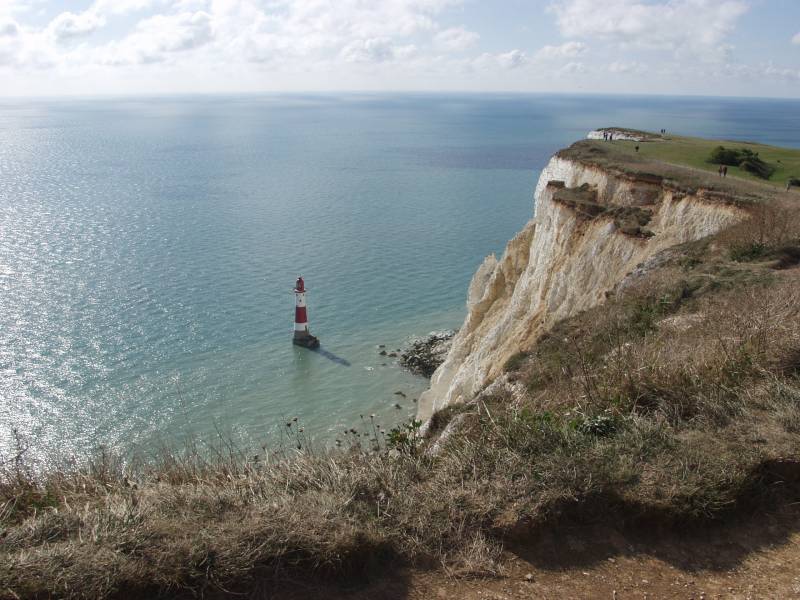
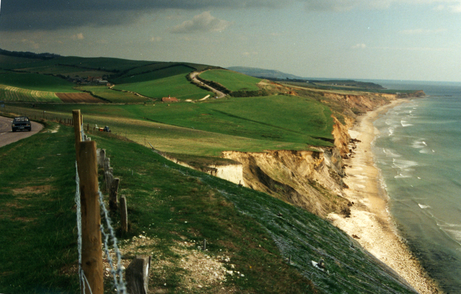
From a geological point of view East Sussex is part of southern anticline of the Weald: the South Downs, a range of moderate chalk hills which run across the southern part of the county from west to east and mirrored in Kent by the North Downs. To the north lie parallel valleys and ridges, the highest of which is the Weald itself (the Hastings beds and Wealden Clay). The sandstones and clays come the sea at Hastings; the Downs at Beachy Head.

HastingsRelief and drainage
The relief of the county reflects the geology.
The chalk uplands of the South Downs occupies the coastal strip between Brighton and Eastbourne. There are two river gaps: the Rivers Ouse and Cuckmere. The Seven Sisters, where the Downs meet the sea, are the remnants of dry valleys cut into the chalk; they end at Beachy Head, 530 feet (162 m) above sea level. To the east of Beachy Head lie the marshlands of the Pevensey Levels, formerly flooded by the sea but now enclosed within a deposited beach. At Bexhill the land begins to rise again where the sands and clays of the Weald meet the sea; these culminate in the sandstone cliffs east of Hastings. Further east are the Pett Levels, more marshland, beyond which is the estuary of the River Rother. On the far side of the estuary are the dunes of Camber Sands. The highest point of the Downs within the county is Ditchling Beacon, at 814 feet (248 m): it is termed a Marilyn.
The Weald occupies the northern borderlands of the county. Between the Downs and Weald is a narrow stretch of lower lying land; many of the rivers and streams occupying this area originate in the Weald. The High Weald is heavily wooded in contrast to the South Downs; the Low Weald less so. Part of the Weald is the Ashdown Forest.
Settlements
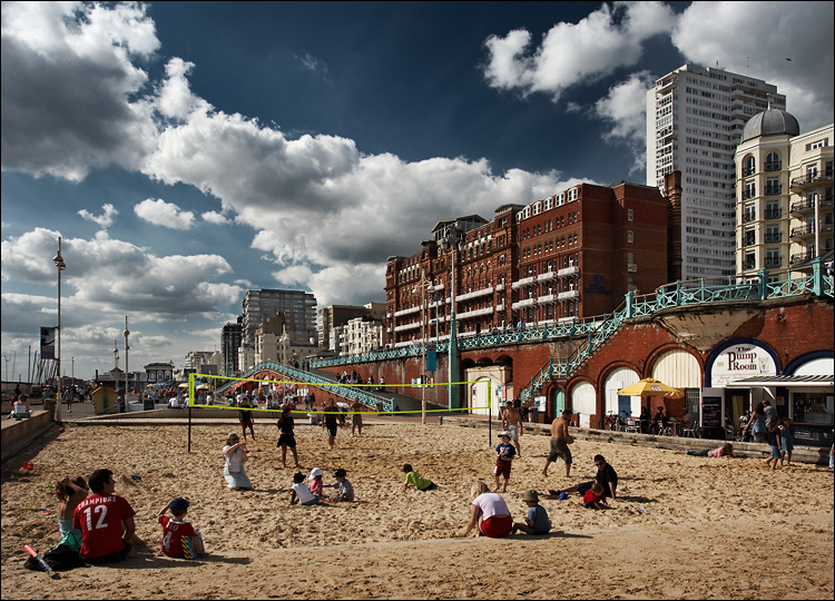
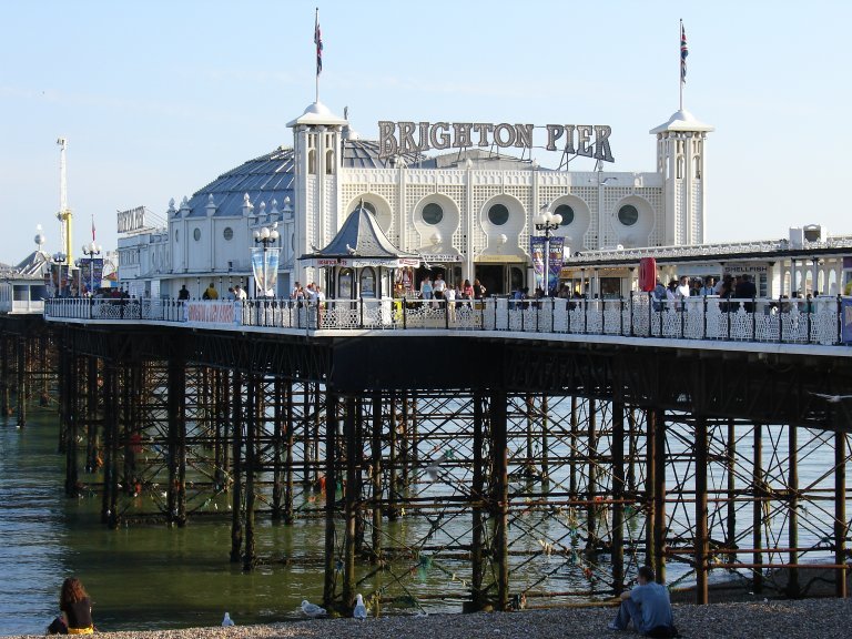
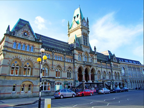
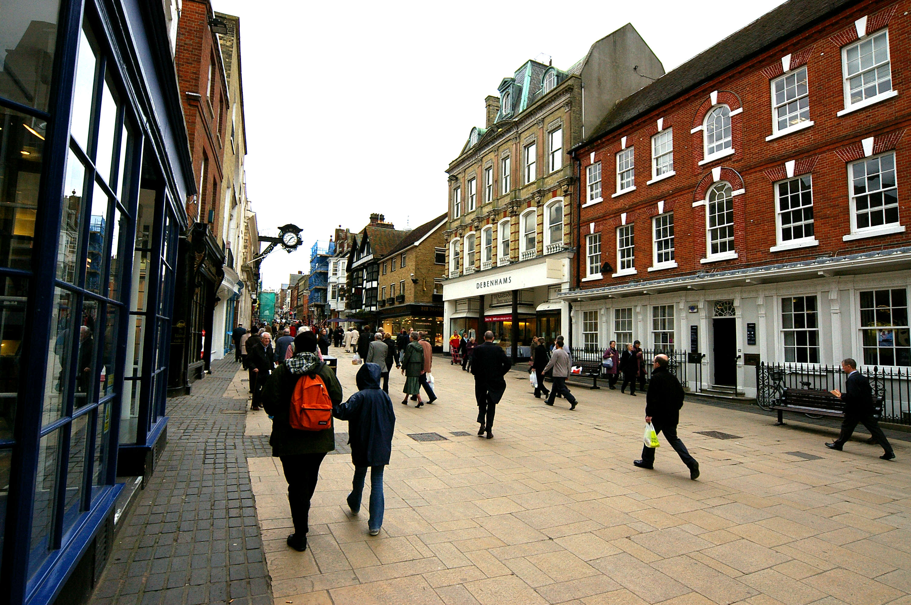
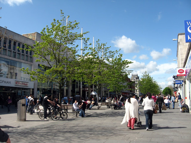
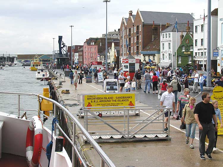
The location of settlements in East Sussex has been determined both by its history and its geography. The original towns and villages tended to be where its economy lay: fishing along the coast and agriculture and iron mining on the Weald. Industry today tends to be geared towards tourism, and particularly along the coastal strip. Here towns such as Bexhill-on-Sea, Eastbourne, and Hastings lie. Newhaven and Rye are ports, although the latter is also of historical importance. Peacehaven and Seaford are more dormitory towns than anything else. Away from the coast lie former market towns such as Hailsham, Heathfield and Uckfield; Crowborough is a centre for the Ashdown Forest. Lewes, the County town of East Sussex; and Battle, with its Norman Conquest beginnings. are the other two towns of significance.
Landmarks
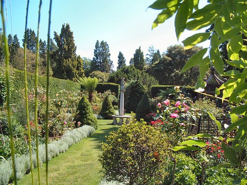
Apart from the physical landmarks such as the Downs and the Weald, East Sussex has a great many landmarks of historical interest. There are castles atBodiam, Herstmonceux, Lewes and Pevensey; and defence works such as the Martello towers and Eastbourne Redoubt. Battle Abbey, built to commemorate the Battle of Hastings; Bateman's, home of Rudyard Kipling, and the University of Sussex buildings at Falmerare among interesting buildings.
It also has a number of great parks suitable for tourists.
El castillo de Bodiam . El bosque de Ashdown . Batemans
Transport
Roads
Unusually East Sussex has no motorways. The main roads through the county are those part of the radial pattern from London: the A21 to Hastings; the A22 to Eastbourne; and the A23 to Brighton. Cross-country routes include the A26 which carries traffic from Newhaven and Lewes north into Kent; and the south coast trunk route, which starts in Folkestone (Kent) as the A259 trunk road, and traverses the south coast to Eastbourne, where it becomes the A27 trunk road and heads westwards towards Chichester in West Sussex and ultimately to Honiton in Devon. All the main roads suffer from congestion and traffic problems: the A27 which connects Eastbourne to Portsmouth is one of the busiest trunk roads in the UK.
Bus routes serve all the main areas of settlement and many of the villages in the county.
Railways
The railways serve the main towns in a similar fashion to the roads. Until the closures of many branch railways in the 20th century, rural East Sussex was well-served by rail: few such branch lines escaped the Beeching Axe so that today only main-line services remain. They include the East Coastway Line (including the Marshlink Line); the London-Hastings line; and the Uckfield branch, the terminus of the Oxted Line. There are three heritage railways: the Kent and East Sussex Railway operates from Tenterden in Kent to Bodiam; the Bluebell Railway from Sheffield Park to Kingscote with a planned extension to East Grinstead; and the Lavender Line Steam Railway near Lewes.
Footpaths
see also Recreational walks in East Sussex
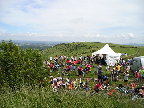
Among the long-distance footpaths in East Sussex are the South Downs Way; 1066 Country Walk, High Weald Landscape Trail, Saxon Shore Way, Sussex Border Path, Sussex Ouse Valley Way, Vanguard Way and the Wealdway.
Enlaces
East Sussex travel guide from Wikitravel
The name Lewes comes from the plural form of Anglo-Saxon "Hlaew", which means "hill". This refers to the hills of the South Downs or ancient burial mounds within the area.
History
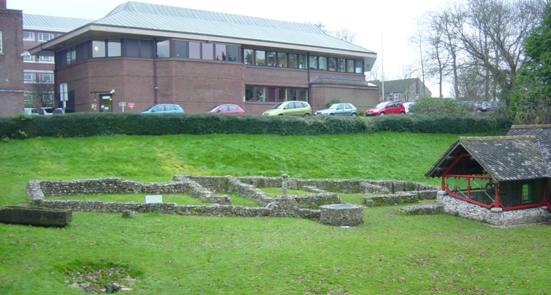
The site that is now Lewes has a very ancient history. Archaeological evidence points to prehistoric dwellers and it is also thought that the Roman settlement of Mutuantonis was here, large quantities of artefacts having been discovered in the area. The Saxons built a castle here, having first constructed its motte as a defensive point over the river; they also gave the town its name.
After the Norman invasion Lewes was given by William the Conqueror to William de Warenne, 1st Earl of Surrey. He built Lewes Castle on the Saxon site; and he and his wife, Gundred also founded a Cluniac priory here in 1078. Lewes was the also site of a mint during the early years after the Norman invasion as well as a mint during the Late Anglo-Saxon period.
The town was the site of the Battle of Lewes in the Second Barons’ War in 1264. At the time of the Marian Persecutions of 1555–1557 Lewes was to witness the deaths of seventeen Protestantmartyrs who were burnt at the stake in the town.
Geography
Lewes is situated in a gap in the South Downs, cut through by the River Ouse, and near its confluence with the Winterbourne Stream. It is approximately seven miles NNW of Newhaven, and an equal distance north-east of Brighton.
The South Downs rise above the river on both banks. The High Street, and the original town, occupies the right bank, climbing steeply up from the bridge; the summit on that side, 2.5 miles (4 km) distant is known as Mount Harry. On the left bank there is a large chalkcliff (Cliffe Hill) that can be seen for many miles.
The latter gives its name to the one-time village of Cliffe, now part of the town. The southern part of the town, Southover, came into being adjacent to the Priory, south of the Winterbourne Stream. The town boundaries were enlarged twice: in 1881 and 1934, and now include the more modern housing estates of Wallands, Malling Hill, Neville and on the Kingston road.
The Greenwich Meridian runs through the western part of Lewes.
Natural sites and events
There are three Sites of Special Scientific Interest within the parish; Lewes Downs, Lewes Brooks and Southerham Works Pit. Lewes Downs is a site of biological interest, an isolated area of the South Downs. Lewes Brooks, also of biological importance, is part of the flood plain of the River Ouse, providing a habitat for many other invertebrates such as water beetles and snails. Southerham Works Pit is of geological interest, a disused chalk pit displaying a wide variety of fossilised fish remains.
On 27 December 1836, an avalanche occurred in Lewes, the worst ever recorded in England. It was caused by a large build-up of snow on the nearby cliff slipping down onto a row of cottages called Boulder Row (now part of South Street). About fifteen people were buried, and eight of these died. A pub in South Street is named The Snowdrop in memory of the event.
On 21 August 1864, Lewes suffered an earthquake shock measuring 3.1 on the Richter scale
In October 2000 the town suffered major flooding during an intense period of severe weather throughout the United Kingdom. The commercial centre of the town and many residential areas were devastated. In a government report into the nationwide flooding, Lewes was officially noted the most severely affected location. As a result of the devastation caused Lewes Flood Action, a pressure group, is in existence to press for better flood protection measures.
Lewes bonfire
The town's most important annual event is Lewes Bonfire - Guy Fawkes Night celebrations on the 5th of November. In Lewes this event not only marks the date of the uncovering of the Gunpowder Plot in 1605, but also commemorates the memory of the seventeen Protestant martyrs.
The current celebrations take the form of a series of torchlit processions through the town. The event is organised by the local bonfire societies, under the auspices of the Lewes Bonfire Council. Lewes itself currently has seven bonfire societies (Nevill Juveniles is a children's society and holds its celebrations a week or two before 5 November; Southover, which disbanded in 1985, reformed in 2005) and a number of nearby towns have their own bonfire societies. The other five local bonfire societies from the town (Cliffe, Borough, Commercial Square, South Street and Waterloo) each proceed on their own route accompanied by a number of other societies from the neighbouring towns.
Each bonfire society has its own traditional costumes (ranging from Tudor dress to Mongol warriors). A number of large effigies are drawn though the streets. Effigies of Guy Fawkes and Pope Paul V, who became head of the Roman Catholic Church in 1605, feature every year. In addition, each of the five main local societies creates a topical "tableau" (usually, but not always, representing a human figure or figures), and the Cliffe society displays on pikes the heads (also in effigy) of its current "Enemies of Bonfire", who range from nationally reviled figures to local officials who have attempted to place restrictions on the event. Restrictions are generally ignored by the Societies.
In 2001 an effigy of Osama bin Laden ensured that the annual event received more press attention than usual (it featured on the front page of some national newspapers) as did the Firle Bonfire Society's 2003 choice of a gypsy caravan. To mark the demise of the 17 martyrs, 17 burning crosses are carried through the town, and a wreath-laying ceremony occurs at the War Memorial in the centre of town. A flaming tar barrel is also thrown into the river Ouse; this is said to symbolise the throwing of the magistrates into the river after they read the Riot Act to the bonfire boys in 1847, but may also be an echo of Samhain traditions. The festivities culminate in five separate bonfire displays, where the effigies are destroyed by firework and flame. Up to 80,000 people have been known to attend this local spectacle, coming from all over the South and sometimes further afield.

Aerial photograph of Lewes Crescent, 1991Economy
The Lewes Chamber of Commerce represents the traders and businesses of the town. Lewes Farmers' Market, one of the first in the UK, was started in the 1990s by Common Cause Co-operative Ltd and is a very popular re-invention of Lewes as a market town.
From 1794 beers, wines and spirits were distributed from Lewes under the Harveys name, and the town is today the site of Harveys brewery.
In September 2008, Lewes launched its own currency, the Lewes Pound, in an effort to increase trade within the town. One Lewes Pound is equal to Ł1. Like the similar currency in Totnes, the initiative is part of the Transition Towns movement.
Landmarks
The town is the location of several historic buildings, including Lewes Castle, the remains of Lewes Priory, and the so-called "Anne of Cleves House" (given to the divorced queen but never lived in by her).
Transport
Lewes, from its inception, has been an important transport hub. Its site as a bridging point was probably originally a ford: today the main routes avoid the town centre. The A27 trunk road taking traffic along the south coast between Eastbourne and Southampton passes to the south of the town. The A26 from Maidstone to Newhaven; and the A275 (the London road) both come in from the north. The Brighton & Hove Bus and Coach Company serve the town.
Lewes railway station was originally the junction for six routes. Today the two erstwhile country routes to the north are both closed at the Lewes end; but the East Coastway Line, connecting London with Eastbourne and Hastings, and the two branches to Brighton and Seaford remain.
The Vanguard Way, a long-distance footpath from London to Newhaven, follows the River Ouse through the town.
 East Sussex portal
City of Brighton and Hove
Boroughs or districts
Borough of Eastbourne • Borough of Hastings • District of Lewes • District of Rother • District of Wealden
Cities and towns
Battle • Bexhill-on-Sea • Brighton • Crowborough • Eastbourne • Hailsham • Hastings • Heathfield • Hove • Lewes • Newhaven • Peacehaven • Polegate • Rye • Seaford • Telscombe • Uckfield • Wadhurst • Winchelsea
Rivers
Cuckmere, Rother, River Tillingham
Topics
History • Geography • Parliamentary constituencies • People • Places • Transport • South Downs • North Downs • Beachy Head • High Weald • Long Man of Wilmington
EAST SUSSEX

Business Directory . Hastings Forums . Archive . Places to Visit . Regional Maps . Local History
View East Sussex attractions
East Sussex <<
www.uksuperweb.co.uk/east-sussex.html<<
www.enjoysussex.info/maps.asp
Home . Places to stay . Places to visit . Outdoor Activities . Maps & Travel
www.uk-photos.co.uk/aerial_brighton.htm
Sussex del Este (East Sussex en inglés) es un condado en el sureste de Inglaterra, en el Reino Unido. Limita con los condados de Kent, Surrey y Sussex del Oeste y al sur con el canal de la Mancha.
El antiguo reino de Sussex se dividió en las regiones administrativas este y oeste, con consejos del condado independientes en 1888.
La capital del condado se estableció en Lewes.
En el nuevo condado de Sussex del Este existen tres distritos administrativamente independientes: Brighton, Eastbourne y Hastings
Historia del antiguo condado de Sussex, lo que incluye a los actuales Sussex del Estey Sussex del Oeste
Dejando aparte los restos prehistóricos, la historia de Sussex se inicia en el ańo 477 cuando los sajones llegaron al oeste del condado y fundaron el "reino de los sajones del sur".
Nota: El descubrimiento de restos romanos en Fishbourne en 1960 dieron luz a la historia de la ocupación romana del condado y su implicación en toda Britania durante el periodo pre-sajón.
Los sajones tomaron la ciudad romana de Regnum, que se convertiría en Chichester, así como la fortaleza de Anderida y el castillo de Pevensey. El rey Aelle se convirtió en el más influyente de los jefes sajones. Tras su reinado, el reino de Sussex inició su declive, cayendo por completo bajo el dominio de Wesex en el ańo 823.
A partir del ańo 895, Sussex sufrió continuos ataques por parte de los Danés (vikingos), hasta la ascensión del rey Canuto. La influencia normanda fue también fuerte en Sussex antes de la conquista normanda. Los puertos de Hastings, Rye, Winchelsea y Steyning estuvieron bajo el poder de la abadía normanda de Fecamp.
Por su situación, Sussex fue un escenario constante para la preparación de invasiones y estuvo a menudo afectada por rebeliones. Durante la guerra de los barones, el condado se convirtió en el centro para las fuerzas reales. Las fuerzas del rey y las de Simon de Montfort se enfrentaron en la batalla de Lewes en 1264.
East Sussex is part of the ancient kingdom of the South Saxons, who established themselves there in the 5th century AD, after the departure of the Romans, although the area had been populated for many thousands of years before then. Archaeological remains are plentiful, especially in the upland areas. The area's position on the coast has also meant that there were many invaders, including the Romans and later the Normans. Earlier industries have included fishing, iron-making, and the wool trade, all of which have declined, or lost completely. In more modern times, Sussex has become popular with tourists, so that the main coastal towns have become seaside resorts.
Geography
Geology
See map reproduced in Weald
From a geological point of view East Sussex is part of southern anticline of the Weald: the South Downs, a range of moderate chalk hills which run across the southern part of the county from west to east and mirrored in Kent by the North Downs. To the north lie parallel valleys and ridges, the highest of which is the Weald itself (the Hastings beds and Wealden Clay). The sandstones and clays come the sea at Hastings; the Downs at Beachy Head.

Hastings
The relief of the county reflects the geology.
The chalk uplands of the South Downs occupies the coastal strip between Brighton and Eastbourne. There are two river gaps: the Rivers Ouse and Cuckmere. The Seven Sisters, where the Downs meet the sea, are the remnants of dry valleys cut into the chalk; they end at Beachy Head, 530 feet (162 m) above sea level. To the east of Beachy Head lie the marshlands of the Pevensey Levels, formerly flooded by the sea but now enclosed within a deposited beach. At Bexhill the land begins to rise again where the sands and clays of the Weald meet the sea; these culminate in the sandstone cliffs east of Hastings. Further east are the Pett Levels, more marshland, beyond which is the estuary of the River Rother. On the far side of the estuary are the dunes of Camber Sands. The highest point of the Downs within the county is Ditchling Beacon, at 814 feet (248 m): it is termed a Marilyn.
The Weald occupies the northern borderlands of the county. Between the Downs and Weald is a narrow stretch of lower lying land; many of the rivers and streams occupying this area originate in the Weald. The High Weald is heavily wooded in contrast to the South Downs; the Low Weald less so. Part of the Weald is the Ashdown Forest.
Settlements
The location of settlements in East Sussex has been determined both by its history and its geography. The original towns and villages tended to be where its economy lay: fishing along the coast and agriculture and iron mining on the Weald. Industry today tends to be geared towards tourism, and particularly along the coastal strip. Here towns such as Bexhill-on-Sea, Eastbourne, and Hastings lie. Newhaven and Rye are ports, although the latter is also of historical importance. Peacehaven and Seaford are more dormitory towns than anything else. Away from the coast lie former market towns such as Hailsham, Heathfield and Uckfield; Crowborough is a centre for the Ashdown Forest. Lewes, the County town of East Sussex; and Battle, with its Norman Conquest beginnings. are the other two towns of significance.
Landmarks
Apart from the physical landmarks such as the Downs and the Weald, East Sussex has a great many landmarks of historical interest. There are castles atBodiam, Herstmonceux, Lewes and Pevensey; and defence works such as the Martello towers and Eastbourne Redoubt. Battle Abbey, built to commemorate the Battle of Hastings; Bateman's, home of Rudyard Kipling, and the University of Sussex buildings at Falmerare among interesting buildings.
It also has a number of great parks suitable for tourists.
El castillo de Bodiam . El bosque de Ashdown . Batemans
Transport
Roads
Unusually East Sussex has no motorways. The main roads through the county are those part of the radial pattern from London: the A21 to Hastings; the A22 to Eastbourne; and the A23 to Brighton. Cross-country routes include the A26 which carries traffic from Newhaven and Lewes north into Kent; and the south coast trunk route, which starts in Folkestone (Kent) as the A259 trunk road, and traverses the south coast to Eastbourne, where it becomes the A27 trunk road and heads westwards towards Chichester in West Sussex and ultimately to Honiton in Devon. All the main roads suffer from congestion and traffic problems: the A27 which connects Eastbourne to Portsmouth is one of the busiest trunk roads in the UK.
Bus routes serve all the main areas of settlement and many of the villages in the county.
Railways
The railways serve the main towns in a similar fashion to the roads. Until the closures of many branch railways in the 20th century, rural East Sussex was well-served by rail: few such branch lines escaped the Beeching Axe so that today only main-line services remain. They include the East Coastway Line (including the Marshlink Line); the London-Hastings line; and the Uckfield branch, the terminus of the Oxted Line. There are three heritage railways: the Kent and East Sussex Railway operates from Tenterden in Kent to Bodiam; the Bluebell Railway from Sheffield Park to Kingscote with a planned extension to East Grinstead; and the Lavender Line Steam Railway near Lewes.
Footpaths
see also Recreational walks in East Sussex
Among the long-distance footpaths in East Sussex are the South Downs Way; 1066 Country Walk, High Weald Landscape Trail, Saxon Shore Way, Sussex Border Path, Sussex Ouse Valley Way, Vanguard Way and the Wealdway.
Enlaces
East Sussex travel guide from Wikitravel
..................................................
Capital: Lewes
Map of Lewes in Sussex, England, UK
Lewes, East SussexUK maps.google.se
Map of Lewes -
Coordenadas: 50° 52′ 12″ N, 0° 1′ 12″ E

Capital: Lewes
Map of Lewes in Sussex, England, UK
Lewes, East SussexUK maps.google.se
Map of Lewes -
Coordenadas: 50° 52′ 12″ N, 0° 1′ 12″ E

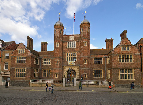
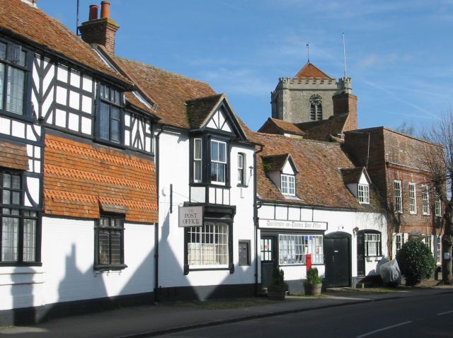
Lewes is the county town of East Sussex, England and gives its name to the Local government district in which it lies. The settlement has a long history as a bridging point and as a market town, and is today an important communications hub, and tourist-orientated town.
EtymologyThe name Lewes comes from the plural form of Anglo-Saxon "Hlaew", which means "hill". This refers to the hills of the South Downs or ancient burial mounds within the area.
History
The site that is now Lewes has a very ancient history. Archaeological evidence points to prehistoric dwellers and it is also thought that the Roman settlement of Mutuantonis was here, large quantities of artefacts having been discovered in the area. The Saxons built a castle here, having first constructed its motte as a defensive point over the river; they also gave the town its name.
After the Norman invasion Lewes was given by William the Conqueror to William de Warenne, 1st Earl of Surrey. He built Lewes Castle on the Saxon site; and he and his wife, Gundred also founded a Cluniac priory here in 1078. Lewes was the also site of a mint during the early years after the Norman invasion as well as a mint during the Late Anglo-Saxon period.
The town was the site of the Battle of Lewes in the Second Barons’ War in 1264. At the time of the Marian Persecutions of 1555–1557 Lewes was to witness the deaths of seventeen Protestantmartyrs who were burnt at the stake in the town.
Geography
Lewes is situated in a gap in the South Downs, cut through by the River Ouse, and near its confluence with the Winterbourne Stream. It is approximately seven miles NNW of Newhaven, and an equal distance north-east of Brighton.
The South Downs rise above the river on both banks. The High Street, and the original town, occupies the right bank, climbing steeply up from the bridge; the summit on that side, 2.5 miles (4 km) distant is known as Mount Harry. On the left bank there is a large chalkcliff (Cliffe Hill) that can be seen for many miles.
The latter gives its name to the one-time village of Cliffe, now part of the town. The southern part of the town, Southover, came into being adjacent to the Priory, south of the Winterbourne Stream. The town boundaries were enlarged twice: in 1881 and 1934, and now include the more modern housing estates of Wallands, Malling Hill, Neville and on the Kingston road.
The Greenwich Meridian runs through the western part of Lewes.
Natural sites and events

There are three Sites of Special Scientific Interest within the parish; Lewes Downs, Lewes Brooks and Southerham Works Pit. Lewes Downs is a site of biological interest, an isolated area of the South Downs. Lewes Brooks, also of biological importance, is part of the flood plain of the River Ouse, providing a habitat for many other invertebrates such as water beetles and snails. Southerham Works Pit is of geological interest, a disused chalk pit displaying a wide variety of fossilised fish remains.
On 27 December 1836, an avalanche occurred in Lewes, the worst ever recorded in England. It was caused by a large build-up of snow on the nearby cliff slipping down onto a row of cottages called Boulder Row (now part of South Street). About fifteen people were buried, and eight of these died. A pub in South Street is named The Snowdrop in memory of the event.
On 21 August 1864, Lewes suffered an earthquake shock measuring 3.1 on the Richter scale
In October 2000 the town suffered major flooding during an intense period of severe weather throughout the United Kingdom. The commercial centre of the town and many residential areas were devastated. In a government report into the nationwide flooding, Lewes was officially noted the most severely affected location. As a result of the devastation caused Lewes Flood Action, a pressure group, is in existence to press for better flood protection measures.
Lewes bonfire
The town's most important annual event is Lewes Bonfire - Guy Fawkes Night celebrations on the 5th of November. In Lewes this event not only marks the date of the uncovering of the Gunpowder Plot in 1605, but also commemorates the memory of the seventeen Protestant martyrs.
The current celebrations take the form of a series of torchlit processions through the town. The event is organised by the local bonfire societies, under the auspices of the Lewes Bonfire Council. Lewes itself currently has seven bonfire societies (Nevill Juveniles is a children's society and holds its celebrations a week or two before 5 November; Southover, which disbanded in 1985, reformed in 2005) and a number of nearby towns have their own bonfire societies. The other five local bonfire societies from the town (Cliffe, Borough, Commercial Square, South Street and Waterloo) each proceed on their own route accompanied by a number of other societies from the neighbouring towns.
Each bonfire society has its own traditional costumes (ranging from Tudor dress to Mongol warriors). A number of large effigies are drawn though the streets. Effigies of Guy Fawkes and Pope Paul V, who became head of the Roman Catholic Church in 1605, feature every year. In addition, each of the five main local societies creates a topical "tableau" (usually, but not always, representing a human figure or figures), and the Cliffe society displays on pikes the heads (also in effigy) of its current "Enemies of Bonfire", who range from nationally reviled figures to local officials who have attempted to place restrictions on the event. Restrictions are generally ignored by the Societies.
In 2001 an effigy of Osama bin Laden ensured that the annual event received more press attention than usual (it featured on the front page of some national newspapers) as did the Firle Bonfire Society's 2003 choice of a gypsy caravan. To mark the demise of the 17 martyrs, 17 burning crosses are carried through the town, and a wreath-laying ceremony occurs at the War Memorial in the centre of town. A flaming tar barrel is also thrown into the river Ouse; this is said to symbolise the throwing of the magistrates into the river after they read the Riot Act to the bonfire boys in 1847, but may also be an echo of Samhain traditions. The festivities culminate in five separate bonfire displays, where the effigies are destroyed by firework and flame. Up to 80,000 people have been known to attend this local spectacle, coming from all over the South and sometimes further afield.
Aerial photograph of Lewes Crescent, 1991
The Lewes Chamber of Commerce represents the traders and businesses of the town. Lewes Farmers' Market, one of the first in the UK, was started in the 1990s by Common Cause Co-operative Ltd and is a very popular re-invention of Lewes as a market town.
From 1794 beers, wines and spirits were distributed from Lewes under the Harveys name, and the town is today the site of Harveys brewery.
In September 2008, Lewes launched its own currency, the Lewes Pound, in an effort to increase trade within the town. One Lewes Pound is equal to Ł1. Like the similar currency in Totnes, the initiative is part of the Transition Towns movement.
Landmarks
The town is the location of several historic buildings, including Lewes Castle, the remains of Lewes Priory, and the so-called "Anne of Cleves House" (given to the divorced queen but never lived in by her).
Transport
Lewes, from its inception, has been an important transport hub. Its site as a bridging point was probably originally a ford: today the main routes avoid the town centre. The A27 trunk road taking traffic along the south coast between Eastbourne and Southampton passes to the south of the town. The A26 from Maidstone to Newhaven; and the A275 (the London road) both come in from the north. The Brighton & Hove Bus and Coach Company serve the town.
Lewes railway station was originally the junction for six routes. Today the two erstwhile country routes to the north are both closed at the Lewes end; but the East Coastway Line, connecting London with Eastbourne and Hastings, and the two branches to Brighton and Seaford remain.
The Vanguard Way, a long-distance footpath from London to Newhaven, follows the River Ouse through the town.
City of Brighton and Hove
Boroughs or districts
Borough of Eastbourne • Borough of Hastings • District of Lewes • District of Rother • District of Wealden
Cities and towns
Battle • Bexhill-on-Sea • Brighton • Crowborough • Eastbourne • Hailsham • Hastings • Heathfield • Hove • Lewes • Newhaven • Peacehaven • Polegate • Rye • Seaford • Telscombe • Uckfield • Wadhurst • Winchelsea
Rivers
Cuckmere, Rother, River Tillingham
Topics
History • Geography • Parliamentary constituencies • People • Places • Transport • South Downs • North Downs • Beachy Head • High Weald • Long Man of Wilmington


%2Bchurchill%26start%3D20%26ndsp%3D20%26um%3D1%26hl%3Dsv%26sa%3DN)


Comentario