MUNDOTEKA 1- Europa

Colapsar
Este tema está cerrado
X
X
 
  • Tiempo
  • Mostrar
Limpiar Todo
nuevos mensajes
  • Nettus
    Usuario
    • 1 feb, 2008
    • 4715
    • Lundby

    40. East Sussex


    Sussex del Este (East Sussex en inglés) es un condado en el sureste de Inglaterra, en el Reino Unido. Limita con los condados de Kent, Surrey y Sussex del Oeste y al sur con el canal de la Mancha.
    El antiguo reino de Sussex se dividió en las regiones administrativas este y oeste, con consejos del condado independientes en 1888.
    La capital del condado se estableció en Lewes.
    En el nuevo condado de Sussex del Este existen tres distritos administrativamente independientes: Brighton, Eastbourne y Hastings
    Historia
    Historia del antiguo condado de Sussex, lo que incluye a los actuales Sussex del Estey Sussex del Oeste
    Dejando aparte los restos prehistóricos, la historia de Sussex se inicia en el año 477 cuando los sajones llegaron al oeste del condado y fundaron el "reino de los sajones del sur".
    Nota: El descubrimiento de restos romanos en Fishbourne en 1960 dieron luz a la historia de la ocupación romana del condado y su implicación en toda Britania durante el periodo pre-sajón.
    Los sajones tomaron la ciudad romana de Regnum, que se convertiría en Chichester, así como la fortaleza de Anderida y el castillo de Pevensey. El rey Aelle se convirtió en el más influyente de los jefes sajones. Tras su reinado, el reino de Sussex inició su declive, cayendo por completo bajo el dominio de Wesex en el año 823.
    A partir del año 895, Sussex sufrió continuos ataques por parte de los Danés (vikingos), hasta la ascensión del rey Canuto. La influencia normanda fue también fuerte en Sussex antes de la conquista normanda. Los puertos de Hastings, Rye, Winchelsea y Steyning estuvieron bajo el poder de la abadía normanda de Fecamp.
    Por su situación, Sussex fue un escenario constante para la preparación de invasiones y estuvo a menudo afectada por rebeliones. Durante la guerra de los barones, el condado se convirtió en el centro para las fuerzas reales. Las fuerzas del rey y las de Simon de Montfort se enfrentaron en la batalla de Lewes en 1264.
    History
    East Sussex is part of the ancient kingdom of the South Saxons, who established themselves there in the 5th century AD, after the departure of the Romans, although the area had been populated for many thousands of years before then. Archaeological remains are plentiful, especially in the upland areas. The area's position on the coast has also meant that there were many invaders, including the Romans and later the Normans. Earlier industries have included fishing, iron-making, and the wool trade, all of which have declined, or lost completely. In more modern times, Sussex has become popular with tourists, so that the main coastal towns have become seaside resorts.
    Geography
    Geology
    See map reproduced in Weald
    From a geological point of view East Sussex is part of southern anticline of the Weald: the South Downs, a range of moderate chalk hills which run across the southern part of the county from west to east and mirrored in Kent by the North Downs. To the north lie parallel valleys and ridges, the highest of which is the Weald itself (the Hastings beds and Wealden Clay). The sandstones and clays come the sea at Hastings; the Downs at Beachy Head.

    Hastings
    Relief and drainage
    The relief of the county reflects the geology.
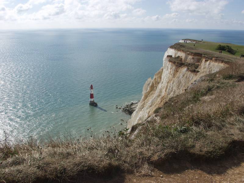
    The chalk uplands of the South Downs occupies the coastal strip between Brighton and Eastbourne. There are two river gaps: the Rivers Ouse and Cuckmere. The Seven Sisters, where the Downs meet the sea, are the remnants of dry valleys cut into the chalk; they end at Beachy Head, 530 feet (162 m) above sea level. To the east of Beachy Head lie the marshlands of the Pevensey Levels, formerly flooded by the sea but now enclosed within a deposited beach. At Bexhill the land begins to rise again where the sands and clays of the Weald meet the sea; these culminate in the sandstone cliffs east of Hastings. Further east are the Pett Levels, more marshland, beyond which is the estuary of the River Rother. On the far side of the estuary are the dunes of Camber Sands. The highest point of the Downs within the county is Ditchling Beacon, at 814 feet (248 m): it is termed a Marilyn.
    The Weald occupies the northern borderlands of the county. Between the Downs and Weald is a narrow stretch of lower lying land; many of the rivers and streams occupying this area originate in the Weald. The High Weald is heavily wooded in contrast to the South Downs; the Low Weald less so. Part of the Weald is the Ashdown Forest.
    Settlements
    The location of settlements in East Sussex has been determined both by its history and its geography. The original towns and villages tended to be where its economy lay: fishing along the coast and agriculture and iron mining on the Weald. Industry today tends to be geared towards tourism, and particularly along the coastal strip. Here towns such as Bexhill-on-Sea, Eastbourne, and Hastings lie. Newhaven and Rye are ports, although the latter is also of historical importance. Peacehaven and Seaford are more dormitory towns than anything else. Away from the coast lie former market towns such as Hailsham, Heathfield and Uckfield; Crowborough is a centre for the Ashdown Forest. Lewes, the County town of East Sussex; and Battle, with its Norman Conquest beginnings. are the other two towns of significance.
    Landmarks
    Apart from the physical landmarks such as the Downs and the Weald, East Sussex has a great many landmarks of historical interest. There are castles atBodiam, Herstmonceux, Lewes and Pevensey; and defence works such as the Martello towers and Eastbourne Redoubt. Battle Abbey, built to commemorate the Battle of Hastings; Bateman's, home of Rudyard Kipling, and the University of Sussex buildings at Falmerare among interesting buildings.
    It also has a number of great parks suitable for tourists.
    El castillo de Bodiam . El bosque de Ashdown . Batemans
    Transport
    Roads
    Unusually East Sussex has no motorways. The main roads through the county are those part of the radial pattern from London: the A21 to Hastings; the A22 to Eastbourne; and the A23 to Brighton. Cross-country routes include the A26 which carries traffic from Newhaven and Lewes north into Kent; and the south coast trunk route, which starts in Folkestone (Kent) as the A259 trunk road, and traverses the south coast to Eastbourne, where it becomes the A27 trunk road and heads westwards towards Chichester in West Sussex and ultimately to Honiton in Devon. All the main roads suffer from congestion and traffic problems: the A27 which connects Eastbourne to Portsmouth is one of the busiest trunk roads in the UK.
    Bus routes serve all the main areas of settlement and many of the villages in the county.
    Railways
    The railways serve the main towns in a similar fashion to the roads. Until the closures of many branch railways in the 20th century, rural East Sussex was well-served by rail: few such branch lines escaped the Beeching Axe so that today only main-line services remain. They include the East Coastway Line (including the Marshlink Line); the London-Hastings line; and the Uckfield branch, the terminus of the Oxted Line. There are three heritage railways: the Kent and East Sussex Railway operates from Tenterden in Kent to Bodiam; the Bluebell Railway from Sheffield Park to Kingscote with a planned extension to East Grinstead; and the Lavender Line Steam Railway near Lewes.
    Footpaths
    see also Recreational walks in East Sussex
    Among the long-distance footpaths in East Sussex are the South Downs Way; 1066 Country Walk, High Weald Landscape Trail, Saxon Shore Way, Sussex Border Path, Sussex Ouse Valley Way, Vanguard Way and the Wealdway.
    Enlaces
    East Sussex travel guide from Wikitravel
    ..................................................
    Capital: Lewes
    Map of Lewes in Sussex, England, UK
    Lewes, East SussexUK maps.google.se
    Map of Lewes -
    Coordenadas: 50° 52′ 12″ N, 0° 1′ 12″ E
    Lewes is the county town of East Sussex, England and gives its name to the Local government district in which it lies. The settlement has a long history as a bridging point and as a market town, and is today an important communications hub, and tourist-orientated town.
    Etymology
    The name Lewes comes from the plural form of Anglo-Saxon "Hlaew", which means "hill". This refers to the hills of the South Downs or ancient burial mounds within the area.
    History
    The site that is now Lewes has a very ancient history. Archaeological evidence points to prehistoric dwellers and it is also thought that the Roman settlement of Mutuantonis was here, large quantities of artefacts having been discovered in the area. The Saxons built a castle here, having first constructed its motte as a defensive point over the river; they also gave the town its name.
    After the Norman invasion Lewes was given by William the Conqueror to William de Warenne, 1st Earl of Surrey. He built Lewes Castle on the Saxon site; and he and his wife, Gundred also founded a Cluniac priory here in 1078. Lewes was the also site of a mint during the early years after the Norman invasion as well as a mint during the Late Anglo-Saxon period.
    The town was the site of the Battle of Lewes in the Second Barons’ War in 1264. At the time of the Marian Persecutions of 1555–1557 Lewes was to witness the deaths of seventeen Protestantmartyrs who were burnt at the stake in the town.
    Geography
    Lewes is situated in a gap in the South Downs, cut through by the River Ouse, and near its confluence with the Winterbourne Stream. It is approximately seven miles NNW of Newhaven, and an equal distance north-east of Brighton.
    The South Downs rise above the river on both banks. The High Street, and the original town, occupies the right bank, climbing steeply up from the bridge; the summit on that side, 2.5 miles (4 km) distant is known as Mount Harry. On the left bank there is a large chalkcliff (Cliffe Hill) that can be seen for many miles.
    The latter gives its name to the one-time village of Cliffe, now part of the town. The southern part of the town, Southover, came into being adjacent to the Priory, south of the Winterbourne Stream. The town boundaries were enlarged twice: in 1881 and 1934, and now include the more modern housing estates of Wallands, Malling Hill, Neville and on the Kingston road.
    The Greenwich Meridian runs through the western part of Lewes.
    Natural sites and events
    There are three Sites of Special Scientific Interest within the parish; Lewes Downs, Lewes Brooks and Southerham Works Pit. Lewes Downs is a site of biological interest, an isolated area of the South Downs. Lewes Brooks, also of biological importance, is part of the flood plain of the River Ouse, providing a habitat for many other invertebrates such as water beetles and snails. Southerham Works Pit is of geological interest, a disused chalk pit displaying a wide variety of fossilised fish remains.
    On 27 December 1836, an avalanche occurred in Lewes, the worst ever recorded in England. It was caused by a large build-up of snow on the nearby cliff slipping down onto a row of cottages called Boulder Row (now part of South Street). About fifteen people were buried, and eight of these died. A pub in South Street is named The Snowdrop in memory of the event.
    On 21 August 1864, Lewes suffered an earthquake shock measuring 3.1 on the Richter scale
    In October 2000 the town suffered major flooding during an intense period of severe weather throughout the United Kingdom. The commercial centre of the town and many residential areas were devastated. In a government report into the nationwide flooding, Lewes was officially noted the most severely affected location. As a result of the devastation caused Lewes Flood Action, a pressure group, is in existence to press for better flood protection measures.
    Lewes bonfire
    The town's most important annual event is Lewes Bonfire - Guy Fawkes Night celebrations on the 5th of November. In Lewes this event not only marks the date of the uncovering of the Gunpowder Plot in 1605, but also commemorates the memory of the seventeen Protestant martyrs.
    The current celebrations take the form of a series of torchlit processions through the town. The event is organised by the local bonfire societies, under the auspices of the Lewes Bonfire Council. Lewes itself currently has seven bonfire societies (Nevill Juveniles is a children's society and holds its celebrations a week or two before 5 November; Southover, which disbanded in 1985, reformed in 2005) and a number of nearby towns have their own bonfire societies. The other five local bonfire societies from the town (Cliffe, Borough, Commercial Square, South Street and Waterloo) each proceed on their own route accompanied by a number of other societies from the neighbouring towns.
    Each bonfire society has its own traditional costumes (ranging from Tudor dress to Mongol warriors). A number of large effigies are drawn though the streets. Effigies of Guy Fawkes and Pope Paul V, who became head of the Roman Catholic Church in 1605, feature every year. In addition, each of the five main local societies creates a topical "tableau" (usually, but not always, representing a human figure or figures), and the Cliffe society displays on pikes the heads (also in effigy) of its current "Enemies of Bonfire", who range from nationally reviled figures to local officials who have attempted to place restrictions on the event. Restrictions are generally ignored by the Societies.
    In 2001 an effigy of Osama bin Laden ensured that the annual event received more press attention than usual (it featured on the front page of some national newspapers) as did the Firle Bonfire Society's 2003 choice of a gypsy caravan. To mark the demise of the 17 martyrs, 17 burning crosses are carried through the town, and a wreath-laying ceremony occurs at the War Memorial in the centre of town. A flaming tar barrel is also thrown into the river Ouse; this is said to symbolise the throwing of the magistrates into the river after they read the Riot Act to the bonfire boys in 1847, but may also be an echo of Samhain traditions. The festivities culminate in five separate bonfire displays, where the effigies are destroyed by firework and flame. Up to 80,000 people have been known to attend this local spectacle, coming from all over the South and sometimes further afield.

    Aerial photograph of Lewes Crescent, 1991
    Economy
    The Lewes Chamber of Commerce represents the traders and businesses of the town. Lewes Farmers' Market, one of the first in the UK, was started in the 1990s by Common Cause Co-operative Ltd and is a very popular re-invention of Lewes as a market town.
    From 1794 beers, wines and spirits were distributed from Lewes under the Harveys name, and the town is today the site of Harveys brewery.
    In September 2008, Lewes launched its own currency, the Lewes Pound, in an effort to increase trade within the town. One Lewes Pound is equal to £1. Like the similar currency in Totnes, the initiative is part of the Transition Towns movement.
    Landmarks
    The town is the location of several historic buildings, including Lewes Castle, the remains of Lewes Priory, and the so-called "Anne of Cleves House" (given to the divorced queen but never lived in by her).
    Transport
    Lewes, from its inception, has been an important transport hub. Its site as a bridging point was probably originally a ford: today the main routes avoid the town centre. The A27 trunk road taking traffic along the south coast between Eastbourne and Southampton passes to the south of the town. The A26 from Maidstone to Newhaven; and the A275 (the London road) both come in from the north. The Brighton & Hove Bus and Coach Company serve the town.
    Lewes railway station was originally the junction for six routes. Today the two erstwhile country routes to the north are both closed at the Lewes end; but the East Coastway Line, connecting London with Eastbourne and Hastings, and the two branches to Brighton and Seaford remain.
    The Vanguard Way, a long-distance footpath from London to Newhaven, follows the River Ouse through the town.
    East Sussex portal
    Ceremonial county of East SussexEast Sussex Portal
    City of Brighton and Hove
    Boroughs or districts
    Borough of EastbourneBorough of HastingsDistrict of LewesDistrict of RotherDistrict of Wealden
    Cities and towns
    BattleBexhill-on-SeaBrightonCrowboroughEastbourneHailshamHastingsHeathfieldHoveLewesNewhavenPeacehavenPolegateRyeSeafordTelscombeUckfieldWadhurstWinchelsea
    Rivers
    Cuckmere, Rother, River Tillingham
    Topics
    HistoryGeographyParliamentary constituenciesPeoplePlacesTransportSouth DownsNorth DownsBeachy HeadHigh WealdLong Man of Wilmington

    Comentario

    • Nettus
      Usuario
      • 1 feb, 2008
      • 4715
      • Lundby

      Brighton

      Brighton
      Map Of Brighton | Interactive Brighton Map Based Information

      Home . Non display Page . Accommodation . Hotels . Bed & Breakfast
      Boutique . Self Catering . Beyond Brighton . Ratings . Accessible
      Booking Information
      Things to Do . Places to Visit . Activities . Beach Life
      Parks and Gardens . Top 50 Things to Do . Beyond Brighton
      Culture ¨. Theatre . Arts
      Nightlife . Comedy . Film . Festivals . What's On

      Non display Page
      Eating & Drinking . Restaurants . Cafes . Pubs & Bars . Shopping
      The Lanes . North Laine . Churchill Square . Hove . Brighton Marina
      Kemptown . Rottingdean
      Maps, Guides & Interactive . Maps . Guides . Blue Badge . Podcasts
      Travel Buddy . Walking Tours . Brightons Villages . Images of Brighton
      Competitions . Eshop

      La vida en Brighton oscila entre la placidez y el desenfreno. Durante siglos, ha sido para los londinenses el destino de fin de semana por excelencia, pero, bajo la apariencia de tranquilo centro vacacional, es una ciudad llena de acción.
      Antiguamente lugar de ocio de la realeza, siempre ha tenido una vena rebelde. Explórala más allá de los salones recreativos y la playa de guijarros y descubrirás una ciudad apasionante. En la actualidad es un lugar creativo, intenso y colorista.
      Además del Royal Pavilion, destacado museo que se cuenta entre los mejores del país, encontrarás fantásticos restaurantes y cafés, magníficos pubs y bares y una interesante vida nocturna. Norman Cook, el nombre real de Fatboy Slim, vive en Brighton, donde actúa como DJ. Cerca de allí se encuentran las fabulosas colinas South Downs. ¡Conviene reservar algo de tiempo para hacer alguna excursión fuera de la ciudad!
      El Tourist Information Centre (www.visitbrighton.co.uk) está en 10 Bartholomew Square.
      Para más información visita nuestra guía de Brighton.

      Picture of The Royal Pavilion, Brighton, Sussex - One of the most vibrant cities in England.
      Brighton's Regency architecture is some of the best in the country - the finest example is the Royal Pavilion.
      Qué ver
      El Royal Pavilion (www.royalpavilion.org.uk/) es de visita obligada en cualquier viaje por el sur de Inglaterra. Esta suntuosa fantasía es un claro símbolo de la decadencia tan poco inglesa que caracteriza a Brighton.
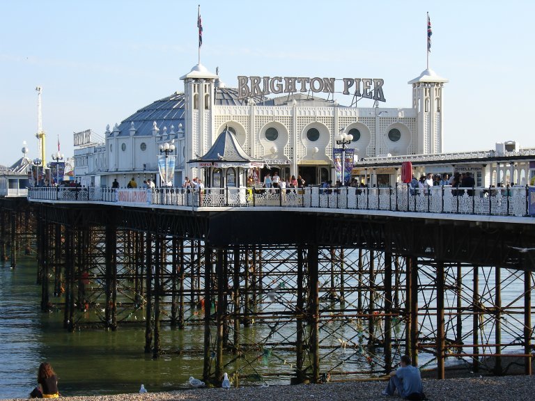
      Junto al Royal Pavilion, el Palace Pier (gratis) es el principal punto de referencia de la ciudad y el máximo exponente de la masificación estival. Contiene las típicas atracciones de feria, salones recreativos y puestos de comida donde venden el típico bastón de Brighton Rock. Casposo pero terriblemente divertido.
      El Brighton Museum & Art Gallery (www.brighton.virtualmuseum.info/) tiene una buena colección de arte y diseño del s. XX, que incluye los labios dalinianos de Mae West, y otra sobre culturas indígenas.
      Puntos de interés alternativos
      El Booth Museum of Natural History (www.booth.virtualmuseum.info/) es un ‘zoo muerto’ victoriano con más de medio millón de especímenes. La sala de las aves es especialmente escalofriante, sobre todo si se ha visto la película de Hitchcock.
      Información privilegiada
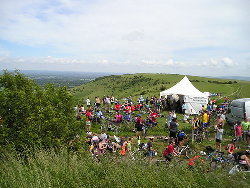
      Desde Brighton podrás visitar algunos de los rincones más bellos de la campiña inglesa. Las South Downs son perfectas para caminar, ir en bicicleta, a caballo o para practicar el parapente. Un destino estupendo para ir de excursión desde Brighton es Ditchling Beacon, con unas vistas increíbles en los días de sol.

      This is the top of Ditchling Beacon.,

      De compras
      The Lanes es la zona de compras más popular, un laberinto de callejones y pasajes repletos de tiendas y boutiques donde se vende de todo, desde rifles del s. XVII hasta la última moda en calzado.
      North Laine, una serie de calles al noroeste de The Lanes, tiene un aire menos turístico y elegante, con numerosas tiendas de ropa de segunda mano, puestos de discos y CDs y comercios de artesanía local. El mercadillo (Upper Gardner St) de los sábados por la mañana también merece la pena.
      Dónde comer
      En The Lanes, North Laine y Preston St, que se adentra en la ciudad desde la costa, cerca del West Pier, hay numerosos cafés, diners y restaurantes para todos los gustos y bolsillos.

      The Hop Poles
      Ideal para el brunch los fines de semana. Generalmente hay cola para conseguir mesa. Tel: +44 1273 710444; 13 Middle Street.
      Terre a Terre
      Elegido mejor restaurante vegetariano de Gran Bretaña por la Sociedad Vegetariana. Incluso a los carnívoros más recalcitrantes les costará resistirse a su imaginativa y deliciosa cocina. Tel: +44 1273 729051; 71 East Street.
      The Black Chapati
      Magnífica fusión de platos tradicionales asiáticos. Tel: +44 1273 699011; 12 Circus Parade, New England Road.
      The De Vere Grand
      Quien no haya probado aún el té de las cinco aquí tiene la oportunidad de cumplir con la tradición más inglesa. Tel: +44 1273 224300; King's Road.
      Restaurants in Brighton
      Brighton - Italian Restaurants
      Brighton - Vegetarian Restaurants
      Brighton - Japanese Restaurants
      Brighton - Thai Restaurants
      Brighton - Indian Restaurants
      Brighton - Seafood Restaurants
      Brighton - Mexican/Tex Mex Restaurants
      Brighton - Spanish Restaurants
      Popular Categories in Brighton
      Brighton - Bars and Pubs
      Brighton - Cafes and Coffee Shops
      Brighton - Food and Drink
      Brighton - Hotels and Travel
      Brighton - Sightseeing and Attractions
      Brighton - Take Aways
      Brighton - Nightlife
      Brighton - Sports and Leisure

      RDF Bar Brighton - The Door Guy - RDF Bar76 Preston Street , Brighton , East Sussex » What's On Guide
      Vida nocturna
      Cuando los mejores DJs británicos no están en Ibiza o Aya Napia, lo más probable es que pinchen en Brighton. Para saber qué está de moda, puedes consultar The Brighton Latest, The List o The Source.
      The Bar With No Name
      Pub tradicional que atrae a artistas locales, clubbers y a quienes simplemente quieren tomarse una buena pinta. Tel: +44 1273 601419; 58 Southover Street.
      Riki Tik
      Es el favorito del público joven para tomar unos cuantos cócteles antes de empezar la noche. Tel: +44 1273 683844; 18a Bond Street.
      Concorde 2
      Cada dos viernes se llena hasta los topes, cuando Fatboy Slim celebra su Big Beat Boutique. El resto de las noches el éxito es similar, con una buena selección de música de baile. Tel: +44 1273 207241; Marine Parade, Kemptown).
      The Joint
      Con algo que ofrecer a todo el mundo, es uno de los locales más populares de la zona. Tel: +44 1273 321692; 37 East Street.

      Dónde dormir
      www.totaltravel.co.uk/.../directory/hostels
      Hay muchas posibilidades para todos los bolsillos. Los fines de semana de verano conviene reservar, y también durante el Brighton Festival (www.brighton-festival.org.uk/), en mayo.
      Baggies Backpackers
      El mejor albergue. Está cerca de la costa y ofrece buenas instalaciones y un ambiente relajado. Tel: +44 1273 733740; 33 Oriental Place.
      University of Brighton
      La universidad alquila pisos para entre dos y ocho personas en diferentes puntos de la ciudad. Tel: +44 1273 643167; Grand Parade.
      Funchal Guesthouse
      Cuenta con habitaciones limpias y acogedoras. En verano, los precios alcanzan las £30 por noche. Tel: +44 1273 603975; 17 Madeira Place.
      Oriental Hotel
      Decorated with bright colours, home-made furniture and cool decor; very funky. Tel: +44 1273 2050509; Oriental Place.
      St Christopher's Inn
      Decorado con colores vivos, muebles hechos a mano y elementos de mucho gusto: un lugar atractivo. Tel: +44 20 7407 1856.

      Comentario

      • Nettus
        Usuario
        • 1 feb, 2008
        • 4715
        • Lundby

        Brighton (2)

        BRIGHTON
        Brighton, antiguo destino costero victoriano, recibió recientemente de la Reina el estatus de ciudad. Aún mantiene un ambiente muy cosmopolita, y sus cafes al borde del mar, sus extraordinarias tiendas, los numerosos restaurantes y un animado ambiente hacen de Brighton un destino popular para pasar el fin de semana.
        Brighton se levanta en la costa sur de Brighton y disfruta de un clima soleado y cálido. Es conocida como “Londres junto al mar”, y en el verano son muchos los que disfrutan de sus muchas instalaciones (bares, restaurantes, clubs, etc) dedicadas al ocio.
        No importa que busca el visitante, en Brighton seguramente lo hallará. Ya sea que quiera ir de compras (el shopping Churchill Square es una de las mejores opciones), pasear, o salir de copas, siempre podrá contar con encontrar un lugar donde hacerlo.
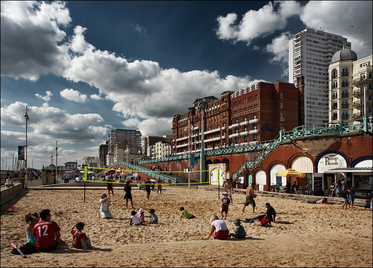
        Una de las mayores atracciones es el Brighton Pier, antes conocido como Palace Pier, un muelle enorme y lleno de juegos de parque de diversiones. En sus alrededores, y a lo largo de la costa, se pueden encontrar canchas de volley y basket, áreas de juego, y muchos bares y restaurantes con vista al mar.
        Lugares de interés
        Royal Pavilion (The) . Brighton and Hove Albion Football Matches
        Churchill Square Shopping Centre . Coral Brighton and Hove Stadium Races
        Komedia
        Hoteles
        The De Vere Grand, Brighton . Hilton Brighton Metropole . Hotel Pelirocco
        The Royal Albion Hotel . The Belgrave Hotel
        Restaurantes
        Whytes . Meeting Place (The) . Al Duomo . English's . Momma Cherri's Soul Food Shack

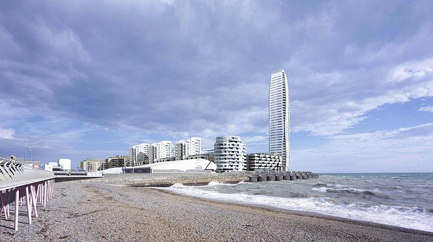
        Project: Brighton Marina Tower, 128m - Status: Under Construction - City: Brighton
        Construction Start: 2007 - Floor Count: 40
        The City of Brighton and Hove
        Known as 'London by the Sea' The city of Brighton and Hove is the UK’s most famous seaside holiday resort. It is truly one of England’s most cosmopolitan cities.

        The city is famous for its Royal Palace, called the Royal Pavilion, and its piers. The city also hosts England’s largest Arts festival every May. It is also a major tourist destination of British and International visitors and it a great place to be during the summer months and all the year round.
        It is also one of the UK’s most popular destinations for international students. Together with British students at the cities two Universities, there are over 15,000 students in the city.
        With a population of 250,000 Brighton and Hove is also the perfect size – large enough to have all the facilities you need, but small enough to get to know quickly if you staying for a short time.

        Our city has two names because many years ago they were two separate places, but they have grown to become one place. Today you cannot see the difference between the two places, but people sometimes say that they live in either Brighton or in Hove so that people know what area of town they are talking about. Brighton is the eastern side, and Hove is the western side.

        www.kentrail.co.uk/Brighton%202.htm

        Brighton was just a fishing village until 1787 when the Prince George, Prince of Wales, decided to build a spectacular palace there. The Brighton Pavilion was built over the next 20 years and remains on of the UK’s most famous and distinctive buildings.

        Brighton then became home to many noble and rich families for the summer months and you will find Brighton mentioned in many of Jane Austen’s novels.
        Brighton has also featured in many other books and films, including Graham Greene’s novel Brighton Rock and the classic film Quadrophenia.
        For information about the local area around the school, clickhere.
        ..................................................


        Curso de inglés en Brighton, en la costa inglesa
        El curso de verano para jóvenes de Brighton ofrece una perfecta combinación entre actividades culturales y clases de inglés. Los estudiantes disfrutarán de las instalaciones del modernísimo centro de estudios recientemente abierto, muy cerca de pie del centro de la ciudad, de la estación de metro y la playa. La duración mínima del curso es de 2 semanas en un grupo máximo de 14 personas en clases multinacionales.

        Curso de inglés para jóvenes en Brighton, StudyTravel
        www.geos-brighton.com/brighton.htm

        Comentario

        • Nettus
          Usuario
          • 1 feb, 2008
          • 4715
          • Lundby

          41. West Sussex


          Sussex del Oeste (West Sussex en inglés) es un condado en el sur de Inglaterra, Reino Unido. Limita con los condados de Sussex del Este (con Brighton y Hove), Hampshire y Surrey. El condado de Sussex se dividió en las regiones administrativas este y oeste, con consejos del condado separados, en 1888. Sin embargo, hasta 1974 en que se produjo la división real, siguieron formando un único condado.
          El punto más alto de West Sussex está situado en Black Down, con una altura de 280 metros sobre el nivel del mar.
          West Sussex is a diverse county; it is well known for its stately homes and castles such as Arundel Castle and Bramber Castle. Over half the county is protected countryside, offering popular walking and cycling ground for visitors and residents alike.
          Chichester is the county town of West Sussex, and the highest point of the county is Black Down, at 280m.
          Historia
          Historia del antiguo condado de Sussex, lo que incluye a los actuales Sussex del Este y Sussex del Oeste
          Dejando aparte los restos prehistóricos, la historia de Sussex se inicia en el año 477 cuando los sajones llegaron al oeste del condado y fundaron el "reino de los sajones del sur".
          Nota: El descubrimiento de restos romanos en Fishbourne en 1960 dio luz a la historia de la ocupación romana del condado y su implicación en toda Britania durante el periodo pre-sajon.
          Los sajones tomaron la ciudad romana de Regnum, que se convertiría en Chichester, así como la fortaleza de Anderida y el castillo de Pevensey. El rey Aelle se convirtió en el más influente de los jefes sajones. Tras su reinado, el reino de Sussex inició su declive, cayendo por completo bajo el dominio de Wessex en el año 823.
          A partir del año 895, Sussex sufrió continuos ataques por parte de los Danés (vikingos), hasta la ascensión del rey Canuto. La influencia normanda fue también fuerte en Sussex antes de la conquista normanda. Los puertos de Hastings, Rye, Winchelsea y Steyning estuvieron bajo el poder de la abadía normanda de Fecamp.
          Por su situación, Sussex fue un escenario constante para la preparación de invasiones y estuvo a menudo afectada por rebeliones. Durante la guerra de los barones, el condado se convirtió en el centro para las fuerzas reales. Las fuerzas del rey y las de Simon de Montfort se enfrentaron en la batalla de Lewes en 1264.

          Settlements
          Most settlements in West Sussex are either along the south coast or are situated in the M23 corridor. Crawley and Worthing are the largest settlements in the county, with populations of approximately 100 000 inhabitants each. Next in size order comes Bognor Regis, on the south coast, followed by the market town of Horsham. Chichester, the county town, boasts a cathedral and city status, and is situated not far from the border with Hampshire. Other towns in alphabetical order are Burgess Hill, East Grinstead and Haywards Heath in the Mid Sussex district, and Littlehampton in the Arun district.
          Other settlements include the towns of Arundel and Shoreham-by-Sea, and the smaller settlements of Billingshurst, Copthorne, Crawley Down, Cuckfield, Henfield, Hassocks, Hurstpierpoint, Lancing, Midhurst, Petworth, Rustington, Steyning, Storrington and Pulborough.
          For a full list of settlements see
          >>List of places in West Sussex<<clic
          Communications and transport
          The M23/A23 runs through the east of the county from Waterloo in London all the way to Brighton. Other major roads are the A272 which runs east to west, and the A27 which does the same but closer to the coast; the A272 going through the middle of the county. Along the majority of the coast can be found the A259, which is often used as an alternate route to the A27.
          Gatwick Airport, which handled over 32 million passengers in 2005, is located to the north of Crawley, and is the second largest airport in the United Kingdom. There is also a considerably smaller local airport at Shoreham. There are 3 main railway routes; the Brighton Main Line, the Arun Valley Line and the West Coastway Line.
          Districts
          Adur . Arun . Chichester . Crawley . Horsham . Mid Sussex .Worthing
          Places of interest
          Castles, houses and other buildings
          Arundel Castle
          Barnham Windmill
          Christ's Hospital, an old public school notable for its archaic uniforms and picturesque campus.
          Goodwood House & Goodwood Motor Circuit
          High Salvington windmill
          Hurstpierpoint College - a Public School, notable for its substantial Sussex flint buildings and large campus.
          Lancing College - a Public School, notable for its substantial Sussex sandstone chapel and large campus.
          Petworth House
          Queen Victoria Hospital East Grinstead - Home of the McIndoe burns centre. Pioneered reconstructive surgery for burns patients during the Second World War.
          Sackville College, a Jacobean almshouse in East Grinstead
          Shipley Windmill
          Standen, East Grinstead
          Uppark
          Cobnor House - Home to the Beale Family who were heavily involved with Chichester Harbour
          Museums
          Amberley Working Museum
          Steyning Museum
          Tangmere Military Aviation Museum
          Weald and Downland Open Air Museum of Historic Buildings at Singleton
          Nature
          WWT Arundel (a nature reserve of the Wildfowl and Wetlands Trust)
          Selsey Bill
          South Downs Way - a long distance footpath
          Stansted Park
          Wakehurst Place
          Ancient history
          Bignor Roman Villa
          Cissbury Ring and Chanctonbury Ring, ancient hill forts located on the South Downs
          Fishbourne Roman Palace
          Religious buildings
          Bosham Church
          St. Margaret's Church, West Hoathly - an 11th century Anglo-Saxon church
          St Mary's Church, Sompting - an 11th century Anglo-Saxon church.
          St Swithuns Church East Grinstead
          St. Nicholas' Church, Worth - a 10th century church in Worth, Crawley
          St. Marks Church, Horsham - an Anglican church in Horsham
          Cittaviveka - a Buddhist monastery in Chithurst
          See also Churches in West Sussex
          The arts
          Pallant House Gallery in Chichester houses one of the most significant collections of 20th century British art outside London. It includes a substantial body of early and mid-20th century work bequeathed by Walter Hussey (Dean of Chichester Cathedral, 1955-1977) and many later works donated by Sir Colin St John 'Sandy' Wilson.
          Worthing Museum and Art Gallery houses the biggest collection of Georgian & Victorian costume in South East England.
          Other
          Gatwick Airport
          Shoreham Airport - the world's oldest continually-operational airport.
          Hickstead Showjumping
          Los restos romanos de Fishbourne
          El Aeropuerto de Gatwick'

          History of Sussex
          Enlaces externos
          West Sussex.info´
          ..................................................
          Capital: Chichester
          Map of Chichester on AboutBritain.com -
          Coordenadas: 50° 50′ 11.47″ N, 0° 46′ 45.05″ O

          Chichester is a cathedral city in West Sussex, England. It has a long history as a settlement; its Roman past and its subsequent importance in Anglo-Saxon times are only its beginnings. It is the seat of a bishopric, with a 12th century cathedral.
          Chichester today is a local government stronghold, three levels being administered from here. It is also a transport hub, and the centre for culture in the region, with a Festival theatre and two art galleries. The nearby Chichester Harbour, together with the South Downs, provide ample opportunities for outdoor pursuits.
          History
          It has been argued that the area was a bridgehead for the Roman invasion of Britain. The city centre stands on the foundations of the Romano-British city of Noviomagus Reginorum, capital of the Civitas Reginorum, and near to the Roman Palace of Fishbourne. According to the Anglo-Saxon Chronicle it was captured towards the close of the fifth century, by Ælle, and renamed after his son, Cissa. It was the chief city of the Kingdom of Sussex. The Roman Road of Stane Street, connecting Fishbourne Palace with London, passes through the city centre. The city streets have a cross-shaped layout, inherited from the Romans: radiating outwards from the medieval market cross lead the North, South, East and West shopping streets. Quite a lot of the city walls are in place, and may be walked along over what still remains .
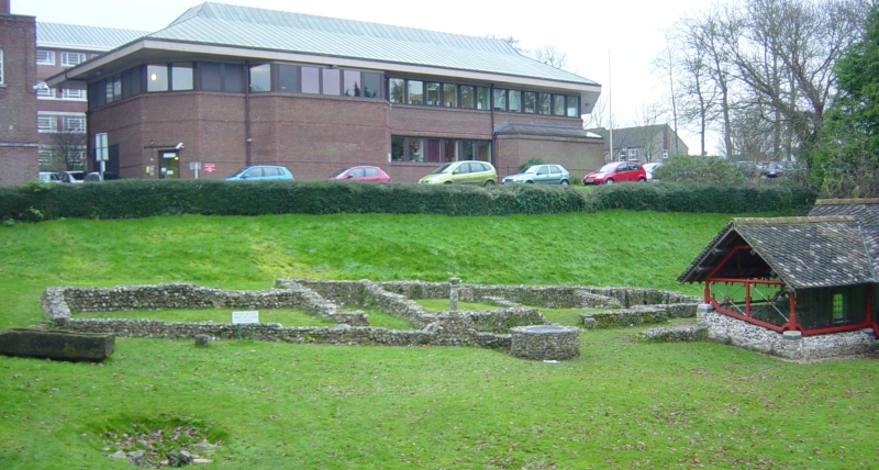
          An amphitheatre was built close to what would have been the city walls, outside the East Gate in around 80 AD. The remains are now buried under land currently used as a park, but the bank of the amphitheatre is clearly discernible and a notice board in the park gives more information.
          Geography
          The City of Chichester is located on the River Lavant and south of its gap through the South Downs: this winterbourne stream often dries up during the summer months. For part of its course through the city is in in underground culverts. Its site made it an ideal place for a settlement, where many ancient routeways converged here. The oldest part is within the walls, but as with most towns growth has occurred beyond those confines.
          The Chichester Conservation Area Character Appraisal was adopted as Supplementary Planning Guidance on the 8 March 2005 by the District Council's Executive Board. The area encompasses the whole of the Roman town, with additions to every side: Northgate, Westgate, Southgate, and Eastgate. The Caledonian Road area to the south-east and Summersdale to the north are also included. Further to the north lies the separate conservation area around Graylingwell Hospital, and to the south, the Chichester Conservation Area has been extended recently to include the newly restored canal basin and part of the canal itself. The Conservation Area has been split into eight 'character' areas, based on historic development, building type, uses and activities.
          Landmarks
          The most obvious landmark is naturally the cathedral, but there are several others. The remains of the Roman amphitheatre are now buried under land currently used as a park, but the bank of the amphitheatre is clearly discernible and a notice board in the park gives more information.
          The Butter Market in North Street was designed by John Nash, and was opened in 1808 as a food and produce market. In 1900, a second storey was added to the building, originally housing an arts institute. It is currently still in use by various small business, however Chichester City Council are soon to carry out a full scale renovation of the building, leaving the future of some of the current retailers in some doubt.
          The Corn Exhange in East Street was built in 1833, one of the first in the country. It is an imposing building, designed to show off its importance to trade. In 1883 it was also used for drama and entertainment. From then it became a cinema (1923-1984), a restaurant, and then a fast food restaurant. It is currently occupied by Next clothing retailers.
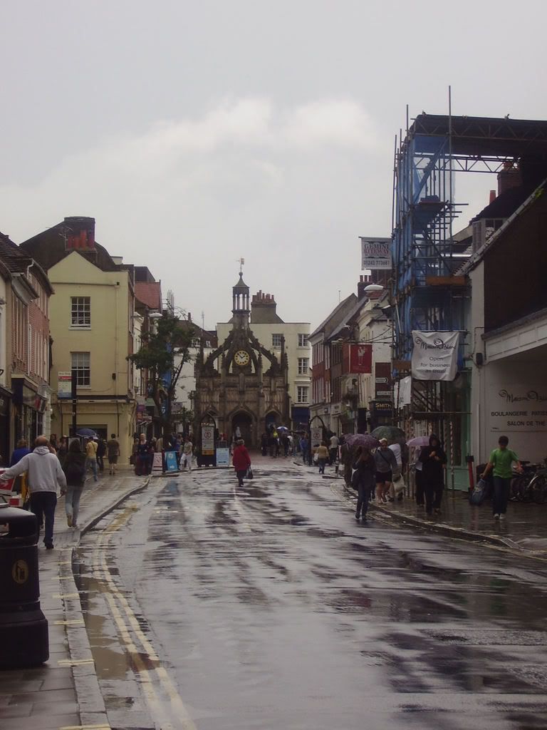
          The Chichester Cross, a one-time site for the market, stands at the intersection of the four main roads in the centre of the city.
          Transport
          Chichester is the hub of several main roads. The most important of these is the A27 coastal trunk road connecting Eastbourne with Southampton. The secondary coastal road, the A259, which began its journey at Folkestone in Kent, joins with a junction with the A27 here and ends in Havant to the west. Both those roads make east-west connections. Three roads give Chichester acces to the north: The A29 from London, which has also joined the A27 to the east of the city; and the A285, which gives access to Petworth and another cross-country road (the A272); and finally the A286, heading towards Guildford.
          Stagecoach South East bus company has its headquarters here.
          Chichester railway station, on the West Coastway Line, has regular services to Brighton, London Victoria via Gatwick Airport, Portsmouth, Southampton and Basingstoke. In the past there was a branch line to Midhurst in the north; and a light railway built by Colonel HF Stephens known as the West Sussex Railway which ran south to Selsey, and which closed in 1935.
          There are several long distance routes for walkers, cyclists and riders in the area, some of which, like the Centurion Way to West Dean in East Sussex, start here.
          Religious buildings
          Chichester Cathedral
          Chichester Cathedral, founded in the 11th century, is dedicated to the Holy Trinity, and contains a shrine to Saint Richard of Chichester. Its spire, built of the weak local stone, collapsed suddenly and was rebuilt during the 19th century. In the south aisle of the cathedral a window in the floor affords a view of the remains of a Romanmosaicpavement. The Cathedral is unusual in the UK in having a separate bell tower a few metres away from the main building, rather than integrated into it. Within the Cathedral there is a medieval tomb of a knight and his wife, the inspiration of the poem "An Arundel Tomb", by Philip Larkin. A fine memorial statue also exists of William Huskisson, once Member of Parliament for the City, but best remembered as the first man to be run over by a railway engine. Leonard Bernstein's Chichester Psalms were commissioned for the Cathedral.
          In addition to the cathedral there are five Church of England churches; St Richard’s Roman Catholic church; and nine other religious buildings of other denominations.
          Culture
          The city holds an annual three-week arts and music festival (“Chichester Festivities“) held in July.
          Its most prestigious cultural location is the Chichester Festival Theatre, one of the United Kingdom’s flagship theatres, whose annual summer season attracts actors, writers and directors from the West End theatre.
          Pallant House Gallery, winner of the 2007 gallery of the year Gulbenkian Prize has a major collection of chiefly modern British art and in 2006 opened its new extension that houses the collection of Professor Sir Colin St John Wilson. It also has a changing programme of exhibitions.
          Chichester Cinema at New Park is the city's first and only arthouse cinema. It shows a selection of mainstream, small-budget and older films, with showings 7 days a week. Vice presidents are Dame Maggie Smith and Kenneth Branagh.
          The following paragraph considers the city’s music scene: in recent years it has experienced growth in various genres.
          Popular music
          A cornerstone of the Chichester music scene is Chichester RAJF (From "Real Ale and Jazz Festival"), a four day festival of music and real ale held each July in tents beside the 13th century Guildhall in Priory Park. Founded in 1981 by members of Chichester Hockey Club as a fund-raising event, the festival has grown in size and ambition. In the early years the focus was on traditional jazz and featured performers such as Kenny Ball, Humphrey Lyttelton and Kenny Baker. In the 1990s blues and R&B were introduced and more recently the festival has increased its capacity to 2500 persons and has offered a wide range of popular music including James Brown, Status Quo, Blondie, Boney M, Robert Cray, Hot Chocolate, Howard Jones, Go West, The Pretenders, The Drifters and Simple Minds. For 2008, Chichester RAJF has announced Squeeze for Sat 12th July. Though the Concert has to finish at 11 0'clock due to the local residents
          Blues on the Farm is a festival held every June at Pump Bottom Farm two miles (3.2km) south of the city. Founded in 1991, it has become the UK's biggest outdoor blues festival hosting many of the top national and international names in a picturesque and friendly environment. Roots Around the World is another such festival, bringing what is described as the best in global music to the city and surrounding village halls.
          Enlaces
          Chichester City Council website
          City Walls Walk: includes map
          Chichester Web - The Chichester Guide
          The Buttermarket plans
          Chichester Web’: churches of Chichester
          Chichester Festivities
          The Website Of Chichester Festival Theatre
          Pallant House Gallery
          Chichester Cinema At New Park

          Comentario

          • Nettus
            Usuario
            • 1 feb, 2008
            • 4715
            • Lundby

            Condado de sussex, los paisajes más hermosos

            CONDADO DE SUSSEX, LOS PAISAJES MÁS HERMOSOS

            www.eastbourne.org/.../downland_walks.php

            En la costa sur de Inglaterra se sitúa el histórico condado de Sussex, que se divide especialmente en dos zonas bien diferenciadas: la oriental y la occidental. Sussex siempre se ha caracterizado por sus maravillosos paisajes costeros, de los más fotografiados de Inglaterra, y por haber sido escenario de grandes batallas en la Historia. La región también ofrece una gran variedad de castillos, casas solariegas y otros edificios históricos por visitar.

            www.contours.co.uk/.../south-downs-way.php

            The South Downs Way runs along the length of the chalk downs of Hampshire and Sussex from the historic little city of Winchester to the dazzling white cliffs of Beachy Head overlooking the seaside town of Eastbourne. For much of its length this delightful National Trail meanders along the crest of the Downs, with far-reaching views northwards over the patchwork fields, woods and villages of the Weald and southwards to the sea, but the route also dips into the beautiful river valleys cutting through the Downs and visits some very pretty villages with their friendly old pubs, thatched cottages and gardens bursting with flowers.
            History is an ever-present companion to the South Downs Way. The route follows ancient tracks established some 5000 years ago when Stone Age man began to cultivate the Downs and mine for the flint from which he made tools. Later settlers all left their marks on the land in the shape of Bronze Age barrows; Iron Age hill forts; Roman tracks; Saxon churches; Norman churches, cathedrals and castles; deserted medieval villages; and the dew ponds created as watering holes for the great flocks of sheep that grazed on the Downs in the 18th and 19th centuries.
            South Downs Map with Boundaries - larger version of map shown above (JPEG Image)
            South Downs Map - download and zoom in for more detail (6.7Mb pdf) (Adobe Acrobat)

            Highlights of the trail include the beautiful cathedral city of Winchester, the Capital of Saxon England; the downland viewpoints of Beacon Hill, Butser Hill, Bignor Hill, Ditchling Beacon and Firle Beacon; the 'Jack and Jill' windmills; the Devil's Dyke, a vast dry valley said to have been carved by Satan to let the sea flood the Weald and destroy all the churches; the picturesque villages of Exton, East Meon, Buriton, South Harting, Amberley and Alfriston; the exhilarating sense of space on top of the Downs; Alfriston's parish church, the 'Cathedral of the Downs'; the 'smallest church in England' at Lullington; the marvellous variety of wildflowers and butterflies found on the sheep-grazed pastures of the Downs; the huge Bronze Age barrows known as the Devil's Jumps; and the spectacular clifftop walk over the Seven Sisters and Beachy Head.

            www.disabledramblers.co.uk/gallery06.shtml

            Sussex es muy atractivo para aquellos que busquen conocer y recorrer un poco de la historia de Inglaterra. Pasear a través de South Downs es un buen ejemplo de ello, y una necesidad para los amantes de la historia.

            Newhaven, East Sussex - Wikipedia, the free encyclopedia

            Estaremos atravesando maravillosos bosques, casas de estilo antiguo y entrañables jardines que son la seña de identidad de Sussex. También nos encontraremos con la fortaleza de Newhaven, lugar donde se libró la famosa batalla de Hastings.

            Pero la historia en Sussex también da paso a disfrutar de su costa. Los pintorescos y encantadores puertos de esta zona inglesa serán una diversión veraniega fascinante. Tierra adentro podemos tomar las mejores fotos quizás de toda Inglaterra en Weald Sussex.

            www.kingoffa.e-sussex.sch.uk/east_sussex.htm

            Y si queréis ir de compras, las ciudades de este condado también ofrecen grandes almacenes con otras tiendas más exclusivas y caras.

            www.e-architect.co.uk/.../downland_gridshell.htm

            Desde junio y hasta agosto, en Sussex se celebran los Premios Anuales de Gastronomía, un evento que reúne lo mejor de la producción del condado. No es de extrañar entonces que la comida y el vino aquí sean exquisitos. Sus restaurantes son muy clásicos, muy ingleses la verdad. Será el lugar ideal para degustar los platos tradicionales.
            Sussex es la meca del entretenimiento para todos los gustos. Desde el Teatro Real en Brighton hasta el Festival de Teatro de Chichester. Cualquiera de ellos podría competir incluso con el West End londinense. También hay muchos pubs muy tradicionales, algunos de ellos llevan abiertos durante siglos. También encontraréis mercados de vinos y lugares para bailar. La música en vivo suele ser muy tradicional, y es difícil encontrar algún bar que no tenga música en directo.

            www.pubsulike.co.uk/pubs/online/index.asp?pub...

            Sussex, como véis, tiene mucho que ofrecernos. Un fin de semana por aquí seguro que os llenará de satisfacción. Os faltará tiempo para todo lo que podríais hacer.
            Texto y foto superior: Jose Manuel Vargas (sobreinglaterra.com)

            Comentario

            • Nettus
              Usuario
              • 1 feb, 2008
              • 4715
              • Lundby

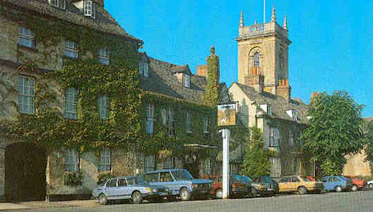
              Woodstock, ciudad natal de Winston Churchill

              Woodstock, ciudad natal de Winston Churchill

              La ciudad de Woodstock estará para siempre vinculada con el gran Palacio de Blenheim y con Winston Churchill, ya que fue aquí, precisamente, donde nació este gran político y primer ministro inglés.

              www.europaallalavagna.it/200688/churchill_en.html

              El palacio fue construido por sir John Vanbrugh en estilo barroco. Tiene dos pisos y está organizado en tres cuerpos que rodean un enorme patio.

              Se comenzó a construir en 1705, concluyéndose sus obras en 1722. Henry Wise, el jardinero de la reina Ana, fue el responsable principal de diseñar los jardines de este majestuoso palacio en el siglo XVIII. Estos jardines son un magnífico lugar, inspirados fundamentalmente en los jardines que se pueden ver en el Palacio de Versalles de París.
              Woodstock tiene una larga e ilustre historia, muy cercana a la realeza, ya que se cree que, antes de la conquista normanda, los reyes ingleses vivían aquí. Además, tiene un particular encanto, sobre todo gracias a sus edificios barrocos del siglo XVIII. Tiene por otro lado un fascinante mercado medieval y un centro histórico muy interesante.

              En Woodstock se halla la casa del famoso poeta medieval Chaucer, mientras que el Ayuntamiento es un precioso edificio del siglo XVIII. Pero como os decíamos, el turismo se congrega fundamentalmente en el Palacio de Blenheim. La decoración interior de este palacio es majestuosa. De ella se encargaron los mejores artesanos y artistas de la época.
              De ese interior os recomendamos visitar sin duda la sala de sir James Thornhill y Louis Laguerre, magníficamente decorada, sobre todo sus paredes y sus techos. Dentro del palacio se sitúa la enorme capilla, construida por Michel Rysbrack, en la cual se halla la tumba del primer duque de la ciudad.

              Otro de los lugares que no sólo los turistas visita, sino que también es signo de veneración por parte de los ingleses, es la tumba de Winston Churchill en el cementerio de Bladon, a un kilómetro y medio de la ciudad.
              Woodstock, al borde de las Cotswolds, es uno de los tesoros ocultos de Inglaterra. Una ciudad muy pintoresca, con sus casas tradicionales y sus tabernas inglesas, todas ellas envueltas en una atmósfera muy serena y moderna. El río Dorn y el Evenlode hacen de los alrededores de la ciudad un paisaje muy exuberante e idílico. Un lugar para visitar al menos una vez en la vida.
              Por: Jose Manuel Vargas (sobreinglaterra.com)
              )))))))))))))))))))))))))))))))))))))))))))))))))) )))))))))))))))))))))))))))))))))))))))))))))

              Woodstock de Información Turística Guía de viajes de vacaciones
              The Oxfordshire Cotswolds Market Town of Woodstock is a pretty place about 10 miles north of Oxford on the A44 to Broadway and Evesham.

              Oxfordshire Cotswolds
              la ciudad de Woodstock es un bonito lugar cerca de 10 millas al norte de Oxford en la A44 a Broadway y Evesham.
              It boasts many charming streets, inns, and tea shops.

              Dispone de muchas calles, posadas, tiendas y el té.
              Woodstock is most famous for the close proximity to the ancestral home of the Churchill family, Blenheim Palace.

              Woodstock es más famoso por la proximidad a la casa solariega de la familia Churchill, el Palacio de Blenheim.
              Thomas Chaucer (thought to be the brother of Geoffrey Chaucer) and famous for being Speaker of the House of Commons, resided here for some years, whilst in later centuries Woodstock was noted for its glove making.

              Thomas Chaucer (cree que el hermano de Geoffrey Chaucer) y famoso por ser Presidente de la Cámara de los Comunes, residió aquí durante algunos años, mientras que en siglos posteriores se observó Woodstock para hacer su guante.

              For the History of the Royal Manor of Woodstock and Blenheim Palace - Click Here
              De Historia de la Real Manor de Woodstock y el Palacio de Blenheim - Haga clic aquí
              COTSWOLD COTTAGES IN THE CENTRE OF THE TOWN OF WOODSTOCK
              Accommodation in and around Woodstock
              Alojamiento en Woodstock y alrededores
              Events in and around Woodstock
              Eventos en los alrededores de Woodstock
              Activities in and around Woodstock
              Actividades en los alrededores de Woodstock
              Places to Eat in and around Woodstock
              Lugares para comer en y alrededor de Woodstock
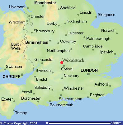
              Map location of Woodstock
              Mapa de ubicación de Woodstock
              Woodstock Tourist Information and Travel Guide England UK

              Comentario

              • Nettus
                Usuario
                • 1 feb, 2008
                • 4715
                • Lundby

                42. Surrey


                Surrey es un condado en el sudeste de Inglaterra, Reino Unido.
                Está dividido en los distritos de Elmbridge, Epsom and Ewell, Guildford, Mole Valley, Reigate and Banstead, Runnymede, Spelthorne, Surrey Heath, Tandridge, Waverley y Woking.
                El condado limita conHampshire, Berkshire, Gran Londres, Kent, East Sussex y West Sussex.
                Surrey tiene una población aproximada de 1.000.000 de habitantes.
                La capital tradicional era Kingston upon Thames que ha dejado de formar parte del condado debido a la expansión de Londres.
                La actual capital es Guildford que, a pesar de tener una catedral, no tiene el rango de ciudad y en la que se encuentra la Universidad de Surrey. En la actualidad, el consejo todavía se encuentra localizado en Kingston aunque existen planes de trasladarlo a Woking.
                El nombre de Surrey proviene de la expresión en inglés antiguo suther-ge que significa "distrito del sur". El condado aparece por primera vez documentado en el año 722 con el nombre de Suthrige.

                Hasta 1889, Surrey contenía los actuales distritos londinenses de Lambeth, Southwark y Wandsworth. En 1965 los distritos de Croydon, Kingston, Merton, Richmond y Sutton entraron a formar parte de Gran Londres. Spelthorne entró en Surrey procedente de Middlesex.
                La reforma del gobierno local de 1974 causó que el aeropuerto de Gatwick y algunas zonas limítrofes se transfirieran a West Sussex. En el acta de gobierno local de 1972, Horley y Charlwood también estaban transferidas pero la presión local hizo provocó que se revirtiera la decisión.

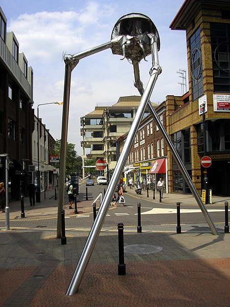
                Sculpture of a Wellsian Martian tripod in Woking

                Settlements and communications
                See also list of places in Surrey.
                Surrey has a population of approximately 1.1 million people. The historic county town is Guildford, although the county administration was moved to Newington in 1791 and to Kingston upon Thames in 1893. The county council's headquarters have been outside the county's boundaries since 1 April1965 when Kingston and other areas were included within Greater London by the London Government Act 1963. Recent plans to move the offices to a new site in Woking have now been abandoned. Due to its proximity to London there are many commuter towns and villages in Surrey, the population density is high and the area is more affluent than other parts of the UK. Surrey is the most densely populated county after Greater London, the metropolitan counties and Bristol. Much of the north east of the county is an urban area contiguous to Greater London. In the west, there is a conurbation straddling the Hampshire/Surrey border, including in Surrey Camberley and Farnham.
                Most English counties have nicknames for people from that county, such as a Tyke from Yorkshire and a Yellowbelly from Lincolnshire; the traditional nickname for people from Surrey is 'Surrey Capon', as it was well known in the later Middle Ages as the county where chickens were fattened up for the London meat markets.
                Physical geography
                Surrey contains a good deal of mature woodland (reflected in the official logo of Surrey County Council, a pair of interlocking oak leaves). Among its many notable beauty spots are Box Hill, Leith Hill, Frensham Ponds, Newlands Corner and Puttenham & Crooksbury Commons. It is the most wooded county in Great Britain, with 22.4% coverage compared to a national average of 11.8% and as such is one of the few counties not to include new woodlands in their strategic plans. Box Hill has the oldest untouched area of natural woodland in the UK, one of the oldest in Europe.
                Much of Surrey is in the Green Belt and is rolling downland, the county's geology being dominated by the chalk hills of the North Downs. Agriculture not being intensive, there are many commons and access lands, together with an extensive network of footpaths and bridleways including the North Downs Way, a scenic long-distance path. Accordingly, Surrey provides much in the way of rural leisure activities, with a very large horse population. Towards the north of the county, the land is largely flat around Staines and borders the River Thames.
                The highest point in Surrey is Leith Hill near Dorking at 294 m above sea level.
                Districts
                Spelthorne . Runnymede . Surrey Heath . Woking . Elmbridge . Guildford . Waverley
                Mole Valley . Epsom and Ewell . Reigate and Banstead . Tandridge
                History
                Major towns
                The largest town in Surrey is Guildford with 66,773; Woking is a close second with a population of 62,796. The third largest town is Ewell with 39,994 people to the north of the county and the fourth is Camberley with 30,155 people in the west of the county. Towns with between 25,000 and 30,000 are Ashford, Epsom, Farnham and Redhill.
                Lugares de interés
                Significant landscapes in Surrey include Box Hill just north of Dorking; the Devil's Punch Bowl at Hindhead; Frensham Common, heathland with a variety of plant, animal and birdlife plus the Great Pond and Little Pond dating from the Middle Ages when they were constructed to provide food for the Bishop of Winchester's estate. Leith Hill to the south west of Dorking is the highest point in south-east England. Witley Common, Thursley Common and Elstead Moat are expansive areas of ancient heathland south of Godalming are run by the National Trust and Ministry of Defence. The Surrey Hills are an area of outstanding natural beauty (AONB).
                More manicured landscapes can be seen at Claremont Landscape Garden, south of Esher (dating from 1715). There is also Winkworth Arboretum south east of Godalming which was created in the 20th century. Wisley is home to the Royal Horticultural Societygardens.
                Surrey has important country houses such as Clandon Park, an 18th century Palladian mansion in West Clandon to the east of Guildford. Nearby there is Hatchlands Park in East Clandon, east of Guildford, was built in 1758 with Robert Adam interiors and a collection of keyboard instruments. Polesden Lacey south of Great Bookham is a regency villa with extensive grounds. On a smaller scale, Oakhurst Cottage in Hambledon near Godalming is a restored 16th century worker's home. There is a museum at Rural Life Centre, Tilford.
                The county is linked to the sea by the River Wey and the Wey and Godalming Navigations. Dapdune Wharf in Guildford commemorates this and is home to a restored Wey barge, the Reliance. Furthermore on the River Tillingbourne, Shalford Mill is an 18th century water-mill.
                There are many typical English villages including Holmbury St Mary which lies in an Area of Outstanding Natural Beauty, close to the Greensand Way and North Downs Way. It was developed in the 19th century and still has a mainly Victorian character as on the whole no new building is allowed. The youth hostel, constructed in the village in 1935, was the first purpose-built by the Youth Hostels Association.
                Runnymede at Egham is the site of the signing of the Magna Carta in 1215. Waverley and Chertsey Abbeys were very significant in medieval Surrey.
                Guildford Cathedral is a post-war cathedral built from bricks made from the clay hill on which it stands.
                Brooklands Museum recognises the motoring past of Surrey. The county is also home to Thorpe Park, a sister theme park of Alton Towers.
                La Catedral de Guildford
                La abadía de Waverley
                See also
                Surrey, British Columbia
                Wikipedia:WikiProject Surrey
                Portal:Surrey
                External links
                Wikimedia Commons / Surrey
                Surrey County Council
                Surrey Interactive Map
                ..................................................
                Capital: Guildford
                Map of Guildford on AboutBritain.com
                Coordenadas: 51° 14′ 7.44″ N, 0° 34′ 28.56″ W
                Guildford es la capital del condado de Surrey, Inglaterra, así como la sede del distrito de Guildford y la sede principal administrativa de la región Sur Este de Inglaterra. La diputación provincial de Surrey, no obstante, tiene su propia base admimistrativa en Kingston upon Thames que, aunque anteriormente estaba en Surrey, es ahora parte de Greater London.
                La población total del distrito municipal de Guildford a partir del censo del año 2001 era 129,701 personas, de las cuales solamente 66,819 personas viven en Guildford (Capital).
                Historia
                Se cree que Guildford fue fundada por colonizadores sajones poco después de que la autoridad romana había estado alejada de Bretaña . El sitio era probablemente escogido porque el "Harrow Way" (un antiguo sendero que continúa a lo largo de Hog's Back) y que cruza a través del Río Wey a estas alturas por medio de un vado (ford). Esto probablemente da lugar a la segunda parte del nombre de Guildford. La raíz de la primera parte del nombre se cree que en realidad se refiere al oro (Gold) en lugar de sociedad o gremio (Guild). Se ha sugerido que el oro puede referirse a las flores doradas por el vado, o la arena dorada, pero esto no se ha comprobado que sea cierto.
                Alfred Atheling, hijo del rey Ethelredo II, había estado viviendo en Normandía en Francia durante la invasión danesa de la Inglaterra Sajona. Después de que Canuto II de Dinamarca muriese, alrededor del año 1040, Alfred volvió a Inglaterra donde fue reunido y recibido en Guildford por el Conde Godwine. Godwine lo entregó a los hombres de Haroldo Harefoot que lo cegaron y mutilaron al grado de que él no se murió largo después.
                Alrededor del siglo XII se construyó un castilloNormando que se construyó como un lugar de descanso por la noche en el punto más meridional de Windsor. Fue visitado en varias ocasiones por el Rey John y el Rey Enrique III. En la actualidad se sigue conservando, restaurado en los tiempos Victorianos y desde entonces se ha vuelto a restaurar los restos en el año 2004, el resto de las tierras cercanas al castillo es un agradable jardín público.
                En 1995 una Cámara se descubrió en Guildford High Street la cual enormemente se creyó ser restos de una sinagoga del siglo XII. Ésta sigue siendo una materia de disputa aunque es probable que sea la sinagoga restante más vieja en Europa Occidental.
                Guildford eligió a dos miembros de la no reformada cámara de los comunes. Del siglo XIV al XVIII, prosperó con el comercio de lana.
                En 1927 fue hecha una diócesis y la Catedral de Surrey se consagró en 1961. Previamente, había sido parte de la diócesis de Winchester.
                El 5 de octubre, de 1974, bombas plantadas por terroristas del IRA Provisionalestallaron en dos pubs de Guildford, matando a cuatro soldados fuera del deber y a un civil. Los pubs fueron fijados como objetivo porque se conoció que soldados de los cuarteles cerca de Guildford fueron frecuentemente. Posteriormente los sospechosos fueron arrestados, quienes se volvieron conocidos como Los Cuatro de Guildford, se les declaró culpables y se les sentenció la condena de prisión en octubre de 1975. ellos declararon haber sido torturados por la policía y negaron la relación en el bombardeo. En 1989, después de una larga batalla legal, sus convicciones se volcaron y fueron liberados.
                El Pueblo
                En el siglo XXI Guildford es un pueblo inglés lleno de movimiento con una atractiva calle principal hecha de fragmentos de granito (frecuentemente llamado empedrado con guijarros), numerosas tiendas y grandes almacenes. Hay una Oficina de Información Turística y varios hoteles incluso el histórico Angel Hotel que mucho tiempo sirvió como una parada de autobuses principalmente de Londres a Portsmouth. Hay una estación del autobús además, un centro de transportación de autobuses libres alrededor del pueblo y un 'Park and Ride' el servicio incluye desde el norte hasta el sur del pueblo.
                Hay un pequeño museo en el centro del pueblo y un nacionalmente éxitos centro de los deportivo "The Spectrum", en el "Stoke Park", el cual es la casa de los Guildford Flamesun equipo de ice hockey. La Universidad de Surrey está situada al noroeste del centro del pueblo, aproximadamente a 10 minutos caminando desde la principal línea de estación de tren de Guildford. La catedral de Guildford es adyacente al campus principal de la universidad y está cercano al Royal Surrey County Hospital.
                Guildford tiene la más visitada Galería de Arte en Surrey - Guildford House Gallery con más de 120,000 visitantes anualmente. La Galleria está situada en La calle principal, Esta abierto de martes a sábados y la admisión es libre. Dispone de su propia colección de arte incluye trabajos de Guildford y el área circundante, y trabaja por Artistas de Guildford, el más notablemente es John Russell R.A.
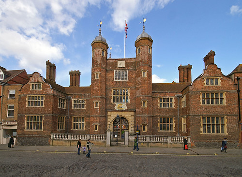
                La Royal Grammar School, Guildford es una vieja escuela, qué se construyó durante el período de los Tudor y fue terminado durante el período de Elizabethan periods and houses a chained library, la La escuela primaria para la Royal Grammar School, es Lanesborough preparatory school. Lanesborough también es la escuela del coro para la Catedral de Guildford.
                Otras escuelas en Guildford incluyen County School, George Abbot, Christ's College, Guildford High School, King's College, University of Surrey, Guildford School of Acting, St. Peter's, Northmead Junior, Tormead School y Worplesdon Primary School.
                Hay un mercado con el mercado a mantenerse durante los viernes y sábados. Un farmers' market normalmente se sostiene en el primer martes de cada mes.
                Deportes y ocio
                El Spectrum Leisure Centre Es un premiado centro nacional deportivo que incluye una gran variedad de piscinas (tanto como para ocio como para la natación seria) El teatro comercial principal del pueblo es el Yvonne Arnaud Theatre el cual a menudo muestra las producciones de antes (y después de) ellos se han pasado tiempo en el London's West End. The Electric Theatre abrió en 1997 para organizar las actuaciones por músicos y grupos de drama de aficionados. Guildford tiene un cinema múltiple llamado Odeon.
                Una enorme variedad de artes culinarias está disponible en los muchos restaurantes en Guildford. Hay numerosos pubs y bares y varios clubs nocturnos.
                Cada verano Guildford organiza un picnic en el campo en Shalford Park por el River Wey. Stoke Park es el sitio de una acción tanto para el Guilfest es un festival de música durinte el verano y el condado de Surrey.
                Guildford es el hogar de los Guildford Flames de la English Premier Ice Hockey League, Guildford United del Combined Counties Football League, Guildford International de la National Volleyball League y Guildford Heat de British Basketball League.
                El equipo de Guildford Cricket Club juega sus partidos en casa en la arena en su propia arena Woodbridge Road. y el equipo Surrey County Cricket Club juega también uno o dos partidos por temporada ahí.
                Guildford También es casa de la estación de radio local 96.4 The Eagle.
                Transporte
                Ferrocarril
                Hay dos estaciones de ferrocarril en Guildford:
                La estación principal, llamada Guildford, se localiza cerca del original puente del pueblo en el lado oriental del River Wey y sirve como línea principal entre LondresWaterloo y Portsmouth. Hay también otras como Reading, Epsom, Gatwick airport, London Bridge y servicios de distancia largos, operados por Virgin Trains, conecta a Guildford con Birmingham y Manchester..
                Road
                El A3une Guildford a Portsmouth, Londres y ela autopista M25.
                AutoBus
                Los servicios del autobús en Guildford se operan principalmente por Arriba con algunos servicios adicionales proporcionados por el Resguardo y el grupo Stagecoach Group.
                Curiosidades
                Guildford es el 9no mejor lugar para vivir en el Reino Unido de acuerdo al show de televisión de "Channel Four Television's" "The Best and Worst Places to Live in the UK". También ha venido en la cima dos años como el destino de tiendas más atractivo y seguro en el Reino Unido, según Eve Prime Retail Survey 2005.
                Los 2006 Financial Times la lista anual de Cima 500 Compañías Globales listan cuatro negocios mayores con una significativa presencia en Guildford.
                El personaje ficticio de The Hitchhiker's Guide to the Galaxy por Douglas Adams, dice ser de Guildford, aunque de hecho el nació cerca Betelgeuse.
                La Academia de Música Contemporánea, una escuela para músicos de rock y pop, está en Guildford.
                La compañía de juegos de PC Lionhead Studios y Surrey Satellite Technology Ltd están situadas en Guildford.
                En Guildford y su estación de tren se desarrolla la historia de amor entre los protagonistas del célebre clásico de cine: "Breve Encuentro" (1945), de David Lean.
                Enlaces externos
                Guildford Borough Council
                University of Surrey
                The Academy of Contemporary Music
                Guildford Jewish Community
                Information on the possible synagogue remains
                Guildford tourist guide from Wikitravel
                The River Wey and Wey Navigations Community Site — a non-commercial site of over 200,000 words all about the Wey Navigations and includes information and images about Guildford.

                Comentario

                • Nettus
                  Usuario
                  • 1 feb, 2008
                  • 4715
                  • Lundby

                  Guildford, turismo de naturaleza y relax

                  Guildford, turismo de naturaleza y relax

                  Guildford es la capital del condado de Surrey, al sureste de Inglaterra. Durante vuestro viaje a la ciudad hay numerosas cosas que podéis hacer y que podéis ver.

                  Guildford presenta un magnífico paisaje y una legendaria historia de reyes y emperadores. Si queréis vamos a echar un pequeño vistazo a todo lo que nos puede ofrecer.

                  www.abbotshospital.org (this page opens in a new window)

                  En el centro de la ciudad destaca el Hospital Abbot, construido en 1619 por George Abbot como asilo para los ancianos de Guildford. Otro lugar que probablemente os sorprenderá es el Guild Hall. Un hecho sorprendente de este edificio es su magnífico reloj de 1683 y que cuelga de la fachada delantera.

                  www.surreyproperty.com/photosearch.html?g=8 - www.castleuk.net/.../186/guildfordcastle.html
                  Además cerca se halla el Castillo de Guildford, con su precioso jardín abierto a los turistas todos los días del año. En invierno, el castillo permanece cerrado, mientras que sólo abre en verano, aunque en periodos concretos. Para el rey Enrique III fue el castillo favorito.

                  University of Surrey and Guildford Cathedral
                  politicalsciencestudies.wordpress.com/.../
                  www.pbase.com/stephen_lumsden/image/27708579

                  Por otra parte, debéis acercaros a la Catedral de Guildford, abierta también durante todos los días del año. Fue construida en 1930 y finalizada en 1961, debido a la Segunda Guerra Mundial. El edificio de ladrillo muestra un interior mucho más hermoso que su exterior. De allí se puede tomar un paseo hasta la Abadía de Santa Catalina admirando el paisaje a lo largo de la orilla del río que cruza la ciudad, el Wey. Este río se une al Támesis en Weybridge.

                  1. Yew tree growing from the rubble of Waverley Abbey in Surrey: 21′gbh.
                  Does it pre-date the Abbey (1128) or the dissolution of the monastries (1540)?
                  www.ancient-yew.org/ageing.shtml
                  Además os citaremos para que anotéis Clandon Park, Gales Park, los viñedos Denbies, los jardines de Painshill, Leith Hill y Newlands Corner.

                  www.pbase.com/john_cooper/image/68046299

                  En Newlands Corner podéis pararos a admirar la belleza natural de la zona, desde la que admirar la Abadía de Waverly.

                  www.paradoxplace.com/.../Waverley_Abbey.htm
                  Si queréis podéis concertar una visita guiada en la Oficina de Turismo. Estas visitas suelen durar una hora y media, e incluye visitas a edificios históricos, en la que os contarán sus leyendas e historias. Es posible elegir una de las tantas rutas que se ofrecen.
                  Podéis ir incluso al Cine Odeón, una multi sala que ofrece las últimas películas americanas. O acercaros al Espectro, un centro comercial de ocio con bolera y patinaje sobre hielo entre otras atracciones.


                  homepage.ntlworld.com/.../lidos/lidos2.htm
                  Finalmente os recomendamos la Lido Guilford, una hermosa piscina de 1930, cerrada normalmente durante el invierno.

                  Texto y foto superior: Jose Manuel Vargas (sobreinglaterra.com)

                  Comentario

                  • Nettus
                    Usuario
                    • 1 feb, 2008
                    • 4715
                    • Lundby

                    43. Hampshire


                    Hampshire es un condado situado en el sur de Inglaterra, en el Reino Unido. Su capital es Winchester. Su población aproximada (2003) es de 1.660.818 habitantes.
                    El condado limita con Dorset, Wiltshire, Berkshire, Surrey y West Sussex. Ocupa un área aproximada de 3.769 km². De norte a sur mide 65 km y de este a oeste 90 km. El condado incluye las ciudades de Portsmouth y Southampton que son, administrativamente, independientes.
                    Hampshire es uno de los principales destinos vacacionales en Inglaterra. Existen diversas atracciones turísticas como diversos complejos situados a la orilla del mar, la zona marítima de Portsmouth y el museo de Beaulieu.
                    En el suroeste se encuentra el espacio llamado New Forest, que fue en otros tiempos coto de caza real. Hampshire tiene una larga historia relacionada con el mar y dos de los mayores puertos de Inglaterra están en sus costas. Los escritores Jane Austen y Charles Dickens nacieron en este condado.


                    A bit like Commercial Rd in Portsmouth really but with a big hill in the background Photo
                    ««« . 1 . 2 . 3 . 4 . 5 . 6 . 7 . »»»
                    Wildlife
                    Hampshire has wildlife typical of the island of Great Britain. One distinguishing feature is that Hampshire has a large free roaming herd of Red Deer, including more than 6500 stags during busy seasons. The stag population is protected by the government and hunting is prohibited.
                    Physical geography
                    History
                    Economy

                    Bridge connectin Portsmouth and Kittery

                    The New Forest area is a National Park, and tourism is a significant economic segment in this area, with 7.5 million visitors in 1992.The South Downs and the cities of Southampton and Winchester also attract tourists to the county. Southampton Boat Show is one of the biggest annual events held in the county, and attracts visitors from throughout the country. In 2003 the county had a total of 31 million day visits, and 4.2 million longer stays.
                    The cities of Southampton and Portsmouth are both significant ports, with Southampton handling a large proportion of the national container freight and Portsmouth housing a large Royal Navy base. The docks have traditionally been large employers in these cities, though again mechanisation has forced diversification of the economy.


                    Hampshire's county town is Winchester, a historic city that was once the capital of the ancient kingdom of Wessex and of England until the Norman conquest of England. The port cities of Southampton and Portsmouth were split off as independent unitary authorities in 1997, although they are still included in Hampshire for ceremonial purposes. Fareham, Gosport and Havant have grown into a conurbation that stretches along the coast between the two main cities. The three cities are all university cities, Southampton being home to the University of Southampton and Southampton Solent University (formerly Southampton Institute), Portsmouth to the University of Portsmouth, and Winchester to the University of Winchester (formerly known as University College Winchester; King Alfred's College).
                    Hampshire lies outside the green belt area of restricted development around London, but has good railway and motorway links to the capital, and in common with the rest of the south-east has seen the growth of dormitory towns since the 1960s. Basingstoke, in the north of the county, has grown from a country town into a business and finance centre. Aldershot, Portsmouth, and Farnborough have strong military associations with the Army, Royal Navy and Royal Air Force respectively. The county also includes several market towns: Alton, Andover, Bishop's Waltham, Lymington, New Milton, Petersfield, Ringwood, Romsey, and Whitchurch.
                    Towns by population size: (2001 census)
                    Southampton- 234,224 . Portsmouth - 187,056
                    Basingstoke - 90,171 (town), 152,573 (borough) . Gosport - 69,348, 77,000 (borough)
                    Waterlooville - 63,558
                    Aldershot - 58,120 . Farnborough - 57,147
                    Fareham/Portchester - 56,010 (town), 109,619 (borough)
                    Eastleigh- 52,894 (town), 116,177 (borough) . Andover - 52,000
                    Havant - 45,435 (town), 115,300 (borough) . Winchester- 41,420
                    Fleet - 32,726
                    For the complete list of settlements see
                    >>>List of places in Hampshire<<<
                    Culture, arts and sport
                    Transport
                    The districts of Hampshire are:
                    The county also contains a national park, covering the New Forest, and therefore governance of this area is carried out by the National Park Authority as well as the New Forest District Council.
                    Historia
                    Durante la invasión romana de Bretaña, Hampshire fue una de las áreas que fueron ocupadas en un primer momento por las tropas invasoras. El condado fue habitado por las tribus Jutish hasta la llegada de los sajones. Hampshire es uno de los primeros "shires" sajones, del que se tiene constancia desde el año 755. Tras el avance de los sajones hacia el oeste, Hampshire se convirtió en el centro del reino de Wessex. La ciudad de Winchester fue la capital del país en la época del dominio anglosajón. Numerosos reyes sajones están enterrados en Winchester.
                    En Winchester se fabrica cerveza y sidra y la producción textil viene siendo tradicional desde la Edad Media. En los espacios donde no hay bosque, los campesinos se dedican a la agricultura, sobre todo cereales y a la producción de lácteos.
                    Después de la conquista normanda, el condado se vio favorecido por los reyes normandos que establecieron el "New Forest" como coto de caza real. A partir del siglo XII los puertos del condado empezaron a ganar en importancia. Servían para comerciar con el continente europeo, sobre todo la lana y los textiles fabricados en Hampshire. Se establecieron las primeras industrias pesqueras y así como los primeros astilleros.
                    El puerto de Southampton ha sido punto de arranque de algunos de los barcos más famosos de la historia como el Mayflower que llevó a los primeros colonos hasta los Estados Unidos y el Titanic.
                    Hampshire desempeñó un papel importante durante la Segunda Guerra Mundial ya que en el puerto de Portsmouth estaba una de las mayores bases de la marina británica. Además, los diseñadores del Spitfire y de otros aviones tenían su sede en Southampton, lo que provocó que la ciudad fuera bombardeada en diversas ocasiones.

                    Basingstoke
                    Enlaces externos
                    Wikimedia Commons / Hampshire
                    Walks Around Hampshire
                    BBC Hampshire
                    Photographs of Hampshire
                    Hampshire Visitor Attractions
                    93 Vintage Photographs of Portsmouth from the Air
                    Information and photographs of Hampshire
                    Historic Farnborough
                    Hampshire Local Community Website
                    Polish Community in Hampshire
                    Portal:Hampshire
                    List of churches in Hampshire
                    List of places in Hampshire
                    Places of interest in Hampshire
                    Recreational walks in Hampshire
                    List of Parliamentary constituencies in Hampshire
                    Business in Hampshire
                    New Hampshire, the US State named after the County.
                    ..................................................
                    Capital: Winchester
                    Winchester, HampshireStorbritannienmaps.google.se
                    Winchester Map - Road detailed map of Winchester - South East -
                    Coordenadas: 51° 3′ 35″ N, 1° 18′ 36″ W

                    The Guildhall - Winchester UK

                    Winchester es una ciudad situada en el extremo sur de Inglaterra. Es la capital administrativa del condado de Hampshire. Tiene una población aproximada de 35.200 habitantes. Es la sede del gobierno local del distrito.
                    It is the seat of the City of Winchester local government district, which covers a much larger area, and is also the administrative capital and county town of Hampshire (despite the county being a named after Southampton).
                    La ciudad tiene importantes edificios históricos como la catedral, construida en el siglo XII; la Gran sala, el único resto existente del Palacio Real; y el Winchester College, escuela pública construida en el año 1382.
                    La Gran Sala se recosntruyó en algún momento entre los años 1222 y 1235. Es conocida por que en sus paredes estuvo colgada la supuesta mesa redonda del Rey Arturo. La mesa actual está datada en el siglo XIV por lo que no es contemporánea del rey. A pesar de eso, sigue siendo uno de los principales atractivos para los turistas. La mesa original no estaba pintada. El rey Enrique VIII ordenó que se pintara en el año 1522. Los nombres de los caballeros están escritos alredeor de la mesa.
                    The city is at the western end of the South Downs with the scenic River Itchen running through it. Winchester railway station is served by trains running from London Waterloo, Weymouth, Portsmouth, Southampton and the North.

                    Historia
                    Los primeros asentamientos en la zona son del periodo anterior a la conquista romana y existen evidencias arqueológicas procedentes de la Edad de hierro. Bajo la ocupación romana, la ciudad, llamada Venta Belgarum, tuvo una importancia considerable.
                    La ciudad tuvo una importancia histórica al ser la capital del antiguo reino de Wessex desde el año 519. Winchester siguió siendo la capital de Wessex y, por extensión, de Inglaterra, hasta algún tiempo después de la conquista normanda cuando la capital se trasladó a Londres. Un importante incendio ocurrido en la ciudad en 1141 aceleró su declive.
                    William de Wykeham (1320-1404) desempeñó un importante papel en la historia de la ciudad; como obispo de Winchester fue el responsable de la estructura actual de la catedral. Fue también el fundados del Winchester College.
                    Durante la Edad media, la ciudad fue un importante del centro del comercio de la lana hasta que empezó a entrar en un lento declive. La famosa novelista Jane Austen murió en la ciudad y está enterrada en la catedral.
                    Enlaces externos
                    Wikimedia Commons / Winchester.
                    Hampshire County Council
                    Winchester (England) travel guide from Wikitravel
                    Winchester Live Festival
                    The Winchester Hat Fair
                    Winchester Hockey Club
                    Winchester City Festival Choir
                    Photos of Winchester in 3d (Anaglyphs)
                    www.geograph.co.uk : photos of Winchester and surrounding area
                    Thirty images of Winchester Cathedral with descriptions

                    Comentario

                    • Nettus
                      Usuario
                      • 1 feb, 2008
                      • 4715
                      • Lundby

                      Los jardines de Exbury, el color del romanticismo

                      Los jardines de Exbury, el color del romanticismo
                      Exbury Map | United Kingdom Google Satellite Maps -

                      Un paseo tranquilo, un lugar relajante e idílico. Todo esto y más fue lo que me parecieron los Jardines de Exbury, ocultos en un agradable campo con vistas al río Beaulieu en el New Forest. Este jardín y el terreno que ocupa rodea una gran casa comprada en 1919 por Lionel Nathen de Rothschild. Fue entonces cuando comenzó su gran pasión por la jardinería, que continuó a lo largo de toda la dinastía Rothschild.

                      En estos maravillosos jardines podremos contemplar la famosa colección de plantas de Rotschild, que incluye impresionante rododendros y azaleas, rodeadas de un maravilloso bosque. Lionel Rothschild fue un hombre sin pretensiones que compaginó su brillante carrera como banquero con su hobby de la jardinería. Por algo hoy en día es uno de los más admirados de toda Inglaterra.
                      Los jardines poseen un encanto excepcional, y posiblemente sean la atracción más visitada en Hampshire de todo el año. Hay cascadas, estanques, un precioso jardín de rosas y una gran cantidad de senderos naturales que nos llevarán a un magnífico y romántico paseo bajo los árboles.

                      Los Jardines de Exbury se pueden visitar en cualquier época del año. Cualquier momento es bueno para acercarse y descubrir su encanto especial. En primavera, cuando la tierra se despierta de los duros meses de invierno, el jardín es una explosión de colores, con sus rododendros, azaleas, camelias y arces. El otoño teje también su propia magia sobre los jardines con su salpicadura de brillantes rojos, naranjas y dorados.

                      La casa no es sólo atractiva para los amantes de la jardinería. Hay un pequeño tren de vapor que recorre parte de los jardines y resulta muy divertido para toda la familia. También existe un amplio programa de eventos y festividades, que van desde las ferias artesanales a noches de orquesta, teatro al aire libre, sobre todo en la época de Navidad, cuando Santa Claus llega en el tren de vapor.
                      Este tranquilo paraíso se presta como un romántico escenario para una luna de miel, o una declaración de amor, porqué no. Así que no perdáis la oportunidad de pasaros y ver con vuestros propios ojos la maravillosa colección de colores que os puede ofrecer la naturaleza.
                      Por: Jose Manuel Vargas 8sobreinglaterra.com)
                      ..................................................
                      Exbury Gardens
                      Exbury
                      Southampton
                      Area: Hampshire
                      Show Map Location:
                      Overview Map (30 Km)
                      Detailed Map (1.5 Km)
                      Visitor Information
                      http://www.gardens-guide.com/gardenpages/_0029.htm

                      A Garden For All Seasons
                      Exbury reflects the changing moods of nature. Early spring sees the magnolias and azaleas are at their peak and full of vibrant colour.
                      The full bloom of the Rose Garden and Herbaceous Gardens announces the arrival of summer. This is the best time to enjoy travelling through the Summer Lane Garden on the steam train.
                      Autumn follows bringing spectacular displays of colour from the Japanese maples, deciduous azaleas and dogwoods that flourish.
                      Exbury Steam Railway
                      Why not let 'the train take the strain' on a magical journey around the northeast corner of the Gardens?
                      Travel over a bridge, through a tunnel and across a pond in the Summer Lane Garden; along the top of the rock Garden and across a viaduct to 'Exbury North' in the America Garden.
                      It's great fun for all the family and a day out at Exbury that the weather cannot spoil!
                      Summer Lane Garden
                      Summer Lane Garden is a naturalistic garden consisting of huge swathes of herbaceous perennials and grasses set within a strong woodland structure to create a summer flowering garden with year round interest. Inspired by Piet Oudolf, it has a contemporary and innovative style and can only be seen from the train.
                      Restaurant and Tea Gardens
                      Take a break at the newly refurbished Mr Eddy's Restaurant & Tearooms with menu options including light snacks, cream teas and lunches or try the Tennis Court Tea Gardens (opening times dependent on weather).
                      The Gift Shop
                      The Gift Shop is packed with hundreds of gift ideas, you do not have to visit the gardens to enjoy browsing for that perfect gift or a treat for yourself.
                      Plant Centre
                      You can grow exquisite varieties of the famous Exbury rhododendrons, azaleas and camellias at home, thanks to the well-stocked plant centre. A wide range of other shrubs, including herbaceous perennials are on sale and the knowledgeable staff will advise you on the best types for your garden.
                      Meet & Greet - Guided Tours
                      An ideal way to learn more about Exbury Gardens and its history. Available by prior arrangement (023 8089 1203). Subject to an extra charge.
                      Chauffeur Driven Buggy Tours
                      Why not tour the gardens in comfort? The Chauffeur driven buggies accommodate up to seven passengers and complete a tour of the gardens in 45 minutes. Subject to availability and small extra charge. Please note that there may be delays for the buggies on busy days in May.
                      You are welcome to visit the Plant Centre, Gift Shop and Mr Eddy's Restaurant without entering the Gardens.
                      Dogs Are Welcome - On A Short Lead.

                      Opening Times
                      1st March to 5th November: Daily (including Bank Holidays) 10.00am - 5.30pm dusk in November.
                      Santa Steam Specials: December 9th, 10th, 16th, 17th, 20th, 21st.
                      Admission Charges
                      High Season: 20th March to 4th June:
                      Adult �7.50; Senior Citizen/Concession/Groups �7.00; Child (3-15yrs) �1.50 Under 3yrs Free; Family (2 adults + up to 3 children) �17.50.
                      Railway: �3.00. Buggy Rides (45 mins): �3.50.
                      All paying visitors in High Season will receive a free voucher to return to Exbury in October/November to see the autumn colours.
                      Senior Citizens: �6.50 Monday to Friday (inclusive) in High Season.
                      Low Season 1st March to 19th March & 5th June to 5th November:
                      Adult �5.00; Senior Citizen/Concession/Group �4.50; Child (3-15yrs) �1.00 Under 3yrs Free; Family �12.00.
                      Railway: �2.50. Buggy Rides (45 mins): �3.50
                      Directions
                      The New Forest, near Beaulieu 20 minutes drive south from M27 west junction 2. Show map of Exbury Gardens & Steam Railway...
                      Exbury Gardens & Steam Railway Postcode for SatNav: SO45 1AZ
                      Nearby Attractions
                      Bucklers Hard Maritime Museum (1 Mile)*
                      Buckler's Hard is a picturesque 18th century village on the banks of the Beaulieu River in the heart of the New Forest. Historically, it is famed as the place where some of the ships of Nelson's fleet were built. Beaulieu (3 Miles)*
                      A unique day out in the heart of the New Forest. The list of things to see is as varied as its history which beckons you from across the centuries. Longdown Activity Farm (7 Miles)*
                      Kid goats and calves to bottle feed, rabbits to cuddle, chicks to hold, pigs to meet and lots of other animals to see. Indoor and outdoor play areas for the children. Bumpy tractor and trailer rides (weather permitting). more nearby attractions...* Distances shown are in a direct line. Distances by road will be longer.
                      Nearby Hotels
                      <A href="http://www.aboutbritain.com/hotels/hotel1100681.asp"> Master Builder's House Hotel (1 Mile)*
                      The Hotel dates back to the 18th Century, and sits on Lord Montagu's Estate, in the New Forest. Our hotel is located on the Banks of the Beaulieu River in the heart of the New Forest. A glorious view of the New Forest created by nature.
                      "http://www.aboutbritain.com/hotels/hotel1228772.asp"> The Montagu Arms (3 Miles)*
                      An outstanding country house situated in picturesque Beaulieu, this AA top 200 hotel is the ideal base for a break exploring the New Forest. "http://www.aboutbritain.com/hotels/hotel3351.asp"> Beaulieu Hotel (3 Miles)*
                      This country house hotel, set midway between Lyndhurst and Beaulieu, is known throughout Hampshire for its unique isolated forest setting. Many of the bedrooms enjoy views across open forest. more nearby hotels...* Distances shown are in a direct line. Distances by road will be longer.
                      Nearby Self Catering
                      http://www.aboutbritain.com/self-catering-holiday-cottages/property4086.asp"> Point Cottages (5 Miles)*
                      Point Cottages are situated on the west bank of the River Medina, at the head of the estuary to Cowes Harbour and its International yachting marinas. "http://www.aboutbritain.com/self-catering-holiday-cottages/property3981.asp"> The Lodge. (6 Miles)*
                      The Lodge is single story and dates from the 1850s. It has recently been extensively renovated to form a perfect "home from home" holiday retreat. The Lodge is situated close to Queen Victoria's Osborne House. <A href="http://www.aboutbritain.com/self-catering-holiday-cottages/property3771.asp"> The Bunney (6 Miles)*
                      The Bunney - Butlocks Heath Village, within Netley Abbey, Eastleigh, Hampshire. The Bunney is in an idyllic location set in the middle of Butlocks Heath village, 'Jewel of the Southern Parishes' Your property could be here
                      Advertising your self catering property or holiday cottage on AboutBritain.com will get you noticed by thousands of potential guests every day. more nearby self catering...

                      Comentario

                      • Nettus
                        Usuario
                        • 1 feb, 2008
                        • 4715
                        • Lundby

                        Southampton

                        SOUTHAMPTON


                        www.lonelyplanet.com/.../england/southampton/
                        Entretenimiento
                        There is more to Southampton than ships, sailing and shopping. The city offers a host of entertainment options, ranging from mainstream cinema and West End style shows to huge pop acts and a bona fide clubbing scene, both in the city itself and in neighboring Bournemouth.

                        Cinema
                        A feast of entertainment can be found at Leisure World, which includes two night-clubs, a restaurant and a 13-screen multiplex Odeon Cinema that shows all the latest Hollywood blockbusters in modern and comfortable surroundings. Virgin Cinemas offers five screens of film entertainment in Ocean Village, while the nearby Harbour Lights Picture House shows more alternative and art-house films to an enthusiastic audience.

                        www.ecastles.co.uk/southampton.html
                        Theatre
                        The main theatre in Southampton is The Mayflower on Commercial Road. It features a huge number of productions every year, some of which come direct from London's West End. Opera, comedy, concerts (classical and pop), ballet and serious drama make up the playlist at the theatre, as well as a popular big-name Christmas pantomime. Behind the Mayflower you will find the Gantry Arts Centre, which is a popular venue for more contemporary theatre productions, as well as music and comedy performances.

                        Theatre lovers can also see a wide selection of plays at the Nuffield Theatre on University Road, while a little further afield the Pavilion Theatre in Bournemouth is another fine venue for theatre productions, catering for all niches and needs. Other excellent theatre venues in the region include the Salisbury Playhouse, the Tivoli Theatre and the Chichester Festival Theatre.

                        Music
                        A few minutes walk away from the Mayflower is the Guildhall, which is part of the Civic Centre complex. This is the venue for larger pop and rock concerts, as well as light entertainment, and attracts chart-topping live acts. Live music can also be enjoyed at the Turner Sims Concert Hall, which specialises in smaller classical shows and jazz ensembles. The town has many smaller venues that provide live musical entertainment. Amongst these are The Joiners Arms in St Mary's Street, which specialises in small independent bands, and Jumpin Jaks at Leisure World, which has live bands and tribute acts every week. Elsewhere, the Bournemouth International Centre is just a half-hour’s drive away and features big shows by acts ranging from Shirley Bassey and Tom Jones to Oasis and Blur.

                        www.cumbriacruise.co.uk/.../
                        Comedy
                        Southampton was one of the first cities outside London to be chosen as a site for a Jongleurs Comedy Club, which regularly attracts top acts from the countrywide comedy circuit. It is situated at the Bargate Centre in the heart of Southampton and offers live comedy from Thursday to Saturday. The Gantry Arts Centre also hosts comedy evenings, while the large theater venues have occasional big-name shows from the likes of Lee Hurst and Steve Coogan. A little further out of town, near the University, Talking Heads regularly has alternative comedians, as does The Brook next door.

                        Night Clubs
                        Southampton has a lively club scene that suits many tastes. Ikon & Diva are based next door to each other at Leisure World, but cater for different markets. Ikon hosts a mix of garage, dance anthems and club classics, while Diva provides more of a retro experience with music from the 70s, 80s and 90s.

                        In the city centre The Beach is an over 20’s venue geared towards fun and socializing, New York New York spins commercial and chart sounds for a lively crowd until 3a at weekends and Four-2-6 offers party tracks and cheap drinks, while The Academy and Lennon’s both cater for a student crowd. Other clubs worth investigating include The Rhino Club in Waterloo Terrace, Kaos in St Mary’s Road and The Dungeon in Bevois Valley.

                        Southampton pub guide, Hampshire pub guide
                        Southampton | Entretenimiento | WCities Destination Guide
                        Southampton guía de la ciudad -
                        Home . Travelling to Southampton . Maps of Southampton
                        Where To Stay . Nightlife and Eating Out . What to See and Do
                        Cruise Passenger and Crew Information
                        Southampton Events . Guided Walks and Tours . Historic Old Town
                        Ocean Village Marina Southampton . Shopping and Markets . Visitors with Disabilities
                        Hampshire's Highlights . Short Breaks . Southampton Tourist Information Centre
                        Accommodation Providers Area . FAQs

                        www.visit-southampton.co.uk/site/nightlife-an...
                        en.arrivalguides.com/guide.php?dest=SOUTHAMPT...
                        www.solent.ac.uk/city/night_life.aspx
                        www.soton.ac.uk/.../ugwhysoton/ugwhysoton5.html
                        Leisureworld, in the centre of Southampton, has nightclubs, restaurants and a multiplex cinema that make it one of the biggest entertainment complexes in the UK. The programme offered here and at other cinemas throughout the city can be accessed by clicking here.
                        Nearby there is Ocean Village, recently redeveloped around one of the main marinas to accommodate cafes and bars and a number of different cinemas. The area is one of the main venues of the Southampton International Boat Show that brings tens of thousands of visitors to the city each September.
                        A short walk from the University there are a wide variety of bars and pubs. The area around Bedford Place in particular has pubs and restaurants to suit everyone's taste and budget and has a number of nightclubs that make for a long evenings entertainment if that is what you want. Many of these clubs, as well as those elsewhere in the city, have concessions for students and put on specials themed events or cater for parties as well.
                        As well as the musical offerings that you will find on campus there are many performances across the musical spectrum that you can catch in the city. Click here to get an up to date listing.

                        Comentario

                        • Nettus
                          Usuario
                          • 1 feb, 2008
                          • 4715
                          • Lundby

                          44. Isle of Wight


                          La Isla de Wight es un condado insular situado en la costa sur de Inglaterra, frente a la ciudad de Southampton. Coloquialmente es conocida como "La isla" (The island) por sus habitantes. Su población en el año 2003 era de 136.252 habitantes.
                          La isla de Wight es el único distrito unitario de Inglaterra que tiene estatus de condado. Tiene un único representante en el Parlamento.
                          The Isle of Wight is a Britishisland and county in the English Channel between three and 8 km from the south coast of the English mainland. It is situated south of the county of Hampshire and is separated from mainland Britain by the Solent. Regular ferry services operate across the Solent of various lengths, Southampton to Cowes is 9.9 miles, Portsmouth Harbour to Ryde Pier is 5.07 miles, Portsmouth Gunwharf to Fishbourne is 7.1 miles, and Lymington to Yarmouth is 4 miles. Popular since Victorian times as a holiday resort, the Isle of Wight is known for its outstanding natural beauty and for its world-famous sailing based in Cowes.
                          The island has a rich history including its own brief status as a nominally independent kingdom in the fifteenth century. It was home to the poet Alfred Lord Tennyson, and Queen Victoria built her much loved summer residence and final home Osborne House at East Cowes. The island's maritime and industrial history encompasses boat building, sail making, the manufacture of flying boats, the world's first hovercraft and the testing and development of Britain's space rockets. It is home to the Isle of Wight International Jazz Festival, Bestival and the recently-revived Isle of Wight Festival, which, in 1970, was one of the largest rock music events ever held. The island has some exceptional wildlife and is also one of the richest fossil locations for dinosaurs in Europe.
                          It has in the past been part of Hampshire; however, it became an independent administrative county (although still sharing the Lord Lieutenant of Hampshire) in 1890. In 1974 it was reconstituted as a non-metropolitan and ceremonial county with its own Lord Lieutenant and the name was adopted as a postal county. The island is the smallest ceremonial county in England at high tide (if the City of London is excluded), but its land area at low tide is larger than that of Rutland, normally thought of as Britain's smallest county. With a single Member of Parliament and 132,731 permanent residents according to the 2001 census, it is also the most populated Parliamentary constituency in the United Kingdom.

                          Historia
                          La mayoría del territorio que compone la isla de Wight fue depositado durante el Cretáceo tardío, como parte del largo valle fluvial en que consistía lo que hoy en día es la costa sur de Inglaterra. Los pantanos de la región han servido para conservar fósiles. Por eso, la isla se ha convertido en una de las localizaciones europeas más interesantes para encontrar restos de dinosaurios (Iguanodon, Valdosaurus, Hypsilophodon, Polacanthus, Baryonyx, Eotyrannus, Neovenator, así como diversas especies de saurópodos).
                          La isla de Wight se convirtió en isla en algún momento de la última edad de Hielo cuando la crecida del mar separó la isla del continente. La isla formó parte de la britania celta. Los romanos la llamaron Vectis. Fue conquistada por Vespasiano durante la invasión romana. Después de los romanos, la isla estuvo ocupada por los jutos, una tribu germánica, al inicio de las invasiones anglosajonas.
                          Durante la conquista normanda se fundó el Castillo de Carisbrooke. La isla no volvió a estar bajo el completo control de la corona hasta que en el año 1293 fue vendida al rey Eduardo I.
                          Enrique VIII fortificó la isla utilizando material procedente de antiguos monasterios. Sir Richard Worsley, capitan de la isla, capitaneó la resistencia del último ataque francés en el año 1545.
                          Entre 1597 y 1602 se construyeron las fortificaciones exteriores del castillo de Carisbrooke. Durante la guerra civil inglesa, el rey Carlos huyó hacia la isla de Wight creyendo que sería bien acogido por el gobernador Robert Hammond. Sin embargo, Hammond ordenó encarcerlar al rey en el castillo de Carisbrooke.
                          La reina Victoria hizo de Osborne House su residencia veraniega. Eso convirtió la isla en el principal lugar de vacaciones para la realeza europea.
                          History
                          Early history . Middle ages . Civil war . Queen Victoria . Modern history
                          Physical geography and wildlife
                          Geology
                          Main towns
                          -Newport, located in the centre of the island, is the county town of the Isle of Wight and is the island's main shopping area. Recent developments include a new bus station with retail complex and a new retail park on the outskirts. Located next to the River Medina, Newport Quay was once a busy port until the mid-19th century, but has now been mainly converted into art galleries, apartments and other meeting places.
                          -Ryde, the island's second largest town with a population of around 30,000, is located in the north east of the island. It is a Victorian town with a half-mile long pier and four miles (6 km) of beaches, attracting many tourists each year. Every year there is a Ryde carnival in two parts, one in the day time and one at night (on a different night) but the night one is all lit up with different colours.
                          -Cowes is the location of Cowes Week every year and a popular international sailing centre. It is also the home of the record-setting sailor Dame Ellen MacArthur.
                          -Sandown is another seaside resort, attracting many tourists each year. It is also home to the Isle of Wight Zoo and Dinosaur Isle geological museum, and one of the island's two 18-hole golf courses.
                          -Shanklin just south of Sandown, also attracts tourists by its sandy beaches. Its main attractions are Shanklin Chine and the old village.
                          -Ventnor is built upon the steep slopes of St Boniface Down on the south coast of the island and leads down to a picturesque bay which attracts many tourists. Recent developments include Ventnor Haven, a small harbour built around a Victorian-style bandstand.
                          The Isle of Wight has no cities. In addition to the above, there are smaller towns along the coasts - particularly on the eastern side of the island. As well as the towns, the island has many smaller villages. Some of these (for example, Godshill) also attract many tourists.

                          Culture
                          Language and dialect

                          The distinctive Isle of Wight accent is a somewhat stronger version of the traditional Hampshiredialect, featuring the dropping of some consonants and an emphasis on longer vowels. This is similar to the West Country dialects heard in Southwestern England, but less removed in sound from the Estuary English of the Southeast. In common with many other English regional dialects and accents, a strong island accent is not now commonly heard, and, as speakers tend to be older, this decline is likely to continue.
                          The island also has its own local and regional words. Some words, including grockle (visitor, tourist - hence grockle-can, tour coach) and nipper/nips (a younger male person), are still commonly used and are shared with neighbouring areas. A few are unique to the island, for example overner (a mainlander who has settled on the island) and caulkhead (someone born on the island or, for sticklers, those born there from long-established island stock). Other words are more obscure and used now mainly for comic emphasis, such as mallishag (meaning caterpillar) and nammit ("noon-meat", meaning food). Some other words are "gurt" as in large or great, also "gallybagger" as in scarecrow.
                          Economy
                          Breweries
                          There are three breweries on the island. Goddards Brewery in Ryde opened in 1993. David Yates, who was head brewer of Burts and Island Brewery, started brewing as Yates Brewery at the Inn at St Lawrence in 2000. Ventnor Brewery, under new management, is the latest incarnation of Burt's Brewery, which has been brewing on the island since the 1840s in Ventnor. Until the 1960s most pubs were owned by Mews Brewery sited in Newport near the old railway station, but it closed and the pubs taken over by Strongs and then by Whitbread. By some accounts Mews beer was apt to be rather cloudy and dark. They pioneered the use of cans in the 19th century for export to British India. The old brewery was derelict for many years but was then severely damaged in a spectacular fire
                          Industry and agriculture
                          Tourism and heritage
                          The heritage of the island is a major asset, which has for many years kept its economy going. Holidays focused on natural heritage, including both wildlife and geology, are becoming a growing alternative to the traditional seaside resort holiday. The latter has been in decline in the United Kingdom domestic market, due to the increased affordability of air travel to alternative destinations.
                          Tourism is still the largest industry on the island. In 1999, the 130,000 island residents were host to 2.7 million visitors. Of these, 1.5 million stayed overnight, and 1.2 million visits were day visits. Only 150,000 of these visitors were international visitors. Between 1993 and 2000, visits increased at a rate of 3% per year, on average.
                          At the turn of the nineteenth century the island had ten pleasure piers including two at Ryde and a "chain pier" at Seaview. The Victoria Pier in Cowes succeeded the earlier Royal Pier but was itself removed in 1960. The piers at Ryde, Seaview, Sandown, Shanklin and Ventnor originally served a coastal steamer service that operated from Southsea on the mainland. The piers at Seaview, Shanklin, Ventnor and Alum Bay were all destroyed by storms during the last century. Today only the railway pier at Ryde and the piers at Sandown, Totland Bay (currently closed to the public) and Yarmouth survive. Blackgang Chine is arguably the oldest theme park in the UK, and one of the oldest in the world.
                          As well as more traditional tourist attractions, the island is often host to walking holidays or cycling holidays through the attractive scenery. Almost every town and village on the island plays host to hotels, hostels and camping sites. Out of the peak summer season, the island is still an important destination for coach tours from other parts of the United Kingdom and an annual walking festival has attracted considerable interest. The 67-mile Isle of Wight Coastal Path follows the coastline as far as possible, deviating onto roads where the route is impassable closer to the sea.
                          A major contribution to the local economy comes from sailing and marine-related tourism.
                          Transport
                          The Isle of Wight has a total of 489 miles (787 km) of roadway. Major roads run between the main island towns, with smaller roads connecting villages. It is one of the few counties in the UK not to have a motorway, as the island's largest road is only a dual carriageway. This runs from Coppins Bridge in Newport, towards the north of Newport near the island’s hospital and prisons.
                          A comprehensive bus network, operated by Southern Vectis links most island settlements with Newport as the central hub.
                          The island's location 5 miles (8.0 km) off the mainland means the most common form of transport is by boat. Car ferry and passenger services are run by Wightlink and Red Funnel as well as a hovercraft operated by Hovertravel. However, fixed links have also been proposed.
                          The island is home to the smallest train operating company in the United Kingdom's National Rail network, the Island Line, running a little under 14 kilometres (about 8.5 miles) from Ryde Pier Head to Shanklin.
                          There are currently two airfields for general aviation, Isle of Wight Airport at Sandown and Bembridge Airport.
                          The island has over 200 miles (322 km) of cycle ways much of which can be enjoyed by families off road. Major Trails to note are 'The Sunshine Trail' which incorporates Sandown, Shanklin, Godshill and Wroxall in a 12 mile circular route. 'The Troll Trail' Which leads from Cowes to Sandown or vice-versa (90 per cent off-road) approx 13 miles either way and 'Round the Island Cycle Route' which circumnavigates the island on a reported 62 miles (100 km) ride. Cycles can be brought to the island by foot passengers on any of the car ferries. Hire cycles are also available.
                          Prisons
                          The island geography, close to the densely populated south of England, led to it gaining three prisons: Albany, Camp Hill and Parkhurst which are located outside Newport on the main road to Cowes. Albany and Parkhurst were once among the few Category A prisons in the UK until they were downgraded in the 1990s. The downgrading of Parkhurst was precipitated by a major escape: three prisoners (two murderers and a blackmailer) made their way out of the prison on 3 January 1995 for four days of freedom before being recaptured. Parkhurst especially enjoyed notoriety as one of the toughest jails in the British Isles and "hosted" many notable inmates, including the Yorkshire RipperPeter Sutcliffe and the Kray twins.
                          Camp Hill is located to the west of, and adjacent to, Albany and Parkhurst, on the very edge of Parkhurst Forest, having been converted first to a borstal and later to later a category C prison. It was originally on the site of an army camp (both Albany and Parkhurst were barracks), where there is a small estate of tree-lined roads with well-proportioned officers' quarters (with varying grandeur according to rank, but now privately owned), to the south and east.
                          Lugares de interés
                          Las rocas llamadas The Needles
                          El castillo de Carisbrooke
                          Osborne House, residencia de verano de la reina Victoria.
                          El castillo de Yarmouth
                          Alum Bay
                          Appuldurcombe House
                          Blackgang Chine
                          Brading Roman Villa
                          Carisbrooke Castle, where King Charles I was imprisoned
                          Dimbola Lodge, home of Victorian photographer, Julia Margaret Cameron
                          Dinosaur Isle
                          Fort Victoria
                          Godshill Village, and Model Village
                          Isle of Wight Bus & Coach Museum
                          Isle of Wight Steam Railway
                          Isle of Wight Zoo, Yaverland
                          Medina Theatre, home to the island's entertainment including music and performances.
                          The Needles, which is near "The Old Battery" museum and Old Look-out Tower tea-room
                          Osborne House, where Queen Victoria and her husband, Prince Alberthad a country residence
                          Quarr Abbey
                          Robin Hill
                          Botanic Gardens, Ventnor
                          Yarmouth Castle, associated with King Henry VIII
                          Enlaces externos
                          Wikimedia Commons / Isla de Wight.
                          Isle of Wight gasification facility
                          List of civil parishes on the Isle of Wight
                          List of places on the Isle of Wight
                          Isle of Wight Rifles
                          Isle of Wight Council
                          Isle of Wight Festival
                          The Isle of Wight Weather Station
                          Isle of Wight County Press
                          Isle of Wight Radio
                          VentnorBlog
                          Wifi Hotspots (Some free)
                          Isle of Wight travel guide from Wikitravel
                          Isle of Wight Pictures
                          Isle of Wight Historic Postcards
                          Isle of Wight Photos
                          Old pictures of Newport
                          ..................................................
                          Capital: Newport
                          Map of Travelodge (Travel Lodge) Newport Isle of Wight on ... -
                          Coordenadas: 50° 42′ 3.6″ N, 1° 17′ 17.88″ W
                          Newport is a civil parish and the county town of the Isle of Wight, an island off the south coast of England. Newport has a population of 23,957 according to the 2001 census. The town is situated slightly to the north of the centre of the island, at the head of the navigable section of the River Medina, which flows northward to the Solent, and on which the town has a quay.
                          There are signs of Roman settlement in the area, which was probably known as Medina, including two known Roman villas one of which, Newport Roman Villa, is excavated and open to the public.
                          There was little later use until after the Norman conquest with the first charter being granted late in the twelfth century. In 1377 an invading French force burnt down much of the town while attempting to take Carisbrooke Castle, then under the command of Sir Hugh Tyrill. A group of French were captured and killed, then buried in a tumulus later nicknamed Noddies Hill, a "noddy" being medieval slang for a body. This was later corrupted to Nodehill, the present-day name for a part of central Newport - a name confusing to many as the area is flat.
                          The town was incorporated as a borough in 1608. The town's position as an area of trade accessible to the sea meant it rapidly took over from Carisbrooke as the main central settlement, eventually absorbing the latter as a suburb. The borough ceased to exist in 1974 after the incorporation of the larger Borough of Medina, which was itself superseded in 1995 by a single unitary authority covering the whole of the Isle of Wight.
                          In recent times, Newport has undergone an influx of changes, with two shopping centres and all new road directions to show for the town's recent development efforts. Newport Quay has also been re-developed, with art galleries such as the Quay Arts Centre, and new flats converted from old warehouses.
                          Geography
                          Geographically located in the centre of the island at co-ordinates 50.701, -1.2883, Newport is the principal town of the Isle of Wight. Transportation connections link all major towns to Newport, making it the main shopping centre and location for public services on the island. The main A3020 and A3054 roads meet at the busy Coppins Bridge Roundabout east of the town centre. The nearest city to the town is Portsmouth, located approximately 13 miles north-east on the mainland. More locally, Ryde, the island's largest town is located to the north-east, with other towns Sandown and Shanklin located to the east, and Cowes to the north.
                          The River Medina runs through Newport, at which point it becomes a navigable tidal estuary.
                          Distance from surrounding settlements
                          -Ryde - 6.73 miles, 10.8 km
                          -Cowes - 4.55 miles, 7.3 km
                          -East Cowes - 5.01 miles, 8.1 km
                          -Sandown - 10.05 miles, 16.2 km
                          -Shanklin - 9.47 miles, 15.2 km
                          -Ventnor - 11.32 miles, 18.2 km
                          -Yarmouth - 9.76 miles, 15.7 km
                          Prisons
                          The town's suburb of Parkhurst is home to three prisons: the notorious Parkhurst Prison itself, Camp Hill, and Albany. Parkhurst and Albany were once amongst the few top-security prisons in the United Kingdom.
                          Amenities
                          Seaclose Park in Newport, located on the east bank of the River Medina, has since 2002 become the location for the revived Isle of Wight Music Festival, which is held annually.
                          St. George's Park is the home of Newport Football Club, the most successful of the Island's football teams, currently playing in the English Southern League. It has a capacity of 3,000. The Isle of Wight County Cricket Ground is located at Newclose, on the outskirts of the town.
                          Newport is home to the Postal Museum, possibly the largest private collection of vintage postal equipment and post boxes in the world.
                          Southern Vectis and Wightbus run buses from Newport bus station to destinations across the island.
                          Notable people
                          Princess Elizabeth of England, daughter of Charles I and Henrietta Maria, is buried here at St. Thomas's Church
                          External links
                          Wikimedia Commons / Newport, Isle of Wight
                          Old postcards of Newport
                          Photos of Newport in 3d (Anaglyphs)
                          Church of St. John the Baptist, Newport
                          St. Paul's Church, Newport

                          Comentario

                          • Nettus
                            Usuario
                            • 1 feb, 2008
                            • 4715
                            • Lundby

                            Guía de Isla de Wight


                            The Official Isle of Wight Festival 2008 website -
                            Isle of Wight Festival 2008 Galleries:

                            Visión General de Isla de Wight
                            Es el único distrito unitario de Inglaterra que tiene estatus de condado. Está situado en la costa sur de Inglaterra, frente a la ciudad de Southampton y coloquialmente es conocido como “La isla” entre sus habitantes. Es una isla pequeña con unos 40 Km. de ancho y una gran variedad de paisajes interiores y costeros, calas y bellas bahías de arenas doradas en donde se puede bañar tranquilo. Tiene muy buena reputación como centro de vela pero también ofrece una inmensidad de posibilidades de realizar cualquier actividad deportiva: pesca, golf, windsurfing y mucho más.
                            Al norte encontrará bosques y pasto al nivel del mar y el sur se caracteriza por los acantilados. Hay dos caminos que recorren la costa, a su paso encontrará varios edificios históricos muy bien conservados de la época victoriana. La casa Osborne, cerca de Cowes, fue diseñada originalmente como retiro veraniego victoriano de la familia real y más tarde se convirtió en residencia permanente de la reina hasta que murió Alberto.
                            ¡La Isla de Wight es el lugar perfecto donde relajarse!
                            Páginas relacionadas: Guía de Inglaterra

                            Áreas y atracciones clave en Isla de Wight
                            Para una isla de 37 Km. por 30 Km., nadie se puede oponer a que por su superficie, cuenta con muchísimos lugares sorprendentes. Le ofrece más de 60 actividades y muchas cosas que hacer tanto si llueve como si hace sol. Hay reservas de animales y pájaros, emocionantes paseos, carnavales y festivales que atraen a visitantes de todas las edades.
                            Vaya donde vaya en la Isla de Wight, verá evidencias del pasado y volverá a épocas de los dinosaurios. Hay villas romanas, castillos medievales, casas históricas y exposiciones que reflejan la vida en otra época del pasado. No se puede perder una visita a la Casa Osborne, destino favorito de la reina Victoria, entregada a la nación por el rey Eduardo VII.
                            La Isla de Wight también ofrece un gran número de festivales y eventos en vivo a lo largo del año.

                            Cosas más interesantes
                            Semana de Cowes - Regata de yatesUna regata de veleros y yates que dura 8 días y se celebra anulamente durante la primera semana de agosto. Participan más de 8,000 navegantes.Los festivales en la Isla de WightHay festivales y eventos en vivo durante todo el año por toda la isla. Las playas de la Isla de WightLas más de 25 millas de playas limpias y todavía poco explotadas, siempre ha sido una atracción turística principal en la Isla. La casa Osborne (al este de Cowes)El palacio donde la Reina Victoria pasó parte de sus vacaciones (como se muestra en la película "Mrs. Brown")."Las agujas" en la Isla de Wight (cerca de la Bahía Alum, al oeste)Uno de los lugares naturales más espectaculares de la isla que consiste en tres grandes torres de roca calcárea que sobresalen del mar.


                            Transporte en Isla de Wight
                            En coche:
                            Las carreteras en la isla están bien señalizadas y muchas tienen muy buenas vistas. Algunas carreteras son estrechas por lo que por favor, respete los límites de velocidad. Si se dirige a destinos turísticos, por favor siga las indicaciones marrones.
                            En autobús:
                            La isla cuenta con un servicio de autobús excelente operado por Southern Vectis.
                            En tren:
                            Hay un único servicio público de trenes en la isla y va desde Ryde Pier Head (conexión con el ferry de Portsmouth) a Shanklin y Sandown. Está dirigido por "Island Line".
                            En ferry:
                            Es muy fácil llegar a la Isla de Wight ya que hay más de 350 travesías diarias. Hay servicios que operan desde Portsmouth, Southampton y Lymington. Si viaja a pie, la mejor opción es la ruta de Portsmouth a Ryde.

                            Guía de Isla de Wight - Datos principales
                            Ubicación: Isla frente a la costa sur de Inglaterra
                            Superficie: 235 km2
                            Población: 126,000
                            Capital: Newport
                            Idiomas: Inglés
                            Moneda: GBP Libras esterlinas (£)
                            Prefijo telefónico: + 44
                            Zona horaria: GMT
                            Electricidad: 240 voltios AC, 50Hz. - Enchufe cuadrado con 3 agujeros
                            Puertos principales: Ryde, Fishbourne, Yarmouth, Cowes
                            Departamento de Turismo: www.islandbreaks.co.uk
                            (directferries.es)

                            Comentario

                            • Nettus
                              Usuario
                              • 1 feb, 2008
                              • 4715
                              • Lundby

                              45. Dorset

                              Dorset (antiguamente Dorsetshire) es un condado ceremonial y —excluyendo las autoridades unitarias de Bournemouth y Pooleno metropolitano de origen histórico, ubicado en el Suroeste de Inglaterra sobre el Canal de la Mancha.
                              Su capital o county town es Dorchester, situado en el sur del condado.
                              En sus zonas más amplias, mide 80 km de este a oeste y 64 km de norte a sur; y tiene un área de 2.653 km². Limita con Devon al oeste, Somerset al noroeste, Wiltshire al noreste y Hampshire al este. Alrededor de la mitad de su población habita en la conurbación del sureste. El resto del condado es principalmente rural y presenta una densidad poblacional baja. Su lema es Who's Afear'd.
                              Dorset es famoso por la Costa Jurásica, declarada Patrimonio de la Humanidad, la cual incluye destacados accidentes geográficos como Lulworth Cove, la Isla de Pórtland, Chesil Beach y Durdle Door. Sobre la misma se hallan también los destino turísticos de Bournemouth, Poole, Weymouth, Swanage y Lyme Regis. El condado es el escenario principal de las novelas del escritor Thomas Hardy, quien nació cerca de Dorchester. Ha estado habitado desde tiempos antiquísimos y cuenta con numerosos yacimientos arquelógicos, incluyendo los castros de Hod Hill y del Castillo Maiden.
                              El condado ceremonial de Dorset representa el 2,03% del área de Inglaterra y se ubica, con sus 2.653 km², en el puesto número 20 en cuanto a superficie entre los 48 condados ceremoniales ingleses. El condado no metropolitano homónimo, de 2.542 km², se encuentra en el número 21 en términos de área entre los 34 condados no metropolitanos de dicho país constituyente.
                              Settlements and communications
                              Dorset is largely rural with many small villages, few large towns, and no cities. The largest conurbation is the South East Dorset conurbation which consists of the seaside resort of Bournemouth, the historic port of Poole and the town of Christchurch plus many villages. Bournemouth was created in the Victorian era when sea bathing became popular. As an example of how affluent the area has become, Sandbanks in Poole was worthless land unwanted by farmers in the nineteenth century, but is said to be amongst the highest land values by area in the world. Bournemouth and Christchurch were added to the county from Hampshire in the county boundary changes of 1974.
                              The other two major settlements in the county are Dorchester, (the county town), and Weymouth, one of the first tourist towns, frequented by George III, and still very popular today. Blandford Forum, Sherborne, Gillingham, Shaftesbury and Sturminster Newton are historical market towns which serve the farms and villages of the Blackmore Vale (Hardy's Vale of the Little Dairies). Blandford is home to the Badger brewery of Hall and Woodhouse. Bridport, Lyme Regis, Wareham and Wimborne Minster are also market towns. Lyme Regis and Swanage are small coastal towns popular with tourists.

                              Weymouth promenade
                              Still in construction on the western edge of Dorchester is the experimental new town of Poundbury, commissioned and co-designed by Prince Charles. The suburb is designed to integrate residential and retail buildings and counter the growth of dormitory towns and car-oriented development.
                              Dorset is connected to London by two main railway lines. The West of England Main Line runs through the north of the county at Gillingham and Sherborne. The South Western Main Line runs through the south at Bournemouth, Poole, Dorchester and the terminus at Weymouth. Additionally, the Heart of Wessex Line runs from Weymouth to Bristol. Dorset is one of only four non metropolitan counties in England not to have a single motorway. The A303, A31 and A35trunk roads run through the county. The only passenger airport in the county is Bournemouth International Airport, and there are two passenger sea ports, at Poole and Weymouth, however the development of these towns both as ports and as industrial centres has over the years been severely constrained by under investment in infra-structure. There are no major trunk routes to the North and both towns remain cut off from the UK motorway network.
                              See also
                              Flag of Dorset
                              List of Dorset beaches
                              List of Dorset schools
                              List of Parliamentary constituencies in Dorset
                              List of places of interest and tourist attractions in Dorset
                              West Country dialects

                              Poole Quay
                              External links
                              Wikimedia Commons / Dorset
                              Dorset travel guide from Wikitravel
                              Visit Dorset Tourist Guide
                              Dorset County Council
                              Dorset County Museum
                              The Dorset Echo
                              Dorchester County Hospital
                              Dorset Wildlife Trust
                              BBC Dorset 'Where I Live' website
                              Dorset Family History - Online Parish Clerk Project (OPC)
                              Dorset Echo — Dorset Beach Guide
                              Dorset Genealogy heraldry and history
                              FlagForDorset website forum
                              Aerial photographs
                              Information and photographs of Dorset
                              Photographs by Wikipedian Steinsky
                              Photographs
                              Photographs
                              Photographs
                              ..................................................
                              Capital: Dorchester
                              Map of Dorchester on AboutBritain.com -

                              Dorchester (50°42′N 2°26′O / 50.7, -2.433) es un pueblo (town) en el sur de Inglaterra, capital del condado de Dorset. Se encuentra situada a orillas del rio Frome, en el cruce de la carreteras A35 y A37, a 35 km al oeste de Poole y 13 km al norte de Weymouth. En 2001 la ciudad tenía una población de 16.171 habitantes. Dorchester ha sido la capital del condado de Dorset desde 1305.
                              Dorchester is a market town in southern central Dorset, England, on the River Frome at the junction of the A35 and A37 roads, 20 miles (32 km) west of Poole and 8 miles (13 km) north of Weymouth. In 2001 the town had a population of 16,171 and a catchment population of approximately 40,000. There were 7,386 dwellings in 2001 and 205 shops in 1991. Dorchester has been the county town of Dorset since 1305.
                              A market is held on Wednesdays. Major employers include Dorset County Council, West DorsetDistrict Council and Dorset County Hospital.
                              The town has two private schools, three first schools, two middle schools and one upper school. The upper school, The Thomas Hardye School, can trace its origins back to 1569, when it was founded by a Dorchester merchant of that name. The Dorset County Museum is centrally located in a Gothic-style building.
                              Dochester y Thomas Hardy
                              El poeta y novelista, Thomas Hardy nació en Higher Bockhampton, Stinsford, localidad situada a una milla de Dorchester, en 1840 y en la ciudad de Dorchester fue donde comenzó su aprendizaje junto al arquitecto y restaurador John Hicks. El hogar de Hardy en su juventud se encuentra al este de la ciudad.
                              Desde 1885 Hardy residió en Dorchester, en una casa llamada "Max Gate", diseñada y construida por el propio Hardy, en ella escribió sus novelas Tess de d'Urbervilles y Jude el oscuro, así como una gran parte de su obra poética. La casa está actualmente abierta al público y es propiedad del National Trust, contiene objetos relativos a Hardy, aunque su estudio ha sido trasladado al "Dorset County Museum".
                              La ciudad imaginaria de Casterbridge en la que se desarrolla alguna novela de Hardy, está basada en Dorchester.
                              Districts
                              Weymouth and Portland . West Dorset . North Dorset . Purbeck . East Dorset
                              Christchurch . Bournemouth . Poole
                              Neighbouring counties are (A–D): Devon, Somerset, Wiltshire and Hampshire
                              Transport
                              The town has two railway stations. Dorchester South railway station on the South Western Main Line to London, Bournemouth & Southampton, until the 1970s an idiosyncratic structure where trains to London reversed twice, then rejoined the through line, was rebuilt in 1989, but Dorchester West railway station, serving Westbury, Bath and Bristol via the Heart of Wessex Line, is still the original Great Western Railway structure designed by Isambard Kingdom Brunel. A bypass road was completed in 1988 by construction company Mowlem to the south and west of the town, diverting through traffic using the A35 and A37 from the town.
                              External links
                              Dorset County Council
                              Census data
                              Dorchester Town website (information, history, photographs)
                              Dorchester Town Discussion website (information, history, photographs)
                              Photographs of Dorchester
                              Photographs of Dorchester
                              Poundbury.info Poundbury Community Website
                              Poundbury.TV Poundbury Video Tours & News
                              My Dorchester — Discover more of Dorchester Dorchester's New Online Community
                              Dorchester Preschool Nursery School Pre-school support for parents of young children in Dorchester, Dorset.

                              Comentario

                              • Nettus
                                Usuario
                                • 1 feb, 2008
                                • 4715
                                • Lundby

                                46. Devon


                                Devon (Dewnans en córnico) es un condado situado en el sudoeste de Inglaterra, que limita con Cornwall al oeste y con Dorset y Somerset al este. El nombre Devonshire se utilizó durante un tiempo aunque en la actualidad ha caído en desuso y se utiliza sólo para algunos nombres oficiales como el de Duque de Devonshire. Su capital es Exeter.

                                The Great Red cliff of Foreland Point
                                Devon is the third largest of the English counties and has a population of 1,109,900. The county town is the cathedral city of Exeter, and the county contains two independent unitary authorities: the port city of Plymouth and the Torbay conurbation of seaside resorts, in addition to Devon County Council itself. Plymouth is also the biggest city in Devon. Much of the county is rural (including National Park) land, with a low population density by British standards. 365 square miles (950 km2) are occupied by Dartmoor.
                                The county is home to part of England's only natural UNESCOWorld Heritage Site, the Dorset and East Devon Coast, known as the Jurassic Coast for its geology and geographical features. Along with its neighbour, Cornwall, Devon is known as the "Cornubian massif". This geology gives rise to the landscapes of Dartmoor and Exmoor, which are both National Parks. Devon has seaside resorts and historic towns and cities, and a mild climate, accounting for the large tourist sector of its economy.
                                Historia
                                Devon fue una de las primeras áreas de Inglaterra que estuvo habitada, al final de la edad de hielo. Se cree que Dartmoor estuvo habitado durante el mesolítico por tribus de cazadores. El nombre "Devon" deriva del nombre que dieron los romanos al pueblo celta que vivía al sur de la península de Britania durante la invasión romana. Les llamaron Dumnonii que se cree significa habitantes del valle profundo.
                                Los romanos mantuvieron la zona bajo ocupación militar durante aproximadamente 25 años. Más tarde, la zona sirvió e frontera entre Brythonic Dumnonia y el Wessex sajón.
                                Durante el siglo IX, el control sajón de la zona vino de los vikingos y de algunas incursiones esporádicas hasta la conquista normanda. Algunos nombres de origen nórdico han quedado como muestra de la presencia de vikinga en el condado.
                                Devon ha participado también en la mayoría de los conflictos ingleses desde la conquista normanda, incluyendo la guerra de las rosas. El hecho quizás más destacable es la llegada de Guillermo de Orange a Torquay para iniciar la Revolución gloriosa en 1688.

                                The inner harbour, Brixham, south Devon, at low tide
                                Devon fue productor de cobre y de otros metales en la antigüedad. El condado es también conocido por sus marineros como sir Francis Drake o sir Walter Raleigh.
                                El condado tiene su propia bandera (no oficial) dedicada a San Petroc, un santo local que cuenta con numerosos fieles tanto en Devon como en los condados vecinos. La bandera se adoptó en el año 2003 después de un concurso organizado por la cadena BBC.
                                .................................................. .................................................. ..........................
                                History . Toponymy . Human occupation . Economy and industry
                                Geology, landscape and ecology . Culture
                                .................................................. .................................................. .

                                Plymouth
                                Welcome . Impressions . Location/Map . Map . Getting there . Seasonal Activities
                                Lodging . Hotels/apartments . Campsites . Farm Holidays
                                What to see and do
                                Attractions . Waterfun . Sports & Leisure . Eating & Drinking . Health & Fitness . Essential Information
                                Highlights
                                Barbican Discoveries . Plymouth City Centre . Heritage City
                                Countryside Attractions
                                Dartmoor . Heritage Coast
                                Cities, towns and villages
                                list of places in Devon
                                list of towns and cities in Devon by population
                                The main settlements in Devon are the cities of Plymouth, a historic port now administratively independent, Exeter, the county town, and Torbay, the county's tourist centre. Devon's coast is lined with tourist resorts, many of which grew rapidly with the arrival of the railways in the 19th century. Examples include Dawlish, Exmouth and Sidmouth on the south coast, and Ilfracombe and Lynmouth on the north. The Torbay conurbation of Torquay, Paignton and Brixham on the south coast is perhaps the largest and most popular of these resorts, and is now administratively independent of the county. Rural market towns in the county include Axminster, Barnstaple, Bideford, Honiton, Newton Abbot, Okehampton, Tavistock, Totnes and Tiverton.
                                Exeter . Plymouth . Torquay . Princetown

                                Part of the seafront of Torquay, south Devon, at high tide
                                Lugares de interés
                                La Abadía de Buckfast
                                La costa jurásica, Patrimonio de la Humanidad
                                Districts
                                Exeter . East Devon . Mid Devon . North Devon . Torridge . West Devon . South Hams
                                Teignbridge . Plymouth . Torbay
                                Famous Devonians
                                Devon is known for its mariners, such as Sir Francis Drake, Sir Humphrey Gilbert, Sir Richard Grenville, Sir Walter Raleigh, and Sir Francis Chichester. The poet Samuel Taylor Coleridge, the crime writer Agatha Christie, the painter and founder of the Royal Academy, Sir Joshua Reynolds, the dog breederJohn "Jack" Russell and frontman Chris Martin from the English rock band Coldplay were born in Devon. Matt Bellamy, Dominic Howard and Christopher Wolstenholme from the English band Muse all grew up in Devon. Trevor Francis, former Nottingham Forest and Birmingham City Professional footballer was born and raised in Plymouth.

                                The beach at Westward Ho!, north Devon, looking north towards the Taw and Torridgeestuaries
                                Enlaces externos
                                Wikimedia Commons / Devon.Commons
                                List of Sites of Special Scientific Interest in Devon
                                Roadford Lake
                                West Country dialects
                                Category:Rivers of Devon
                                Devon County Council
                                BBC Devon
                                Discover Devon
                                Genuki Devon
                                ..................................................
                                Capital: Exeter
                                Exeter Map - Detailed, Interactive Map of Exeter, England
                                Coordenadas: 50° 42′ 0″ N, 3° 48′ 0″ O
                                Exeter, la capital del condado de Devon, es una de las ciudades más antiguas de Gran Bretaña. Situada en el corazón de la parte oeste de Inglaterra, un área famosa por su clima suave y su belleza natural, es una mezcla de antigüedad y modernidad con murallas romanas, una catedral normanda y modernas instalaciones.
                                Cuenta con numerosos parques y jardines, se ha ganado el título de "la ciudad europea de las flores" y es conocida también como "la ciudad en el campo", porque los campos que la rodean pueden ser vistos desde cualquier parte de la ciudad.
                                Tiene una población de 115.000 habitantes.
                                Con su nombre se bautizó a uno de los cruceros pesados que combatieron en la Batalla del Río de la Plata. Además, en su honor existen ciudades llamadas Exeter por todos los países anglosajones (vea Exeter).
                                Exeter is a city, district and county town of Devon, England. Exeter is located approximately 37 miles (60 km) northeast of Plymouth, and 70 miles (110 km) southwest of Bristol, on the River Exe. The city has a population of 111,076 according to the 2001 Census.
                                Exeter was the most south-westerly Roman fortified settlement in Britain and has existed since time immemorial. Exeter Cathedral, founded in 1050 is Anglican.
                                Tourism forms a vital part of the city's economy, and in 2004 Exeter was granted Fairtrade City status. Exeter has been identified as one of the top ten most profitable locations for a business to be based, and has a sizable service economy, with a catchment workforce of 300,000 people within a 45 minute commute. The city has good transport links, with Exeter Central railway station, Exeter St David's railway station, the M5 motorway and Exeter International Airport connecting the city both nationally and internationally.
                                .................................................. .................................................. ................................
                                History
                                Roman times . Saxon times . Medieval times . Tudor and Stuart times
                                Georgian and Victorian times . Wartime and post-war times

                                Catedral de Exeter
                                Geography
                                The city of Exeter was established on the eastern bank of the River Exe on a ridge of land backed by a steep hill. It is at this point that the Exe, having just been joined by the River Creedy, opens onto a wide flood plain and estuary which results in quite common flooding. Historically this was the lowest bridging point of the River Exe which was tidal and navigable up to the city until the construction of weirs later in its history. This combined with the easily defensible higher ground of the ridge made the current location of the city a natural choice for settlement and trade. In George Oliver's The History of the City of Exeter, it is noted that the most likely reasons for the original settling of what would become modern Exeter was the "fertility of the surrounding countryside" and the area's "beautiful and commanding elevation [and] its rapid and navigable river". Its woodland would also have been ideal for natural resources and hunting.
                                Exeter sits predominantly on sandstone and conglomerate geology, although the structure of the surrounding areas is varied. The topography of the ridge which forms the backbone of the city includes a volcanic plug, on which the Rougemont Castle is situated. The Cathedral is located on the edge of this ridge and is therefore visible for a considerable distance.
                                Edificios notables
                                Entre los edificios más notables se encuentran:
                                --La catedral anglicana, dedicada a San Pedro. Fue fundada en 1050 cuando el obispado se trasladó desde la cercana ciudad de Crediton (lugar de nacimiento de San Bonifacio) en busca de una mayor protección, que le otorgaba la muralla romana de Exeter, contra los piratas, probablemente vikingos. El edificio actual fue completado alrededor del año 1400. Una estatua de Richard Hooker, teólogoanglicano del siglo XVI, nacido en Exeter, se erige junto a la catedral.
                                --Las ruinas del castillo de Rougemont, construido poco después de la conquista normanda. Algunas partes más modernas del castillo estuvieron en uso hasta principios de 2006 como edificio de los juzgados. Una placa cercana a la verja de las ruinas normandas recuerda que en 1685 estuvo presa en Exeter Alice Molland, la última persona ejecutada por brujería en Inglaterra.
                                --"Guildhall", el edificio municipal en uso, más antiguo de Inglaterra.
                                --"The Guild of Tuckers and Weavers".
                                --"The Custom House", edificio de ladrillo más antiguo de la ciudad.
                                --"St Nicholas Priory" en Mint Lane.
                                --Distintas iglesias medievales, entre las que se encuentra St Mary Steps que tiene un destacado reloj.
                                --"The House That Moved", un edificio de estilo Tudor del siglo XIV, ganó su nombre en 1961 cuando fue trasladado desde su emplazamiento original en la esquina de Edmund Street para dejar espacio para la construcción de una nueva carretera.
                                --"Parliament Street" en el centro de la ciudad, de la que se dice que constituye una de las calles más estrechas del mundo.
                                Muchos de estos edificios están construidos en piedra arenisca roja, que da su nombre al castillo y al parque que lo rodea.
                                Landmarks
                                Among the notable buildings in Exeter are:
                                --The cathedral, founded in 1050 when the bishop's seat was moved from the nearby town of Crediton (birthplace of Saint Boniface) because Exeter's Roman walls offered better protection against "pirates", presumably Vikings. A statue of Richard Hooker, the 16th century Anglicantheologian, who was born in Exeter, has a prominent place in the Cathedral Close.
                                --The ruins of Rougemont Castle, built soon after the Norman Conquest; later parts of the castle were still in use as an Assize court until early 2006 when a new Crown Courts building opened. A plaque near the ruined Norman gatehouse recalls that in 1685 Alice Molland, the last person executed for witchcraft in England, was imprisoned in Exeter. The future of the castle is at the moment uncertain, but moves are afoot to alter its use, possibly to a restaurant and housing.
                                --The Guildhall, the oldest municipal building in England still in use.
                                --Mols Coffee House Historic building in the Cathedral close.
                                --The Guild of Tuckers and Weavers, a fine old building that is still used for smart functions.
                                --The Custom House in the attractive Quay area, which is the oldest brick building surviving in the city.
                                --St Nicholas Priory in Mint Lane, the remains of a monastery, later used as a private house and now a museum owned by the city council.
                                --A number of medieval churches including St Mary Steps which has an elaborate clock.
                                --"The House That Moved", a 14th century Tudor building, earned its name in 1961 when it was moved from its original location on the corner of Edmund Street in order for a new road to be built in its place. Weighing more than twenty-one tonnes, it was strapped together and slowly moved a few inches at a time to its present day position.
                                --Parliament Street in the city centre is one of the narrowest streets in the United Kingdom (see photograph).
                                --The Butts Ferry, an ancient cable ferry across the River Exe.
                                Many of these are built in the local dark red sandstone, which gives its name to the castle and the park that now surrounds it (Rougemont means red hill).
                                Northernhay Gardens located just outside the castle, is the oldest public open space in the whole of England, being originally laid out in 1612 as a pleasure walk for Exeter residents. Much of Northernhay Gardens now represent Victorian design, with a beautiful display of trees, mature shrubs and bushes and plenty of flower beds. There are also many statues here, most importantly the war memorial by John Angel and the Deerstalker by E.B. Stephens. The VolunteerMemorial from 1895, also in the gardens, commemorates the formation of the 1st RifleVolunteers in 1852. Other statues include John Dinham, Thomas Dyke Acland and Stafford Northcote (a local landowner who was a VictorianChancellor of the Exchequer).

                                Transport
                                The M5 motorway to Bristol and Birmingham starts at Exeter, and connects at Bristol with the M4 to London and South Wales. The older A30 road provides a more direct route to London via the A303 and M3. The M5 is the modern lowest bridging point of the River Exe. Going westwards, the A38 connects Exeter to Plymouth and south east Cornwall, whilst the A30 continues via Okehampton to north and west Cornwall. Travel by car in the city is often difficult with regular jams centred on the Exe Bridges area. To address the problem, Devon County Council is considering the introduction of congestion charges.
                                Exeter's main operator of local buses is Stagecoach Devon, which operates most of the services in the city. Dartline is a minor operator in the City. Former Cooks Coaches were taken over by Stagecoach forming Stagecoach Cooks Coaches. Western Greyhound is also a main operator connecting Exeter to Cornwall, Somerset and many different places in South West England. High Street, pedestrianised except for bus and bicycle traffic, serves as the main hub for local buses. Country and express services operate from the city's bus station, in Paris Street, which intersects High Street at its eastern end; some also call at Exeter St Davids railway station for direct connection to train services. Country bus services, mostly operated by Stagecoach, run from Exeter to most places in East and North Devon, but some are very infrequent. Regional express services run to Plymouth, Torbay, Bude, and along the Jurassic Coast to Lyme Regis and Weymouth, some operated by Stagecoach and others by First Bus. National Express operates long distance routes, for example to Heathrow and London.
                                There are two main line railway routes from Exeter to London, the faster route via Taunton to London Paddington and the slower West of England Main Line via Salisbury to London Waterloo. Another main line, the Cross-Country Route, links Exeter with Bristol, Birmingham, the Midlands, Northern England, and Scotland. Many trains on all three lines continue westwards from Exeter, variously serving Torbay, Plymouth and Cornwall. Local branch lines run to Paignton (see Riviera Line), Exmouth (see Avocet Line) and Barnstaple (see Tarka Line). There is also a summer weekend service to Okehampton for access to Dartmoor. Exeter is served by two main railway stations. Exeter St Davids is served by all services, whilst Exeter Central is more convenient for the city centre but served only by local services and the main line route to London Waterloo. There are also six suburban stations, Topsham, St James Park, Exeter St Thomas, Polsloe Bridge, Pinhoe and Digby & Sowton, served only by local services.
                                Exeter International Airport lies east of the city and the local airline, previously called Jersey European and British European but now known as Flybe, is a significant local employer. The airport offers a range of scheduled flights to UK and Irish regional airports and charter flights including a seasonal service to Toronto, Canada. Connections to international hubs began with Paris Charles de Gaulle in 2005 and later a daily service to Amsterdam Schiphol Airport.
                                The Exeter Canal was built in 1558, making it one of the oldest artificial waterways in Britain. It was cut to bypass weirs that had been built across the River Exe to prevent trade in the city and to force boats to unload at Topsham from where the Earls of Devon were able to exact large tolls to transport goods to Exeter. Originally 3 feet deep and 16 feet wide (0.9 m by 5 m), it ran 1.75 miles (2.8 km) from just below the Countess Weir to the centre of Exeter. It was later extended to Topsham, deepened and widened, and was successful until the middle of the 19th century since when its use gradually declined - the last commercial use was in 1972. However it is now widely used for leisure purposes, and the city basin is being included as part of a £24 million redevelopment scheme.
                                Enlaces externos
                                Commons
                                Wikimedia Commons / Exeter (Devon).
                                Exeter Book
                                Exeter (HM Prison)
                                Henry Phillpotts
                                Wikimedia Commons / Exeter
                                Exeter City Council
                                Photographs of Exeter
                                Exeter Memories includes film and photo essays
                                History of Exeter from White's Devonshire Directory, 1850
                                Exeter Hotel and information portal
                                Exeter (DMOZ.org)
                                ExeterViews, Information site / visitor guide
                                Exeter on Wikitravel
                                Exeter's community radio station, Phonic FM
                                Southwest Underground: Information on Exeter's music scene

                                Comentario

                                Trabajando...