MUNDOTEKA 1- Europa

Colapsar
Este tema está cerrado
X
X
 
  • Tiempo
  • Mostrar
Limpiar Todo
nuevos mensajes
  • Nettus
    Usuario
    • 1 feb, 2008
    • 4715
    • Lundby

    Bulgaria General Information

    Bulgaria General Information

    WELCOME TO BULGARIA

    General Information
    Location:
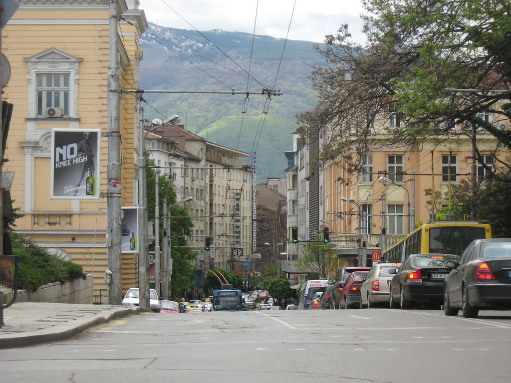
    Bulgaria is situated in Southeast Europe and occupies the eastern part of the Balkan Peninsula.
    To the north it borders on Romania, to the west on the Republic of Macedonia and the Federal Republic of Yugoslavia, to the east on the Black Sea, to the south on Greece and to the southeast on Turkey's European part.
    Area: 111.000 sq km.

    Relief:

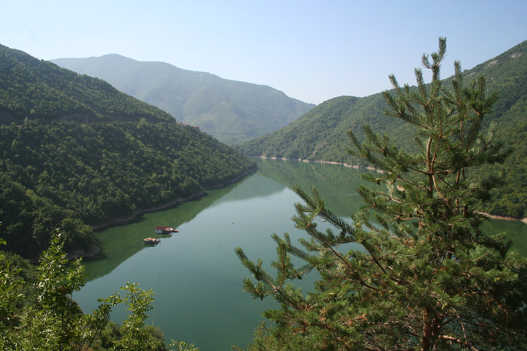
    Extremely varied: large plains and lowlands, low and high mountains, valleys and lovely gorges.
    Climate:
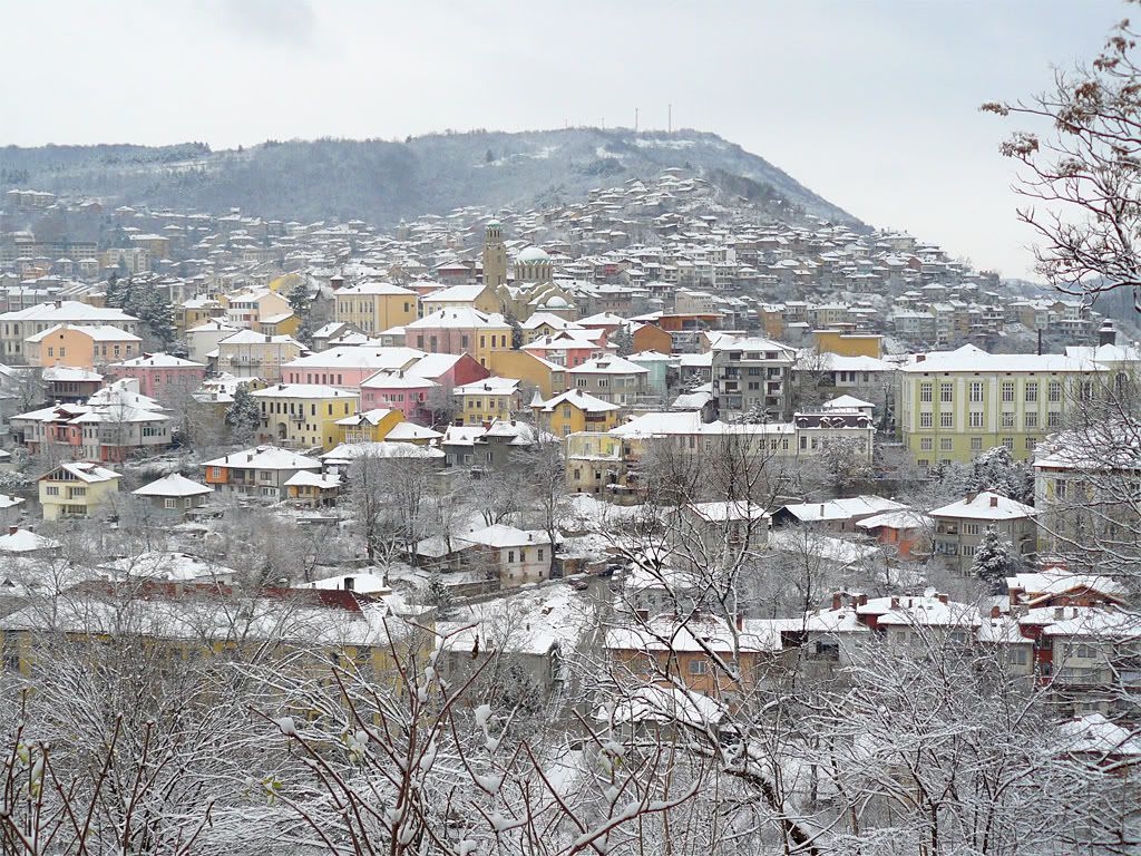
    Temperate continental with clearly marked four seasons.
    A Mediterranean influence is felt in the country's southern regions.
    The average annual temperature is 10.5°C.
    The average January temperature is around O°C.
    Average summer temperatures rarely exceed 30°C.
    Population:
    Bulgaria has a population of approximately 7.8m people, and a land area of 43,000 miles (111,000 km). Sofia, the Capital, which has approximately 1.2 m residents and is the largest city in Bulgaria. The other main Cities and Towns are Plovdiv, Varna, Bourgas, Stara Zagora, Ruse and Pleven
    Language:
    Bulgarian.
    English, German, French and Russian is spoken in the country's resorts, hotels and restaurants.
    Alphabet:
    Cyrillic. Signs along international motorways, in airports and resorts are also spelled in Roman letters.
    Religion:
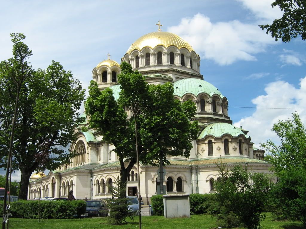
    86.6% of the population are Orthodox Christians, 13% are Muslims. The Bulgarian Church is autonomous and headed by a Patriarch.
    State government:
    Bulgaria is a parliamentary republic with democratic government.
    Capital:
    Sofia (pop. 1,141,000)

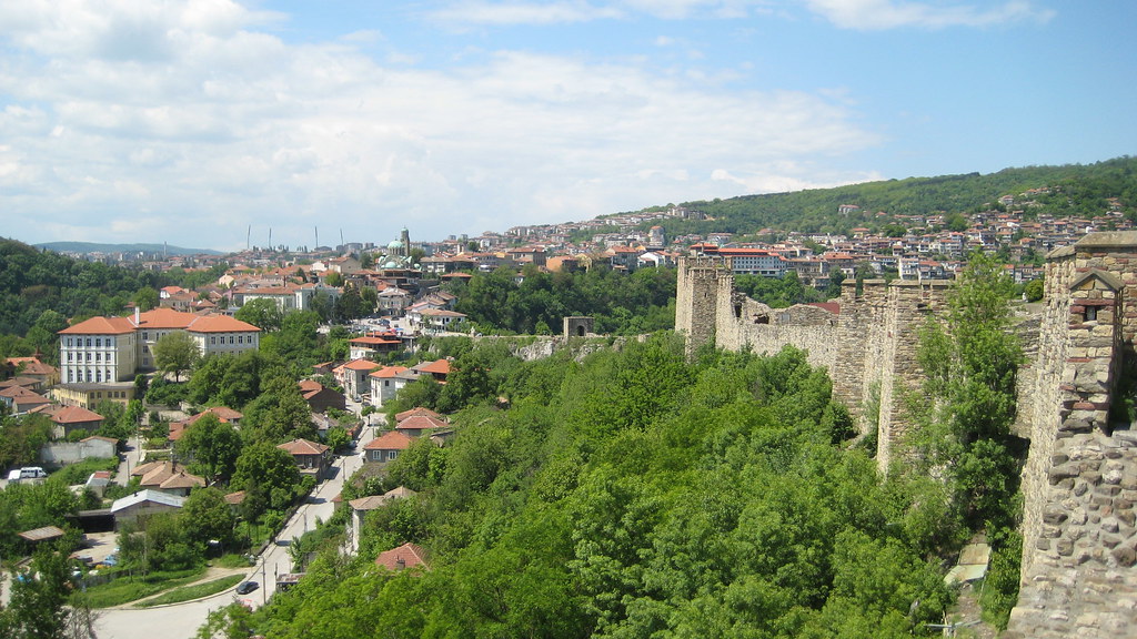
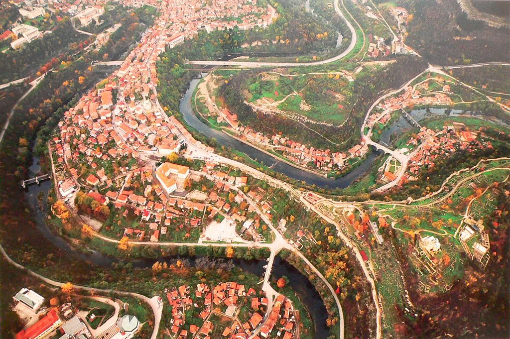
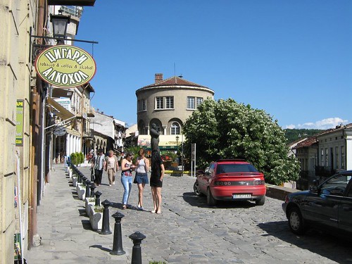
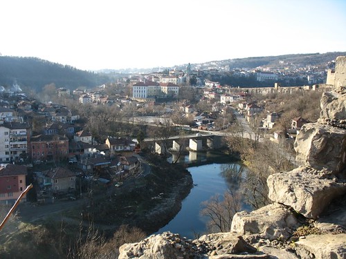
    Large Cities: Plovdiv, Varna, Bourgas, Rousse, Veliko Tarnovo

    Key Tourism Destinations

    From a tourism perspective, the most popular destinations are along the coastline, the Ski resorts and the Spa & Wellness resorts. The Black Sea Coast is dominated by the larger more successful summer resorts such as those at Sunny Beach, Pomorie, Sozopol, St. Vlas, Albena and Balchik, which are serviced by two main airports at Bourgas and Varna.

    The mountain destinations have grown in popularity substantially in recent years, the most successful one being at BANSKO, the other two main Skiing resorts being Borovets and Pamporovo. Skiing is also available in Sofia on Vitosha Mountain.

    Spa & Wellness: Bulgaria’s spas and hot mineral springs have been noted for their recreation effects ever since the ancient Tracian, Greek and Roman times. Over 800 hydro mineral springs clustered in over 240 water formations, rich in hot and cold mineral water with temperatures varying from 37°C up to 101°C, spout out from a depth of over 2000 metres. Bulgarian hydrothermal, bioclimatic, mud treatment, sea cure and other health resources are ranked among the best in Europe.
    Bansko offers modern spa centres for your complete relax and recreation. Most of the high class hotel complexes offer different massages and relaxing spa procedures, performed by professionals in the field.
    Events Overview
    The Bulgarian lands have rich and most diverse cultural heritage. Inhabited since prehistoric times, they keep lasting traces from different ages with rich traditions. Their location on a crossroads explains the intertwining, mixing, the mutual influences of the culture, mores, and religions of tribes and peoples, having lived and crisscrossed the region.
    Invaluable is the cultural and historical heritage of ancient Thracians, Greeks, Romans, of generations of Bulgarians leaving through their achievements intriguing and useful information about their lifestyle, traditions and their spiritual enlightenment.
    Here is a list of some of the most popular national holidays, which you might find interesting:
    • Christmas Eve (24, 25 and 26 December)
    The Christmas celebrations start on 24th December and continue three days. Nine vegetarian dishes are prepared and ritual bread is baked. Families gahter on the table with meat meals on it, sing songs and have fun.
    KOLEDUVANE 25 December
    Koleduvane is the biggest folk musical event in which only boys participate as major figures in the ritual. The basic idea is to wish health, good luck and fertility to the heads of households, to their houses, livestock, land, etc. The koledari, as those participating in the ritual are called, are divided into two age groups. The first group includes those between the ages of 15 and 18, the second those from 6 to 14. Each group consists of 10 to 15 koledari who divide the houses of their village or neighborhood among themselves, to be sure each house will be blessed.
    • New Year (31 December, 1 and 2 January)
    On the first day of the New Year the children visit the neighboring houses carrying with them a “survachka” a cornel-tree twig decorated with bright woolen threads and small coins. The children then bless the members of the families they visit and wish them health and fortune all through the new year.
    • Liberation Day, National Bulgarian Day (3 March)
    March 3, Bulgaria’s national day, symbolises the restoration of the third Bulgarian kingdom after almost 500 years of Ottoman rule. The treaty of San Stefano, signed on March 3 1878, was the milestone of this process and the day remains one of the most celebrated in Bulgaria’s history. The San Stefano treaty ended the Russo-Turkish, which started in 1877.
    Please note that, 3 March is official public holiday in Bulgaria, and is a non-working day for state institutions, schools and most private businesses but restaurants, bars and cafes and big shops are open.
    • Easter - one week after the Catholic Easter
    Easter in one of the most significant holidays in the Bulgarian calendar. In tune with worldwide Orthodox traditions, bright red colored eggs and Easter breads known as "kolache" or "kozunak" are the prominent symbols of Easter in Bulgaria.
    Other non-working days for state institutions, schools and most private businesses are:
    • Labour day (1 May) – Labour day is official non working day in Bulgaria and state institutions are not working.
    • Bulgaria’s Unification Day (6 September) -
    • Bulgarian Independence Day (22 September)
    Bulgarians observe a number of traditional customs as well:
    • Trifon Zarezan on 14th February is the ancient festival of the wine growers. Vines are pruned and sprinkled with wine to ensure a bounteous harvest.
    • On 1st March Bulgarians give one another martenitsa, red and white tasselled threads which are worn for health and happiness at the coming of spring. When wearers see their first stork of the season, the martenitsa is tied to the nearest tree.
    • The Mummers Day – By the end of the Winter, on Zagovezni in Bulgaria special rituals called Mummer's games take place. The Mummer's games are performed by men only. They put on special masks hand-made by each of the participants.
    Most of the masks are constructed by wood. Different colored threads are glued on it as well as pieces of multicolored fabrics, mirrors and other shiny elements. The masks representing a ram, a goat or a bull are considered the strangest. Their necessary part of the Mummer's games proves the thesis that the origin of the mummer's games is connected to the ancient Dionysius' games.
    • Cyrillic Alphabet Day (24 May) – Bulgarians celebrate the day of the Sts Cyril and Methodius, dedicated to spirituality and education.

    The Festival of Roses
    is celebrated with folk songs and dances at Kazanlak and Karlovo on the first Sunday in June.
    • The Jazz Festival – 8 -13 August, Bansko – Jazz virtuosos from all over the world perform on Bansko’ s stage. All jazz fens are welcomed to experience a real music fiesta at the foot of the Majestic Pirin Mountain.
    • “Nestinarstvo” – fire dancing is one of the most mysterious phenomena in the Bulgarian history and folklore. This pagan ritual is marking the arrival of summer fire dancers in deep trance. They are walking bare foot on hot coals under the sounds of bagpipes and drums, carrying an icon of St. Constantine.
    • Bagpipe Festival in Gela, Rodope Mountains – in August, musicians from all over the region get together to blow their gaidi, at the Rodope annual bagpipe festival. A speciality of the Rodope Mountain, the huge, deep-voiced kaba gaida accompanies singing or plays dance music, alone or in concert with other bagpipes, and the festival is a rare chance to hear the awesome sound of Sto kaba gaidi - one hundred of them playing together.

    The Celebrations of the Thracian Kings in the valley of the Thracian kings
    – 31 August – 2 September – Life show on open stage in Kazanlak. By arts of dancing, music and individual charm young artists re-create part of the Dionysius mysteries and the way the God of wine and his suite entertained themselves.
    • 23rd September – the Plumb Festival – Interesting festival honouring the Plum Rakia in Troyan town in Bulgaria. Troyan town is being transformed into a original life stage, presenting unique traditions, delicious local cuisine and of course the famous Troyanska Slivova Rakiya (plum rakia).
    • 1 November – National Day of the Bulgarian Enlighteners (Holiday for all educational institutions)

    Comentario

    • Nettus
      Usuario
      • 1 feb, 2008
      • 4715
      • Lundby

      Bulgaria -enlaces


      Holidays in Bulgaria

      Beach . Birdwatching . Golf . Health . History . Hunting . Monasteries/ Religious Mountain biking . Rural . Ski . Spa & Wellness . Trekking . Water sports . WineConference . Yachting

      Top Resorts
      Visit Bulgaria

      Plovdiv
      Blagoevgrad . Bourgas . Dobrich . Gabrovo . Haskovo . Kardjali . Kyustendil . LovechMontana . Pazardjik . Pernik . Pleven . Plovdiv . Razgrad . Rousse . Shoumen . Silistra . Sliven . Smolyan . Sofia . Stara Zagora . Targovishte . Varna . Veliko Tarnovo . Vidin . Vratsa . Yambol'
      MORE TOWNS

      Bulgaria Guide
      General information
      Bulgarian Monasteries . SPA Bulgaria . The Black sea . History . Geography Maps . Weather . Airports in Bulgaria . Webcams . Currency . Forums
      .
      Mountains in Bulgaria
      The Balkan Mountain Range . Rila Mountain . Pirin Mountain . The Rodope Mountain . Vitosha Mountain

      Musala 2,925 m . -el pico más alto de Bulgaria.
      Travel Arrangements
      Visit Bulgaria . Visa Requierments . Choose Destination . Flights to BulgariaTransport in Bulgaria . Advice

      Comentario

      • Nettus
        Usuario
        • 1 feb, 2008
        • 4715
        • Lundby

        Sofía -fotos


        Comentario

        • Nettus
          Usuario
          • 1 feb, 2008
          • 4715
          • Lundby

          Veliko Turnovo

          Veliko Turnovo
          Veliko Turnovo Map | Bulgaria Google Satellite Maps

          Vacaciones en Veliko Tarnovo Bulgaria


          La ciudad de Veliko Tarnovo está situada en la zona norte de Bulgaria, en las cuatro colinas de Tsarevets, Trapezitsa, Momina Krepost y Sveta Gora y en el banco del río Yantra.

          Tsarevets fue la capital del Segundo Reino Búlgaro en el siglo XII AC, por lo que tuvo una importancia extraordinaria en la vida política y espiritual de Bulgaria.

          Los lugares de mayor interés turístico son el fuerte medieval de Tsarevets, la Torre Baldwin, el Palacio Real, la Iglesia de Santa Petka y una gran variedad de pequeñas iglesias.

          Hoy, Veliko Tarnovo, con sus 65.000 habitantes, es un centro cultural, histórico y turístico muy importante en Bulgaria.
          Los estudiantes de la universidad de St. Cyril y Methodius (la segunda más grande en el país) y la universidad nacional militar Vasil Levski, aumentan la población en 12.000 personas.
          Su situación en Bulgaria, buen clima, recursos naturales, patrimonio histórico y arquitectura bien conservada, convierten a Veliko Tarnovo en una de las ciudades más visitadas en Europa del Este. Escondida y rodeada de un paisaje fantástico, Veliko Tarnovo es una joya por descubrir.
          Desafortunadamente, todavía no hay vuelos directos hasta Veliko Tarnovo, pero si hay buenas conexiones en tren desde Plovdiv y Ruse. Desde Sofia y Varna se puede viajar en tren hasta Gorna Oriahovitsa y desde allí, a Veliko Tarnovo.
          Todos los días hay trenes internacionales a Estambul y Bucarest que pasan por Veliko Tarnovo. También desde Gorna Oriahovitsa se puede llegar a Atenas y Belgrado.


          www.whichbulgarianproperties.com/holidaysinbu...

          Cómo comprar casa en Bulgaria - Viajes de inspección - Abogados en Bulgaria - Construcción en Bulgaria - Transportes y mudanzas - Inspeccion de viviendas - Venta de casa en Bulgaria - Vacaciones en Bulgaria

          Lugares de interés en Bulgaria

          Sofia - Albena - Varna - Plovdiv - Stara Zagora - Pamporovo - Veliko Tarnovo - Dobrich - Balchik - Kavarna - Complejos turísticos en Bulgaria - Sunny Beach - Golden sands - Bansko - Golf en Bulgaria - Esquí en Bulgaria - Turismo de salud en Bulgaria - Turismo de aventura en Bulgaria - Reserva vuelo a Bulgaria - Reserva hotel en Bulgaria
          Más sobre Bulgaria

          Mapa de Bulgaria - Historia de Bulgaria - Clima en Bulgaria - Cultura en Bulgaria Idioma búlgaro.

          Comentario

          • Nettus
            Usuario
            • 1 feb, 2008
            • 4715
            • Lundby

            Veliko Tarnovo Region

            Veliko Tarnovo Region


            VELIKO TARNOVO . PLEVEN . GABROVO

            Previous user photo Next user photo

            www.panoramio.com/photo/8864755

            VELIKO TARNOVO
            - one of the most ancient Bulgarian cities is built amphitheatrically on four hills-Tsarevets, Trapezica, Momina Krepost and Sveta Gora, in between which is curving river Jantra. It once was the political,financial and economic centre of The Second Bulgarian Kingdom, being the capital of the Medieval Kingdom for over 200 years. Today,the impressive history of this town can be best felt through experiencing the unique by Europe′s standards spectacle “Sounds and Light”.

            www.welcome2bulgaria.com/.../index.html

            There are about 40 churches in the town and the nearby village of Arbanasi.

            The oldest of them is from the end of the XII century. Veliko Tarnovo is one of the most beautiful Bulgarian towns,which has retained the scent and spirit of the past centuries.

            .
            PLEVEN - The today ′s town occurred close to an old Thracian and Roman village,called Strogozia which was built in the Kailaka area. Pleven has a rich history. It became widely known during the Russo-Turkish war(1877-1878).

            Interesting to the visitors of the town are the Kailak fortress, the tumulus in the Skobelev park, the Pleven Epopee Panoramic exhibition, the old bridge on the Vit river, many monuments. The beautiful area of Kailaka is close to Pleven.

            GABROVO - is a town in central northern Bulgaria. It is situated at the foot of the central Balkan Mountains, in the valley of the Yantra river, and is known as an international capital of humour and satire, as well as noted for its Bulgarian National Revival architecture. Gabrovo is also known as the longest town in Bulgaria, stretching over 25km along the Yantra, yet reaching only 1km in width at places.

            Places of interest in Gabrovo include House of Humour and Satire and Aprilov High School. In Gabrovo province sites include architectural reserve Bozhentsi, Ethnographic Complex Etara, Dryanovo Monastery and Sokolski Monastery.

            www.valenatours.com/index.php?lang=en&page=ve...

            Comentario

            • Nettus
              Usuario
              • 1 feb, 2008
              • 4715
              • Lundby

              Montañas búlgaras

              Montañas búlgaras

              Debajo del pico Maliovitsa.

              Momchilovtsi, montañas Ródope
              .

              Llanura superior de Tracia
              .
              Tracia
              Tracia (en griego Thrákē ), región del sureste de Europa , en la Península de los Balcanes , al norte del Mar Egeo , enclavada en Grecia y en Turquía europea. Es una región histórica que, en su época, se extendía desde Macedonia hasta el Mar Negro y el mar de Mármara; y desde el mar Egeo hasta el Danubio. Ocupa la punta del sudeste de la Península Balcánica y comprende el Nordeste de Grecia, el sur de Bulgaria, y la zona europea de Turquía. Sus límites han variado en diferentes períodos. Las montañas Ródope separan la Tracia griega de la búlgara y el río Maritsa separa la Tracia turca de la griega.
              Las ciudades principales de la zona son Estambul, Gallipoli, Edirne (antes Adrianópolis) y Tekirdag, todas ellas en Turquía. En la zona griega se distinguen Komotene, Janto y Alejandrópolis como las ciudades más grandes. La región de Tracia es esencialmente agrícola. Allí se produce tabaco, arroz, trigo, algodón, seda, aceite de oliva y frutas.
              (Wiki-Urban).

              Bezbog Summit, Monte Pirin.

              Puente del Diablo, Montañas Ródope.

              Vista desde la fortaleza de Belogradchik.

              Vihren desde el lado norte, el segundo pico más alto de Bulgaria, 2914 m.

              Koncheto, Pirin.

              Sinanitza, uno de los más espectaculares picos en Pirin.

              La ciudad de Smolyan, montañas Ródope.

              Comentario

              • Nettus
                Usuario
                • 1 feb, 2008
                • 4715
                • Lundby

                Fotos de Bulgaria


                Saltos de Skaklia, cerca de Vratza, SO de Bulgaria

                Koncheto, Pirin.

                Lago Popovo, pico Dzhengal al frente.
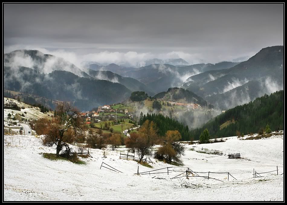
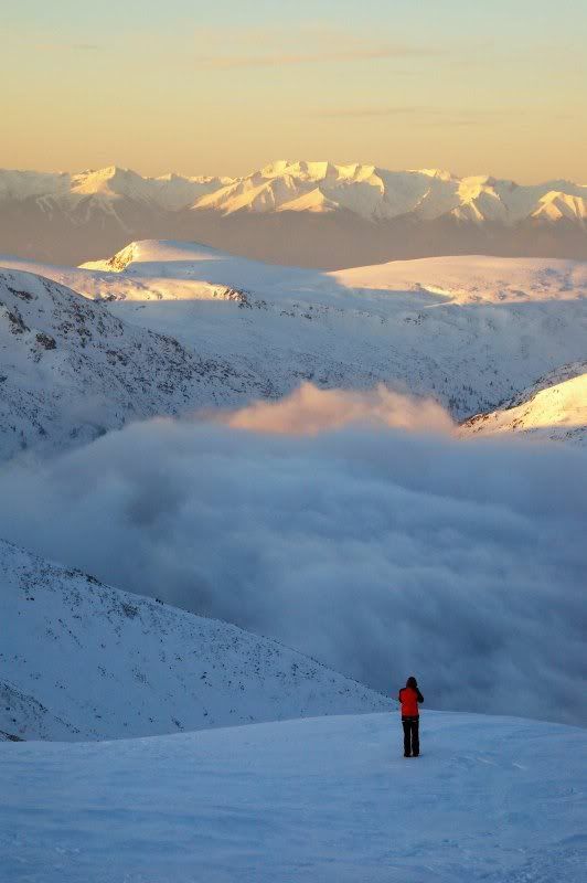
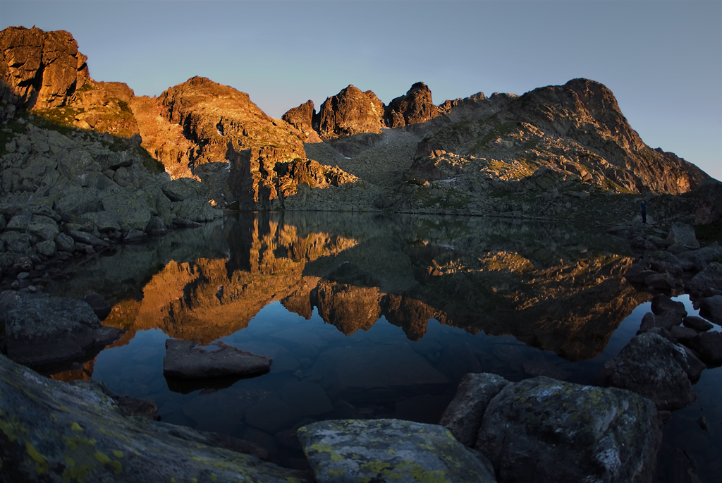
                Stara Planina, Botev, 2376 m

                Trigrad, Ródope.

                Belogradchik Roks.

                Lago Vacha, montañas Ródope.

                Pirin, Tevnoto ezero

                Strashnoto ezero (Lago Scary), Rila.

                Comentario

                • Nettus
                  Usuario
                  • 1 feb, 2008
                  • 4715
                  • Lundby

                  Bulgaria - fotos

                  Fortaleza Cherven, Norte de Bulgaria


                  Vista desde el pico de Nymph, Parque Nacional de Pirin.


                  Vista desde el pico Polezhan dirección lago Popovo, Pirin.


                  Monasterio Glozhenski


                  Pueblo de Zasele, garganta del río Iskar.


                  Ruinas de la fortaleza de Shumen, norte de Bulgaria.


                  Los montes Ródope o montañas Ródope son un macizo montañoso de la antigua Tracia y de las actuales Bulgaria y Grecia, limitado por los valles del río Mesta (el actual Места búlgaro) al oeste y del río Maritsa (el antiguo Hebro, Evros/ Meriç) al norte y al este.
                  Antiguamente habitaban en esta cordillera los tracios díos.
                  Montañas Ródope (Rodopi Mountains), vista hacia el lago Vucha.


                  Pico Kamenitza, Pirin.


                  Pirámides de arena en Melnik.


                  Ródope (Rhodopes), la carretera a Smolian.
                  *** Visit to Bulgaria : SMOLIAN, Bulgaria *** - Travel guide and ...

                  Comentario

                  • Nettus
                    Usuario
                    • 1 feb, 2008
                    • 4715
                    • Lundby

                    Bulgaria -fotos

                    Vistas desde Stara Planina | Beklemeto Pass


                    Vistas desde Stara Planina | Caballos semi-salvajes 1


                    Vistas desde Stara Planina | Caballos semi-salvajes II


                    Vistas desde Stara Planina | Caballos semi-salvajes III


                    Vistas desde Stara Planina


                    Vistas desde Stara Planina | Caballos semi-salvajes IV


                    Monte Pirin

                    Comentario

                    • Nettus
                      Usuario
                      • 1 feb, 2008
                      • 4715
                      • Lundby

                      Bulgaria -fotos y enlaces


                      Pistas de esquí de Borovet
                      Borovets is a modern ski resort in Bulgaria. Skiing and snowboarding for professionals and beginners. Book now and take the best holidays ever.


                      Stara Planina


                      Pirin
                      Pirin - Wikipedia, the free encyclopedia


                      Los 7 lagos Rila
                      Montañas Rila - Wikipedia, la enciclopedia libre
                      El macizo de Rila son las montañas más majestuosas de todo Bulgaria.
                      Rila son unas montañas en el sudoeste de Bulgaria y las más altas
                      montañas de Bulgaria y de los [[Balcanes]. El macizo es además el
                      sexto más alto de Europa
                      (cada uno representado únicamente por el pico más alto), detrás del
                      Cáucaso, los Alpes, Sierra Nevada, los Pirineos y el Monte Etna.

                      El nombre de Rila , se alega que, es de origen tracio y significa "montaña
                      bien regada", a causa de la abundancia en Rila de lagos glaciares (unos 200)
                      y calurosas primaveras. Algunos de los más largos y rápidos ríos de los
                      Balcanes nacen en Rila, incluyendo los ríos Maritsa, Iskar y Mesta.

                      El pico más alto es el Musala de 2925 msnm; es el pico más alto de los
                      Balcanes, justo con la misma altura que el monte Olimpo. Emplazado a
                      dos horas de la capital de Bulgaria, Sofía. Es la principal zona de esquí
                      cercana a Sofía y hay varios albergues de montañas en sus laderas.

                      Posee más de 2.000 especies de plantas y una gran riqueza faunística.
                      Geología
                      Rila es una montaña de cumbre redondeada macizo tectónico,
                      parte de la más antigua tierra de los Balcanes, el Macizo Macedonio-Tracio.
                      Está compuesta por granito y rocas de gneis durante el Paleozoico
                      (hace 250.000.000 años). El relieve alpino de Rila se formó más tarde,
                      hace de 10-12.000 años, tras la Glaciación de Würm o Wisconsin,
                      cuando la línea de nieve estaba a 2100 msnm, encima de esta línea
                      los glaciares cambiaron radicalmente el relieve existente, creando
                      profundos circos, pirámides abruptas, picos redondeados, picos rocosos,
                      muchos valles valleys, morrenas y otras típicas formaciones glaciares.

                      Límites y clima
                      Rila tiene 2.400 km2. la cima de la montaña se alza sobre los valles
                      montañosos circundantes, con el Borovets Saddle (1305 m) conectando
                      la cresta principal de Musala con las crestas Shipochan y Shumnatica
                      que conectan con el Ihtiman Sredna Gora montañas a través del paso
                      de la Puerta de Trajano. El Yundola Saddle (1375 m) y el
                      Avraam Saddle (1295 m) enlazan Rila con los Ródope al este,
                      mientras que la conexión con Pirin
                      es el Predel Saddle (1140 m), el único con el Verila que está en el
                      Klisura Saddle (1025 m).

                      El clima es típicamente alpino, con 2000 mm de precipitación en
                      Musala anualmente, 80% de la cual es nieve. La media de temperatura
                      más baja medida en Musala es en febrero con –11,6 °C y la mínima
                      absoluta de -31,2 °C. la media de temperatura en agosto is 5,4 °C,
                      el máximo es de 18,7 °C.

                      Subdivisión
                      Rila se subdivide en numerosas partes dependiendo de su posición
                      geográfica.

                      --Rila Este o la Cresta Musala es la parte más alta y vasta.
                      El pico más alto, tiene 12 de los 18 picos por encima de 2.700 m
                      localizados allí — Musala, Yastrebets, Irechek, Deno, Mancho, etc.

                      Los lagos Musala Lakes se extienden en esta parte de Rila, como el
                      Ledeno ezero ("Lago Helado"), el lago más alto de los Balcanes a 2.709 m.
                      Otros lagos en Rila Este son los Lagos Maritsa Lakes y los Lagos Ropalitsa.
                      El renombrado resort de la montaña Borovets está también localizado
                      en esta parte de la montaña.

                      --Rila Central o la Cresta Skakavets es la parte más pequeña
                      (1/10 del área total), con los más famosos de los lagos galciares
                      — los Lagos del Pescado, los Lagos Dzhendem, Lago Iozola y los
                      Lagos del Monasterio Lakes. El más grande lago glaciar de los Balcanes,
                      Smradlivo ezero ("Lago Apestoso") con un área de 21,2 km2,
                      está localizado en Rila Central, como los picos Kanarata, Cherna
                      polyana, Malak Skakavets y Golyam Skakavets, Rilets. La cresta
                      del Skakavtsi Iskar . A otra bien conocida cresta en esta área es
                      la de Marinkovitsa y Vodniya chal, extendiéndose hasta la
                      reserva forestal de Kobilino branishte.

                      (los picos de Golyam Skakavets y Malak Skakavets, Pchelina y
                      Sveti Duh) asciende aislada entre los ríos Levi y Beli
                      --Rila Noroeste ocupa uel 25% del área total de Rila. el pico más
                      alto es el Malyovitsa de 2.730 m. Los Siete Lagos Rila son un hito
                      importante en esta parte, con muchos picos remotos y pequeños lagos.

                      --Rila Suroeste o la Cresta Kapatnik ocupa el 30% de Rila y es la
                      más antigua reserva de Bulgaria. Aparte de esta pequeña parte
                      septenetrional, Rila Suroeste no tiene la misma apariencia alpina
                      que las otras partes.

                      Picos de Rila
                      Musala — 2925 m
                      Malka Musala — 2902 m
                      Ovcharets — 2768 m
                      Golyam Kupen — 2731 m
                      Malyovitsa — 2729 m
                      Popova kapa — 2704 m
                      Malka Malyovitsa — 2698 m
                      Lopushki vrah — 2698 m
                      Lovnitsa — 2695 m
                      Kanarata — 2691 m
                      Orlovets — 2685 m
                      Pastri slap (Aladzha slap) – 2684 m
                      Zliya zab — 2678 m
                      Eleni vrah — 2654 m
                      Ravni vrah (Ravni chal) — 2637 m
                      Belmeken (Kolarov) — 2627 m
                      Kamilata — 2621 m
                      Golyam Mechi vrah — 2618 m
                      Dvuglav — 2605 m
                      Golyam Mermer (Mramorets) — 2598 m
                      Dodov (Drushlevishki) vrah — 2597 m
                      Kozi vrah — 2587 m
                      Iglata — 2575 m
                      Golyam Mechit — 2568 m
                      Ushite — 2560 m
                      Ptichi vrah (Ashiklar) — 2536 m
                      Malak Mechit — 2535 m
                      Yanchov vrah — 2481 m
                      Malak Mechi vrah — 2474 m
                      Strazhnik (Kurdzhilak) — 2469 m
                      Budachki kamak — 2447 m
                      Kukov vrah — 2411 m
                      Tsarev vrah — 2376 m
                      Damga (Ivan Vazov) — 2342 m
                      Markov kamak (Gorna Kadiitsa) — 2342 m
                      Malka Popova kapa — 2180 m
                      Treshtenik — 2020 m
                      Angelov vrah
                      Malak Lopushki vrah
                      Malak Mermer
                      Lugares de interés
                      Culturalmente, Rila es famosa por el Monasterio de Rila, el más
                      grande y más importante monasterio de Bulgaria, fundado en el
                      siglo X por San Juan de Rila.

                      Enlaces externos
                      Wikimedia Commons / Montañas Rila.
                      Rila National Park website
                      Website on Northwest Rila

                      Seven Rila Lakes - Wikipedia, the free encyclopedia
                      Seven Rila Lakes- Rila National Park- Rila Mountains
                      Seven Rila Lakes in National Rila Park, Bulgaria


                      Hotnitsa Waterfalls


                      Kademliiskoto Praskalo

                      Ledenika Cave
                      In Vrachanski Balkan there are about 300 caves but the most famous is
                      Ledenica Cave.

                      Ledenica Cave is situated at 16 km. westwards from the town of Vratsa.
                      The Ledenika cave is situated in the Northwest part of the Stresherski
                      Balkan in the Vratsa Mountain. It’s entrance is the lowest part of the
                      Ledenika land depression.
                      It’s altitude is 830 metres.The cave is opened all the year round and
                      there are guides who can take you there.

                      There are several halls with wonderful formation, the most impressive
                      being the Concert hall (60m long, 46m wide and 22,7 m high) which has
                      a fantastic acoustics. It has hosted a lot of concerts. The entry fee is
                      just a symbolic one. Next to the cave there is a tourist settlement. In
                      the direction to the settlement there is also an open-chair lift, its initial
                      station being between the town of Vratsa and the village of Zgorigrad.
                      In the mountain you can ski from November to May. There are also many
                      tourist paths all over the beautiful Balkan.The Ledenika cave was opened
                      for the first time in 1961. In 1962 it was proclaimed for a natural landmark.
                      The temperature in the cave varies from -7° C to -15° C (in winter in the
                      Antechamber) and to 8° C in the inner parts. The moisture of the air is 92%.

                      Ledenika is richly decorated with speleothems: stalactites, stalagmites,
                      curtains and water falls. This it is the most frequently visited show cave
                      in Bulgaria.

                      The hut Ledenika is near the cave. It has 48 beds, a tourist kitchen and a
                      restaurant for 50 people. The Cave is Working hours - summer: 8:30 to
                      12:30am and 1:30 to 6:00pm; winter: 8:30am to 4:00pm, seal available.


                      Ledenika Cave


                      Detailed information about the Bulgarian towns and cities
                      Central Southern Bulgaria
                      Batak, Bratsigovo, Peroushtitsa, Pazardzhik, Koprivshtitsa, Sopot,
                      Karlovo, Kalofer, Hissarya - spa resort, Plovdiv, Asenovgrad,
                      Chepelare, Smolyan, Devin, Pavel Banya, Kazanluk, Stara
                      Zagora, Chirpan, Dimitrovgrad, Haskovo, Kurdzhali
                      Southeastern Bulgaria
                      Svilengrad, Elhovo, Yambol, Sliven, Kotel, Karnobat, Aitos,
                      Malko Turnovo
                      Northwestern Bulgaria
                      Berkovitza, Chiprovtzi, Belogradchik, Vidin, Kozlodui, Oriahovo,
                      Montana, Vratsa, Mezdra, Botevgrad, Etropole, Yablanitza,
                      Cherven bryag, Loukovit, Lom
                      Central Northern Bulgaria
                      Teteven, Troyan, Apriltzi, Lovech, Pleven, Nikopol, Svishtov,
                      Pavlikeni, Sevlievo, Gabrovo, Tryavna, Dryanovo, Elena, Veliko
                      Turnovo, Gorna Oryahovitsa, Byala, Rousse
                      Southwestern Bulgaria
                      Petrich, Sandanski, Gotse Delchev, Bansko ski resort,
                      Razlog, Blagoevgrad, Doupnitsa, Samokov, Kyustendil, Pernik,
                      Pirdop and Zlatitsa, Panagyurishte, Kostenets, Velingrad
                      Northeastern Bulgaria
                      Pliska, Shoumen, Veliki Preslav, Turgovishte, Razgrad,
                      Toutrakan, Silistra, Dobrich, Provadia
                      Bulgarian Black Sea Coast
                      Shabla, Roussalka, Kavarna, Balchik, Albena, Zlatni Pyasutsi
                      (GOLDEN SANDS), St. St. Konstantin and Elena, Varna, Kamchia,
                      Obzor, Elenite, Slunchev Bryag (SUNNY BEACH), Nessebar,
                      Pomorie, Bourgas, Sozopol, Dyuni, Primorsko, Kiten, Tsarevo, Ahtopol
                      Bulgarian Mountains
                      Rila, Rila Monastery, Borovetz, Malyovitza, Pirin,
                      Melnik and The Rozhen Monastery, Shiligarnika,
                      Stara Planina (The Balkan Mountain), KOM - Emine Route,
                      The Rhodope Mountains, Pamporovo, Bachkovo Monastery,
                      Shiroka Luka, Vitosha

                      Comentario

                      • Nettus
                        Usuario
                        • 1 feb, 2008
                        • 4715
                        • Lundby

                        Burgas

                        BURGAS
                        Coordenadas: 42° 30′ 0″ N, 27° 28′ 0″ E
                        Burgas Region Map: Akheloy — Zvezdets | Bulgaria Google Satellite Maps

                        Burgas is the second-largest city and seaside resort on the Bulgarian Black Sea Coast with population 210,260.
                        It is also the fourth-largest by population in the country, after Sofia, PlovdivVarna. It is the capital of Burgas Province and an industrial and tourist centre.
                        Surrounded by the coastal Burgas Lakes and located at the westernmost point of the Black Sea, the large Burgas Bay, Burgas has the largest and most important Bulgarian port. Today, it is a key economic, cultural and tourist centre of southeastern Bulgaria, with the Burgas Airport serving the resorts of the southern Bulgarian coast.

                        List of cities in Bulgaria
                        Bulgarian Black Sea Coast
                        Lake Burgas
                        Burgas AirportWikimedia Commons /Burgas
                        Wikisource has the text of the 1911 Encyclopædia Britannica article Burgas.
                        Burgas City Official Website
                        Burgas largest website, Information about Burgas
                        Factor Newspaper, Bourgas news
                        Burgas Regional Administration
                        Nikola Gruev's gallery of Burgas

                        Durante los meses de varano se multiplica la población y adquiere una atmósfera increíble -hay "toneladas" de gente en el centro, en la 'promenade street' que va hacia el Sea Garden Park.

                        Burgas es la segunda ciudad en tamaño en la costa búlgara del Mar Negro. Es la capital de la provincia de Burgas y un centro turístico e industrial. Los tres lagos de Burgas se encuentran alrededor de la ciudad; el Lago Burgas, el Lago Atanasovo y el Lago Mandra.

                        Los lagos de Burgas forman el complejo de pantano más grande y más valioso en Bulgaria. Su superficie total, juntos con los pantanos, atolla, charcas de pescado y otros cuerpos de agua, alcanzan hasta 9500 hectáreas, de las cuales 3330 ya han sido designados como áreas protegidas o postuladas para su designación como tales.

                        Siendo el centro de la costa sur del Mar Negro; es una ciudad con el comercio bien desarrollado y la industria. El tiempo es favorable, el invierno suave y el verano cuenta mucho tiempo asoleado. Las playas son conocidas por la arena negra, que esuna mezcla de diversas aleaciones de magnetita, la razón de su color oscuro, con fama de tener efectos curativos.

                        .Hoy en día, el puerto local es el más grande de Bulgaria, agregándole importancia a la economía de la región. La ciudad también alberga exhibiciones nacionales anuales y festivales internacionales y tiene una dinámica población estudiantil que se añade a los atractivos de la ciudad. Su mayor interés es el centro de la ciudad, es la parte más antigua y más agradable, organizado en tormo a dos grandes arterias peatonales donde se suceden cafés y tiendas.

                        El Distrito Museo de de Historia, es uno de los lugares más impresionantes de la ciudad, posee una colección de objetos expuestos rica de viejas colonias sobre el coste de Mar Negro; hay objetos de historia moderna y fotografías de líderes renombrados.

                        El Museo Etnográfico es también de especial llamamiento a los extranjeros por sus exposiciones de koukeri de máscaras, trajes tradicionales, rituales accesorios, tejidos y bordados. El museo se aloja en una casa construida en 1873 y posteriormente declarado monumento cultural.

                        Burgas tiene dos universidades; la Universidad Libre de Burgas está en medio de la calle Aleksandrovska, sobre la gran plaza. Instalada en la antigua sede local del partido comunista, fue la primera universidad del país. Los edificios principales de la Universidad Asen Zlatarov esestan localizado en la entrada de oeste de la ciudad.
                        El Museo de la Naturaleza y Ciencia es otro lugar de interés para los visitantes de la ciudad. Contiene más de 1200 exposiciones de insectos y reptiles y más de 140 especies de peces, plantas que crecen en el distrito de Strandzha, protegidas y especies endémicas. El Museo Arqueológico exhibe bellos objetos de la antigüedad griega y romana. Además, algunos animales vivos, principal atractivo para atraer niños.


                        Otro de estos lugares es la Galería de Arte, albergada en el edificio de una antigua Sinagoga de estilo de secesión; con salas de exhibición exterior y de Bulgaria de sus obras, y los iconos pintados por reconocidos artistas del Renacimiento. Entre los edificios de la iglesia, uno de ellos es el de San Cirilo y la Catedral de San Metodio, cerca de donde se plantea el mercado.
                        La catedral es interesante por sus maravillosos frescos y el altar de madera. Otra impresionante visita en Bourgas es la Iglesia armenia situada cerca de Bulgaria Hotel. Fue construida en 1855 por la minoría armenia local apoyado por los búlgaros. Por último, una sala filarmónica, una ópera, un teatro de drama y un teatro de marionetas se encuentran en bellos edificios y ofrecen funciones durante toda la temporada.


                        Lejos del ajetreado centro de la ciudad, el Jardín del Mar es un bonito lugar para pasear en días de verano caliente. El parque está situado en una colina próxima a la costa, y es rico en flores, árboles y esculturas. Dentro del parque hay un casino, un pequeño zoológico y un teatro al aire libre que alberga el Festival Internacional de Folclore. El jardín comienza en la central de autobuses y la estación de tren. Hay pequeña escalera a la playa arenosa y en el verano la costa esta llena de muchos coffees y clubs de noche.

                        Otro de los sitios de interés para los visitantes son las minas de sal Burgas. Ellas lindan con el Lago Burgas, y algunas de ellas hasta el Lago Atanasovo. Los baños minerales están a 13 kilómetros al noroeste, hacia la ciudad de Aytos. Los restos de un establecimiento antiguo romano también se hallan allí.

                        El pueblo de Kraimorie, al sur de Bourgas en el camino hacia la antigua fortaleza de Pirgos. Hay una playa cerca de la aldea, así como residencias privadas y alojamientos de vacaciones. El Parque Otmanli está a 15 km de Bourgas, cerca de la Choukalya caape. Posee amplios y espesos bosques y tiene en una zona de caza y bungalows para la recreación.


                        El Aeropuerto Internacional de Burgas es una conexión con los mayores centros turísticos del Mar Negro, tales como Sunny Beach, Nesebar, Sozopol, Dyuni y Elenite. Hay autobuses hacia el aeropuerto cada media hora. También se puede viajar en autobús a Sozopol, Varna, Sunny Beach, Nesebar, Ruse y Sofía. La estación central de autobuses de la ciudad está situada junto a la estación de tren; el tren expreso viaja a Sofía en menos de 6,30 horas. también la cuarta en población en el país, después de Sofia, Plovdiv y Varna. Situada a 132 kilómetros al sur de Varna.
                        (burgas.com.es)

                        Comentario

                        • Nettus
                          Usuario
                          • 1 feb, 2008
                          • 4715
                          • Lundby

                          Burgas -fotos

                          .


                          .


                          .


                          .

                          .

                          Comentario

                          • Nettus
                            Usuario
                            • 1 feb, 2008
                            • 4715
                            • Lundby

                            Stara Zagora

                            Stara Zagora
                            www.stara-zagora.co.uk/stara-zagora-travel.html
                            Stara Zagora Region Map: Aprilovo — Zora | Bulgaria Google ...


                            42° 26′ 0″ N, 25° 39′ 0″ E

                            Stara Zagora (en búlgaro Стара Загора) es una ciudad de Bulgaria.Está situada en el centro del país.Tiene una población de 162.768 habitantes.Es la sexta ciudad más grande del país.
                            Geografía y clima
                            La ciudad se encuentra en la histórica region de Tracia.Es la capital de la provincia de Stara Zagora.Se encuentra a 90 km al noreste de la ciudad de Plovdiv y a 231 km al este de la capital del país - Sofía. La ciudad se encuentra a 196 m sobre el nivel del mar.El clima es continental templado con influencias del mar Mediterráneo.La media de la temperatura anual es de 13ºC.


                            Historia

                            Stara Zagora es una da las ciudades más antiguas de Bulgaria y de Europa del Sudeste.Tiene una historia de más de 8000 años.Eso demuestran los ocho nombres que ha tenido a lo largo de su historia: Beroe,Augusta Trajana,Vereya,Irinopolis,Boruy,Eski Zagra,Zheleznik y Stara Zagora.
                            La ciudad fue fundada por los tracios en el siglo IV a. C. con el nombre de Beroe (que probablemente en tracio significa "hierro").Después,durante la época del Imperio Romano,en el siglo II,la ciudad fue nombrada Augusta Trajana,en honor del emperador Trajano.Durante la época del Imperio Bizantino,entre los siglos VI-VII,la ciudad se llamó Vereya.


                            Posteriormente,en el siglo VIII,la ciudad fue nombrada Irinopolis,en honor de la emperatriz bizantina Irina.Después,la ciudad fue conquistada por los búlgaros y durante los siglos VII-VIV se llamó Boruy.En el año 1364 la ciudad pasó en manos de los turcos que la llamaron Eski Zagra.Durante los años 50 del siglo XIX la ciudad se llamó Zheleznik (la traducción búlgara de Beroe).En el año 1871 la ciudad fue nombrada
                            definitivamente con el nombre de Stara Zagora.

                            Economía
                            Stara Zagora es un importante centro administrativo e industrial.Es un mercado agrícola importante que produce trigo,cerveza,vinos,telas,pieles,fertilizantes,har ina de trigo y esencia de rosas.Sirve como conexión central de la red ferroviaria búlgara,que conecta la ciudad con todas las ciudades búlgaras,y también con las ciudades de Europa Oriental y Europa Occidental.


                            Educación y cultura

                            Stara Zagora es hoy una de las ciudades contemporáneas más modernas de Bulgaria.Es un centro cultural y de la educación importante.Hay escuelas secundarias,escuelas técnicas y escuelas secundarias especializadas,muchos de investigación e institutos culturales.En la ciudad se encuentra la universidad tracia de Stara Zagora.En la ciudad hay una ópera,que es una de las más grandes en la Península Balcánica.También hay varios parques,uno de los cuales se llama Ayazmoto,el más grande y conocido de la ciudad.En Stara Zagora hay varios museos y galerías.En la ciudad hay muchos hoteles,que están a disposición de los turistas que quieran visitarla.En Bulgaria,Stara Zagora es conocida como la ciudad de los tilos,las calles rectas y los poetas.


                            The "Defenders of Stara Zagora Memorial Complex" was erected in 1977.
                            The Defenders of Stara Zagora...

                            Landmarks
                            The Antique Forum
                            Thracian Tomb
                            The Roman Baths
                            The Samarsko Zname Monument
                            Ayazmoto Park
                            Defenders of Stara Zagora Memorial Complex
                            Memorial House of Geo Milev
                            The South Gate of Augusta Trajana
                            The Opera House (built 1925)
                            Stara Zagora Transmitter with one of the few Blaw-Knox Towers
                            Enlaces
                            Wikimedia Commons alberga contenido multimedia sobre Stara Zagora.
                            La página oficial de la ciudad
                            Fotos de Stara Zagora
                            Más fotos de la ciudad
                            Turismo en Stara ZagoraLa página oficial de la Opera Star
                            (Wikipedia)


                            Abarca la llanura de Stara Zagora, Kazanlak hervidor de agua, algunos de los medios de los Balcanes y el Sredna Gora Montañas.
                            La región es rica en recursos hídricos.
                            Además de la parte superior de la corriente del río Tundzha y sus numerosos afluentes, la zona es abundante en manantiales kársticos.
                            Hay un montón de fuentes de agua mineral en Pavel Banya, Stara Zagora balnearios,pueblo de Yagoda.
                            La presa de Koprinka es una de los mayores en el país.


                            Tazha garganta, las áreas protegidas de Enina Gorge y Maglizh Gorge, caprichosas formaciones de acantilados, hermosas cascadas (Kademliisko Praskalo, Babsko Praskalo, Tarnichensko Praskalo, Golemiyat Skok, etc) y las cuevas de la región ofrecen muy buenas condiciones para el turismo y la relajación.
                            En la aldea de Granit se pueden encontrar el árbol más antiguo de Bulgaria - pedunculate un roble (Quercus robur) de 1640 años de edad.
                            Su ciudad capital Seutopolis hoy se encuentra en la parte inferior de la presa del lago Koprinka, mientras que los numerosos Tracio montículos y tumbas descubiertas a lo largo del río en el Tundzha Kazanlak tetera dio origen al nombre de la región "El Valle de los Reyes de Tracia".
                            La tuma de Kazanlak, está inscrita en la Lista del Patrimonio Mundial de la UNESCO. Hay una serie de monumentos históricos en la región que están relacionados con la liberación de Bulgaria del dominio otomano.
                            .
                            Municipios en Stara Zagora: 11
                            Municipio de Stara Zagora, en el municipio megabalance Daskalovi, Municipio Gurkovo, Municipio Galabovo, Municipio Kazanluk, Municipio Maglij, Municipio Nikolaevo, Municipio OPAN, Municipio Pavel banya, Municipio Radnevo, Municipio Chirpan
                            .
                            Stara Zagora tiene uno de los más altos niveles de vida en Bulgaria.

                            Ciudades, pueblos, barrios y centros turísticos en Stara Zagora municipio:
                            la ciudad de Stara Zagora, Arnautito Aldea, Aldea de Benkovski, Bogomilovo Aldea,Aldea de Borilovo, Aldea de Borovo, Aldea de megabalance Kunchevi, Badeshte Aldea,Aldea de Vodenicharovo, pueblo de Gorno Botevo, Aldea de Dalboki, Aldea de Elenino,Aldea de Elhovo, Aldea de Zagore, Aldea de Zmeyovo, Aldea de Kazanka, Aldea de Kalitinovo, Aldea de Kaloyanovets, Aldea de Kirilovo, Aldea de Kozarevets, Aldea de Kolena, Pueblo de Lovets, Aldea de Lozen, Aldea de Lyulyak, Aldea de Lyaskovo, Aldea de Madjerito, Aldea de Malka Vereya, Aldea de Kadievo Malko, Aldea de Mihaylovo,Pueblo de Mogila, Pueblo de Novo Selo, Aldea de Oryahovitsa, Aldea de la Ostra Mogila , Aldea de Pamukchii, la aldea de Petrovo, Aldea de Ploska Mogila, Aldea de Podslon, Aldea de Preslaven, Aldea de Pryaporets, Aldea de Pshenichevo, Aldea de Pastrovo, Aldea de Rakitnitsa, Aldea de Rumanya, Aldea de Samuilovo, Aldea de Sladuk kladenets , Aldea de Starozagorski bani, Aldea de Strelets, Aldea de Sulitsa,Pueblo de Han Asparuhovo, Aldea de Hristianovo, Aldea de Hrishteni

                            Comentario

                            • Nettus
                              Usuario
                              • 1 feb, 2008
                              • 4715
                              • Lundby

                              Targovishte


                              Targovishte is a province in central Bulgaria. Its main city is Targovishte, while other towns include Popovo, Opaka and Omurtag.

                              The town of Targovishte represents a natural strategic crossing on the route towards Bulgarians two exit points - the city of Varna /110 km away from Targovishte/ and the city of Rousse /100 km away/. There is a convenient road connection, via Stara Planina Mountain Range, to the south Bulgaria, the Biosporus and Asia Minor.
                              The town's proximity to the two exit points of the country - the city of Varna and the city of Rousse makes it to a natural strategic crossing on those two routes.
                              There is a convenient road connection via the town of Kotel to the southern Bulgaria. The central road - transporting arteries cross the municipal area in 4 directions.
                              The total municipal highway network covers 282,2 km, which is partially being reconstructed under the EU PHARE Programme.
                              The Sofia - Varna railway section also passes by the town.

                              General information
                              Number of settlements: 52 villages and 1 town
                              Population: 70 606
                              Altitude: from 150 to 690 m
                              The highest point: Peak Kodzhakus /690 m/
                              Climate: mild - continental
                              Soils: humus, dark - grey, grey woodland soil and alluviallawn
                              Flora: broad-leaved species, conifers
                              Fauna: foe, deer, wild boar, fox, badger, wolf, hare, partridge, dove, turtle - dove
                              Mineral wealth: industrial - scale rock formations, marl and red fields
                              Natural wealth: wells of palatable mineral water of proven healing properties

                              Landmarks
                              The rich cultural, historical and natural heritage of the municipality of Targovishte, combined with its geographic position creates serious potential for the development of the tourism as a key economic centre.
                              Targovishte attracts with its residential quarter Varosha built in the period of the National Revival, where one could visit The Assumption church (1851), the Slaveykov school (currently the Historical Museum - 1863), Hadzhi Angelova house (Etnographic Exposition), the house of Hadzhi Roussi (Archaeological Exposition). Other places of interest are the houses of the famous persons from Targovishte: standard-bearer of Botev detachment - Nikola Simov-Kouruto, the artists - prof. Nikola Marinov and Stephan Kutsarov.
                              The beautiful lake Borovo Oko is a pleasant place for recreation. In the vicinity you can also visit the Nikola Marinov art gallery and museum-house.
                              A natural forest park, called by the locals The Park, is situated 7 kilometers to the south of the town next to the Targovishte passage. Its beautiful nature, the mineral spring and the comfortable first-rate road from Sofia to Varna attract both citizens and guests of the town. A treatment centre is built based on the healing properties of the mineral water.
                              Some of the interesting landmarks in the area are as follows: Konyat - unique figure resembling a horse formed on the almost vertical eastern slope of Lale Balkan, the natural phenomen on Vodopada (The Waterfall), the cave Marinina dupka. The Krumovo Kale castle is also situated here. All these sights are located in the picturesque gorge of the river Vrana. In the recreational zone the tourists could find plenty of lilac-shrub as well as the rare Urumovo tulip.
                              The surroundings of Targovishte reveal the wine traditions of the region. The vineyard massifs of the wine sort Muscat near the village of Kralevo and the winery in the village of Nadarevo are of a tourist interest - in the latter you could taste selected wines from Targovishte.
                              The region has favourable natural and climate conditions and offers attractive possibilities for development of tourism in all its forms - cultural, historical, ecological, balneo-therapeutical, fishing, hunting, rural, child, congress and business tourism.
                              In a distance of only 100 km away from Targovishte you can find unique sights from the Bulgarian cultural and historical heritage, such as Veliki Preslav, Pliska, Zheravna, Kotel, Elena, Svestari, and Isperih.
                              www.topbulgarianproperty.com/index.php?p=geoi..
                              Municipios en Turgovishte: 5
                              Municipio Targovishte, Municipio Antonovo, Municipio Omurtag, Opaka Municipio, Municipio Popovo
                              See it on the map
                              www.topbulgarianproperty.com/index.php?p=geoi..


                              )))))))))))))))))))))))))))))))))))))))))))))))))) ))))))))))))))))))))
                              Capital: Targovishte
                              targovishte-targoviste-turgovishte tagged map - Tagzania
                              . 43° 15′ 0″ N, 26° 35′ 0″ E

                              Targovishte, the capital city (population: 46 000; 170 m above sea-level) of Targovishte Province, is situated in a flat country crossed by Vrana and Siva rivers at the southern foot of the low mountain of Preslav. It covers a territory of 688 671 decares.
                              Targovishte is 339 km north-east of Sofia, 41 km west of Shumen, 25 km north-west of Veliki Preslav, 24 km north-east of Omurtag, 100 km north-east of Veliko Tarnovo, 36 km south of Razgrad, and 35 km south-east of Popovo.
                              The town's proximity to the two exit points of the country - the city of Varna and the city of Rousse makes it to a natural strategic crossing on those two routes.
                              There is a convenient road connection via the town of Kotel to the southern Bulgaria. The central road - transporting arteries cross the municipal area in 4 directions.
                              The total municipal highway network covers 282,2 km, which is partially being reconstructed under the EU PHARE Programme.
                              The Sofia - Varna railway section also passes by the town.
                              13 km away from Targovishte there is the base of Targovishte Airport. It represents a clear advantage for the municipality, but due to the lack of funds the airport facilities are practically unusable on this stage.
                              .
                              History
                              Remains of thracian settlements as well as the Old Roman ones where discovered in the vicinity of Targovishte. Also found were an early Byzantine settlement and a fortress dated back to V - VI cent. B.C. The favourable geographic location, the climatic and natural facts troughout centuries defined this region as a preferable living area which was densely populated also in the Middle Ages at the time of the 1 and 2nd Bulgarian Kingdoms.
                              The old name of the settlement - Eski Djumaya - emerges for the first time in a 1573 Ottoman tax register. From XVII on, it became an administrative centre and the place where the most popular trade fair in the European part of the Ottoman Empire used do be held. It was here where the merchandises and cultures of Austria, Germany, England, Russia, the Near East and the Arabic world got in close touch.
                              After its liberation from the Ottoman rule during the Russian-Turkish war /1877-1878/, cherishing its traditions, the town assumed European pattern of social and economic development.
                              In 1934 Eski Dzhumaya was renamed Targovishte. From 1959 on it acquired the statute of administrative centre of a district. Later on the town bacame a regional centre.
                              Culture
                              Targovishte is a respectful and active cultural centre. The town has hosted many traditional cultural events such as Festival of Women's and Girls' Choruses, Dramatic Festival entitled "The Big Theater In The Small Town", as well as the international festival of professional scenic performances for children "The Magic Curtain".
                              Nikola Marinov Art Gallery keeps the biggest water color collections countrywide, which includes works by Bulgarian and foreign artists. This unique collection is being enhanced on a regular basis through donations made by the international Biennial - Pleinair in water - colour painting in Targovishte.
                              The regional Petar Stapov Library is located in a modern building with 6 reading - rooms where 330 thousand volumes of literature are offered to the readers. The library also serves as a modern community and information centre equipped with a house computer network.
                              A lesson in history for Targovishte students is held in the museum house of Nikola Simov - Kuruto , the bearer of the Botev's detachment. The collections of the Historical Museum of Targovishte are kept on show in remarkable houses typical of the time of the Bulgarian National Revival in the old town of Targovishte, such as the "Cyril and Methodius and their five disciples" School, the house of Hadzhi Angel and the House of Hadzhi Russi.
                              Also unique are the two local orthodox temples - the 150-year old Assumption Church and the St. John of Rila. The latter preserves the mortal remains of Metropolit Andrey of New York - a prominent donor and benefactor of Targovishte.
                              The big building of cultural club "Napredak" is situated in the very centre of the town. There are 39 village cultural clubs on the territory of the municipality.
                              There are two theaters in Targovishte - the Dramatic Theatre with the status of open state scene, and the Puppet Theatre.

                              'Landmarks
                              The cultural and historical heritage is little known, but nevertheless surprisingly rich. The region has been inhabited since hoary antiquity. Remnants of settlements from the Neolith (6000 years B.C.) have been found. Later archeological findings give evidence for the civilization of the Thracians and the Roman. In ХVІІ century Targovishte already became centre of the most famous fair in the European part of the Ottoman Empire. The following findings are of a particular interest - the eneolithic religious prehistoric scene from the village of Ovcharovo, the Thracian golden treasure from the village of Kralevo (III century B.C.). The tourists could also visit the Byzantine basilica near the village of Draganovets, the ancient town of Misionis (Krumovo Kale). The abundance of ruins in the region of Derventa passage brings us back to Mediaeval Bulgaria and Byzantium. The old living quarter of Targovishte called Varosha is impregnated by the romance of the years of the Bulgarian National Revival.
                              The unique combination of natural resources and climate, historical and cultural sightseeing turns the municipality of Targovishte into an attractive destination for domestic and international tourism.

                              The wines of Targovishte
                              Wine-production and vine-growing are traditional sectors in the economy of the municipality of Targovishte. The various sorts of wines of the region have won plenty of medals.
                              www.topbulgarianproperty.com/index.php?p=geoi..


                              Ciudades, pueblos, barrios y centros turísticos en Targovishte municipio:

                              Ciudad de Targovishte, Alvanovo Aldea, Aldea de Aleksandrovo, Bayachevo Aldea, Aldea de Bistra, Bojurka Aldea, Aldea de Bratovo, Aldea de Buynovo, Buhovtsi Aldea, Aldea de Vardun , Aldea de Vasil Levski, Aldea de Golyamo Sokolovo, Aldea de Golyamo novo, Aldea de Gorna Kabda, Aldea de Davidovo, Aldea de Draganovets, Aldea de Dralfa, Aldea de Dulgach, Aldea de Zdravets, Aldea de Koprets, Aldea de Koshnichari, Pueblo de Kralevo, Aldea de Krashno, Aldea de Lilyak, Aldea de Lovets, Aldea de Makariopolsko, Aldea de Makovo, Aldea de Miladinovtsi, Aldea de Mirovets, Aldea de Momino, Aldea de Nadarevo, Aldea de Ovcharovo, Aldea de Osen, Aldea de Ostrets , Aldea de Paydushko, Aldea de Pevets, Aldea de Podgoritsa, Aldea de Preselets, Aldea de Presian, Aldea de Presyak, Aldea de Probuda, Aldea de Prolaz, Aldea de Razboyna, Ralitsa Aldea, Aldea de Rosina, la aldea de Ruets, Pueblo de Straja, Aldea de Saedinenie, Aldea de Tvardintsi, Aldea de Turnovtsa, Aldea de Tsvetnitsa, Aldea de Cherkovna
                              (guide.bulgaria.com)
                              )))))))))))))))))))))))))))))))))))))))))))))))))) ))))))
                              .
                              Surrounding areas
                              The Turgovishte spring
                              is located 8 km south-west of the town. The temperature of the mineral water is 27oC, and the water debit is about 6 litter per second. It cures diseases of the kidney and gastric-enteric diseases. A real resort has been set up in its vicinity - an open swimming pool, a prophylactic house, a hotel, and private villas. Part of the mineral water is bottled. There is a regular bus line to the town.
                              In the immediate vicinity of the town is the interesting Hunting Park, the Yukya Forest-Park, the Borovo Oko lake, and 7 km away is the Park in the Turgovishte gorge.
                              Twenty-four kilometres south-west of Turgovishte is the town of Omourtag where there are preserved the Menzilishkata drinking-fountain from 1779, the St. Dimitur Church from 1851 and six Revival houses among which is the one belonging to granny Ivanka Hadzhiiska (built in 1876) where she hid 200 women and children from the Turkish army during the War of Liberation. At present it houses the town museum. There is a regular bus line between Turgovishte and Omourtag.


                              The Roman Bridge
                              is situated some 60 km south-west of Turgovishte between the villages of Vidanovo and Malko Dolyane, above the Stara River. In spite of its name it does not date back to Roman times, it was built in 16th-17th century. It is 60 m long, 4 m wide and the top-point height is 10 metres. It has the shape of a crescent with one central arc and 5 supplementary ones. It was built directly on the natural rock. This unique installation has been completely preserved; it fascinates with the exquisiteness of its architecture. In ancient times it was an important strategic road.
                              The village of Stevrek is the point of departure (on the Omourtag-Elena way); there is bus transport from the village to Omourtag and Antonovo. The distance from the village to the bridge is 8 km (1.30-2 hours long walk) along the country road fit for vehicles. The road goes through the former village of Malko Dolyane.
                              The Garbatata drinking-fountain
                              is located 50 metres away from above mentioned Stara River, some 75 km south-west of Turgovishte and some 25 km west of Antonovo. It is a natural limestone rock, about 4 metres high and having the shape of an arc. On top there is an outfall where runs the water falling from the vertical cliff above the limestone ridge. So falling from the outfall the water forms a small cascade called the Garbatata drinking-fountain (meaning a drinking-fountain crooked like a hunchback). The small village of Stara Rechka is the point of departure; a regular bus runs between the latter and Antonovo. One can get to the drinking-fountain from the village following a tourist map route for about an hour walk.

                              Comentario

                              • Nettus
                                Usuario
                                • 1 feb, 2008
                                • 4715
                                • Lundby

                                Varna

                                Varna, la joya oculta del Mar Negro

                                La ciudad de Varna se encuentra a orillas del Mar Negro, 469 kilómetros al noroeste de la capital Sofía. Tiene una población de 350.000 habitantes, y es, tras la capital y Plovdiv, la tercera ciudad más grande del país.


                                Pero, sin duda, la ciudad más turística, por sus playas y su ambiente. Para los búlgaros es la joya del Mar Negro. Aún así, Varna no sólo es un encanto para el amante de las playas, sino que es una ciudad antigua, medieval, renacentista y moderna a la vez.


                                Durante los meses de verano es la mejor época para visitar Varna, tomar el sol a unas temperaturas muy agradables, y disfrutar de los múltiples balnearios que nos ofrece la ciudad. O bien visitar el Jardín Marítimo, en la misma playa de Varna, el mayor parque de la ciudad. Su construcción data de 1878.


                                Dentro del parque podemos encontrar el Museo Naval, el Museo de Historia Natural, el Acuario con una maravillosa exposición de los peces tropicales del Mar Negro, el Observatorio Astronómico y el Planetario, el Delfinario. Un auténtico lugar de diversión que no os podéis dejar atrás.


                                Pero Varna no sólo es playa, no sólo es ambiente veraniego. Su centro histórico destaca por su gran valor arquitectónico y monumental. La Iglesia de la Asunción, la Catedral de la ciudad, la segunda iglesia más grande del país tras la de San Alexander Nevsky en Sofía, fue erigida en 1884 por el arquitecto Guencho Kunev en honor a la indepencia búlgara del Imperio Otomano. Resulta deslumbrante su estilo bizantino, su espacio interior, profusamente decorado, y sobre todos sus vidrieras, por las que la iglesia fue declarada Monumento Nacional en 1950.


                                En nuestra visita histórica a Varna destaca el Evksinograd, un pequeño palacio construido como residencia de verano de Alexander de Battenberg, utilizado más tarde por el Zar Boris III. La construcción, iniciada en 1866, corrió a cargo del arquitecto vienés Rumpelmayer. Es curioso observar el contraste de estilos que este palacio demuestra en la ciudad, pues al estilo bizantino predominante en Varna, el Evksinograd recuerda a los palacios franceses del siglo XVIII. También es precioso el parque que rodea el palacio, unos jardines de maravillosas plantas exóticas.
                                En 1972 se descubrió al norte de la ciudad la necrópolis de Varna, correspondiente a 5000 años antes de Cristo. En ella podemos observar enterramientos, objetos dorados, cerámica, decoraciones de cobre. Los yacimientos encontrados se suelen considerar los más antiguos de la Europa del Este.
                                Es muy bonita también la Iglesia ortodoxa de la Virgen María, construida en 1602. Es una iglesia de madera oscura ricamente adornada con símbolos ortodoxos e iconos. También visitamos la Iglesia de San Nicolás, de 1865, la iglesia a la que acuden los marineros de Varna para pedir protección a su patrón, San Nicolás, una de las iglesias más bellas en su conjunto interior que podamos visitar en todo el país.
                                Pero Varna también es conocida por su lago, el más profundo de la costa del Mar Negro, formado en la desembocadura del río Provadiya. Una larga columna de arena lo separa del mar, convirtiéndolo en uno de los lugares más frecuentados por los turistas dada la belleza del paisaje en esta zona de la ciudad. Otro de los símbolos de Varna es la Torre del Reloj, del siglo XVII, torre que sobresale de los edificios de la ciudad, situada tras el Teatro de Varna, y en un espeso bosque. De 24 metros de altura, en la antiguedad solía ser usado por los bomberos de la ciudad como torre de vigilancia.


                                Y para terminar una visita al mercadillo tradicional de la plaza de la Catedral donde las babouchkas venden encajes hechos a mano, o bien situarnos en el paseo Knyaz Boris, el gran centro comercial de Varna.
                                Como véis, turismo de playa, turismo urbano, monumentos, iglesias, un precioso lago… A partir de ahora ya podéis decir algo más de un país como Bulgaria.


                                Cómo llegar
                                La ciudad de Varna es una de las pocas ciudades búlgaras que cuenta con aeropuerto. De todas maneras, encontrar un vuelo directo desde España a Varna es bastante complicado, por lo que lo mejor será hacer escala en Sofía y desde allí o bien tomar un vuelo a Varna, en 40 minutos se llega en avión desde Sofía a nuestra ciudad, o bien tomar un tren que en apenas 4 horas nos llevará a la Estación Central de Varna.
                                Aquí podéis encontrar vuelos a Sofía, y los mejores hotelesen Varna en concreto o en Bulgaria en general.

                                (texto: Jose Manuel Vargas)
                                (sobreturismo.es)


                                Landmarks
                                City landmarks include the Varna Archaeological Museum, exhibiting the Gold of Varna, the Roman Baths, the Battle of Varna Park Museum, the Naval Museum in the Italianate Villa Assareto displaying the museum shipDrazki torpedo boat, the Museum of Ethnography in an Ottoman-period compound featuring the life of local urban dwellers, fisherfolk, and peasants in the late 19th and early 20th century.
                                See also: Sea Garden (Varna)
                                The Sea Garden is the oldest and perhaps largest park in town containing an open-air theatre (venue of the International Ballet Competition, opera performances and concerts), an aquarium (opened 1912), a dolphinarium (opened 1984), the Nicolaus Copernicus Observatory and Planetarium, the Museum of Natural History, a terrarium, a zoo, an alpineum, a children's amusement park with a pond, boat house and ice-skating rink, and other attractions. The National Revival Alley is decorated with bronze monuments to prominent Bulgarians, and the Cosmonauts' Alley contains trees planted by Yuri Gagarin and other Soviet cosmonauts in the 1960s. The Garden is a national monument of landscape architecture and is said to be the largest landscaped park in the Balkans.
                                The waterfront promenade is lined by a string of beach clubs offering a vibrant scene of rock, hip-hop, Bulgarian and American-style pop, techno, and chalga. In October 2006, The Independent dubbed Varna "Europe's new funky-town, the good-time capital of Bulgaria"[29]. The city enjoys a nationwide reputation for its rock, hip-hop, and other artists, clubs, and related events such as July Morning and international rock and hip-hop (including graffiti[30]) venues.
                                .
                                The city beaches, also known as sea baths (морски бани, morski bani), are dotted with hot (55° С = 131° F) sulphuric mineral water sources (used for spas, swimming pools and public showers) and punctured by small sheltered marinas. Additionally, the 2.05 km long, 52 m high Asparuhov most bridge is a popular spot for bungee jumping. Outside the city are the Euxinograd palace, park and winery, the University of SofiaPobiti Kamani rock phenomenon, and the medieval cave monastery, Aladzha.
                                Botanical Garden (Ecopark Varna), the

                                Tourist shopping areas include the boutique rows along Prince Boris Blvd (with retail rents rivaling Vitosha Blvd in Sofia) and adjacent pedestrian streets, as well as the large mall and big-box cluster in the Mladost district, suitable for motorists. Two other shopping plazas, Piccadilly Park and Central Plaza, are conveniently located to serve tourists in the resorts north of the city centre, both driving and riding the public transit. ATMs and 24/7 gas stations with convenience stores abound.

                                .
                                Food markets, among others, include supermarket chains Piccadilly and Burleks. In stores and restaurants, credit cards are normally accepted. There is a number of farmers markets offering fresh local produce; the Kolkhozen Pazar, the largest one, also has a fresh fish market but is located in a crowded area virtually inaccessible for cars.
                                Like other cities in the region, Varna has its share of stray dogs, for the most part calm and friendly, flashing orange clips on the ears showing they have been castrated and vaccinated. However, urban wildlife is dominated by the ubiquitous seagulls, while brown squirrels inhabit the Sea Garden.
                                Varna - Wikipedia, the free encyclopedia
                                Varna beach resort, The summer capital of Bulgaria
                                Varna travel guide - Wikitravel


                                Comentario

                                Trabajando...