Si esta es tu primera visita, asegúrate de echarle un vistazo a la AYUDA haciendo click en el enlace. Es posible que tengas que registrarte antes de nada. Haz click en la palabra "registrate" para iniciar el proceso de registro. Para empezar a leer mensajes, selecciona el foro que quieres leer de la lista de abajo.
Lee todas las normas del foro antes de publicar cualquier mensaje, estas han sido creadas pretendiendo ir en concordancia con el sentido común, el orden y la cordialidad. Cualquier miembro del foro ACEPTA todas las condiciones del mismo antes de publicar. En caso de incumplir alguna de las normas aquí expuestas, los moderadores o el Administrador podrán borrar, editar o cerrar el mensaje en cuestión sin previo aviso. Si necesitas que el Administrador o los moderadores te resuelvan alguna duda ponte en contacto con ellos haciéndoles llegar un mensaje privado.
Los moderadores están para cuidar del cumplimiento de las normas del foro. Realizan este trabajo sin ningún tipo de compensación para el bien de todos. Tenedlo en cuenta.
El Administrador se reserva el derecho de modificar, suprimir o ampliar estas normas si lo ve conveniente, previa publicación de las mismas.
Aún cuando el Administrador y moderadores de este foro harán todo lo posible por mover cualquier material cuestionable tan pronto como sea posible, es imposible revisar todos los mensajes. Por lo tanto tu aceptas que todos los mensajes por ti publicados en este foro, expresan tus opiniones y no la del Administrador, moderadores o webmaster (excepto en mensajes publicados por ellos mismos) por lo cual no se les considerara responsables.
Normas de comportamiento y de carácter legal
1.- Presta atención a las buenas maneras en el foro, este fue creado para intercambiar opiniones y experiencias, recuerda que detrás de cada Nick hay una persona con la que estás dialogando. Los insultos, tanto directos como indirectos, a cualquier miembro del foro (ya sea usuario, Administrador o moderador) no serán tolerados. Se pide con ello respeto y educación, tanto en el trato como en las formas hacia todos los usuarios. Se editara o borrara el hilo donde esto no sea cumplido y, se pedirá a los implicados que solucionen sus diferencias por privado. En caso que se estimen, por la gravedad e insistencia, el administrador podrá bannear al usuario.
2.- Se evitará cualquier manifestación, mediante texto, hipervínculos o imágenes, que atenten contra las leyes vigentes o, incite directa o indirectamente, a la promoción de actividades ilegales.
3.- No está permitido realizar SPAM en el foro, salvo si el Administrador o los moderadores lo consideran de especial interés/actualidad.
4.- Los moderadores, están aquí para mantener el correcto funcionamiento del foro. Si un mensaje tuyo o de otro usuario es borrado, editado, movido o cerrado no abras otro, tampoco para pedir explicaciones. Se borrarán automáticamente los mensajes o hilos abiertos por este motivo. No se moderan mensajes sin ninguna razón, la explicación está en estas normas. No se permitirá el cuestionamiento público de estas normas. Si alguien tiene algún problema o sugerencia al respecto, se enviará un Mensaje Privado a un moderador o un correo electrónico al Administrador. Con gusto les responderán con los motivos del borrado, edición, traslado o cierre del mensaje. No contestarán a dudas de este tipo por otro medio que no sea ese.
5.- Por favor, utiliza los MP (Mensajes Privados) para temas personales. Evita mensajes del tipo “Para xxxx”. Recuerda que un mensaje privado es PRIVADO, y no puede ser expuesto en público sin el consentimiento del autor del mismo.
6.- En caso de incumplimiento reiterado de las normas se procederá a un baneo y pérdida de nick al usuario en cuestión. Todo mensaje queda registrado con tu IP y cada persona es responsable de sus palabras. Esto no obsta a la edición o borrado de los mensajes que no cumplan las normas descritas en esta página
7.- Para evitar agravios comparativos con las empresas colaboradoras, queda prohibido hacer publicidad de ningún tipo (Autocaravanas, piezas, talleres, recambios, servicios...) con fines lucrativos, sea nuestro o no dicho negocio, incluido en el nombre de usuario y en la firma (incluya hipervínculo o no). De esta manera los que soportan la colaboración mediante banners publicitarios no tienen competencia desleal.
8.- Está prohibida la doble personalidad, una persona solo podrá usar un nick para participar en este foro. Los nick dobles serán suspendidos sin necesidad de previo aviso. El usuario que tenga más de un nick será sancionado en consecuencia y/o expulsado temporal o permanentemente.
Normas de educación y cortesía
1.- Trata a los demás como te gustaría ser tratado. Participa siempre con educación. Las faltas de respeto repetidas pueden ser causa de expulsión del foro
2.- Piensa antes de escribir y evita frases que puedan resultar ofensivas desde los puntos de vista de religión, raza, política u orientación sexual. Recuerda que internet es global y diferentes culturas tienen diferentes costumbres.
3.- Procura dar tus opiniones con moderación. La firmeza que muestres en darlas no debe implicar un desprecio hacia los demás. Evita los enfrentamientos personales, siempre hay una forma de expresar tu criterio sin molestar a los que puedan tener otra opinión. Ayuda a que no se perpetúen guerras de mensajes incendiarios y recuerda que los insultos o ataques personales están prohibidos. Tampoco está permitido participar en discusiones simulando la opinión de personas distintas (astroturfing) ni abusar del sistema llenando de respuestas los temas tratados acaparando la conversación.
4.- Ten en cuenta que en el lenguaje escrito es difícil dar entonación. Los emoticonos están para ayudar a transmitir tu estado de ánimo o entonación.
5.- Ten paciencia, sobre todo con los principiantes y los que comenten algún error, tarde o temprano te puede pasar a ti. Las actitudes recriminadoras suelen ser mal recibidas. Siempre se acepta mejor y se hace más caso a una respuesta expresada correctamente y en tono moderado.
6.- Contra las ofensas o los intentos de provocación la medida más efectiva es la indiferencia.
7.- En este foro se respeta tu intimidad por lo que se te pide que respetes la intimidad de los demás no dando, en ningún caso, datos personales de nadie.
8.- Se respetuoso. Si reproduces información de esta u otras webs, cita la fuente de donde la has sacado y pon el enlace de la misma. No se permitirá cortar y pegar textos, este tipo de aportaciones serán eliminadas automáticamente.
Consejos y normas de publicación de mensajes
1.- Ac Pasión es un foro de ámbito nacional, y por ello el lenguaje usado en el mismo es el castellano.
2.- Antes de realizar una consulta o plantear tus dudas, revisa los temas del foro o bien utiliza la búsqueda, ya que es posible que encuentres la respuesta que buscas en algún otro mensaje publicado con anterioridad.
3.- Antes de publicar tu mensaje, elije el subforo más adecuado para el tema que deseas colgar. Si no está en el subforo que le corresponde será trasladado sin necesidad de aviso.
4.- Los títulos de los mensajes deben ser explicativos del contenido, no importa si son largos. Esto da velocidad al foro pues los foreros ya entran donde saben que les interesa y también ayuda mucho a la hora de hacer búsquedas. Por ejemplo, titular un mensaje "Una duda", "Algo falla", "SOCORRO! problemas!", "Me aconsejáis",.... no es nada explicativo y tiende a hacer perder el tiempo a los foreros. Títulos correctos serian, " Oigo un zumbido en la parte delantera al girar a derechas", "Se me funde repetidamente el mismo fusible", etc... , largos y explicativos.
5.- Solamente están permitidos mensajes de compra-venta o cambio en el foro correspondiente. Se borrará cualquier otro mensaje o enlace, incluidas las firmas que no cumplan esta norma.
6.- No cambies de tema en medio de un hilo. Intenta buscar un hilo similar o, en su defecto, abre un mensaje nuevo. Intentemos evitar contestaciones del tipo "hombre, forero X, aprovechando que te encuentro żme podrías comentar como hiciste X cosa?"
7.- Si has realizado una pregunta y no has recibido respuesta, pregúntate si la has hecho de forma correcta o en el subforo indicado. Ten en cuenta que los usuarios del foro son voluntarios y que, por ejemplo, muchas veces no te responderán si la solución de su problema es fácilmente localizable usando el buscador.
8.- Escribe con corrección tus mensajes respetando la ortografía y la gramática, en la medida de lo posible. Recuerda que esto es un foro, no un teléfono móvil, tienes todo el espacio que necesites para escribir, no es correcto ni necesario escribir como lo harías en un sms. Tampoco es correcto escribir todo tu mensaje en mayúsculas, en internet se considera gritar, ni usar palabras malsonantes, groseras o hirientes.
9.- Esta prohibido abrir un tema del estilo "La tienda XXX son unos estafadores", o reflotar uno ya existente con ese fin. Siempre se podrá opinar de las experiencias de cada uno en las diferentes tiendas, talleres, etc..., pero con respeto. Estos problemas habrá que solucionarlos con la propia tienda, taller, etc..., y solo en caso de que la estafa quede demostrada judicialmente se podría llegar a permitir este tipo de temas.
10.- Para evitar discusiones, no se permitirán mensajes de religión y/o política, a no ser que guarde una estrecha relación con el autocaravanismo.
Normativa para Firmas y Avatares
1.- Las firmas podrán tener un máximo de 250 caracteres y podrán contener caritas "smiles"
2.- Las firmas no podrán contener imágenes externas a acpasion.com, para insertar una imagen personalizada como firma la deberemos subir directamente desde nuestro ordenador al foro, sin utilizar páginas de almacenaje de imágenes o utilizando enlaces directos a imágenes de otros lugares.
3.- Las firmas podrán contener un máximo de una imagen y estará limitada a un tamańo máximo de 450px (ancho) por 100px (alto) y con un peso máximo 120KB.
4.- Las imágenes para los Avatares deberán tener un tamańo máximo de 110px (ancho) por 110px (alto) y con un peso máximo 50KB.
5.- Está permitido incluir en las firmas, enlaces hacia blogs y paginas personales, pero queda prohibido incluir enlaces a webs y foros de esta misma índole. La publicidad de cualquier producto o negocio tanto propio como ajeno esta totalmente prohibida.
6.- No está permitido utilizar un logotipo o marca comercial como avatar o imagen de perfil.
7.- Cualquier avatar o firma que sea ofensivo/a o insultante hacia AC Pasión o para cualquiera de sus miembros, colaboradores o administradores será retirado/a inmediatamente.
8.- AC Pasión se reserva el derecho de solicitar la modificación, o modificar el avatar o firma de un usuario cuando éste no se cińa a las normas aquí establecidas.
Sobre baneos e infracciones
A partir de hoy día 24/07/08, los baneos o infracciones no serán obligatoriamente avisados con anterioridad por mensaje privado o email, a fin de evitar interpretaciones de tipo “me estáis amenazando, etc...”.
Si el administrador o un moderador ven un post ilegal lo borrará e, inmediatamente después, procederá al baneo del usuario que escribió dicho mensaje.
Si un usuario baneado hace uso del foro a través de otro usuario el mismo será expulsado del foro.
Ponemos un email a disposición de los usuarios baneados que deseen conocer la razón por la cual han sido baneados y, dependiendo de esta y los argumentos que se expongan, se procederá o no al levantamiento de dicho baneo.
El usuario puede solicitar la baja como usuario del foro en cualquier momento remitiendo un email a la dirección: bajas@acpasion.com, si bien el usuario debe conocer que el hecho de tramitación y solicitud de baja como usuario no implica retroactividad y no podrá exigir el borrado de mensajes y/o opiniones vertidas por el mismo en el foro ya que las mismas se mantendrán en el no pudiendo exigir su eliminación con acuerdo a las normas ya establecidas en este foro. Ya que son considerados mensajes y/u opiniones en un medio público y gratuito es decir, una aportación pública, en este caso a un colectivo y en un marco de colaboración, aportando información y detalles. La eliminación de los mismos privaría a todo el colectivo del acceso a esa información.
EL DESCONOCIMIENTO DE LAS NORMAS POR PARTE DE LOS USUARIOS NO EXIME DE SU CUMPLIMIENTO Y MUCHO MENOS LES DA DERECHO A QUE EL ADMINISTRADOR O LOS MODERADORES TENGAN QUE JUSTIFICAR SUS ACTOS EN CUMPLIMIENTO DE DICHAS NORMAS.
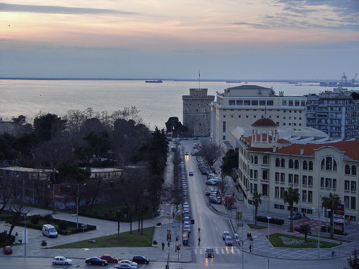
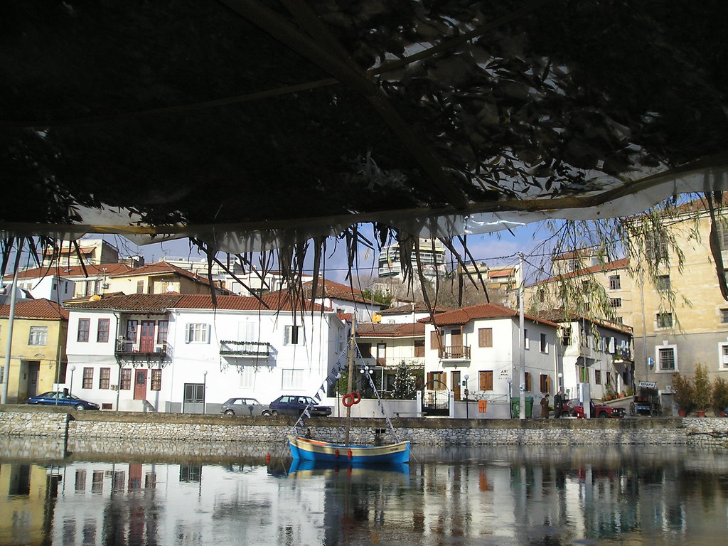
Drama is a town and municipality in northeastern Greece. Drama is the capital of the prefecture of Drama which is part of the East Macedonia and Thrace periphery. The town (pop. 42,501 in 2001) is the economic center of the municipality (pop. 55,632), which in turn comprises 53.5 percent of the prefecture's population, the highest percentage in Greece. The next largest towns in the municipality are Choristí (pop. 2,625), Χiropótamos (2,601), Kalós Agrós (1,216), Kallífytos (1,083), and Koudoúnia (885). The municipality is the 12th-largest in Greece at 488.830 km˛, although it is only the third-largest in Drama Prefecture (following Kato Nevrokopi and Paranesti). Drama Prefecture Drama
(Wikipedia)
DRAMA
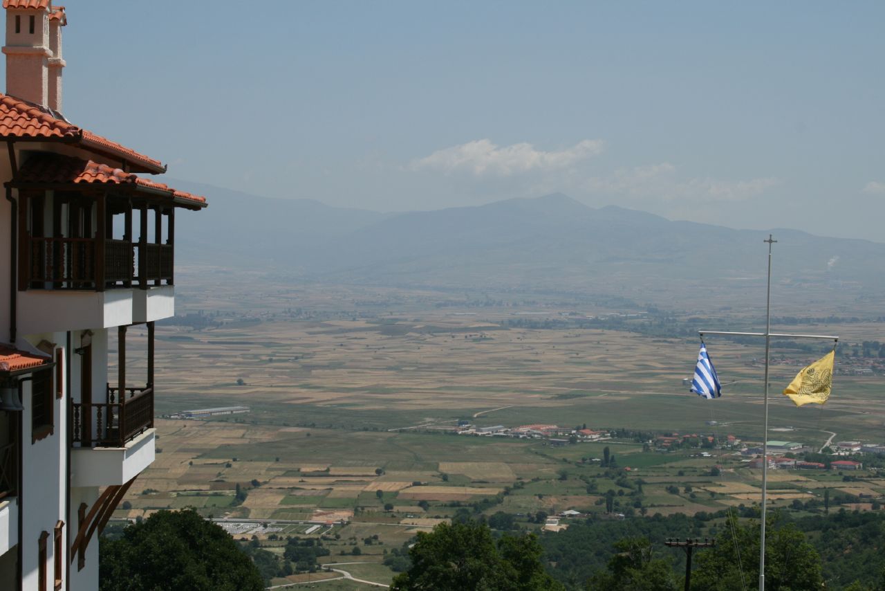
This county is located in the region of Eastern Macedonia and borders Bulgaria on the north, the county of Xanthi on the east, Kavala on the south and Serres on the west. This county is especially dear to those who love mountainous environments and the wildlife and nature located there.
Drama offers beautiful valleys and mountains, mountain refuges and ski centres, majestic forests and flocks of birds. It is a fertile land with huge tobacco crops stretching in every direction. Furthermore, there are caves with multi-coloured stalactites and rivers with crystal clear water just waiting to be discovered.
On your journey through this county you will encounter many Byzantine churches, which testify to the importance of this area in the Byzantine era. This region also witnessed a boom during the Classical era.
Serres, Macedonia Central SERRES It is in the region of Eastern Macedonia and stretches from the Strymoniko Gulf in the south up to the Greek-Bulgarian border in the north. It also borders the counties of Drama and Kavala on the east and Thessaloniki and Kilkis on the west. Even though the county of Serres isn't renowned for tourism, it has made good use in recent years of its resources, its natural environment in particular, and this admirable initiative has succeeded in offering visitors the facilities required for a most comfortable stay.
The mountains are the most prominent aspect of the natural environment in this area. They are snow-capped in Winter and covered in rich green vegetation during the summer.
Other attractions include the aquatic areas such as Lake Kerkini, the cave of Alistrati, the gorge of Angiti, the Nigrita thermal springs and the ancient town of Amfipoli.
These attractions combined with the natural environment of the area allure the visitor who is looking for something out of the ordinary.
The town of Kilkis is the capital of the prefecture of the same name. Agios Georgios (St.George) Hill dominates the town, which is spread out at its feet. The post-Byzantine church of St.George graces its summit; built in 1832, known for its rare frescoes. At the foot of the hill of St.George there is a two-floor cave (spelaeo), which is amongst the 17 more important caves in Greece and internationally. It covers over 1000m. It is beautifully decorated with stalagmites and stalactites, and it has healing qualities (spelaeotherapy).On the hill there is also a tourist pavilion, an amphitheatre, a heroes' monument, and a war museum dedicated to the battle of Kilkis (1913). Picturesque Goumenissa, located 50km from Kilkis, built on the slopes of Mount Paiko, has quaint, narrow alleyways and charming old traditional houses. A tasty wine and strong spirits (tsipouro) are local specialties. Just 6 kilometres southwest of Goumenissa is the village and the important archaeological site of Europos. The exhibits at the Archaeological Museum of Kilkis (Nomarchia) include a rare archaic sculptures (kouros) and findings, which date from the Neolithic era to the Roman times. At the village of Palio Gynekokastro, the ruins of an impressive Byzantine fort are worthwhile visiting. In the northern part of the prefecture is located the Lake Doiran and River Axios, with a rich natural environment and waters suitable for swimming. There is a marina for fishing boats and yachts. In Doirani village taverns offer a rich variety of delicacies fished from the lake. The splendidly situated Chilia Dendra, 4km from Doirani village is ideal for holidays. The west region of the prefecture is Mount Paiko (1500m above sea level). The ascent of Mount Paiko offers scenic views, thickly wooded slopes, streams and picturesque small villages. On the border of the Kilkis and Thessaloniki prefectures is located the Lake Pikrolimni, one of the most important therapeutic lakes of Greece with a fully organized clay therapy centre situated on its shore. Finally, at Kolchis parish, one can see ruined tombs from the 4th century AD and an Early Christian settlement (6th century).
*
How to get there: From Athens and Salonika by bus (KTEL) and train (OSE).
From abroad via border stations at Evzoni and Doirani (by car) or Idomeni (by train).
At Doirani there is a customs office, tourist information office and foreign exchange facilities of the National Bank of Greece. The Two-Stored Cave on the hill of Ai-Giorgis was discovered accidentally by alumberman. It covers an area of more than 1000 m2 and boasts an impressive decoration of stalactites and stalagmites. Kilkis lies in Central Macedonia; it has a population of some 82,000 residents.
The gateway to Northern Greece, it has two road border stations linking the country with Europe (Evzoni and Doirani) and one rail entry-exit point (Eidomeni).
It shares borders to the north with Yugoslavia, to the east with Serres Prefecture, to the south with Thessaloniki Prefecture, and to the west with Pella Prefecture.
The plain of Kilkis, which is part of the Central Macedonian plain, is limited to the west by Mt. Paikos, to the northeast by the Kerkini (Belles) mountains and to the east by Mt. Krousia.
The Axios river runs through the western section of the district, the Gallikos, the gold-bearing Exedoros river of antiquity, the southwest portion.
The region also boasts two lakes: Doirani on the Greek-Yugoslav border and Pikrolimni where Thessaloniki and Kilkis prefectures meet.
Large expanses of the region are covered by forests of willows, oaks and pines, as well as rarer species of plants and flowers. The climate is continental with cold winters and hot summers. The economy is based primarily on agriculture, the most important corps being grains - wheat and maize, and to a lesser extent barley and rye.
Fields of sunflowers, cotton, tobacco and clover are also common. The areas of Goumenissa and Mouries are notable for their garden vegetables, fruit (especially apples and peaches), almonds, hazelnuts and grapes. The wines of Goumenissa are of the highest quality and bear the label "d’ origine controlée".
This text (extract) is cited October 2003 from the Greek National Tourist Organization tourist pamphlet (1992).
www.showcaves.gr/default.asp?V_DOC_ID=2023
. The cave, located on the Hill of Agios Georgios, constitutes the most important touristic site of the city. It was discovered by chance in about 1925. In 1960, the president of the Hellenic Speleological Society, Miss Anna Petrochilos, made its first mapping. The works for its exploitation started in 1977 and the cave opened for the public in 1986.It has an unusually original form, as far as Greek caves are concerned, since it has a formation system of crevices, which in parallel and vertical directions, are perpendicularly opened. There are high ceilings and mazy narrow corridors. It has six spacious chambers while on the walls, the floors and the ceilings there are calcareous ornaments and unique stone corals. Inside the cave, more than 300 samples of fossilized animal bones were found in a very good maintenance condition and studied by paleontologists.
According to a research of Czech doctors in 1988 the climate in the cave presents therapeutical qualities for the child bronchial asthma. Agios Georgios cave is destined for the development of speleotherapy for the first time in Greece. Caves in Greece - Ancient Greece, map of Greece, Athens Greece ...
))))))))))))))))))))))))))))))))))))))))))))))) Kilkis Kilkis. The prefecture of Kilkis is located in central Macedonia, between the prefectures of Thessaloniki, Serres and Pella and borders on the north with FYROM. The city of Kilkis is the capital of the prefecture and is located 49 kilometers from Thessaloniki. This city is built around the hill of Agios Georgios on the top of which you can find the psot-Byzantine church of Agios Georgios. The most important places to visit in the region are first of all the cave of Kilkis, the monument of the 3-day battle, the picturesque villages, the Doirani lake with its rich natural environment and several museums. Places of interest in Macedonia (the 13 prefectures) Thessaloniki, Halkidiki (Chalkidiki), Kavala, Drama, Serres, Kilkis, Pella, Imathia, Pieria, Florina, Kozani, Grevena and Kastoria. Places of Interest in Kilkis The monastery of Panagia Goumenissa: This monastery is a dependency of the Iviron Monastery of Mount Athos with a miracle-working icon of the Virgin. The archaeological museum of Kilkis town: It exhibits rare findings dating back to prehistoric, Hellenistic, Roman and Byzantine times. The hill of Agios Georgios: here you can also see an amphitheatre, a municipal refreshment room, sports and walking grounds as well as a famous cave and the church of Agios Georgios The Byzanntine castle of Paleo Gynaikokastro: this castle was built during the 13th century by the Emperor Andronikos Paleologos. Gynaikokastro means "women's castle" and was so named because of its fortification which was so secure, it could even be defended by women. Natural landscapes: There are many beautiful natural landscapes that tourists can admire, such as Doirani Lake, Pikrolimni lake, the Axios River, the massifs of the Paiko, and Kroussia Mountains, the natural waterfalls of Skra, Metalio Lake in Axioupoli and the cave of Kilkis )))))))))))))))))))))))))))))))))))))))
Thassos is a green greek island in the Aegean Sea and it is farfamed for its clean beaches, its hospitality, its tasty vine and the magnificent honey. The history of Thassos is lasting back into the antiquity. At that time, Thassos was famous for its goldmines and marble. Until today, you can see much archaeological treasures, which will make your journey to something special. Also the giant marble factories, which are exporting the marble in the whole world, will amaze you. At the Thassos-Island-Website you will get every information that might be useful for spending a good time at Thassos. We wish you much fun with our Website! .
The Nightlife
After a relaxing day lying on the soft sand near the crystalline sea, it is possible to go in one of the many taverns or restaurants of Thassos for an excellent meal. Then, the choice has to be made among the many lively bars of the island to enjoy a drink. At last, the various clubs are here for finishing the night with loud music, dance and drinks. Read more
The beaches of Thassos
The coastline of Thassos is embellished by the numerous sandy and pebble beaches and by the romantic, small coves of the island. Thassos is known in Greece for the extreme beauty of the beaches. It is due to their soft golden sand, to their crystalline waters and to the verdant trees which are boarding them. Everyone who set foot on Thassos will be amazed by its beaches. Read mor
Villages
The attractive island of Thassos is charming everyone with its beautiful mountainous villages. They are very picturesque and unspoiled by mass tourism. The traditional architecture of the island in Greece can be seen in those villages as well as the local atmosphere. The capital of the island, Limenas, is an attractive place with interesting archaeological sites. Thassos also has some charming coastal villages and a few busy touristy resorts. Read mor Thassos Greece: Travel guide to Thassos Island, Eastern Aegean
"Thassos ahora es una destinación turística hermosa, con el acceso fácil de Kavala o de Keramoti al lado de hydrofoil o balsea el barco, con los caminos excelentes y las amenidades magníficas para todos los visitantes..." destinación para el recorrido: Isla De Thassos
Florina, Macedonia Occidental Macedonia occidental West Macedonia - Wikipedia, the free encyclopedia The prefecture of Florina is situated in the northwestern part of Macedonia. The whole area is covered in green with a fantastic mountain scenery completed by the two Lakes of Presma, (the Great and the Small). In Mikri Presma, (Small), the visitor can find the isle of Agios Achileos with a gorgeous view of the region. Florina is an ideal all-season holiday destination with picturesque villages and unique sites. The prefecture offers to the visitor all kinds of facilities, including hotels, guesthouses, tavernas and cafeterias. .
Florina Canton (named after its principal town, Flórina) is the northern most part of Makedonía, bordering on the republic of FYROM and containing the northern parts of the Vernon mountain and many lakes. Mountainous in terrain, it is a great place to visit both in the winter and the summer.
In ancient times, the area was inhabited by the "Ligistés", a dynasty born by Vromerós, part of which family was Euridipi, the mother of Philip the 2nd. The family was closely knit, judging by the fact that even the murderers if King Philip 2nd, were Liggistés. The area gave birth to fanous warriors such as Pérdikas, two Generals of Alexander the Great, Leonátos and Krateró. The Romans took over the area subsequently only to be succeeded by the Byzantians. In the 20th century, Flórina was liberated in 1912 and became part of modern Greece.
Transport There are daily buses both from Athens (10 hours) and Thesaloniki (4 hours) as well as trains that terminate in Flárina. Local transport includes buses to Edessa, Kozáni and Kastoriá.
Things to do, in the winter include hiking to the nearest refuge on Mount Vernon, at an altitude of 1650 meters (5000 feet), which can take 70 people. Skiing is also possible and there are two ski lifts in operation. In the summer hiking and discovering the town are highlights as are trips to nearby towns and villages, especially Niki at the border. FLORINA. The Zoo is a major sight which includes Lions, and Tigers as well as Mediterranean bears, the Modern Art Museum, the Museum of Florina Painters and the Archaeological Museum to name a few.
NIKI This border town conbtains a beautiful Ksenóna (Pension), designed and built in a specific way typical of the area. In addition there is a small folk museum well worth visiting.
FLORINA It is located in the region known as Western Macedonia and borders F.Y.R.O.M. on the north, Albania on the west, the counties of Kastoria and Kozani on the south and Pella on the east. The population of the county is roughly 50,000 people. View and book hotels in FLORINA. Click here. The natural environment of the county is a combination of mountains, plains and lakes. It is especially well known for its lakes and Great Prespas, Small Prespas, Vergoritida and Petron are but a few of the lakes located there. The winters in this area are especially cold and there is a winter resort in Pisoderi. The temperature often falls below zero here in the coldest months. During the summer, visitors can sun themselves on the banks of the lakes Small Prespas and Vergoritida, which have been especially formed to act as beaches to cater for tourists. The natural environment which is rich in vegetation, the beautiful scenery and the lakes in particular all attract visitors to the area both summer and winter. Furthermore, one of the three officially recognised mineral water springs is located in this county, the spring of Xino Nero (literally translated as Sour Water). Apart from bottling water, another major industry of the area is that of producing fruit juice. The county of Florina took part in the Macedonian Struggle and wasn't liberated until 1912. Just one day at the Prespas lakes combines the majestic lakes with a National Park and visitors are able to do a whole manner of things including visiting historical monuments, traditional dwellings, going swimming and walking through lovely scenery. It also offers you the chance to walk through a beautiful cypress forest. The Prespas National Park covers 250 sq km, 50 of which form the nucleus of the park, the most protected zone. The village of Nymphaios is located on the slopes of Mount Vitsios. Its folk museum, renowned mansions with murals on the exterior walls and attractive guest houses all make it worth a visit.
Home page
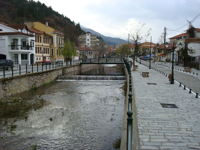
- Macedonia -Florina Florina Town The capital town of Florina lies in the central part of the homonymous region. It is the gateway to the Prespa Lakes, (the Great and the Small), surrounded by the mountains of Vernos and Varnous. More precisely, it is situated on a hillside covered in chestnut trees. With a population of approximately 16,700 inhabitants, it is a significant market town with an economy dominated mainly by agriculture and tourism. Florina is, also, known, for its locally made leather handicrafts.
Many are the houses representing specific periods and architectural styles, with the interior decoration consisting of carved wooden ceilings and cupboards.
The visitor may find in the town all kinds of facilities, including hotels, cafeterias, restaurants and commercial shops.
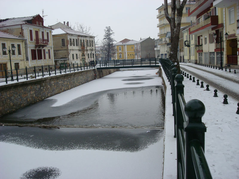
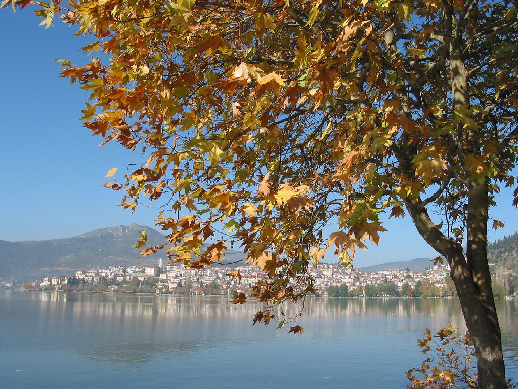
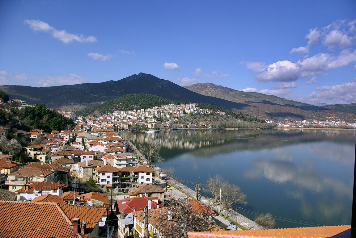
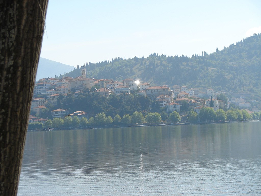
www.filoxeniakastoria.gr/en/kastoria.htm The city of Kastoria is built on a peninsula that penetrates Orestiada lake and unfolds amphitheatrically 620m above sea level. There are findings showing that the region has been inhabited even since the Neolithic era. Today, Kastoria is a modern city which maintained in a great extent its traditional Character and its Byzantine Monuments.
Orestiada lake is considered morphologically the most beautiful lake of Greece and has been announced as “ Monument of natural beauty” by the Ministry of Culture of Greece.
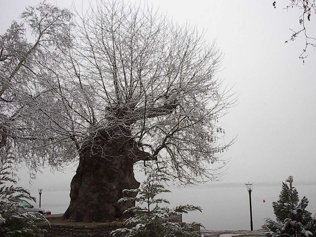
It preserves a rich bird fauna about 200 spieces. At the lakeshore there are enough square and parks,where visitors can walk on the stone pavements and admire the natural beauty.
A number of caves have been discovered where the mountains meet the lake sides.
Inside of The Dragon Cave have been found 7 underground lakes, halls and corridors-tunnels. Sightseeing
Kastoria is a city in northern Greece in the periphery of West Macedonia. It is the capital of Kastoria Prefecture, located at 40°31′00″ N 21°16′00″ E . The town's population is estimated as some 20,660 people (1991 census). It is situated on a promontory on the western shore of Lake Orestiada, in a valley surrounded by limestone mountains. The town is known for its many Byzantine churches, Ottoman-period domestic
Kastoria a city located 552kms NW from Athens and 210 kms W from Thessaloniki. Kastoria is also connected with Athens by air, through the “Aristotle” International Airport at Argos Orestikon. It has a population of 20.636 (2006).
ECONOMY. Kastoria is renowned for its fur trade, which dominates the local economy. Indeed (as mentioned above) the town was possibly named after one of the former staples of the trade – the European beaver (kastóri in Greek), now extinct in the area. Trading in mink fur now predominates and every year an international showcase of fur takes place in the city. Other industries include the sale and distribution of locally grown produce, particularly wheat, apples, wine and fish. Recently a large shopping center has been built in the city of Kastoria. The town's airport is named Aristotelis Airport.
LANDMARKS. Kastoria is an important religious centre for the Greek Orthodox Churchmetropolitan bishop. It originally had 72 Byzantine and medieval churches, of which 54 have survived. Some of these have been restored and provide useful insight into trends in Late Byzantine styles of architecture and fresco painting. The Museum of Byzantine History located on Dexamenis Square houses many examples of Byzantine iconography. and is the seat of a
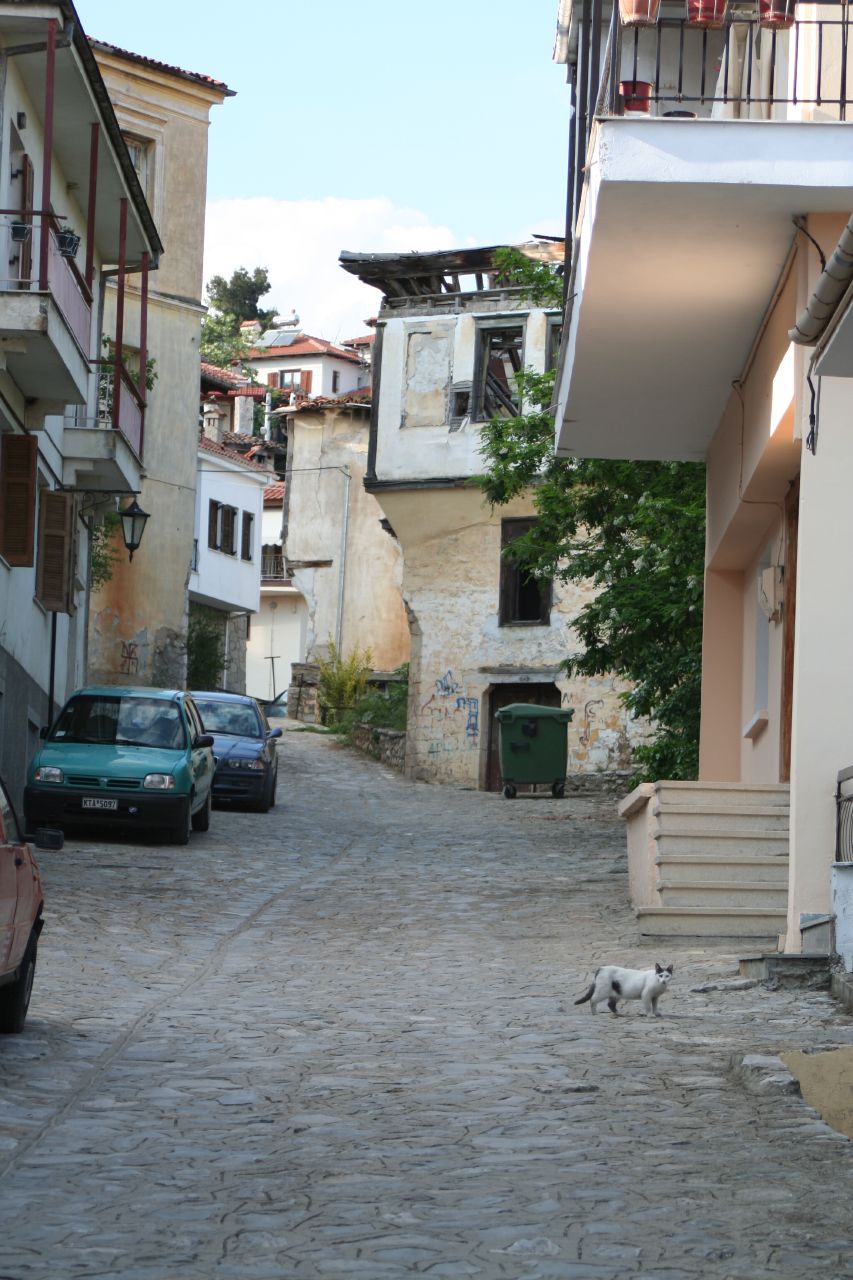
Set on a hilly, wooded peninsula extending deep into a slate-coloured lake, KASTORIÁkastóri in Greek) of the name had been trapped to extinction by the nineteenth century, Kastoriá still supports a considerable industry of furriers who make up coats, gloves and other items from fur scraps imported from Canada and Scandinavia and, increasingly, from the pelts of locally farmed beavers. Animal-rights activists will find the place heavy going as the industry is well-nigh ubiquitous: you'll see scraps drying on racks, and megastores line all the approach highways, pitched at Russian mafiosi buying mink coats for their womenfolk, to judge from the profuse Cyrillic signposting. is one of the most interesting and attractive towns of mainland Greece. It's also wealthy by Greek standards and has been so for centuries as the centre of southeast Europe's fur trade; although the local beavers ( For most visitors, however, Kastoriá's main appeal lies in traces of its former prosperity: dozens of splendid arhondiká – mansions of the old fur families – dating from the seventeenth to nineteenth centuries, plus some fifty Byzantine and medieval churches, though only a handful is visitable and of compelling interest. About the only reminder of Muslim settlement is the minaretless Kursun Tzami marooned in a ridgetop car park; there's also a patch of an originally Byzantine-fortification wall down on the neck of the peninsula. Kastoriá suffered heavy damage during both World War II and the civil war which followed it. Platía Van Fleet, by the lakeside at the neck of the promontory, commemorates the US general who supervised the Greek Nationalist Army's operations against the Communist Democratic Army in the final campaigns of 1948–49. The town was nearly captured by the Communists in 1948, and Mount Vítsi (2128m), the mountain dominating the northeastern shore of the lake, was, together with Mount Grámmos (2520m) to the west, the scene of their last stand in August 1949. However, most of the destruction of Kastoriá's architectural heritage is not due so much to 1940s munitions as to 1950s neglect, 1960s development and 1970s "renovation". It is miraculous that so many isolated specimens of Balkan vernacular and Neoclassical townhouses survive, mostly higher up on the peninsula where the steep grades have frustrated cement mixers. The town has a strong tradition of rowing, and rowers can be seen out daily on the lake opposite Odhós Megálou Alexándhrou. Even the Oxford and Cambridge Blues have been known to practise their strokes here. The less energetic might prefer to take one of the regular boat trips on the lake during the spring and summer months; they leave from the jetty near the fish market on the northern side of town (tel 04670/61 758 or 74 289; noon and 6pm; €3).(yahoo.com)
Water Skiing
... in the Peloponnese, where the 1997 European Championships were organised, while lakes such as Pamvotida in Ioannina, Stratos near Agrinio, and Kastoria in Western Macedonia are home to water-ski races. Water-ski events : The Senior World Championship takes place every year in the Ververonta lagoon...
Hiking – Mountaineering – Climbing
... of the European long-distance path E4 has two parts: the first has its starting point in the Prespes area and reaches the town of Igoumenitsa via Kastoria-Ioannina-Dodoni; the second part begins in Florina, crosses the mountainous regions of western, central and eastern Macedonia (along Greece's...
Preserved natural monuments
... Messinia The mixed forest of Promahon-Lykostomou Aridaias (Pella) The natural cypress forest in Ebona, Rhodes The mixed forest of Grammos (Kastoria) The cypress of Prassia, Evritania
Churches - Monasteries
The churches, places intended to meet the needs of Christian worship, are a characteristic and inextricable element of the Greek landscape. From the austere,...
Carnival in Western Macedonia
... here, is the "Langotsaria", according to which groups of people put on disguise light fires and dance.Municipality of Grevena: Tel.: 24620 22402 KASTORIA The Rangoutsaria of Kastoria is a ritual which goes back to pagan times. Groups of people, old and young, wearing fancy dresses and playing folk...
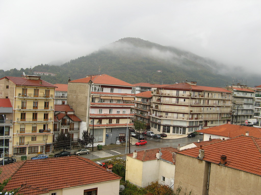
Kozani es la capital de la prefectura homónima, la mayor de la región de Macedonia occidental en el norte de Grecia. Está emplazada entre las montańas de Bermio, Burino y Pieria, y distante unos 15 km del lago Polyfytos, que está a 710 metros sobre el nivel del mar. Se ubica asimismo a una distancia de 120 km de Tesalónica y a 470 km de Atenas. Su población es de 50.000 habitantes. Coordenadas: 40°18′00″ N 21°47′00″ E Describen a esta ciudad con palabras como "bomnita", alpina", divertida" y otras muchas palabras positivas.
Kozani is the home of the Technological Educational Institute of West Macedonia and the department of Energy Management of the University of West Macedonia, with about 10,000 students from all over Greece and other places.
.
Kozani prefecture is located in Western Macedonia and borders the counties of Pella and Florinaon the north, Imathia and Pieria on the east, Larissa on the southeast, Kastoria on the west and Grevena on the south.
The county of Kozani is situated on the crossroads between the regions of Macedonia, Epirus and Thessaly. It is best known for the role it plays in supplying electricity to the rest of Greece. Kozani is the sole place in Greece where saffron is grown as a crop and the fruit grown here is of excellent quality, mostly peaches and apples. The area is also famed for its dairy produce and fine wines.
All of the above have brought prestige to the area both from within Greece and the Balkans.
Many findings from prehistoric, ancient and Byzantine times show that this county has a rich and interesting history. Previous user photo.........................Next user photo
www.panoramio.com/photo/1500834 Destacan varias iglesias, así como algunas mansiones seńoriales del siglo XIX y su máxima atracción, el reloj de Santo Nikolaos. De los edificios distingue el pasillo de ciudad, el museo del folklore, el templo metropolitano de Santo Nikolaos y las mansiones de G. Lasani y G. Vurka. Durante la semana del carnaval la ciudad vive al ritmo del mismo. La Biblioteca Municipal Kovedarios, en Kozani, es la segunda más grande de Grecia y alberga 70.000 libros, 388 manuscritos y 315 códigos. Museos Museo Arqueológico de Kozani
Museo del Folclore
Museo del historia local
Los mansiones de G. Vourkas y G. Lassanis ))))))))))))))
La región de Kozani es renombrada para la producción del griego macedonio azafrán (Krokos Kozanis)
Economía y recursos naturales
Sus principales productos agrícolas son cereales, judías, almendras, manzanas, frutos secos y castańas. Son importantes las producciones de carne de vaca, cordero, mantequilla, queso y cuero. En esta tierra es abundante el lignito,así como el oro y el mármol. La planta eléctrica de Ptolemaida produce la mayoría de la electricidad de Grecia. La tradicional industria de la piel y su exportación es una gran fuente de ingresos para sus habitantes.
Historia Se han hallado restos arqueológicos de hace 300.000 ańos en Paleokastro un pueblo cercano a la ciudad de Kozani. Pueden visitarse los restos arqueológicos de Aiane y de Sissanion y los museos arqueológicos de Aiane y de Kozani. Paleokastro es un pueblo de la provincia de Kozani, uno de los más antiguos esta, controlado por el ayuntamiento de Siatista. La población es muy pequeńa, apenas 400 habitantes residuen hoy en día, ya que los jóvenes paleokastrinos se van a vivir a la ciudad (Kozani o Siatista).
El puente (1352 m.) sobre el lago artificial del río Aliakmnonas en la Prefectura de Kozani.
Kozani es una prefectura de Grecia. Tiene una superficie de 3.516 Km2. En el Monte Bermio se hala la Cueva de Skoteino , con bellas estalactitas y estalagmitas. Territorio muy montańoso, cuya máxima altitud es el Monte Askio de 2.111 m. Sólo tiene dos pequeńos valles, los de Kozani y Ptolemaida, y está regada por el gran río Aliakmonas, cuyas aguas desembocan en el lago artificial de Polyfytos.
Capital:Grevena Grevena Map | Greece Google Satellite Maps
Coordenadas: 40° 5′ 0″ N, 21° 25′ 0″ E Overview:
Grevena is a mostly mountainous region surrounded by the Pindus and the Hassia range. It is described by beautiful natural surroundings, rivers and lakes with wildlife and rare species of flora and fauna, as well as ancient stone bridges and other sites that go deep in history comprise an ideal holiday destination for piece and quiet in nature. The visitor has also the opportunity to participate in activities in nature or in local events throughout the year.
***The Portitsa Bridge, down the Kanavia valley, built to enable the cross of Venetikos river
***The masonry arch "Bridge of Spanos"
***The Great Virgin Mary Church
***The Knide Neolithic settlement
***The Monastery of the Assumption in Spileo village and the Monastery of Zavorda on the summit of Kalistrato mountain
Places to visit:
***Deskati, the second largest city in the prefecture, at an altitude of 860m
***The Flegga Lakes, at 1,950m altitude
***The Pindus Mountains
***The Pindus National Park at Valia Kalda, with its Brown Bear
***Vassilitsa Ski Resort
***The region of Vlachochoria (=Vlach villages)
Special Events:
On New Year's Eve the custom of "Regoutsaria" takes place in Agios Georgios, on Good Friday a religious procession at Zavorda Monastery, on Thursday after Easter monk auctions and holy icons' litany in Spileo village. Other customs include the "Kleidonas" celebration on mountain villages and the Wine Festivals in Trikormo late August.
Grevena is a town and municipality in Greece, capital of the Grevena Prefecture. The towns's current population is 10,177 citizens; it lies about 400 km from Athens and about 180 km from Thessaloniki. The municipality's population is 15,481. Population density was the smallest of the region until the 1990s, while Grevena has been linked with the Via Egnatia since the early-2000s, now connecting Igoumenitsa with the Evros of Alexandroupoli at the border with Turkey. Its mountains surround the municipality, which is situated by the river Greveniotikos which flows into the Aliakmon. Other significant towns in the municipality are Amygdaliés and Méga Seiríni.
History The earthquake that occurred in the region on 13 May, 1995 with an intensity of 6.6 R
Another earthquake on Monday 5 January, 2005 measured 4.9 R, near Grevena. It took place at 18:00 (UTC), 20:00 local time (EET), and no damage was reported. Another earthquake with a measured intensity of 5.4 R occurred on Thursday 17 July, 2007, 19:23 (UTC), 21:23 local time (EET), followed by weak seismic activity. Some older buildings were lightly damaged in villages northeast of Grevena. caused only material damage. The worst hit area was the county of Ventzia. Luckily there were two warning earthquakes, of lesser intensity, that preceeded the main earthquake a few minutes and warned (scared) people. They sent everybody out of their houses. When the main earthquake came, it destroyed approximately all the houses in several villages of the Ventzia County - the houses collapsed to the ground - but all the inhabitants were outside their houses.
Grevena is a prefecture in Greece. Its capital is the city of Grevena. Much of the prefecture is mountainous. According to the 2001 Greek census, Grevena is the least densely populated and third-least populous prefecture (after Lefkada and Evrytania) in Greece. It was created in 1967 out of the old Grevena-Kozani prefecture in which the capital was Kozani. Grevena has no provinces and borders with the prefectures of Ioannina (Epirus) to the west, Kastoria to the northwest, Kozani to the north and east, Larissa to the southeast and Trikala to the south. The mountains include LygkioChasia to the southwest and the south and Vourinos to the northeast. The longest river is Aliakmon which flows to its east, the central part and the northern part. The region's economy relies on farming and agriculture. Wheat and legume crops (mostly chickpeas) cover most of the cultivated areas. Livestock production (including goat and lamb) is also strong. An increasing portion of the farming output is produced under organic farming or low input practices. Other main sources of income include ecotourism, forestindustry and the ski resort of Vasilitsa, which is a popular destination for winter holidays.
Grevena West Macedonia
While human life in the wider region of the prefecture has been known to exist from ancient years, the exact date that the city of Grevena was founded remains unknown, as well as the course of its development over the passage of centuries. The city had the misfortune, from antiquity on, of being an obligatory passage of both ally and enemy troops from Lower Macedonia and Orestiada to Ipirus and Thessaly .
This caused great ordeals to the residents and as a result, for entire centuries, there is no mention of the city's name anywhere. Grevena is reported for the first time with the name Grivana, by Konstatino Porfyrogennito (905 - 953). In Byzantine manuscripts of the 10th century, the Bishop of Grevena was placed 6th in line of order, from a total of 16 Bishops of the Archdiocese Axridon, which exhibits the areas' social, political and demographic supreme standing.
In the 13th century the Archbishop of Nafpaktos Ioannis Apopaukos, describes the city in his letters of correspondence: "Grevena, a great city, has educated residents and everything that the soul might desire." Between 1600 - 1800, the city has two names, sometimes referred to as "Grevena - Avles" and othertimes as "Grevena - Avles, commonly known as". This explains why some elders said that the city was built higher than the 'Avles', as well as why some historians conclude that the original name of Grevena was Avles.
In 1806 the French researcher Fragkiskos Poukevilk, who found himself in Grevena, writes: "the Greveno was founded by a group of settlers from the castle of Vouhalitsas. This is a city that is found at the banks of the river Venitikos and many believe to be the ancient Europos. FESTIVALS OF GREVENA
"KLIDONA" 24 JUNE The custom of "Klidona" is a custom that varies throughout the prefecture. The women tie flowers in their jewellery with red threat and place them in containers. Singing, they go to the central water fountain and they fill the containers with water, which the unmarried women then use to make bread with. Whosevers' yeast rises first, will be the one who will be married first.
"FESTIVAL OF ST. PARASKEVI" 25, 26, 27 JULY In most villages of the prefecture, this day is celebrated with dance, songs, while traditional foods are served to the residents.
"FESTIVAL OF PROPHET ILIA" 20 JULY This day begins with church services and then a festival follows with traditional dances.
"FEAST OF CHERRY" The feast of cherry is during the month of June.
"DEKAPENTAUGOUSTOS" The events for the Dekapentaugousto (August 15th) differ from village to village and last for days. The festival begins on the eve, with dance and food for all. In most villages there is a re-enactment of a shepherd's wedding and the local residents dress in traditional attire.
"ROGKATSARIA" "Rogkatsaria" is a festival celebrated on January 1st each year. On that day, half of the youth of the villages dress in traditional Greek attire (foustaneles) and the other half in Turkish attire. A battle re-enactment is performed, where the Turks are always taken as prisoners.
" CUSTOM OF FANOY" This custom is celebrated the evening of Carnival Sunday, where old and young persons dance around a big fire, praising the rebirth of nature after winter.
"FEAST OF SAINT SPIRIT" Celebrated each year the day of Saint Spirit in a lot of villages of the province. The women make pies and sweets, that are offered in the churches of the villages.
.The prefecture of Grevena lies in the south west part of Western Macedonia. It is a mountainous area with a rich natural habitat: forests (-Valia Calda, Valia Kirna), rivers (Aliakmon, Venetikos) valleys and flora and fauna abound. Nature intertwines with culture and history, making Grevena an attractive destination for tourists. . Stone bridges, listed monuments and gastronomy
Grevena has a rich cultural and historical heritage with museums (a paleontological museum and archaelogical sites), important religious monuments (churches, monasteries) and the most impressive stoned bridges in all Macedonia. The most noteworthy are declared as listed monuments by the 11th Ephorate of Byzantine Monuments. The region promotes geotourism and has alpine and tourist trails. Mushrooms are an important part of local gastronomy and history. Recreation – no shortage of activities
As a mountainous region, Grevena offers diversity in the recreational activities – hiking and trekking, horse riding, mountain climbing and river sports (kayak and white water rafting). Most of the activities are related to snow and take place in the winter time. Grevena has one of the best ski resorts (Vasilitsa) and the only one with black-pine trees surrounding the ski trails.
The Pindos mountain range forms a natural park with protected areas and reserves, including the Pindos natural park. Treasures such as the Tsourgiakas cave highlight the natural peculiarities of the region. Fauna and flora are particular assets and combine with cultural and archeological sites such as stonebridges, water mills and churches to add value to the region. Systematic paleontological research and excavations take place in the broader area of Grevena where many mammalian fossils have been found. Stone bridges – remnants of the Ottoman Empire
Grevena has many historical bridges, from the times of Ottoman domination. There are 13 stone bridges over the Venetikos River, some of which are considered to be the most important bridges in Greece. Valia Kalda (warm valley) is one of the most important natural reserves in Greece. It is located in Pindos and is well worth a visit. Arkoudorema stream dominates this wild landscape and its waters offer shelter to otters and two kinds of trout. Crevices, high peaks and cliffs alternate in a wild setting which overlooks the small lakes of Flegga. The Orliakas gorge and the Tsourgiakas cave are two uncommon limestone formations which give shelter to many birds.
Traditional villages
The village of Deskati has a traditional style, with many churches and monasteries that are worth visiting. The village of Trikomo, on the eastern slopes of the Pindos mountains among the hills, is famous for its many vineyards, its strong Tsipouro (traditional spirit) and its ample fine wine.
Other villages worth visiting are Krania, with deep shaded forests, Vlachochoria which lies lost inside the forests, pastures and fresh waters, Samarina which just like the rest of the mountain villages is inhabited in the summer. Lavdas, Panorama and Polineri can be found by following the forest road from Abdella where there is a magnificent view of Orliakas and Vasilitsa. Carnival celebrations – revisiting the past. Carnival celebrations – revisiting the past
During carnival celebrations lots of customs and traditional events take place in the region attracting many visitors. The themes for the festivals are drawn from the experiences of locals, their social life and the history of the area. Locals and visitors are entertained on a cultural route that includes photographs, music and songs – all of which offer a true sense of a genuine Grevena feast.
The region organises a themed street festival called Anakatosaria which is comprised of traditional dance and song.
Every year, Deskati celebrates Easter Pasxalogiorta. Inhabitants revive the local custom of Andromana of saying goodbye to this great Orthodox feast by organising a traditional festival that attracts many visitors. The youngest people perform the Andromana local dance which is unique in Greece. Standing on each other’s shoulders, the dancers form three rows consisting of six, five and three persons respectively. Getting a taste for local cuisine
Local cuisine includes exquisite dishes made from mushrooms, meats, cheeses and organic products. Home made products like marmalades, sweets and candies, and local spirits like Tsipouro are famous throughout the region.
One way of presenting and promoting Grevena’s specific products, especially local and organic products, is the mushroom feast organised in the summer. A mushroom society has also been set up and informs the public about the mushrooms in the area and how to cook them. ))))))))))))))))))))))))))))))))))))))))))
The prefecture of Grevena, with a total area of 2,291 sq. km., has a population of approximately 38,000 inhabitants. The capital town is that of the homonymous name, while most of the area is mountainous, covered in trees. Grevena borders with the prefectures of Ioannina, Kastoria, Kozani, Larissa and Trikala. The longest river is that of Aliakmon.
The prefecture of Grevena is considered as being one of the most beautiful wintry destinations in Greece, with several picturesque villages and natural sites, such as the forest of Valia-Kalda- the jewel of the province. For the lovers of sports, there is the opportunity of enjoying skiing and river fishing.
All over the area, the visitor may come across a great number of imposing stone-arcaded bridges. The prefecture of Grevena, with a total area of 2,291 sq. km., has a population of approximately 38,000 inhabitants. The capital town is that of the homonymous name, while most of the area is mountainous, covered in trees. Grevena borders with the prefectures of Ioannina, Kastoria, Kozani, Larissa and Trikala. The longest river is that of Aliakmon.
The prefecture of Grevena is considered as being one of the most beautiful wintry destinations in Greece, with several picturesque villages and natural sites, such as the forest of Valia-Kalda- the jewel of the province. For the lovers of sports, there is the opportunity of enjoying skiing and river fishing. All over the area, the visitor may come across a great number of imposing stone-arcaded bridges.


 .
.


 .
.


 DRAMA
DRAMA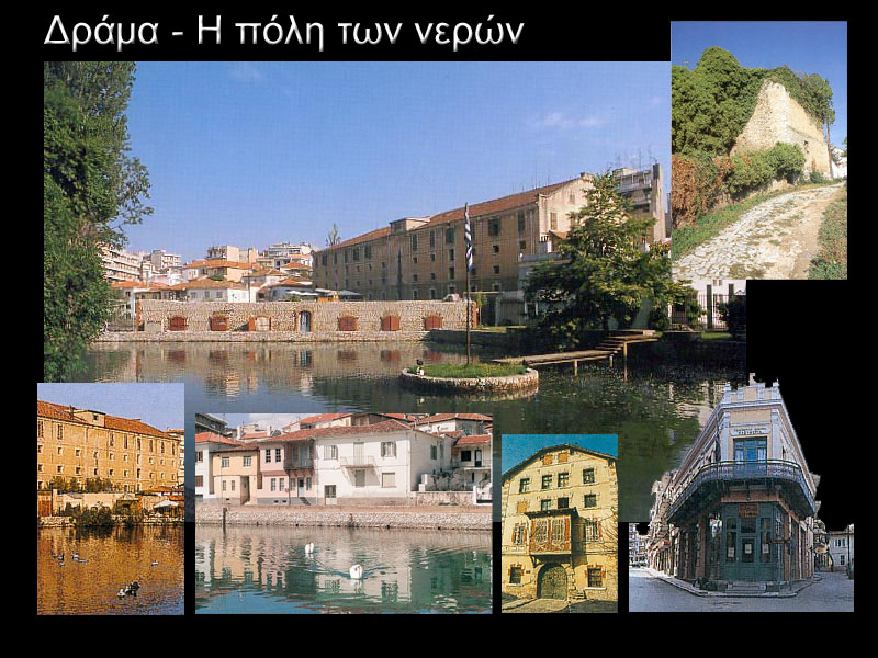


 Ancient sites within the Prefecture:


 .
.
Comentario