Si esta es tu primera visita, asegúrate de echarle un vistazo a la AYUDA haciendo click en el enlace. Es posible que tengas que registrarte antes de nada. Haz click en la palabra "registrate" para iniciar el proceso de registro. Para empezar a leer mensajes, selecciona el foro que quieres leer de la lista de abajo.
Lee todas las normas del foro antes de publicar cualquier mensaje, estas han sido creadas pretendiendo ir en concordancia con el sentido común, el orden y la cordialidad. Cualquier miembro del foro ACEPTA todas las condiciones del mismo antes de publicar. En caso de incumplir alguna de las normas aquí expuestas, los moderadores o el Administrador podrán borrar, editar o cerrar el mensaje en cuestión sin previo aviso. Si necesitas que el Administrador o los moderadores te resuelvan alguna duda ponte en contacto con ellos haciéndoles llegar un mensaje privado.
Los moderadores están para cuidar del cumplimiento de las normas del foro. Realizan este trabajo sin ningún tipo de compensación para el bien de todos. Tenedlo en cuenta.
El Administrador se reserva el derecho de modificar, suprimir o ampliar estas normas si lo ve conveniente, previa publicación de las mismas.
Aún cuando el Administrador y moderadores de este foro harán todo lo posible por mover cualquier material cuestionable tan pronto como sea posible, es imposible revisar todos los mensajes. Por lo tanto tu aceptas que todos los mensajes por ti publicados en este foro, expresan tus opiniones y no la del Administrador, moderadores o webmaster (excepto en mensajes publicados por ellos mismos) por lo cual no se les considerara responsables.
Normas de comportamiento y de carácter legal
1.- Presta atención a las buenas maneras en el foro, este fue creado para intercambiar opiniones y experiencias, recuerda que detrás de cada Nick hay una persona con la que estás dialogando. Los insultos, tanto directos como indirectos, a cualquier miembro del foro (ya sea usuario, Administrador o moderador) no serán tolerados. Se pide con ello respeto y educación, tanto en el trato como en las formas hacia todos los usuarios. Se editara o borrara el hilo donde esto no sea cumplido y, se pedirá a los implicados que solucionen sus diferencias por privado. En caso que se estimen, por la gravedad e insistencia, el administrador podrá bannear al usuario.
2.- Se evitará cualquier manifestación, mediante texto, hipervínculos o imágenes, que atenten contra las leyes vigentes o, incite directa o indirectamente, a la promoción de actividades ilegales.
3.- No está permitido realizar SPAM en el foro, salvo si el Administrador o los moderadores lo consideran de especial interés/actualidad.
4.- Los moderadores, están aquí para mantener el correcto funcionamiento del foro. Si un mensaje tuyo o de otro usuario es borrado, editado, movido o cerrado no abras otro, tampoco para pedir explicaciones. Se borrarán automáticamente los mensajes o hilos abiertos por este motivo. No se moderan mensajes sin ninguna razón, la explicación está en estas normas. No se permitirá el cuestionamiento público de estas normas. Si alguien tiene algún problema o sugerencia al respecto, se enviará un Mensaje Privado a un moderador o un correo electrónico al Administrador. Con gusto les responderán con los motivos del borrado, edición, traslado o cierre del mensaje. No contestarán a dudas de este tipo por otro medio que no sea ese.
5.- Por favor, utiliza los MP (Mensajes Privados) para temas personales. Evita mensajes del tipo “Para xxxx”. Recuerda que un mensaje privado es PRIVADO, y no puede ser expuesto en público sin el consentimiento del autor del mismo.
6.- En caso de incumplimiento reiterado de las normas se procederá a un baneo y pérdida de nick al usuario en cuestión. Todo mensaje queda registrado con tu IP y cada persona es responsable de sus palabras. Esto no obsta a la edición o borrado de los mensajes que no cumplan las normas descritas en esta página
7.- Para evitar agravios comparativos con las empresas colaboradoras, queda prohibido hacer publicidad de ningún tipo (Autocaravanas, piezas, talleres, recambios, servicios...) con fines lucrativos, sea nuestro o no dicho negocio, incluido en el nombre de usuario y en la firma (incluya hipervínculo o no). De esta manera los que soportan la colaboración mediante banners publicitarios no tienen competencia desleal.
8.- Está prohibida la doble personalidad, una persona solo podrá usar un nick para participar en este foro. Los nick dobles serán suspendidos sin necesidad de previo aviso. El usuario que tenga más de un nick será sancionado en consecuencia y/o expulsado temporal o permanentemente.
Normas de educación y cortesía
1.- Trata a los demás como te gustaría ser tratado. Participa siempre con educación. Las faltas de respeto repetidas pueden ser causa de expulsión del foro
2.- Piensa antes de escribir y evita frases que puedan resultar ofensivas desde los puntos de vista de religión, raza, política u orientación sexual. Recuerda que internet es global y diferentes culturas tienen diferentes costumbres.
3.- Procura dar tus opiniones con moderación. La firmeza que muestres en darlas no debe implicar un desprecio hacia los demás. Evita los enfrentamientos personales, siempre hay una forma de expresar tu criterio sin molestar a los que puedan tener otra opinión. Ayuda a que no se perpetúen guerras de mensajes incendiarios y recuerda que los insultos o ataques personales están prohibidos. Tampoco está permitido participar en discusiones simulando la opinión de personas distintas (astroturfing) ni abusar del sistema llenando de respuestas los temas tratados acaparando la conversación.
4.- Ten en cuenta que en el lenguaje escrito es difícil dar entonación. Los emoticonos están para ayudar a transmitir tu estado de ánimo o entonación.
5.- Ten paciencia, sobre todo con los principiantes y los que comenten algún error, tarde o temprano te puede pasar a ti. Las actitudes recriminadoras suelen ser mal recibidas. Siempre se acepta mejor y se hace más caso a una respuesta expresada correctamente y en tono moderado.
6.- Contra las ofensas o los intentos de provocación la medida más efectiva es la indiferencia.
7.- En este foro se respeta tu intimidad por lo que se te pide que respetes la intimidad de los demás no dando, en ningún caso, datos personales de nadie.
8.- Se respetuoso. Si reproduces información de esta u otras webs, cita la fuente de donde la has sacado y pon el enlace de la misma. No se permitirá cortar y pegar textos, este tipo de aportaciones serán eliminadas automáticamente.
Consejos y normas de publicación de mensajes
1.- Ac Pasión es un foro de ámbito nacional, y por ello el lenguaje usado en el mismo es el castellano.
2.- Antes de realizar una consulta o plantear tus dudas, revisa los temas del foro o bien utiliza la búsqueda, ya que es posible que encuentres la respuesta que buscas en algún otro mensaje publicado con anterioridad.
3.- Antes de publicar tu mensaje, elije el subforo más adecuado para el tema que deseas colgar. Si no está en el subforo que le corresponde será trasladado sin necesidad de aviso.
4.- Los títulos de los mensajes deben ser explicativos del contenido, no importa si son largos. Esto da velocidad al foro pues los foreros ya entran donde saben que les interesa y también ayuda mucho a la hora de hacer búsquedas. Por ejemplo, titular un mensaje "Una duda", "Algo falla", "SOCORRO! problemas!", "Me aconsejáis",.... no es nada explicativo y tiende a hacer perder el tiempo a los foreros. Títulos correctos serian, " Oigo un zumbido en la parte delantera al girar a derechas", "Se me funde repetidamente el mismo fusible", etc... , largos y explicativos.
5.- Solamente están permitidos mensajes de compra-venta o cambio en el foro correspondiente. Se borrará cualquier otro mensaje o enlace, incluidas las firmas que no cumplan esta norma.
6.- No cambies de tema en medio de un hilo. Intenta buscar un hilo similar o, en su defecto, abre un mensaje nuevo. Intentemos evitar contestaciones del tipo "hombre, forero X, aprovechando que te encuentro żme podrías comentar como hiciste X cosa?"
7.- Si has realizado una pregunta y no has recibido respuesta, pregúntate si la has hecho de forma correcta o en el subforo indicado. Ten en cuenta que los usuarios del foro son voluntarios y que, por ejemplo, muchas veces no te responderán si la solución de su problema es fácilmente localizable usando el buscador.
8.- Escribe con corrección tus mensajes respetando la ortografía y la gramática, en la medida de lo posible. Recuerda que esto es un foro, no un teléfono móvil, tienes todo el espacio que necesites para escribir, no es correcto ni necesario escribir como lo harías en un sms. Tampoco es correcto escribir todo tu mensaje en mayúsculas, en internet se considera gritar, ni usar palabras malsonantes, groseras o hirientes.
9.- Esta prohibido abrir un tema del estilo "La tienda XXX son unos estafadores", o reflotar uno ya existente con ese fin. Siempre se podrá opinar de las experiencias de cada uno en las diferentes tiendas, talleres, etc..., pero con respeto. Estos problemas habrá que solucionarlos con la propia tienda, taller, etc..., y solo en caso de que la estafa quede demostrada judicialmente se podría llegar a permitir este tipo de temas.
10.- Para evitar discusiones, no se permitirán mensajes de religión y/o política, a no ser que guarde una estrecha relación con el autocaravanismo.
Normativa para Firmas y Avatares
1.- Las firmas podrán tener un máximo de 250 caracteres y podrán contener caritas "smiles"
2.- Las firmas no podrán contener imágenes externas a acpasion.com, para insertar una imagen personalizada como firma la deberemos subir directamente desde nuestro ordenador al foro, sin utilizar páginas de almacenaje de imágenes o utilizando enlaces directos a imágenes de otros lugares.
3.- Las firmas podrán contener un máximo de una imagen y estará limitada a un tamańo máximo de 450px (ancho) por 100px (alto) y con un peso máximo 120KB.
4.- Las imágenes para los Avatares deberán tener un tamańo máximo de 110px (ancho) por 110px (alto) y con un peso máximo 50KB.
5.- Está permitido incluir en las firmas, enlaces hacia blogs y paginas personales, pero queda prohibido incluir enlaces a webs y foros de esta misma índole. La publicidad de cualquier producto o negocio tanto propio como ajeno esta totalmente prohibida.
6.- No está permitido utilizar un logotipo o marca comercial como avatar o imagen de perfil.
7.- Cualquier avatar o firma que sea ofensivo/a o insultante hacia AC Pasión o para cualquiera de sus miembros, colaboradores o administradores será retirado/a inmediatamente.
8.- AC Pasión se reserva el derecho de solicitar la modificación, o modificar el avatar o firma de un usuario cuando éste no se cińa a las normas aquí establecidas.
Sobre baneos e infracciones
A partir de hoy día 24/07/08, los baneos o infracciones no serán obligatoriamente avisados con anterioridad por mensaje privado o email, a fin de evitar interpretaciones de tipo “me estáis amenazando, etc...”.
Si el administrador o un moderador ven un post ilegal lo borrará e, inmediatamente después, procederá al baneo del usuario que escribió dicho mensaje.
Si un usuario baneado hace uso del foro a través de otro usuario el mismo será expulsado del foro.
Ponemos un email a disposición de los usuarios baneados que deseen conocer la razón por la cual han sido baneados y, dependiendo de esta y los argumentos que se expongan, se procederá o no al levantamiento de dicho baneo.
El usuario puede solicitar la baja como usuario del foro en cualquier momento remitiendo un email a la dirección: bajas@acpasion.com, si bien el usuario debe conocer que el hecho de tramitación y solicitud de baja como usuario no implica retroactividad y no podrá exigir el borrado de mensajes y/o opiniones vertidas por el mismo en el foro ya que las mismas se mantendrán en el no pudiendo exigir su eliminación con acuerdo a las normas ya establecidas en este foro. Ya que son considerados mensajes y/u opiniones en un medio público y gratuito es decir, una aportación pública, en este caso a un colectivo y en un marco de colaboración, aportando información y detalles. La eliminación de los mismos privaría a todo el colectivo del acceso a esa información.
EL DESCONOCIMIENTO DE LAS NORMAS POR PARTE DE LOS USUARIOS NO EXIME DE SU CUMPLIMIENTO Y MUCHO MENOS LES DA DERECHO A QUE EL ADMINISTRADOR O LOS MODERADORES TENGAN QUE JUSTIFICAR SUS ACTOS EN CUMPLIMIENTO DE DICHAS NORMAS.
Map of Ionian islands of Greece
The Ionian islands region includes the prefectures of Corfu, Lafkada, Zakynthos, Kefalonia and Ithaca.
THE IONIAN SEA – WHERE WEST MEETS EAST
The islands of the Ionian sea stretch along the western coast of the central part of the Greek mainland and further to the south along the western coast of the Peloponnese. They constitute an independent group of twelve small and large islands with their own special character.
Their unique natural beauty, combined with their long history and the blend of all the different cultures and influences which have left their traces on the islands, has endowed each one of them with its own distinctive image.
The Ionia islands in fact consist of tow separate, individual groups of islands, each with its own character. The northern group is dominated by Corfu with the Diapontia islands (Othoni – Erikousa – Mathraki – Diapolo and other smaller islands) to the north-west , and Paxos and Antipaxos , with their own constellation of smaller islands, to the south east.
The more densely clustered central group consists of Lefkada, separated from the mainland by a channel of water, and the islands around it: Skorpios – Kalamos – Skorpidi – Madouri – Meganisi – Sparti – Heloni – Kefalonia – Zakynthos and the celebrated Ithaca.
The Ionians Islands are one of the most famous group of Islands in Greece and attract thousand of visitors every year. The Ionian Islands consists of seven major islands which are situated near the western coast of Greece along the Epirus and the Peloponnese. These islands are from North to South: Corfu, Paxi, Lefkada Ithaki Kefallonia, Zakynthos, and Kythira. The islands are all famous for different reasons. Each island is different with its unique beauty and charm. Ionian Corfu Pictures
Select the following to view detailed map of town/village: Agios Gordios Map Agios Matheos Map Barbati Map Benitses Map Dassia MapGouvia Map Ipsos Map Kasiopi Map Mesogi Map Moraitika Map Perama Map Town Map
Las Islas Jónicas (griego: Iónioi Nísoi) son un archipiélago de Grecia que se encuentra frente a las costas noroccidentales de la Grecia continental y peninsular, sobre el Mar Jónico. Tradicionalmente se les llama las Siete Islas(Heptanesos, Heptanisia o Eptanisia), aunque el grupo incluye muchas otras islas pequeńas.
Se encuentran entre los paralelos 39ş54'16 y 37ş36'29 de latitud norte.
Las principales islas son de Norte a Sur: Corfú Paxos Leucas (Leucas, Leucada o Santa Maura) Ítaca (mencionada en la Odisea) Cefalonia (Kefalonia) Zante, se suele contar entre las Islas Jónicas a Citerea (Kythira) y a sus pequeńas islas satélites: Antikythira y Elafonissos aunque el grupo de Citerea se encuentra bastante distante, al sur del Peloponeso.
De este modo las Islas Jónicas a excepción de Citerea forman una de las regiones administrativas griegas llamadas "Periferias" (Periféreies -"Περιφερειες"-).
La extensión total del archipiélago es de 2.307 Km˛.
La mayor altitud de todo el conjunto insular en cuestión es el Aínos Oros (1.628 m) ubicado en la zona meridional de la isla Cefalonia. El principal centro urbano de las Islas Jónicas es la ciudad de Corfú.
-----------------------------------------------------------------------------------------------------------------------------------------
The six northern islands are off the west coast of Greece, in the Ionian Sea. The seventh island, Kythira, is off the southern tip of the Peloponnesus, the southern part of the Greek mainland. It should be noted that Kythira is not part of the periphery of Ionian Islands (Ionioi Nisoi), as it is included in the periphery of Attiki. Latin transliteration, as well as Modern Greek pronunciation, may suggest that the Ionian Sea and Islands are somehow related to Ionia, an Anatolian region; in fact the Ionian Sea and Ionian Islands are spelt in Greek with an omicron (Ιόνια), whereas Ionia has an omega (Ιωνία). In Modern Greek this is purely a spelling distinction, but the different pronunciations in Ancient Greek would have eliminated the risk of confusion between the two areas. Furthermore in both Ancient Greek and Modern Greek, the Ionian is accented in the antepenult (i-O-nia) whereas Ionia in the penultIonia is Ionic, not Ionian. (ion-I-a); also the proper adjective for The islands themselves are known by a rather confusing variety of names. During the centuries of rule by Venice, they acquired Venetian names, by which some of them are still known in English (and in Italian). Kerkyra was known as Corfů, Ithaki as Val di Compare, Kythera as Cerigo, Lefkada as Santa Maura and Zakynthos as Zante. A variety of spellings are used for the Greek names of the islands, particularly in historical writing. Kefallonia is often spelled as Cephallenia or Cephalonia, Ithaki as Ithaca, Kerkyra as Corcyra, Kythera as Cythera, Lefkada as Leucas or Leucada and Zakynthos as Zacynthus or Zante. Older or variant Greek forms are sometimes also used: Kefallinia for Kefallonia and Paxos or Paxoi for Paxi.
Geografía
El archipiélago consta de islas eslabonadas casi paralelas a la costa meridional de la Península de los Balcanes, al ser parte de una cordillera, las islas son de relieve muy accidentado con las costas generalmente muy abruptas así como repletas de bahías y cabos. Los únicos cursos de agua superficial son pequeńos arroyuelos de muy escaso caudal que suelen mantenerse secos durante el estío. El clima es el mediterráneo, aunque en las Islas Jónicas existe un microclima dado por la fuerte influencia del mar y por la alternancia de los vientos cálidos provenientes de África con los fríos (viento Bóreas) procedentes del cuadrante noreste. De este modo el archipiélago tiene un clima más húmedo que el de otras costas mediterráneas y, pese a los vientos fríos, un clima cálido que refuerza características subtropicales.
El archipiélago conocido con el nombre de islas jónicas se divide en tres grupos distintos que son los siguientes:
El grupo del Norte comprende las islas de Corfú y Paro y los islotes de Antipaxos y Fano.
En el grupo del medio están las islas de Santo Mauro, Theaki, Cefalonia, y Zante, además de algunos islotes y escollos de poca importancia. El grupo meridional se compone de Cerigo, Cerigoto y algunas otras islas pequeńas. Flora
La flora típica es la garriga mediterránea, predominando los cipreses, olivos, mirtos, laureles y vides. Fauna
En la actualidad casi la totalidad de la fauna mayor es doméstica, destacándose sin embargo Zante por la presencia en sus playas de grandes tortugas marinas de la especie Caretta caretta, que llegan a medir un metro y medio de longitud. Historia
Hasta la Edad Moderna la historia de las Islas Jónicas es prácticamente la misma que la de toda Grecia (ver: Historia de Grecia); a fines de la Edad Media quedaron bajo el control de Venecia, por eso se libraron de la conquista otomana. En el ańo 1797, con la disolución de la República de Venecia por el Tratado de Campoformio, Corfú la principal isla del archipiélago pasa a la órbita de la Francia regida por Napoleón I, las otras islas son puestas en el ańo 1799 bajo el protectorado conjunto de Rusia y Turquía constituyéndose con éstas islas en 1800 la "república independiente de las Siete Islas" que rápidamente cae bajo "protección" francesa en 1807 con el tratado de Tilsit. El archipiélago forma parte de un distrito de las Provincias Ilíricas del llamado "Imperio Napoleónico". En 1809Inglaterra expulsa a Francia, la soberanía inglesa se oficializa en 1814 y se ratifica en 1815 al concluir el Congreso de Viena. Ante la fuerte oposición de los habitantes y la presión de las otras potencias, Inglaterra atiende los reclamos helénicos y devuelve las Islas Jónicas a Grecia en el ańo 1864.
En 1916, durante la Primera Guerra Mundial tropas francesas ocupan las islas para contener una eventual expansión de los llamados Imperios Centrales (Imperios Alemán, Austrohúngaro y Otomano). Al concluir la Primera Guerra Mundial las Islas Jónicas fueron restituidas a Grecia pero en 1923 Italia intenta ocuparlas arguyendo que "históricamente eran italianas", en el cuadro de la Segunda Guerra Mundial, entre 1941-1943 las islas caen bajo la ocupación de Italia y Alemania, en 1944 tras las masacres que las tropas alemanas hacen contra las tropas italianas la ocupación es exclusivamente alemana, poco antes de concluir la Segunda Guerra Mundial las islas Jónicas son liberadas y recuperadas por Grecia. Para una historia más detallada ver el artículo Corfú. Economía
En el 2005 el principal factor de la economía en las Islas Jónicas es el turismo, le siguen en importancia la industria naval, la pesca, y la producción de aceite de oliva y vinos. Demografía
La mayor parte de la población es de etnia griega, aunque se han radicado muchas personas procedentes de otras zonas de Europa (albaneses, rusos, croatas, italianos, ingleses, alemanes etc). El número de habitantes hacia el 2001 rondaba las 200.000 personas, viviendo más de la mitad en Corfú.
(wikipedia)
Welcome to Map of Corfu section. Corfu is one of the most famous destinations of Greece and attracts thousands of visitors every year. Corfu offers a spectacular landscape. It is a mountainous island with impressive landscapes, dense vegetation due to many rainfalls in winter, long golden sandy beaches, one of Greece’s most beautiful towns, many traditional villages, impressive Venetian fortresses and lively resorts all around the island.
Beautiful Corfu, the most popular island of Ionian Sea enthralls with its landscape multiformity, the verdant areas, the picturesque watersides with the crystal-clear waters, the heavy cultural heritage and the modern touristic infrastructure. The incomparable natural beauty in combination with the countless historical sights fascinates the visitor.
Corfú (Kérkyra) es una isla griega en el mar Jónico, ante la costa noroeste del Epiroalbanés. Es, a su vez, una prefectura (nomós) de Grecia y la ciudad más importante y capital de la misma. En muchos textos aparece bajo el nombre arcaizante de Córcira o Korcyra. Geografía
La isla de Corfú con un área de 593 km˛ es la mayor -y de las mayores, la más septentrional- de las Islas Jónicas también conocidas como Heptonesos o Heptanísia (Siete Islas), encontrándose en el mar jónico, muy próxima al Epiro en la costa continental, de cuya parte albanesa le separan sólo los 2 km del Vório Stenó KérkyrasÓros Pandokrátôras (Monte Pantocrátor) con 966 m de altitud. La zona meridional es considerablemente menos accidentada poseyendo algunas pequeńas llanuras.
El nomós o prefectura de Corfú tiene una extensión de 641 km˛ y está constituido por la isla de Corfú, la cual contiene 12 de las 16 municipalidades (dimoí) así como por otras islas menores: Paxoí y Antípaxoi al sur, Mathráki y Erikoúsa al norte y varios islotes.
La ciudad de Corfú, capital de la prefectura, se encuentra aproximadamente en el centro de la costa oriental de la isla. Aunque los griegos de Corinto colonizaran la isla hace más de 2500 ańos, y pese a haber estado poblada principalmente por griegos desde entonces, su arquitectura tiene muchas similitudes con la propia de las poblaciones portuarias italiana, seńal esto de su largo periodo de pertenencia a la República de Venecia.
.
Población
El nomós de Corfú poseía para 2001 una población de aproximadamente 120.000 habitantes, con una densidad de 176 hab./km˛. La capital contaba con unos 31.000 habitantes.
El gentilicio más frecuente es corfiota, aunque a veces puede encontrarse corfiano /a. En griego es kerkyréos /a (Κερκυραίος /α). Historia de Corfú Mitología
Su nombre griego, Kérkyra, está relacionado con dos poderosos símbolos relacionados con el agua: Poseidón, dios del mar y Asopo, un importante río de la Grecia continental. Según el mito, Poseidón se enamoró de la bella ninfaCórcira, hija de Asopo y de Metope, una ninfa de río. Así pues, la raptó, según era costumbre entre los dioses en los mitos de la época (el mismo Zeus actuó así más de una vez). Poseidón la llevó a la isla, que hasta el momento no había tenido nombre, y, en un arrebato de felicidad, le ofreció su nombre al lugar: Kókyra', que acabó evolucionando a Kérkyra (en dórico). Juntos, tuvieron un nińo al que llamaron Faiax, del cual descendieron los feacios (en griego faiakioi).
Por lo anterior, también se la relaciona con la Euskeria o isla de los feacios, mencionada en la Odisea ya que acogieron a Ulises en su regreso a Ítaca.
Otros nombres que se le han dado, sobre todo en literatura, son: Drepanë o Arpi, Markris, Cassopaea, Argos, Gorgo y Górgyra. Economía
Para 2005 la principal actividad económica era el turismo, ya interesante en la isla desde fines de s XIX. Por ejemplo, la emperatriz Elisabeth de Austria, más conocida como "Sissi", poseía una villa de recreo llamada Ajílio (también conocida por la transcripción inglesa Achilleion) en las proximidades de la ciudad de Corfú.
Muy estrechamente relacionadas con el turismo se encuentran hoy las otras principales actividades económicas del nomós: producción de vid y vinos, producción de aceitunas y aceite de oliva, limones, naranjos, quinoto (esta última planta frutal fue llevada desde Japón a Corfú por los ocupantes ingleses a fines del siglo XVIII, en la actualidad el licor de quinoto es característico de la isla) etc., es decir, elementos básicos de la gastronomía típica que resulta uno de los tantos atractivos turísticos. Situación semejante es la de las pequeńas si bien lucrativas industrias que producen de manera casi artesanal textiles y cerámicas. Otros atractivos turísticos son sus monumentos: iglesias bizantinas y latinas, ruinas de templos griegos y romanos, las fortalezas venecianas, etc. La ciudad de Corfú posee un buen puerto de aguas profundas cotidianamente visitado por los transbordadores y ferries que la comunican Brindisi y Bari en Italia y con Igoumenítsa y Patras en la Grecia peninsular. Posee así mismo un aeropuerto internacional y una excelente infraestructura hotelera. Es por otra parte sede de la Universidad Jónica y de dos obispados, uno ortodoxo griego y otro católico romano. Véase también Regiones de Grecia Prefecturas de Grecia Universidad Jónica Enlaces externos Wikimedia Commons alberga contenido multimedia sobre Corfú.Commons Página oficial de la ciudad Página Guía oficial (Prefectura de Corfú) Web en espańol de Corfú Guía de Corfú Grabado de la Gran Fortaleza de Corfú Las fotos de Corfú de Tim van Woensel
What to See:
The citadel in the harbour was made by the Venetians. The Regency palace in the town was built by the British, and the French made a copy of Paris's Rue de Rivoli. This gives the island its typical European style.
To really see the beauty of the island you should rent a car and go to some of the pretty villages and deserted beaches. For example, you should visit Sidari, Aharavi, Dasia, Ypsos, the channel of love, the fishing villages Benitses, Moraitika etc..
From Kassiopi you can see Albania if the weather is clear enough.
If you want a taste of the cosmopolitan side of Corfu, you can visit the most popular square Spianada in the town for a coffee or a drink. The palace Achilleon where the empress Sissy lived is quite splendid.
The old and new Castro are worth visiting, as well as St. Spyridon, with the tallest bell tower of the island. The palace of Ag Michael and Georgiou and the church of Vlahernas are other places of interest.
There is an archaeological museum you definitely should go to if you are interested in ancient history.
Just outside town is an area called Pontikonisi, which not only is beautiful, but also has a church dedicated to the Virgin Mary from the 13th century. This is probably the most photographed spot in Corfu.
On a cliff just by the most popular beach, Paleocastritsa, there is a 13th century monastery, which holds the huge bones of a whale. At Kalami you can see the house of Lawrence Durell. What to Do :Watersports are available at many beaches, as well as diving and biking. You can also go horse riding in Ermone and Sidari. In Sidari there are also some really nice tracks for walking.There is an 18 hole golf course. Watch cricket matches in Corfus capital or go to the casino. Around the island, especially by the bigger hotels there are tennis courts. A must for the young is the Waterland in Gouvia. Corfu Beaches :There are many beaches on the island, but they are all situated outside the town. The most famous one was the one Odysseus was allegedly washed ashore on, Paleocastritsa, but there are many more choices: Sidari, Ermones and Kavos are only a few of the nice beaches. Agios Georgios is very long (3km) and great for watersports and families with children. Corfu Nightlife:The busiest areas are Mandouki (also called the Disco Strip) and the capital Kerkyra. The Bond film 'For your eyes only' was shot here. Food in Corfu :The local pie is worth a try, as well as and Sofrito which is cooked meat with carrots, garlic and onion. Kumquat is a special liqueur made from Japanese oranges grown on the island. Corfu Shopping :The most typical local product is the ceramics. There are a lot of wooden things to buy - jewellery, toys, houseware etc. You can get a bottle of local wine, or why not a bottle of Kumquat. Leatherware, clothes, rugs, icons and embroidery are other nice souvenirs. Getting Around in Corfu:There are many good roads on Corfu as well as a local bus service It is also easy to rent cars and bikes. We have a nice map of Corfu to help you getting around the island of Corfu. Corfu Getting There :Corfu has its own airport which is also connected to Athens. Ferryboats and hydrofoils go between Corfu and Igoumenitsa daily, and the trip with the ferry takes about 1 ˝ hours. You can also get here by boat from Patra. Several times a day there are also ferries to Italy.
)))))))))))))))))))))))))))))))))))))))))))))))))) Isla de Ithaca
.
Ithaca is one of the most famous islands of Greece. The small island is located just a few miles from the island of Kefalonia, in the Ionian Sea. It is a beautiful mountainous and calm island with many familial little beaches and some picturesque villages. As opposed to the other islands of the Ionian, Ithaca has kept all its authenticity and has not yet been spoiled by mass tourism. Ithaca Pictures
The small and currently picturesque island ofIthaca is Odysseus' homeland. The luxuriant vegetation, the natural sights, the traditional settlements, the deep blue waters of Ionian Sea and the historical wealth render Ithaca an attractive destination that offers mostly calm holidays.
What to See
Ithaca's beautiful little capital Vathy has the worlds largest natural harbour. Here you can visit the cave of the nymphs, as well as the small archeo-logical museum. Local artists have their own shops, and the many small cafes and taverns will impress you.
The monastery of the Virgin Mary (Panagia) Kathara is open for visitors.It was probably built in the 16th or 17th century, and has very beautiful icons, as well as very nice surroundings.
There are also some ancient ruins just outside Stavros.
What to Do :You just Relax!!! Ithaca is also excellent for snorkelling and some people like to climb its mountains. The nature is steep and beautiful, and has a wide range of flora and fauna, so going for long walks is a good choice. Bring lots of water, though, and prepare for some serious climbing. There are water sports, tennis courts and daytrips to the neighbouring islands.
In August there is a cultural festivals with artists and orchestras from all over the world. Beaches There are both sand and pebble beaches. Vathi, Frikes and Kioni all have beaches, but a great alternative is also to take a boattrip and visit some of the more inaccessible places. You'll be amazed by how clear the water actually is!
Nightlife: Ithaca is an island for relaxing but if you want some nighlife, there are two discos in Vathy. Otherwise, you can enjoy some very nice little bars and cafes with a romantic atmosphere in the evenings. Food-The local taverns serve mostly good, traditional Greek food. Most of the local specialties are based on fish, and there are some sweets that are worth a try. Shopping: You can find both traditional souvenirs and clothes on the island. In Vathy there are several shops with very distinct handmade costume jewelley, art works and antiques. Getting Around There is a bus connecting Vathy, Frikes and Kioni. Because the island is so mountainous, many find the bustrip horrific, since the roads are quite narrow and winding. There are also smaller boats that can take you around the island. A few taxis work, and you can rent a moped. Getting There :Ithaca doesn't have an airport, so most people prefer to take a direct flight to Cephalonia or Lefkas, and a boat from there. From both islands there are ferries as well as excursion boats.
The island of Lefkada is large and fertile and has much to offer to the visitor, like impressive landscapes, long golden sandy beaches with amazing colors that seem as if the blue of the sea has been mixed with bleaching water, traditional villages, a charming capital, several animated beach resorts with many activities, Orthodox churches, archaeological sites and museums, perfect wind conditions for windsurfing and kite surfing and much more… Lefkada Island is therefore a popular destination in the Ionians and attracts thousands of visitors every summer. Whether one prefers peaceful, educational or active holidays, it remains one of those top destinations. This site has all the information you need to organize your holidays on the island.
The beautiful island of Lefkada is the only island that has got road access, as it islinked to Aitoloakarnania by a floating bridge. The countless natural sights, the pinewoods, the historical buildings and the insular air that the traditional villages give off, impress the visitor. Very near to Lefkada, opposite Nydri, Scorpios, the island of Greek magnate Aristotelis Onasis, is found.
What to See:
Lefkas town is the island's capital. Here, there is an interesting archaeo-logical museum as well as the original "gramophone museum". There are several churches as well. The Venetian church Christ the Almighty (Cristou Pandokratora) dates back to the 17th century.
The castle of Agia Mavra dates back to the 14th century, but has been renovated many times since then. It was originally built by Sicilian rulers, and used to protect the old town. There is a nice church here, and during summer there are often various cultural events going on.
The Papanikolis cave is also worth a visit. It is a big stalactite cave which can only be reached by boat.
The monastery of Panagia Faneromeni (The Illuminated Virgin Mary) is open for visitors. According to tradition, St. Paul the Apostle preached here, and there is a church inside dedicated to St. Paul and. St. Peter. The monastery was probably built on an ancient sanctuary, perhaps to Artemis or Hera
What to Do: Windsurfing and watersports are the two major things to do here, but the island also is very nice to explore yourself, either on foot or by renting a vehicle. There are often events going on in the Castle of Agia Mavra, and you can go on several boattrips to the neighbouring islands, as well as Onassis' island Scorpio - which, of course, you can not visit. Beaches: There are both sandy and pebble beaches here. On the beaches around Nidri you'll find lots of watersports and taverns, but there are also several more quiet beaches like Lagada and Dessimi. Nightlife: The most bars and discos are in Nidri, and this is a paradise for people who really want to party. Lefkas town also has many options. If you want a more quiet time, Perigiali and Nikiana might suit you better. Food: There is both Greek and international food served on the island. You get the most choices in Lefkas town and Nidri, but there are also many taverns in the villages and at many beaches. Shopping :You'll find everything you need in Nidri and Lefkas town. There are both traditional shops with lots of handicraft things, as well as more ordinary souvenir and sweets to bring home. Getting Around: There are both buses, boats and taxis to take you around, but if you really want to explore the island you should definitely rent a car or a moped. Getting There : The airport, Aktion, is on the mainland and from there the drive is about 1 hour.
)))))))))))))))))))))))))))))))))))))))))))))))))) Isla de Kefalonia
Kefalonia Greece is a popular destination. It is the largest island of the Ionians and is considered as one of the most beautiful and authentic ones. It is a mountainous island with impressive landscapes, dense vegetation, long golden sandy beaches, a nice capital, small traditional villages, beautiful orthodox churches, archaeological ruins, Venetian castles, a National park for the protection of the fauna and flora, some animated beach resorts with many restaurants, bars and clubs, several museums. Kefalonia Greece is an island that has everything the visitor might whish for: whether one prefers quiet, educational or active holidays, this is one of the Ionian’s top destinations… This section proposes a Greece map of Kefalonia, map with all the major locations and maps of all the other islands of the Ionian….
Kefalonia is the biggest island of Eptanisa. It's an island with sharp contrasts and a unique physiognomy. The steep slopes, the golden sandy beaches, the scenic churches and the ancient monuments and forts captivate the glances of admiration. The famous film “The Mandolin of Captain Koreli” was shot on the beautiful island of Kefalonia.
What to See:
Most island tours include the cave Drogarati and the underground lake Melissani, the monastery of Ag (St.) Gerasimos, the picturesque Fiscardo and a view of the amazing Myrtos bay. You should also try to visit the Venetian Castle of Kefalonia, nunnery of Ag (St.) Andreas, the Calliga and Robola wine factories, the plaque of Lord Byron with its wonderful view, as well as the perfectly built Kourkomelata which has been rebuilt almost as it was before the earthquake. In Argostoli there is an archaeological museum as well as a folklore museum. Just outside Argostoli is Katavothres where the water disappears under the island, only to come out on the other side. The tomb of Odysseus is still being excavated and is worth a visit. It is located outside Poros. Many locals firmly believe this Mycenaean tomb must have belonged to Odysseus, and that this great king impossibly could have ruled just the small Ithaca.
In the beautiful little village Assos you can visit a Venetian Citadel, and enjoy a nice meal in the tiny harbour. Assos is also called the Honeymoon village, since Charles and Diana made a stop here with their yacht when newly wed.
In Skala are the remains of a Roman villa with a beautiful mosaic floor.
From the island there are daytrips to the neighbouring islands Ithaka, Lefkas and Zakynthos (Zante), and to Ancient Olympia on the Peloponnese. What to Do :You can enjoy water sports at many beaches, for example Makrys Gialos, Platys Gialos and in Skala. In Skala there is also horse riding. Just outside Argostoli there is a Go-cart place, and in town there is a square where children can drive mini cars and motorbikes. There is also an outdoor cinema just off the main square. In Ag Efimia there is a diving school. Cephalonia Beaches :Two of the best sand beaches are to be found in Lassi and are called Makrys Gialos and Platys Gialos. They are suitable for children, but can get quite busy during high season. Myrtos is probably the most photographed beach in Greece but the road down to it is so steep and winding that no bus can take you there, so you'll have to either walk all the way or rent your own vehicle. It is a pebble beach and the sea quickly gets deep, so it is not an ideal place for small children. In Skala there is another long sand beach. In Fiscardo you will have to get into the sea from rocks, but the water is crystal clear. Petanias is also a nice pebble beach. If you can, you should also try to get to the paradise beach Antisami, which is outside Sami, but has no bus connections. There are many more beaches and they are all special in one way or the other. Nightlife:Most of the clubs and bars of Cephalonia are in and around Argostoli. There are also places in Sami, Lixouri, Skala, Poros and Fiscardo, but they do not get as busy as in Argostoli. Cephalonia is not a party island, but the nightlife is quite good anyway, and during high season you will think you have ended up in somewhere in Italy because of the many Italian holidaymakers. There are usually really good beach parties organized as well. Food :There is a wide variety of both local and international restaurants. The rule "eat where the Greeks are" apply here just as on any other island. ShoppingThe shopping street in Argostoli is called Lithostratos and that's where you will find the post office, banks and a few cafes as well. Basically, the only really local things to buy here are either the wines Robola or Calliga or the Cephalonian honey called Golden Honey. Cephalonia is not a shopping paradise, but you can get your usual souvenirs and jewellery.
In Fiscardo you'll find small shops with a bit of everything and artists by the harbour. Getting Around: There are several places to rent cars and bikes, and it is definitely worth it if you really want to explore this big island. There are local buses connecting the main villages, but quite a few places are inaccessible without a vehicle of your own. A very good alternative to driving yourself is hiring a taxi for the day. You'll need to do a bit of bargaining, though. There is a ferry boat between Argostoli and Lixouri. Getting There :The airport is situated a few km outside Argostoli. There are daily flights to Cephalonia except the charter flights. There are also ferry boat connections with the neighbouring islands as well as the mainland (Patras, Igoumenitsa and Kyllini) from Argostoli, Sami and Poros. During high season there are also Ferry connections to Italy.
)))))))))))))))))))))))))))))))))))))))))))))))))) Isla de Kythira
.
Kythira is one of the most isolated islands in Greece and it is located between the Aegean and Ionian Sea. The island belongs to the Ionian Islands group, or Dodecanese, and has a lot to offer to the visitors: beautiful landscapes, nice beaches, a charming town and more....
Kythira is goddess' Aphrodite Island. It is the most secluded island of the cluster, as it is found southeast of Peloponnese. The continuous landscape alternations and the maintenance of the authentic island physiognomy are features of the island. The unique natural beauties, the picturesque watersides, the Byzantine churches, the ravines, the caves and the gullies render Kythira an earthly paradise.
All the Ionian Islands constitute ideal destinations for cosmopolitan and tranquil holidays in summer as well as in winter. The warm and cordial hospitality of habitants will overwhelm you. Taste the gastronomic pleasures of each island and live memorable experiences!
Although Paxi is a small island, it has a cosmopolitan character. The whole island is an immense olive grove and is famous for its excellent quality oil. The holiday resorts of the island in combination with the landscapes of incomparable enchantment, the lee creeks and the limpid sea attract a lot of visitors.
What to See:
Paxi is a sight in itself since it is very pretty, but there is also a Venetian kastro and the cave of Ipapanti. What to Do :You come here to relax, so bring some snorkelling gear and enjoy the waters! There are sometimes daytrips to Corfu. Beaches
There are some lovely little beaches you can discover of
your own, but the best known are at Gaius and Lakka Nightlife: There are a few bars in Gaius, but don't expect any wild partying. In stead, enjoy warm the summer evenings with a cold drink on one of the quiet little places, or stay plate on some tavern. Food: You will find that the taverns here serve very good, traditional Greek food. You can also get pizza and pasta at some place. Shopping: In Gaios there are a couple of shops where you can buy some of the islands renowned olive-oil and more traditional souvenirs. Getting Around There is a bus connecting Gaios and Lakka, and a few taxis. Apart from that you'll have to walk. Getting There: There are daily ferryboats between Paxi and Patras. There are also connections with Igoumenitsa.
)))))))))))))))))))))))))))))))))))))))))))))))))) Isla de Zakynthos
Zakynthos or Zante is one of the most famous destinations of the Ionian Islands but also of Greece. It is a beautiful island that can get also very crowded by tourists. It attracts thousands of visitors every year. More than the many beach resorts with long sandy beaches filled with umbrellas and sun beds, this island also offers some incredible landscapes, many mountain villages, a charming town, archaeological sites, museums, incredible local products, great food and much more… This section offers a Zakynthos map with all the major locations….
Zakynthos, fiore di levanter, is a verdurous mountainous island with unique natural beauties, idyllic beaches with aquamarine waters, impressive sea caves and glorious history. The turtle caretta-caretta and the mediterranean seal monachus-monachus take shelter in the island. What to See:
There is a museum dedicated to Dionysios Solomos in the town, as well as a museum of Byzantine art.
The church of St Dionysios (Ag Dionysios) holds the relics of Zante's patron saint.
At Mt. Bochali outside Zakynthos town there is a Venetian citadel.
You can go on excursions to visit the beaches where the turtles Caretta Caretta lay their eggs at night. If you are lucky, you might also catch a glimpse of the Monk Seal Monachus Monachus.
By boat from Agios Nikolaos, you can visit the famous blue caves in the north of the island. The blue caves are among the most famous sights of the island with an amazing beautiful color of the water, the largest of the caves is the cyanon cave. Another popular sight is the shipwreck (Navagio) on the beach of Smuggler's Bay. You should also visit the white cliffs at Keri reminiscent of the white cliffs of Dover, England.
What to Do:
Many of the beaches offer water sports. Porto Zorro is an excellent place for snorkelling and diving from the rocks in the edge of the beach, in Porto Zorro you will find a well organized beach with umbrellas as well as many bars and cafes. There are also daytrips to Cephalonia, and some travel agencies offer trips to Ancient Olympia on the mainland. Zakynthos Beaches :In general the beaches on the island are excellent for families with children. There is the very famous shipwreck beach which you can visit by boat. In the busy town Laganas there is a 9km beach. Argassi and Alikes can get extremely busy. At the Vasilikos peninsula the beaches are well suited for children. The only thing you have to look out for when you are out on your own trying to find a nice beach, as to make sure it doesn't have signs or fences there about the turtles. These places should be left alone. Another nice beach is near Keri the lake Keri beach just opposite the small island Marthonissos. Near to the village Xirokastelo are the beaches of Daphne and Sekania. Not far from Porto Zoro is the famous Banana beach very popular to many young people. In Kalamaki the beach is from white sand and dunes, in both sides of the beach there are white cliffs. Otehr good beaches of Zakynthos are Gerakas, Porto Roma and Agalas. Zakynthos Nightlife:Laganas gets extremely busy during the high season and its full of bars and clubs , you can even found here English pubs . Argassi is a bit quieter, but has quite a few bars and clubs. In Zakynthos town there are also a few bars, but it is generally quiet here. Food in Zakynthos :From local specialties worth trying is the skordostoumpi,a dish with aubergines and garlic and the meat dish sartsa. Other local foodstuff products is cheese, such as mytzithra and Ladotyri . Zakynthos has also very good wines. There is a wide variety of both local and international restaurants in Zakynthos. The rule "eat where the Greeks eat" applies here as in any other Greek island. You'll find all sorts of eateries, for small purses there is always the solution of souvlaki of fast food. Shopping :The best shopping is in Zakynthos town, where you can get souvenirs, clothes and icons. you should also by local cheese and wine as well as the local sweets like the Mandolato (sweet made of almonds) and Pastelia a sweet made from honey and sesame. Getting Around: the island has a very good road network. There are local buses that go almost everywhere in the whole island, and also many taxis and rentals of cars and motorbikes. Small excursion boats go to many of the beaches of Zakynthos. In town you can go walking around the small streets and explore the hidden sights, such as market and small shops Zakynthos Getting There : By Air: Zakynthos has its own airport which is linked to good transportation, and there are daily flights to and from Athens and flights from Corfu, Cephalonia and Thessaloniki. The island during the summer months has many charter flights from many European countries. By boat. The island is connected with Patras and Kilini on the mainland, while there are also ships from Zakynthos to Cephalonia. By bus. There are also daily bus services KTEL from Zakynthos to Patras and Athens and from Zakynthos by bus to Nafpaktos, Larissa and Thessaloniki.
Ítaca (Ithaki en griego moderno, alfabeto griego: Ιθάκη; ver también Lista de topónimos griegos) es una isla del mar Jónico, que pertenece a Grecia y tiene una superficie de 96 km˛ y 5.000 habitantes. Es un municipio independiente en la prefectura de Cefalonia, y se encuentra al noreste de la isla de Cefalonia.
Su capital, Vathy, tiene una de las mayores bahías naturales que sirven como refugio a embarcaciones del mundo.
Ítaca es un popular destino turístico, en especial para quienes visitan otras Islas Jónicas.
www.the-writers-garret.com/swimmingwiththeric.. Ítaca: żla patria de Odiseo?
Hay dudas acerca de que la isla llamada Ítaca en la actualidad sea la patria legendaria de Odiseo (Ulises), el protagonista de La Odisea de Homero. El autor describe 26 lugares específicos de Ítaca y ninguno de ellos parece corresponderse con la moderna Ítaca. Existen varias teorías para explicar por qué esto es así, ninguna de las cuales es concluyente. Por otro lado, algunos estudiosos creen que puede que se trate del lugar donde habitara el mismo Homero.
Otras teorías En el canto II de La Ilíada se mencionan sucesivamente los contingentes del ejército aqueo, entre los cuales están:
Los de Duliquio y las sagradas islas Equinas, que están situadas frente a la costa de Élide; al frente de éstos iba Meges Filida, igual a Ares, al que había engendrado el cochero Fileo, caro a Zeus, que había emigrado a Duliquio, enemistado con su padre. A éste cuarenta naves le seguían.
A su vez, Odiseo acaudillaba a los magnánimos cefalenios, que poseían Ítaca y su frondoso Nérito y administraban Crocilea y la escarpada Egílipe, a los que poseían Zante y administraban Same y sus alrededores, y a los que poseían el continente y regían la costa de enfrente. De éstos era jefe Odiseo, igual a Zeus en ingenio. A éste, doce naves, de proas rojas, le seguían.
Pero las descripciones que hace Homero en La Odisea sobre la patria de Odiseo no se corresponden con la actual Ítaca:
Soy Odiseo, el hijo de Laertes, el que está en boca de todos los hombres por toda clase de trampas, y mi fama llega hasta el cielo. Habito en Ítaca, hermosa al atardecer. Hay en ella un monte, el Nérito de agitado follaje, muy sobresaliente, y a su alrededor hay muchas islas habitadas cercanas unas de otras, Duliquio y Same, y la poblada de bosques Zante. Ítaca se recuesta sobre el mar con poca altura, la más remota hacia el Occidente, y las otras están más lejos, hacia Eos y Helios. Es áspera, pero buena criadora de mozos.
Esto ha llevado a los investigadores a realizar otras hipótesis basándose en sus estudios. Una de ellas, defendida desde 2005 por el británico Robert Bittlestone sitúa la patria de Odiseo en la península de Paliki. Según esta teoría, esta península que se asemeja en gran medida a las descripciones de Homero, habría constituido una isla en tiempos antiguos al estar dividida la isla de Cefalonia (de la que forma parte), por un canal marino, que con el tiempo se habría cerrado. Según esta hipótesis, la actual Ítaca podría haber correspondido en realidad a la homérica isla de Duliquio.
Some topics of interest of Ithaca Island Greece... Villages Vathy, capital of the island of Ithaca Greece, is where most of the population of the island is concentrated. The village of Stavros is the second most populated. Other villages such as Exogi (Out Land), Anogi (Upper Land), Kioni and Frikes have a few inhabitants and have strongly conserved their authenticity and unspoiled beauty. The capital has been declared a traditional and preserved settlement by a law in Greece in 1978 Read more The beaches of Ithaca The island of Ithaca Greece has, among its many beauties, wonderful beaches which offer white smooth pebbles or fine light-coloured sand mixed with verdant trees coming down to the crystalline emerald waters of the Ionian Sea which are glimmering under the Mediterranean sun of Greece. The whole scenery of Ithaca looks like a paradise. Read more The Nightlife Ithaca Greece is mostly an island for relaxing and enjoy the natural beauties and doesn’t offer a very intense nightlife like the other islands of the Ionian in Greece. Nevertheless, the beautiful island has two pleasant night clubs (in the island’s capital, Vathy) and some nice and romantic bars. Read more. Historia
La leyenda hace derivar su nombre del héroe epónimo Itacos.
Fue habitada en el cuarto milenio según unos grabados encontrados en Pilikata; otros hallazgos en este lugar y en la Cueva de Loizos se pueden datar entre el 3000 y el 2000 a. C. Hacia el ańo 1000 a. C. el reino de Ítaca dominaba a las otras islas JónicasAcarnania.
En el 180 a. C. fue incluida en la provincia romana de Iliria.
Bajo el dominio bizantino se construyó un puerto conocido como Polis o Jerusalén que quedó cubierto de arena después de un terremoto en el 967. En el 1086 se presentaron los primeros piratas normandos; los normandos conquistaron la isla en el 1185 y pasó en feudo a la familia Orsini y después a los Tocco. Ítaca siguió por tanto las vicisitudes de la vecina Cefalonia.
En 1479 fue saqueada por los otomanos. Los dańos fueron muy importantes y buena parte de la población fue capturada y llevada como esclavos. De los que quedaron muchos emigraron. En el 1504 estaba prácticamente despoblada, y fue necesario que los venecianos concedieran privilegios (exención de impuestos y concesión de tierras) a los que la quisieran poblar para que el número de habitantes se recuperara. En el 1569 se construyó la primera fortaleza. Los gobernadores venecianos no fueron en general unos buenos gobernantes, pero prosperó lentamente. En el 1648 hubo un fuerte terremoto que provocó grandes dańos. Un nuevo terremoto se produjo en 1766.
En el 1797 la isla fue ocupada por los franceses (les había estado cedida por el tratado de Campo Formio del 17 de octubre de 1797, y el 7 de noviembre de 1797 se creó el departamento de Ítaca. El 25 de octubre de 1798 fue ocupada por los rusos y el 2 de abril de 1800 quedó integrada en el protectorado ruso-otomano de la República de las Siete Islas, hasta que volvió a los franceses el 20 de julio de 1807 y a finales de octubre de 1809 Ítaca fue ocupada por los ingleses y fue (5 de noviembre de 1815) uno de los estados insulares dentro de la República de las Islas Jónicas bajo protectorado británico.
La flota comercial de la isla luchó al lado de los rebeldes griegos desde 1821 y se ofreció refugio a los griegos. El partido radical de T. Paizis, partidario de la unión a Grecia, logró el objetivo el 1 de junio de 1864. En 1876 se produjo un nuevo terremoto, que se repitió en 1912 y en 1918. El más devastador fue el de 1953. (Wikipedia) Greek Islands - Ithaka
Throughout the ages Ithaca has been known as the home of Odysseus. For years Homer's hero wandered before he finally returned to his island kingdom. Though he visited beautiful, exotic, far-flung lands, Ithaca never left his mind for the moment. And even today, once you've been to Ithaca, it's difficult to forget this small, mountainous island with its captivating coves that conjure up some earthly paradise.
Ithaca is separated from Kephalonia by a channel some 2 to 4km's wide. The west coast of the island is steep and almost barren in contrast to the green, gentle shoreline on the east.
The capital and largest settlement is Ithaca or Vathi; its red-roofed delightful houses set amidst enchanting scenery at the end of the deep closed bay of Molos. Taking the capital as a starting point, it's easy to get to know the island's landmarks.
3km's to the northwest lies the so-called Cave of the Nymphs (Nimfon Cave). Here according to the myth, Odysseus hid the gifts bestowed upon him by the Phaeacians who deposited him upon Ithaca's shores ten long years after the end of the Trojan War.
Also worth visiting is the medieval Monastery of the Archangels at Perahori.
North of the capital and 600m above sea level, the Kathara Monastery (Moni Katharon) has a unique view of the island from its bell tower. On the horizon you can make out the mountains of Akarnania, the Echinades islets, the peaks of Zakinthos, the eastern coast of Cephalonia and even the entrance to the Gulf of Patras.
The bay of Polis to the west is the site of another cave (Loizos' cave). This one yielded up shards on which were carved inscriptions testifying to the worship of Artemis, Hera and Athena. Even more interesting, in the cave were also found recently twelve tripods similar to the other that the Phaeacians were supposed to have given to Odysseus.
Stavros, a village 17km's northwest of Ithaca, is a good base from which to explore the northern section of the island.
About 1km north of Stavros is Pelikata; excavations on this hillside between the bays of Polis and frikes brought to light remains of a small Bronze Age settlement. The finds unearthed there reinforce the theory that the ancient city of Ithaca lies somewhere in the vicinity.
Kioni and Frikes, typically Ionian villages, on the northeast coast are un spoilt, wonderful places for a short excursion or an extended sojourn.
Ithaca offers lovely beaches for bathing, caves for exploring and un crowded hamlets where noisy nightlife is unheard of. "When you set out for Ithaca", wrote the poet of Constantine Kavafis. He was referring to Ithaca as one's ultimate destination." Thus, Ithaca, this verdant Ionian island, may become your own favourite place, a place that draws you back year after year, when you plan your summer holiday.
Pueblo recomendado en el interior: Karya. Buen sitio para comprar tejidos artesanales. (Debido a su altura, más frío que en la costa).
Muchas rutas de Thessaloníki a Lefkada. Una que pase por Meteora-Metsovo-Yiannena se recomienda. Lefkada presume de tener algunas de las mejores playas de Europa (Kathisma, Porto Katsiki y Egremni). Hay carretera costera alrededor de la isla con excelentes vistas y acceso a bonitos pueblos costeros (Agios Nikitas, Vassiliki, Nydri).
Hay mucha movida nocturna en la ciudad principal durante los meses de verano y un festival folklórico internacional a mediados de agosto que atrae grupos de todo el mundo (el festival folklórico más antiguo de Grecia, que el 2009 será su 47:avo ańo) http://www.lefkas.net/ Travel-to-Lefkada.com - The Best Guide To Lefkada Island, Greece Lefkada Travel Information and services for your holidays, Lefkada ... Lefkada Travel Information and services for your holidays, Lefkada ...
Ciudad de Lefkada
Porto Katsiki Bienvenido a Lefkada (Lefkas o) isla, una de las mayores islas de Grecia y el Jónico. Muchos visitantes eligen Lefkada por sus magníficas playas. Si esto es lo que usted está buscando eche un vistazo a: Porto Katsiki,Kathisma y más playas. Hemos preparado una sección Interesante con imágenes panorámicas de varias playas y lugares.
Alojamiento: Lefkada hoteles,estudios de Lefkada. Esta guía aspira a proporcionar un estímulo para todos aquellos que aman la tierra de Lefkada para buscar y explorar, para descubrir la isla, raíces y tradiciones. Lefkada se encuentra en el centro de la islas Jónicas y la isla más cercana se Paxi, Corfú al Norte, Ithaki, Zakynthos y Kefalonia al Sur..
Kathisma
Porto Katsiki, la playa más conocida, es hoy considerada como uno de las más destacadas de Europa. Esta es una playa de excepcional belleza, famosa en todo el mundo. más ....
Vasiliki es uno de los más populares destinos turísticos en la isla y está a 40 km S de la ciudad de Lefkada. Su bahía es ideal para el surf ... más .... Vasiliki Entre Lygia y Perigiali, a 9 km de la capital de la isla, se encuentra el maravilloso pintoresco pueblo de pescadores de Nikiana.
Construido a los pies de ...más ....
Nydri y los alrededores de la Municipalidad de Ellomenos se encuentran en el sur-este de Lefkada. Tiene muchas bellezas físicas, tanto en las costas, así como el interior, que dejan ....más ..... Nydri - Wikipedia, the free encyclopedia
Tsoukalades es un pequeńo pueblo con un par de hoteles con impresionantes vistas de la puesta del sol el mar Jónico, se encuentra a unos 15 minutos en coche de Lefkada Ciudad. La arquitectura de la zona es tradicional y vale la pena visitar la playa de Kaminia muy próximo a la aldea. También cerca de Tsoukalades (1 km) es la hermosa playa de arena de Pefkoulia, donde se puede nadar en el agua azul-verde.
Aghios Ioannis beach is one of the most beautiful beaches in Lefkas and the closest to the capital on the island. It can get very windy here making it a favourite among windsurfers and kite surfers. The capital Lefkas Town is a few kilometres away and all the amenities of the mainland are just over the bridge. Agia Marina is located within a suburb of the town. Distance from airport approximately 24 kilometres. Agios Ioannis , playa espectacular; aguas azules en contraste con los verdes de las montańas, pasar por alto el más importante ...más .....
How to get to Lefkada
"Paradise can not be found - it must be discovered", as a Greek philosopher described once. The journey to Lefkada resembles the adventure of discovering a virgin paradise. Particularly for travellers arriving from Germany the adventurous journey to this island shows why mass tourism so far could not take over this beautiful island. Lefkada remains that one bird of paradise whose species is threatened to become extinct. By airplane
There are direct flight connections to the nearest airport Aktio-Preveza, approx. 18 km from Lefkada. (please consult your travel agent)
A good way to reach Lefkada is by plane to Corfu, the neighbour island of Lefkada. Flights to Corfu are available from almost every European airport.
The short distance (approx. 100 km) from Corfu to Lefkada can best be travelled by ferry boat from Corfu to Igoumenitsa and from there by Milos mini bus. Ferry boats to Igoumenitsa leave Corfu daily between 06.00 and 22.00. It takes about 1 - 1.5 hours to reach Igoumenitsa.
There is also a connect flight from Corfu to Aktio-Preveza once a week with Olympic Airways.
Many travellers choose a flight to Athens. There are domestic flights to Aktio-Preveza several times per week .
Travellers arriving by plane in Athens can also easily reach Lefkada by bus. There are several busses leaving Athens for Lefkada on a daily basis. The journey will reward the traveller with marvellous views of beautiful landscapes (approx. 4 hrs. journey / approx. 25€ per person). The Marina
Possibly the most modern marina of Mediterannean Sea has been operated since 2002. With a total capacity of 620 yachts up to 45 metres in length and 3,5 meters draught can be accommodated, while there are dry docking facilities for approximately 278 boats. The structure, the facilities, the hospitability and the services are of highest standards satisfying the most demanding visitor.
Arriving with your own vehicle Lefkada is the only island in Greece which is connected to the mainland. A journey by car, motorcycle or bus is therefore possible. Travellers, arriving by ferry from Italy will face another 120km from the port of Igoumenitsa or Patra. www.milosbeach.gr/en/travelinfo.php
Lefkada
One of the beautiful islands of the Ionian sea, Lefkada has the added advantage of being easily accessible through a small draw bridge. Lefkada belongs to the province of Eptanisa (or Heptanese = seven islands) in western Greece.
Despite its small size, I was surprised to find out that the island landscape is laced with much variety which made our visit a delight. The small town of Lefkada appeared soon after we crossed the drawbridge, and we drove easily through it on our way to a beach named Kathisma. Within minutes we found ourselves climbing a winding narrow road that took us on top of a hill overlooking the whole valley and the town below. The scenery from there is spectacular and I took the opportunity to shoot some good photographs.
We continued our drive on the narrow island road through small towns, olive groves, and endless hills until we reached Kathisma beach which we had read was among the best beaches in Greece. It took much longer to get there than what the map seemed to imply and our little girls were anxious to hit the beach. Parking right on the beach road was no problem, and within minutes we were splashing in the cool Ionian waters. Kathisma beach is a very nice beach full of life. It is well organized with ample parking, restaurants and kiosks within easy reach. It is also full of youthful beach activities like volleyball and tennis courts, and parasailing and hand gliding from the steep hill above. It is also a large beach that did not feel overcrowded despite the multitude of people who were there. My sister Vivi and her husband George had joined us for the trip, and their young son with our little girls got to play in the sand all day, as we relaxed under the hot sun and watched the people and the paragliders who flew over the beach. The town of Lefkada
Our drive back towards Preveza took us through the town of Lefkada again, and we stopped to have dinner. It is a small town with Italian architectural character and a lively street life. As the sun dipped bellow the horizon, people of all ages and ethnicity came out for a slow stroll through the narrow streets and to have a quiet dinner with friends. The town square where we sat for dinner became the center of life with a magical flare as small street vendors setup shop and demonstrated their goods for all who passed by. Balloons, windmills, jewelry, plastic jumping spiders, cotton candy, young and old tourists, children on bicycles and on running feet, tourists and locals, all assembled there in the little square to paint a picture of life and happiness. It was the perfect end to a nice day at the island. Getting to the Lefkada Island
Our trip from Arta to Lefkada island had also a visit to Porto-Katsiki beach scheduled but we found it impossible to fit both beaches in the same one-day trip. Mostly due to the fact that in order to get to Lefkada going south from anywhere in Epirus, you must cross from Preveza to Aktion by ferry. Although ferries run at a regular pace of every 45 minutes or so, it is a major bottleneck and we found ourselves waiting in the scolding sun for over an hour before we boarded the ferry for the 20 minute trip across. By summer 2002, the undersea tunnel will be ready, and it should make the trip much easier and faster. The ferry cost us 1100 drachma, or about 3€ (Currency Converter) for a car and its passengers. UPDATE:
In the summer of 2002 we visited Lefkada once again, but this time we were spared the ferry trip because the undersea tunnel is ready. We followed the signs to the tunnel and soon after we passed the town of Preveza, we slid under the sea for the short drive (5-10 minutes) across to Aktio. Our little girls were very disappointed to find that the tunnel had no windows to watch the underwater life, something that we hope future underwater tunnel designers will fit into their plans. We happily paid the 3€ toll upon our exit from the tunnel. Porto-Katsiki | Our trip to the beach
We did return within a week to the island of Lefkada though, this time determined to reach Porto-Katsiki beach that was voted as one of the best in Greece (it was number two behind Myrtos Beach in Kefalonia). Once again we took the same road from the town of Lefkada going south through many hills, and we passed the Kathisma beach following the map towards the southern end of the island. We found ourselves on a very narrow road that continued on a steep incline for what seemed to be an eternity. In fact I began wandering if we would ever find the other side of the tall mountain we were climbing, and whether or not we would ever reach Porto-Katsiki within the day! The southern end of the island is more sparsely populated than the north, and since I was running low on gas I really began worrying about getting stuck in this high altitude. In fact, there is not a single gas station in west side of the island after Kathisma until one reaches Vasiliki, and to reach Vasiliki from Porto-Katsiki one must drive back north to Komili!
VASILIKI
The trip was becoming an adventure that I had not planned for, and things got even worst as we passed Athanio because my gas gage seemed to dip well below the red "E" and the road became narrower to the point where it barely fit our little car by itself in many places, and it often seemed to disappear into a steep cliff. Even though I fancy myself a skilled driver my palms were sweating every time I found my car precariously squeezing between the road gaps which were swallowed by a 100 meter cliff below and the oncoming traffic on the other side, all within a space that seemed barely enough for one car. We did manage to reach Porto-Katsiki on fumes and I was very surprised to see what seemed like a million cars parked on hastily plowed parking lots. Porto-Katsiki
The scenery at Porto-Katsiki is truly spectacular. The beach is carved out of the soft limestone mountain, and it is framed by huge vertical cliffs that seem to hang ominously above the fragile white beach and the turquoise water. The only way to reach the sand is through the very steep and narrow concrete steps that the locals have cast upon the cliff. We could not help but marvel at the beauty of the scenery as we sat under the shade on one of the restaurants to have lunch. The descent to the beach through the narrow steps was rough with our little girls (aged 5 and 2) and all our beach gear, and we had a hard time finding a place to set our umbrellas in the narrow strip of white sand that was literally packed with bathers.
We had a nice day at the beach, but we learned a few things from our visit: Porto-Katsiki is still a wild place and one of the best looking beaches in Greece, but it has been discovered by too many people. It is not the best place to be with small children (since there are no bathrooms anywhere in the area, and the densely populated beach does not allow for free play,) and it is definitely not a good beach to visit during the month of August when the entire country of Greece is on vacation. We loved Porto-Katsiki for its raw beauty and we will return to it, but next time we will make sure that we visit during an "off" month (like May, June, or September.) Next time we will have a full tank of gas, and we will make sure that everyone has been fed and visited a restroom before we reach the beach. Porto Katsiki is justly included among the best beaches of Greece. The East Coast of Lefkada
The east coast of lefkada is much more developed than the rest of the island. The efects of packaged tourism have transformed Nydri to a busy port that has lost all its character when it transformed itself to the generic tourist town it is today. Nydri is the base for many small boats that offer daily cruises around the island.
Nydri
Amazingly enough there are no good beaches to swim near Nidri. Asking around we found Desimi and Mikros Gialos a few kilometers south, but these beaches are nothing to write home about compared with the beaches of western Lefkas.
The road on the east coast is much better than the west coast, so if you are heading south this is the fastest route to take.
Lefkada, the island that enchants... The bright sun, vivid colours, crystal sea and golden sandy beaches, silver coloured moon and the pure beauty of the untamed natural landscape- these are the features which have sculptured the emerald Greek island Lefkada.
Calm and charming from the first moment with the true, genuine, warm Lefkadian smile, it welcomes those who have chosen Lefkada for their destination. Tradition and development go hand in hand, and visitors enjoy the hospitality, entertainment and adventure.
Lefkada is surrounded by blue waters with white endless sandy beaches, mostly in the west. The east is dominated by the green Prigiponissia with its picturesque anchorages and its sandy gulfs. The beaches of Kathisma, Porto Katsiki, Egremni, Gyra, Gialos and Agiofylli pose a great problem to visitors: Where should they go first?
The advantages of the natural environment and the weather conditions of Lefkada favour an alternative kind of vacation. The safe sea and the several small islands with natural resorts on the eastside of the island offer ideal conditions for sailing, while the modern facilities for anchorage make the place ideal. Diving, sailing and windsurfing are available at the watersportcentres in Nydri, Vasiliki and Ai Yiannis in the city of Lefkada.
Vasiliki bay (12 km), a real surfers paradise !!!! From May until the end of September the thermal wind increases each afternoon to 15 till 25 knots. Aghios Yannis beach for kite surf fans. Material renting and lessons. The mountainous area of Lefkada is full of paths ideal for the mountain biker or for hiking They offer many routes with superb sights on the sea, away from any traffic.
Lefkada, the best choice for your holiday...
A short visit was all that was needed for Aristotle Onassis to find himself in love with Lefkada. He bought the island Scorpios opposite of Nydri, and there he created his personal paradise, which he enjoyed with the Kennedy family, Maria Callas, Churchill and other celebrities. For the same reasons and all that you can discover yourself we have decided to build our villas on Lefkada, the island that enchants...
Lefkada is situated above the islands of Kefalonia and Ithaki and it is separated from the mainland (the prefecture of Etoloakarnania) by a narrow canal. The island of Lefkada is connected to the mainland by a drawbridge above the canal and a bridge above the lagoon. It is the only island of the Ionians that can be reached by road. Lefkada is a mountainous and fertile island covered on its major part with dense vegetation. There are two peaks over 1000 m. One of the reasons of its popularity is the impressive landscapes it offers. The island has some endless white sandy beaches surrounded by impressive vertical cliffs. In some locations, the water looks as if the blue colour of the sea was mixed with bleaching water. The beaches that can be found in Lefkada must be the most impressive in Greece. Lefkada also has 10 satellite islands: Meganisi, Kalamos, Kastos, Madouri, Skorpidi, Skorpios, Thilia, Petalou and Kythros. The most famous islet is Scorpios which is one of the very few private islands in Greece. It was purchased by the famous Greek ship-owner Aristotelis Onassis. The island of Lefkada remains relatively undeveloped despite the fact that it must be one of the most beautiful islands in Greece. It is however very famous in the windsurfing and kitesurfing world for the reason that many beaches offer daily perfect conditions to practice these sports. The capital of Lefkada island is Lefkada or Lefkas city. It is a small town with Italian architectural character and a lively street life. As the sun dips bellow the horizon, people of all ages and ethnicity come out for a slow stroll through the narrow streets and to have a quiet dinner with friends. Lefkada's central square becomes the center of life with a magical flare as small street vendors setup shop and demonstrate their goods for all who pass by. Balloons, windmills, jewelry, plastic jumping spiders, cotton candy, young and old tourists, children on bicycles and on running feet, tourists and locals, all assemble there in the little square to paint a picture of life and happiness. Lefkada city is also famous for the music and art festival that takes place at August and brings together traditional music and dancing groups from all over the world.
Porto Katsiki is with no doubt the most famous beach of Lefkada. The scenery at Porto Katsiki is truly spectacular. The beach is carved out of the soft limestone mountain, and it is framed by huge vertical cliffs that seem to hang ominously above the fragile white beach and the turquoise water. The only way to reach the sand is through the very steep and narrow concrete steps that the locals have cast upon the cliff. Porto Katsiki is still a wild place and one of the best looking beaches in Greece. Although Porto Katsiki is considered to be the most famous beach of the islald Lefkada is full of sandy beaches with crystal waterKathisma, Athani, Agios Nikitas, Egremni, Ponti, Desimi, Gyra are only some of them…
Nidri village is situated on the East Coast of Lefkada (Levkas, Lefkas), Nidri is also sometimes spelt Nydri and is the Lefkada's main tourist resort. Halfway between Lefkada Town (17km north) where the island is connected by Road Bridge to the mainland, and Vassiliki (21km south) with it's ferry connection to Kefalonia, Nidri has it's own small ferry port with ferries to Kefalonia, Ithaka and Meganissi. Nydri is also the base for many small boats that offer daily cruises around Lefkada Island. Nidri is one of the main yachting destinations in the Ionian Sea. Due to it's location on the East Coast of Lefkada the sea is usually calm, that is why it is an ideal place to learn how to sail. Combined with an interesting coastline full of sheltered and secluded bays, and several islands offshore such as Skorpios (the private Onassis Island), there's plenty to see. All of this can also be enjoyed on one of the local boat trips which run throughout the summer - ideal for those that can't bring their own boat! Or rent a dinghy while you are here and explore by yourself. Lefkada is an excellent destination that waits to be discovered!!! (www.villapetros.com/Maps/Maps.htm)
Beaches Porto Katsiki Port Katsiki is a famous beach in Lefkas. It is located on the southern of the island and is ranked among the six best beaches of the Mediterranean Sea. Its sandy beach is at the base level of a huge white rocky mountain. This fabulous beach is accessible by going down appx 100 steps the side of a hill. It became very well known in the mid 90`s when a modern road network was constructed.It is voted every year as the most beautiful beach of Greece. Kathisma It is located only 14 kms east from down town Lefkas and only 2 kms from the traditional village of Aghios Nikitas. This is the continued beach of Aghios Nikitas,interrupted by high and rocky cliffs. Turcquoise water & white sand compose the grand beauty of this landscape and give an excellent impression to the visitor. Vasiliki Vasiliki is a picturesque village 38 km from downtown built on the top of the bay. It is surrounded by green valleys, fabulous beaches and crystal water beaches. This is a long beach that ends to the well known Pontos Bay. The wind coming down from the big mountains to the valley creates excellent conditions for wind surfing. And is worldwide known to surfers who find in Vassiliki their paradise on earth. Egremnoi Egremnoi,located 30 kms from down town Lefkas is a magnificent beach for those who are looking for destinations of unusual beauty. Landscape is a unique combination of pine trees and turquoise color water and beach is accessible by going down 250 steps. Gialos Gialos beach is a small bay with calm waters located on the southeast side of the island, beyond Poros Village and offers to visitors impressive views. An ideal beach when it is windy as this beach is wavy almost never. It worths it! Agios Nikitas Aghios Nikitas is a small by the beach village, on the west side of the island, 12 km from down town Lefkas (from the open Ionian sea). Today, this is among the most popular tourist centers of the island,due to its naturally beauty, its crystal waters and its wonderful beaches. Aghios Nikitas beach is small with fabulous ciel waters and white beach, while it is surrounded by many traditional tavers and bars. Near by there are Pefkoulia Beach and Mylos Beach. Nydri Among the most popular tourist places of Lefkas, Nydri attracts thousands of people in summertime and is located at 17 kms from Lefkas down town. Blue waters, pebbles, endless view and cosmopolitan nights fascinate visitors every year. Tourist services, all day entertainment and one beach that arrives here from Perigiali. From that beach, wonderful view to Scorpios island, Skorpidi island, Heloni and Madouri islands. In Nydri, you will find hotels, taverns, cafes, bars and night clubs.
Isla de Kefalonia Kefalonia Greece is a popular destination. It is the largest island of the Ionians and is considered as one of the most beautiful and authentic ones. It is a mountainous island with impressive landscapes, dense vegetation, long golden sandy beaches, a nice capital, small traditional villages, beautiful orthodox churches, archaeological ruins, Venetian castles, a National park for the protection of the fauna and flora, some animated beach resorts with many restaurants, bars and clubs, several museums…
Kefalonia Greece is an island that has everything the visitor might whish for: whether one prefers quiet, educational or active holidays, this is one of the Ionian’s top destinations…
This section proposes a Greece map of Kefalonia, map with all the major
locations and maps of all the other islands of the Ionian… Kefalonia map with Google View location of Kefalonia on Greece map !!
Transport to Kefallonia Local Ferries
Patras-Sami : 3hours
Kyllini-Poros: 1.5 hours
Kyllini-Argostoli: 2.5 hours
Fiskardo-Vassiliki: 1.5 hours
Pessada-Ag. Nikolaos: 1.5 hours Internastional Ferries
Brindisi-Sami: 12 hours
Brindisi-Patras: 15 hours Airplane
Athens-Kefalonia: 45 min Roads
Poros-Argostoli: 45 km
Sami-Argostoli: 24 km
Argostoli-Nostos Studios & Apartments: 12 km
Poros-Nostos Studios & Apartments: 33 km www.nostostudios.gr/location.htm
Myrtos Kefalonia: Myrtos beach of Myrtos is the trademark of Kefalonia Island and is considered as one of the most beautiful beaches of the entire Ionian Islands. Located north of Argostoli (the island’s capital), this impressive beach has a fine golden sand and wonderful turquoise waters (as if someone has thrown bleach in the blue sea); the whole place is surrounded by impressive and majestic vertical rocky cliffs. This pure paradise is one of the most photographed places in Greece and attracts thousands of visitors every summer. A snack-bar, sun beds and umbrellas rentals are available on the beach.
Kefalonia is the largest island in the Ionian group. With its mix of spectacular mountain scenery, pine covered hills, and sandy coves, it has become a popular summer holiday destination, even more so since the release of the film, Captain Correlli's Mandolin, set on Kefalona, and based on the best selling novel of the same name, written by Louis de Bernieres.
Gradakia beach at Lassi. Most package holiday makers will find themselves staying in Lassi, Not far fron the capital Argostoli, it has a large selection of bars and restaurants, this is easily the liveliest resort on the island. Unfortunately a wide and very busy road runs through the resort but it does have a good selection of sandy beaches to choose from. Argostoli is the islands capital, it lies in a picturesque bay with mountains for a backdrop. Unfortunately the town itself is not the prettiest to be found in Greece, many of the buildings have half finished top floors so that the owners can evade paying the local roof tax. A bad earthquake in 1953 resulted in the destruction of most of the buildings on the island, so explaining this lack of more traditional housing.
The harbourside at Argostoli with all the boats coming and going is not the first place you would choose to have a swim, but this turtle seemed to be enjoying the experience. Myrtos beach has been described as one of the most dramatic beaches in the Ionian islands. The beach, which nestles in steep clffts, is a strip of fine white sand and pebbles. There is no shade on the beach except for the usual sun umbrellas that are for hire, so be warned, this beach is a real sun trap, it also can get very crowded in high season. Assos, now a quiet village, was once a stronghold which was started by the ancient Greeks and added to over the centuries by successive conquerors. The present castle is Venetian and was built during the sixteenth century. Its large interior area is now a park.
Situated close to the village of Karavomylos, is Melissani cave. This cave can only be explored by boat. It can be accessed by descending some twenty or so steps to a landing stage, from here, small rowing boats will take you into the cave for a trip that will last approximately 10 minutes. The cave has a collapsed roof so daylight shines through onto the surface of the internal lake below, lighting your way across its deep and clear waters.
Poros was one of the first sites on the island to be developed for tourism. It is a mix of small hotels and apartment blocks plus plenty of shops and tavernas. The beach is mostly shingle and quite narrow, but has a good selection of watersports available. There are good ferry links from here to Killini on the mainland and to the island of Lefkas.
Poros actually sits in two bays, the first as discussed earlier where most of the tourists are based, the second is just over the headland where you will find the towns harbour. Although the main seafront has the majority of the bars and tavernas, the old port area is quieter and has a more gentler atmosphere. There are also a couple of quite good fish tavernas. YouTube - The beautiful Greek Island of Kefalonia
Kefalonia , Ionian Islands, Greece. Kefalonia is the largest of the Ionian Islands and covers an area of 781sq km, has a coastline of 253km and about 45,000 inhabitants. Kefalonia is situated between the islands of Lefkada on the north and Zakynthos on the south. It is in distance of 52 nautical miles from Patras and 22,5 from Kyllini. It is a part of Kefalonia and Ithaki Prefecture with nine municipalities, eight on the island of Kefalonia and one is Ithaki a separate island. The Prefecture of Kefalonia also includes the islands of Kastos and Kalamos. Kefalonia is named after its shape meaning ‘island with a head’ after the Greek word for head ‘kefali’. The capital of the island and also a port is Argostoli home to one third of the island’s inhabitants. There are three more harbours on the island Sami, Poros and Lixouri.
Kefalonia is mountainous with highest Mount Ainos(1629m) and Paliki mountains to the northwest. Mount Ainos has been declared a National Park because is the only mountain in the Mediterrenean to posses a unique fir forest species called Abies Kefallia and inside the park the wild horses of Ainos can be seen. Touring around the island there are many picturesque villages such as Fiscardo a traditional settlement with beautiful neoclassic buildings, Assos one of the most scenic villages, Sami the second busyiest port with many archaeological findings and many others. Kefalonia is characterised by a landscape of astonishing natural beauty with tall forested mountains interchanging with rocky hills, valleys that as they reach out to the sea are transformed into fertile plains and golden beaches, amazing lakes and rivers and natural caves, the impressive sinkholes. Kefalonia is definitely one of the most popular holiday destinations in Greece not only because of the amazing landscapes but also for the friendly noble inhabitants characterised by their unquiet spirit and soul. Many notable people were born in Kefalonia such as: Juan De Fuka (Ioannis Fokas) captain and explorer (1536-1602), Nikos Kavadias (1910-1975) author and poet, Andreas Gerasimos Michalitsianos (1947-1997) Greek-American astronomer and NASA astrophysicist, Dionysis Zakynthinos the greatest Greek Byzantinologist, Gerasimos Sklavos the greatest Greek sculptor of the 20th century, Panagiotis Kavvadias the father of the Greek archaeology and many others.
According to archaeological findings Kefalonia was one of the first regions inhabited in Greece. During all those years many foreign civilizations tried to conquer it. During the Palaeolithic era Kefalonia was divided into four cities States Sami, Pali, Krani, Pronnoi forming the ‘Tetrapolis’ (meaning four towns). These cities were autonomous and had their own coins. Phillip of Macedonia attacked the island in 218BC but he was defeated. In 187BC the Romans conquered the island and turned it into a naval base against mainland Greece. During the Byzantine period the threat of the pirates grew especially the Saracens. The 11th century was the end of the Byzantine era and Kefalonia was consequently conquered by Franks, Normands and suffered the Turkish dynasty when Ahmed Pasha and his troupes ruled the island for few years. In 1500 the Venetian era began which lasted for 300 years. Saint Georgios Fortress was the capital at that time and when it was destroyed by an earthquake in 1757 the capital was moved to Argostoli that remains until today. The Venetians had divided the society into three classes and the noble class, the richest and wealthiest had all the privileges creating an atmosphere of conflict between the inhabitants. So when the French arrived in 1797 they were warmly welcomed as Napoleon had promised the abundance of the oligarchy created by the Venetians. At this period schools were established, the National Library and art and literature were blooming.
In 1800 the state of Seven United islands was created as the first independed Greek state but as occurrences continued the island fell under the French once again. In 1809 British came to the island and the United States of the Ionian Islands was established under the protection of Great Britain. Although Kefalonia was never under the Turkish rule their inhabitants helped the Greek revolution for indepedence and they were finally united in 1864 along with the rest of the Ionian Ιslands. During WWII the allied forces of Italians and Germans occupied the island. In 1943 more than 50,000 Italian soldiers were slaughtered by the Germans described in the famous book ‘Captain Corelli’s Mantollin’ by Luis de Bernieres. In August 1953 a major earthquake of 7 Richter destroyed the island completely except Fiscardo that remained untouched. Towns and villages were rebuilt and the few people who remained on the island found the strength to go on with their lives.
Playa de Potamakia
Kefalonia Natural sights
The lake and cave of Melissani is a stunning cave of extreme archaeological and geological interest situated 2km from Sami. It is one of the most magical and significant places to visit in the whole of Greece. The cave is ‘B’ shaped with two chambers separated with land 40m wide, 36m high and 3.5m long. The water has a depth of 20 to 30 m and is a mixture of seawater and fresh water. On the roof of one of the chambers is a big oval opening and when the sun is right above the rays hit the turquoise waters and the whole cave is lit with blue light creating a magical illusion. The second chamber is dark, with many stalactites lit with electric lights. The cave was used as a sanctuary of God Panas and excavations carried out in 1951 brought to light many artefacts dating back to 3rd and 4th century BC. Myth has it that the cave was named after the nymph Melissanthi who committed suicide because of her unreturned love for God Panas and the dolphins having been used by the nymph to deliver her messages turned into stone after her death. The stalactites inside the cave have the shape of dolphins. On the top of the cave a balcony has been placed so that visitors can see the cave from above. The cave of Melissani is an out of the world experience.
Katavothres is a very rare and astonishing geological phenomenon unexplained for centuries 3km outside Argostoli. The phenomenon is that large amounts of seawater disappear in the site, through underwater tunnels pass at the bottom of the sea and the mountains and end up in the east part of the island. In 1963 a geologic team added purple dye in the water, followed its flow that reached the Melissani cave 15km away in a semi salted form in a trip of just two weeks. It is definitely a place that the visitor must see. Drogarati cave is estimated to be 150 million years old 37 meters below ground. It is a very impressive cave with polychrome stalactites and stalagmites. The rocks are made from iron, chalk and limestone and that is why there are white and red coloured formations. Inside the temperature is always 18 degrees Celsius and there is plenty of oxygen.
The Movie: Captain Corelli’s Mandolin
During the summer of 2000 the island of Kefalonia was greatly raised as filming took place for the movie ‘Captain Corelli’s mandolin’ based on the novel by Louis de Bernieres. The novel is based on events that took place during WWII on the island of Kefalonia. When the Italian troupes arrived at the idyllic Greek island appreciated the place and the locals and felt bad for their invasion, so much unlike their war partners the Germans. Captain Corelli (Nikolas Cage) a kind person with love for the music and hate for the war wins the love of the local doctor’s daughter Pelagia (Penelope Cruz) although she is to be married with Mandras (Cristian Bale). The film was released at the end September 2001. It was shot on many beautiful locations on the island such as Sami where captain Corelli and his men march towards the harbour and the battle between Italians and Germans, Antisamos beach it was the location of the Italian camp, the famous Myrtos beach the scene of the exploding mine, Horgota beach known as Mandras beach (from the movie character) the place where he was kissing Pelagia, the picturesque village of Farsa and many others. The film was directed by John Madden and the photographs of the azure skies and the beautiful beaches with the turquoise waters made it the movie of the year.
Resorts, Beaches and Villages
Argostoli is the capital of the island since 1757 and the main natural port with a population of 14,000 inhabitants. It is located on the southern part of the island, surrounded by wooded mountains and built amphitheatrically with a view to Koutavo’s lagoon. The entire town with the Venetian buildings was destroyed from the earthquake of 1953 but the town was built from the start to become a modern town with traditional elements. At the entrance of the town is Drapano Bridge a stone bridge constucted in 1813 by the Swiss De Bosset who was in the service of the British army.
The original bridge was wooden and it was made so that the villagers could communicate easily with the capital. In the middle stands the scenic obelisk a small pyramid dedicated to the British Empire. The heart of the town is Valianou square full of cafes, bars, restaurants and four hotels in each one of the corners, the place where the locals gather for the night out. Lithostroto Street is the commercial street with all the shops, the church of Saint Spiridon and the clock tower of Cabana square wherethe inhabitants burnt the bible of the aristocrats when the French arrived. The Archaeological Museum houses a collection of artefacts such as coins, vases, bronze weapons from the Mycenaean, the Hellenistic and the Roman periods. The Korgialenian Library (with 50,000 books) and the Folklore Museum are housed in the same building and exhibits items of life in Kefalonia during the 19th century. The theatre of Kefalos is a beautiful new building considered as one of the best theatres in Greece. The lighthouse of Agii Theodori, the trademark of Kefalonia, built by the British governor Napier in 1829 is a small round building with Doric columns. The port of Argostoli is very busy with most frequent the Lixouri ferry (every half hour) and the large ferries for Patras. In close distance of Argostoli are the organised beaches of Makris Gialos, Platis Gialos, Gradakia and Kamaroules awarded with the Blue Flag for their cleanliness. Nightlife is vivid for every taste. Argostoli is a cosmopolitan place ideal for unforgettable vacations.
Lassi is a very developed resort because of its beautiful beaches of Makris Gialos and Platis Gialos. Lassi is full of hotel complexes, restaurants offering a variety of Greek and international dishes and few lively bars.
Makris Gialos is a fully organised beach with golden sand and clean waters. Watersports, jet skis and water ski are available as well as a very nice beach bar.
Platis Gialos is a much smaller beach, very clean with some interesting rocks to the side. It is not as organised as its neighbour, much quieter but lovely as well.
Avithos is a sandy beach located at the south west of the island a couple of kilometres from Argostoli. The beach is located in a very peaceful area facing the island of Dias where in antiquity there was an altar of Zeus. The beach is usually not very crowded and the waters are shallow ideal for families. At one end there are few rocks and the beach is more private attracting nudists. There are sun beds, umbrellas and a tavern. There are turtles on this beach so their code must be followed. More beaches on the southwest are Gradakia, Kalamia and Paliostafida.
Lixouri is the second largest village located on the large bay of Argostoli built where the ancient city of Pali, one of the four most important ancient towns, used to be. The locals refer to it as Piccolo Paris as it is one of the most known tourist resorts in Greece.
Platia Petritsi is the main square with many bars and cafes. The 1953 earthquake left two mansions still standing and one of them the Lakovaton houses the Library and the museum. Nearby are the Byzantine monasteries of Koronatou and Kipoureon worth visiting. In Lixouri was established one of the oldest philharmonic orchestras and its inhabitants are famous for their musical skills. In the area around Lixouri are some of the nicest beaches on the island others organised and crowded and others small and isolated. Lixouri has all sorts of accommodation, many restaurants bars and clubs with live music.
Petani is a Blue Flag beach located on the west coast of the Lixouri peninsula very similar to Myrtos. The rocky cliffs end up in the sea with the wonderful colours of turquoise to cobalt blue. Xi is a Blue Flag beach situated south of Lixouri and is one of the most famous beaches of the island. It is a long beach with orange and red sand and shallow clear waters making it ideal for children. Xi beach offers all the comforts to swimmers, accommodation, watersports facilities, sun beds and umbrellas and beach volley. The visitor in Xi beach can enjoy a mud bath if the sand is mixed with the water.
Kounopetra is a beach at the south west part of Kefalonia famous for the big rock that moved rhythmically every 20 minutes but after the earthquake of 1953 it stopped. Near that rock is a small tavern. The beach is very similar to Xi with red sand and clear shallow waters ideal for children.
Lepeda is a sandy beach with red and orange waters located 2km south of Lixouri. There is an interesting cove and a small pool created by the rocks ideal for snorkelling. On the beach there are sun beds and umbrellas, a beach bar, boats and canoes for hire. Walking on the beach the cave and the monastery of Agia Paraskevi can be found where the local story says that the water dripping from the walls of the cave is a remedy for the eye infections. More beaches around Lixouri and the west are Agios Spiridon, Megas Lakkos, Agia Eleni, Platia Ammos, Vatsa bay and Farsa
Little shops cafes and Ice cream parlours line the harbour of Fiscardo
Fiscardo is the only village on the island that stayed intacked by the 1953 earthquake. It is a lovely picturesque village located on the far north of the island 50km from Argostoli. The village is based around the ‘L’ shaped waterfront with the coloured Venetian buildings, many restaurants, cafes and bars overlooking across the water the islands of Ithaki and Lefkada. Fiscardo is a perfect place for evening strolls in the narrow streets of the village and the waterfront when the moonlight is all over the port. The port is full of yachts belonging to Greek celebrities and personalities from the International jet set who visit Fiskardo not only for its beauty but also for dining in the famous Tassia’s tavern. The old lighthouse built by the Venetians is inactive but the Victorian lighthouse built near the old is the active one and both can be visited. From the port there are daily cruises to the islands of Ithaki and Lefkada as well as Onassi’s island Skorpios and Meganissi. During high season a ferry runs from Fiscardo to Vassiliki in Lefkada. A motor boat can be hired for those who want to explore all the nearby secluded pebble beaches and coves.
Emblisi is a wonderful beach with pebbles and very interesting rock structures at both ends of the beach. Recent excavations brought to light a small theatre and Roman tombs. Fiscardo is a very impressive settlement with a unique and charming atmosphere. Beaches of the northeast are Kaminakia bay, Agia Sofia, Hagiana, Horgota, Foki bay and Kamini bay.
Assos is one of the most, if not the most, picturesque villages in Kefalonia located on the northwest coast 36km from Argostoli. The village is dominated by the 16th century Venetian castle built high on the hill and the coastal scenery is magical as the dense vegetation and the white rocks meet the Ionian blue sea. Assos is the ideal place for those who want to escape their overstretched way of life and just relax or for those who love taking photos, paint or just walk in the neighbourhoods of the village and the beautiful coast. Except the town beach with clear shallow waters there are many more small secluded beaches around and motor boats are available for hire. Assos is not a place for clubbing but a number of cafes and bars are available for admiring unforgettable sunsets in a friendly atmosphere.
Myrtos is the trade mark of Kefalonia and one of the most famous beaches of Greece situated in the northwest of the island. The beach is famous not only for the unbelievable colours of the sea changing from deep blue to sky blue and from green to turquoise but also for the surrounding imposing vertical cliffs. For 12 consecutive times it has been voted the best beach in Greece and in the top-ten beaches all over the world and is one of the most photographed places in Greece. More beaches at the northwest region are Kimilia, Dafnoudi, Agia Kyriaki, Alaties and Agia Ierousalem.
Agia Efimia was a small fishing village that has evolved to a popular tourist resort. It is located 31km from Argostoli on the east coast and is reached passing through a beautiful green landscape. Its natural boarders are mountains to the north and south and sea to the east and west. The port of Agia Efimia welcomes every summer thousands of tourists, yachts and sailing boats. The port is lined with cafes restaurants and bars where the visitor can relax in a hospitable atmosphere and enjoy the wonderful views of the island of Ithaki and the sunset. There are many pebble beaches and coves and some of them can be reached by road while for others a boat must be hired. There is a regular ferry service from Agia Efimia to Lefkada and to Ithaki. Tourist infrastructure is getting better and better every season to meet all demands.
Sami is located in the east coast of Kefalonia, 22km from Argostoli, on Sami bay near the ruins of one of the four main ancient cities. The surrounding area is of amazing beauty with spectacular views across to the island of Ithaki. The waterfront of the village has a number of restaurants, cafes and lively bars. It is a very busy port, connecting the island to Patras and Italy with large ferries, water taxis, local ferries and cruises to the island of Ithaki. Nearby Sami are the famous caves of DrogaratiMelissani, the monastery of Agrilia with a panoramic view of the island and some astonishing beaches. An important scene of the movie ‘Captain Corelli’s Mandolin’ was filmed at the port that transformed modern Sami to wartime Argostoli.
Antisamos is a wonderful beach, one of the best on the island,attracting thousands of tourists. It is located near Sami 22km from Argostoli in stunning scenery surrounded by verdant hills. The beach has pebbles and the waters have the shades of blue. The monastery of Agrilion is high up above the beach offering excellent views of Sami and the beach. There is a water sport centre, a cafe and a restaurant.
Poros
Poros is a seaside small town located in the southeast of the island 40km from Argostoli. The main square is full of restaurants, bars and traditional Greek tavernas. The port of Poros serves the harbours of Patras and Kyllini in the Peloponnese, many caicques organise daily trips to nearby beaches and cruises to the islands of Ithaki and Zakynthos. The beach of Poros is one of the best in the island with a length of 2km and crystal clear waters. Nearby is the monastery of Atros the oldest on Kefalonia and a beautiful gorge that legend has it was made by Hercules. More beaches on the southeast are Paliouras, Paradise and Karavomilos.
Skala is the largest resort in southern Kefalonia 37km from Argostoli and 12km from Poros. In Skala tourists will find many restaurants, cafes, bars and accommodation mainly on the main road but the characteristic about the village is the very long sandy beach with the crystalline waters and the pine trees that separate the sea from the land. On the beach watersports are available and lively beachbars and along the coast more secluded beaches can be found. Close to the village are the remains of the Roman Villa with the impressive mosaics.
Lourdata
Lourdata is a village built in a magnificent location of steep hills ending up to a beach on the second largest bay of the island 16km from Argostoli. At the background Mount Ainos with pine and cypress trees and the fertile valleys characterise the area. Every year there is more development to meet with tourist demands as thousands of people come to Lourdata. The beach (Lourdas beach) is quite long with fine sand and deep azure waters and few tavernas can be found there offering excellent sea food.
Pessada is the local port for the ferries to Zakynthos and a fishermen’s harbour located at the south part of the island. It also has a beautiful beach ideal for those who want privacy and for snorkelling. The beach has soft sand and behind the slippery rocks another small bay is hidden. There are no beach facilities here except a cantina. Nearby is the church of Estavromenos.
Agios Thomas consists of two small sandy beaches located near the village of Karavados. It has many rock formations for sunbathing and is ideal for snorkelling. The first beach has a tavern and the other a nice snack bar offering nice view of the bay. The village of Karavados has natural spring waters.
Spartia is a bay ideal for snorkelling and paradise for sailing because of the wind conditions of the area. Some beautiful houses are built on the green hillsides that deep into the water. In one side is a jetty used by fishermen. More beaches on the south are Mounda bay, Katelios, Koroni, Sisia, Megalipetra, AiHelis, Trapezaki, Agia Pelagia and Ammes bay.
Accessibility
Kefalonia has an International airport 9 km south of Argostoli at the area of Svoronata. Apart from the scheduled flights to and from Kefalonia during the summer the island can be reached by plane with charter flights from many European airports or via Athens with departures from London Heathrow and Manchester. There are everyday flights with Olympic airways and Aegean airlines from International airport of Athens and the flight time is 45 minutes. Kefalonia is also connected with Thessaloniki, Corfu, Zakynthos etc. The charter flights from the UK depart from London Gatwick, Birmingham, Bristol, Cardiff, East Midlands, Luton, Manchester and Newcastle with Thomas Cook Airlines, Thomson Fly, Avro flights, XL Airways, First Choice Airways and MyTravel Airways.
There are daily ferry services to Kefalonia from various places. Daily ferries depart from Patras (3 hours and 30m) and the port of Kyllini (1 hour and 15m) in the Peloponnese and the port of Astakos in Aitoloakarnania (2hours and 15m). There are also connections with Kefalonia ferries to all the ports on the island, Ithaki (Vathi), Lefkada (Nydri and Vassiliki) and the ports of Italy (Ancona, Bari, Britizi, Venice). From the ports of Ratras and Kyllini to Poros and Sami, from Ithaki to Sami, from Lefkada to Fiskardo. The ferry lines that go to Kefalonia are Ventouris Ferries (Bari-Kefalonia), Agoudimos Lines (Bari-Kefalonia), Superfast Ferries (Ancona/Patras, Bari/Patras), Anek Lines (Ancona-Patras), Minoan Lines (Ancona-Patras), Strintzis Lines (Patras and Kyllini), Endeavor Lines (Britizi-Kefalonia) and Ionian Ferries (Kyllini-Kefalonia).
For arrivals with yachts and private boats they can refuel and get supplies in the ports of Fiscardo, Agia Efimia, Poros, Sami and Argostoli.
KTEL has daily intercity bus routes from Athens and Patras to the ports of Patras and Kyllini and from there the correspondent lines to the ports of Kefalonia (Sami, Argostoli, Lixouri and Poros).
The road network on the island is quite good and all the villages and the settlements are easily and frequently accessed by the local bus service.
English........................................... ...Greek Phonetic
Yes............................................... .............Ney
Water............................................. ..........Nero
No................................................ ............Okhi
Drink............................................. ............Poto
Thank you..........................................Efhar isto
Wine.............................................. ..........Krasi
Please............................................ .....Parakalo
Bread............................................. .........Psomi
Good Morning......................................Kalim era
The Bill........................................To logariasmo
Good Evening......................................Kalis pera
No problem..................................Okhi provlima
Good Night..........................................Kal inihta
Nice, beautiful......................................... ..Orea
Good bye............................................... Yassas
Very nice.............................................P oli orea
Today............................................. .......Simera
Sun............................................... .............Ilios
Tomorrow.......................................... .......Avrio
Sea............................................... ......Thalassa
Yesterday......................................... .......Kthes
Sand.............................................. ..........Amos
How are you......................................Ti kanete
Dancing........................................... ......Horevo
OK................................................ .........Endaxi
I'm having fun................................Thiskethazo
I'm fine and you.................................Kala, esis
Table............................................. .......Trapezi
Hello............................................. .........Ya soo
Chair............................................. ........Karekla
How much is it...................................Poso kani
Knife............................................. .........Maheri
I like it...............................................M oo aresi
Fork.............................................. .........Pirooni
A lot............................................... .............Poli
Spoon............................................. .......Kootali
A little............................................ ............Ligo
Holiday........................................... ..Thiakopes
I'm hungry............................................ ...Pinao
I don't understand...................Then katalaveno
I'm thirsty........................................... ..Thipsao
I love you...........................................Se agapo
Bon appetite.......................................Kal i orexi
Yippee!........................................... ............Opa BEIKS Espańol-Griego Libro de Frases Parlante para Palm OS


 .
.


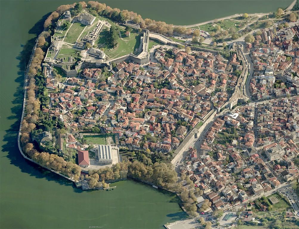
 .
.
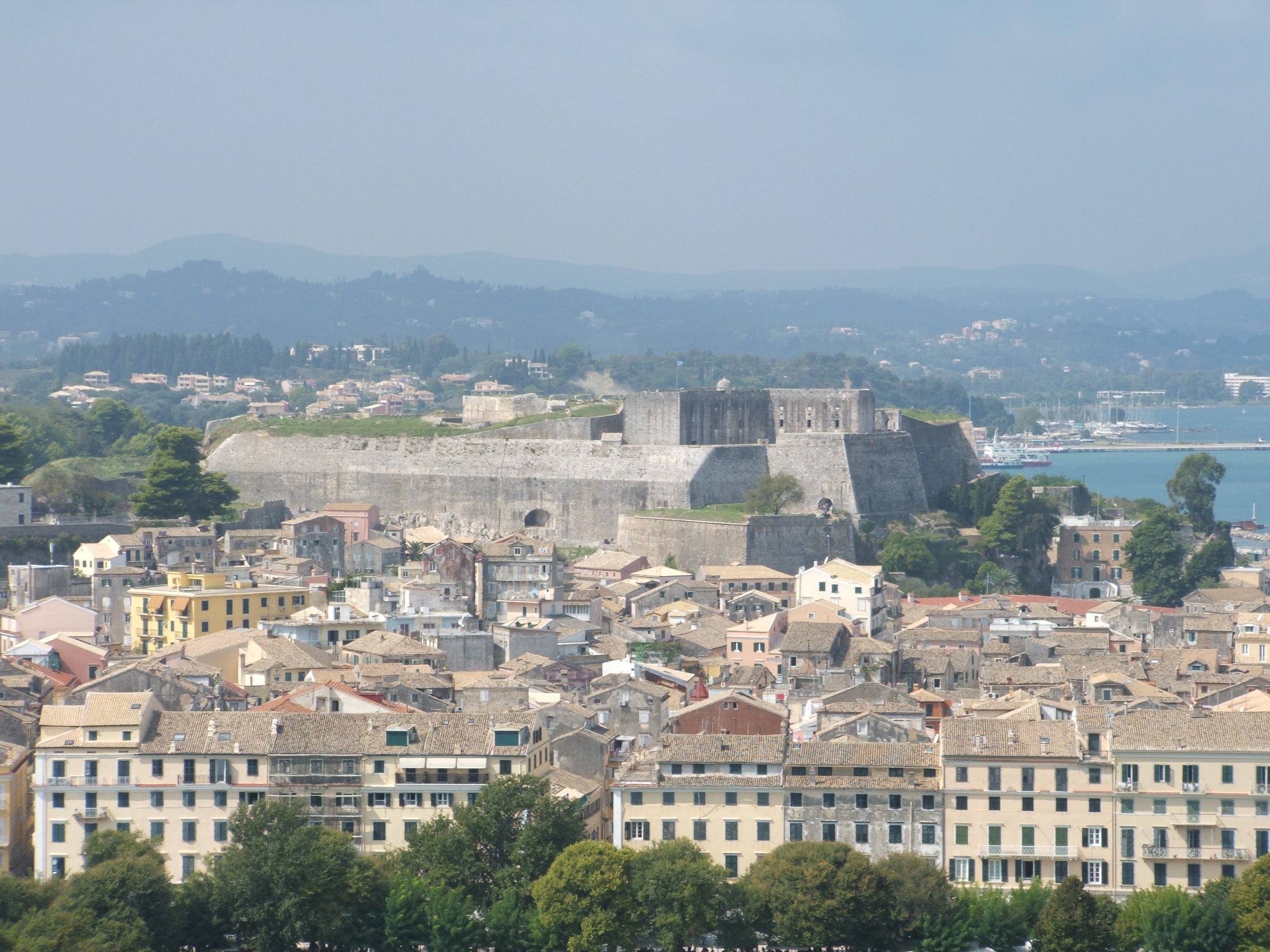

 .
.

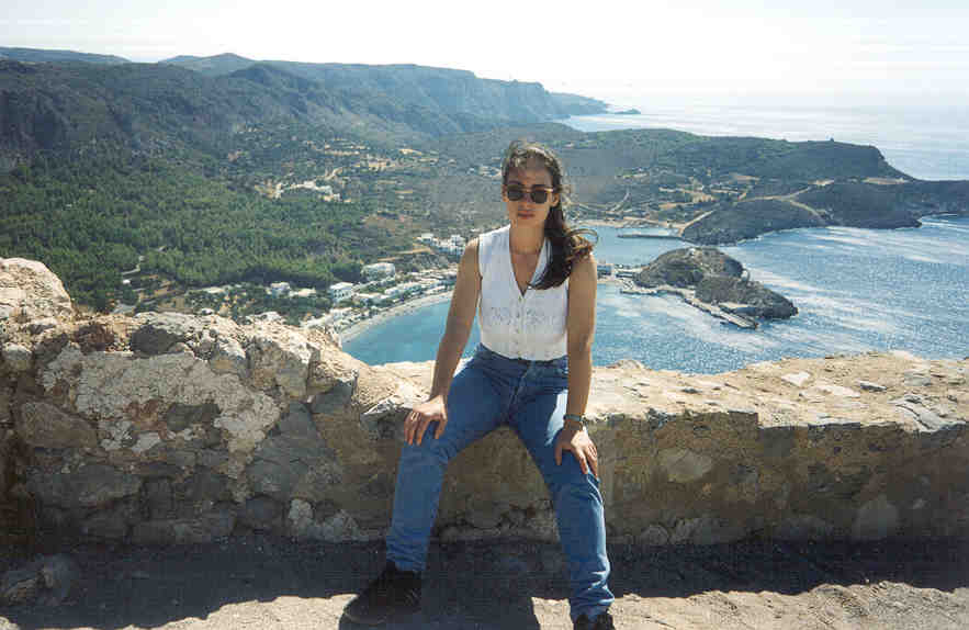 .
. .
.
 .
. .
. .
. .
. .
. .
.


 .
.


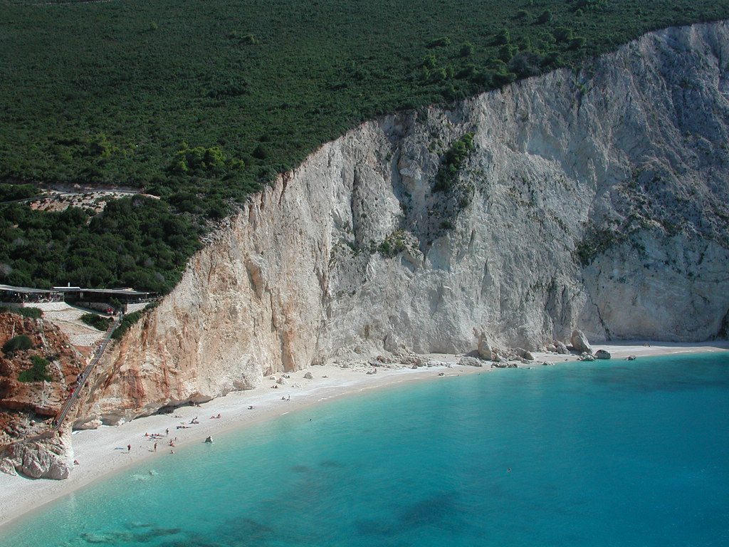
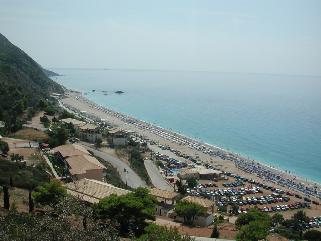
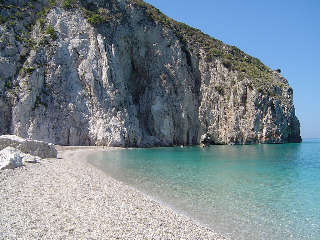
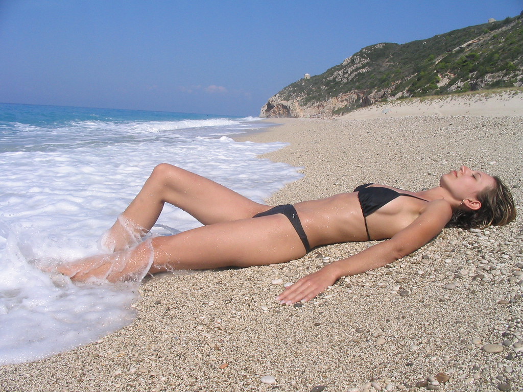


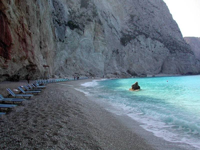
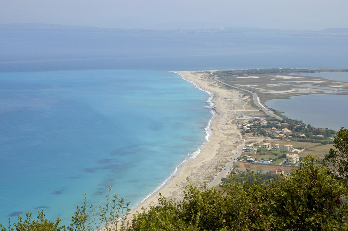


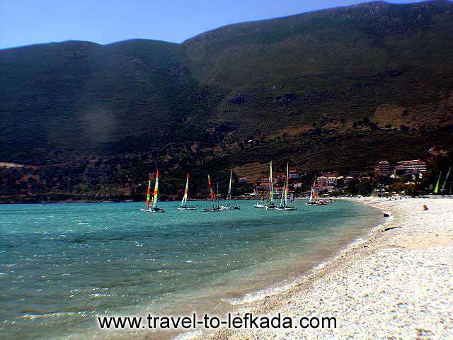

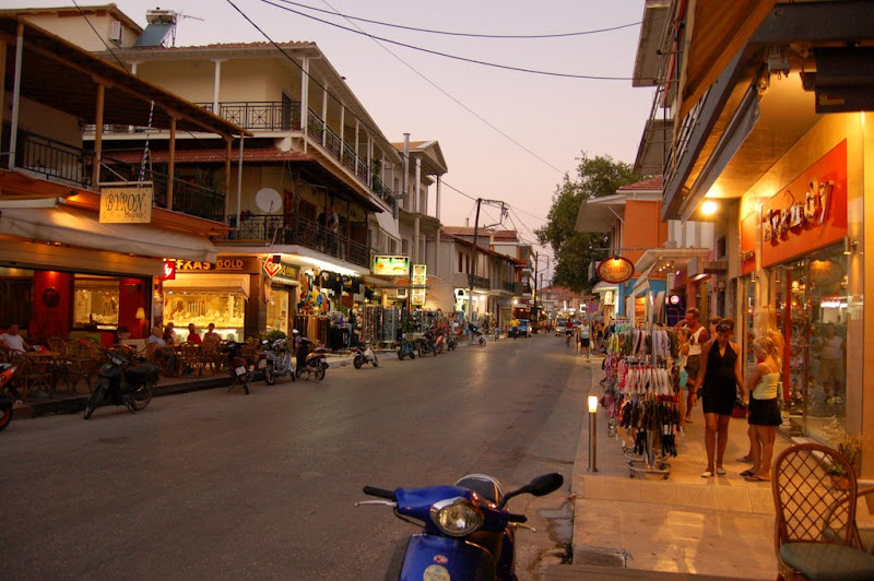


 .
.


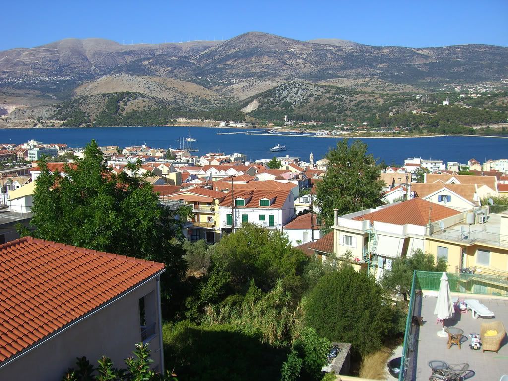


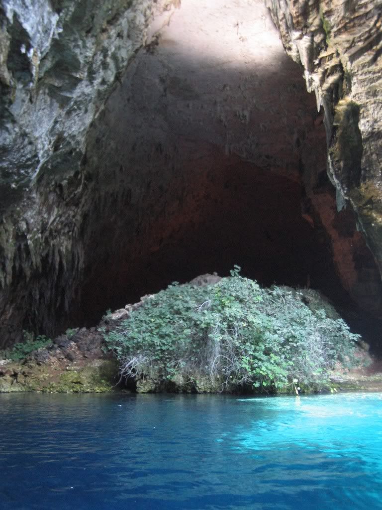


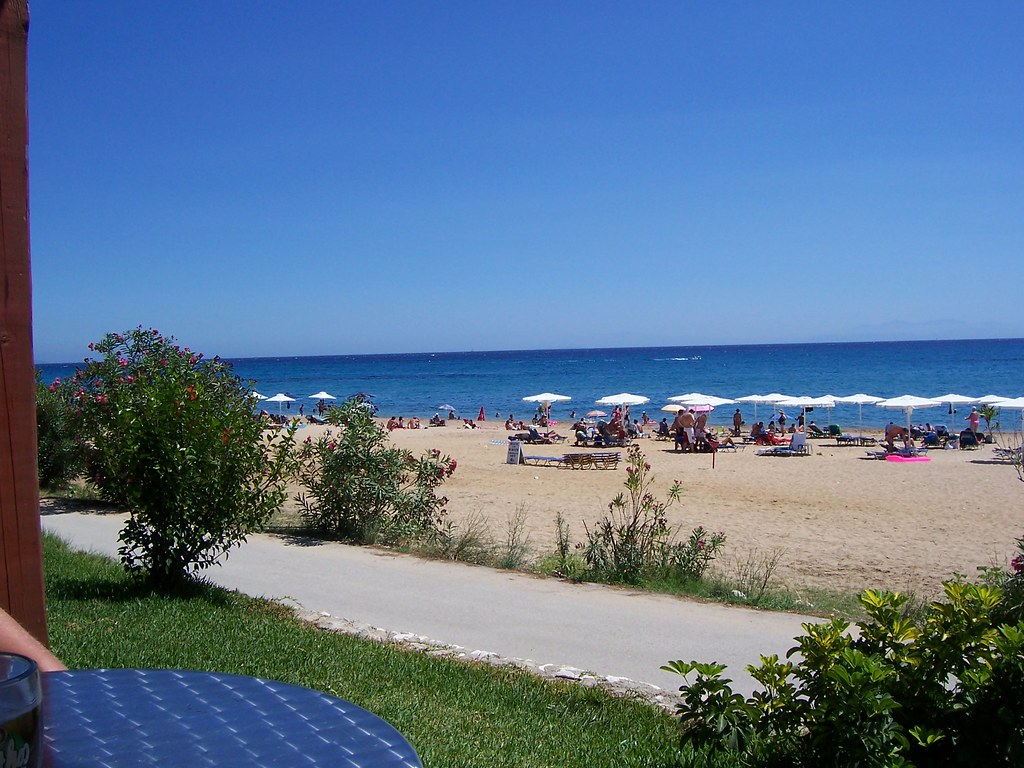
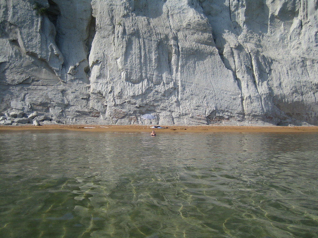
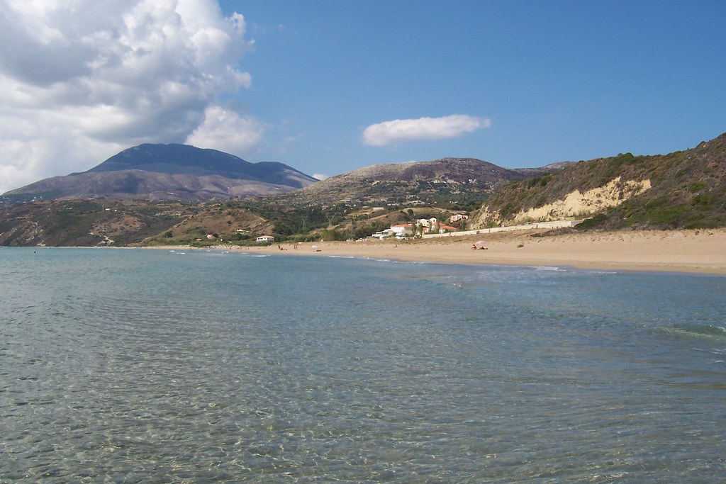

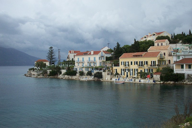


Comentario